
Photo: Wikipedia
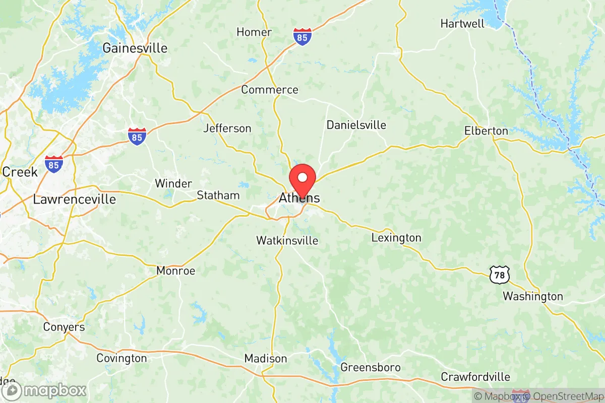
Strategic Assessment of Clarke County
Workable tactical position. Some exposure to population density or targets, but generally defensible in a crisis.
What does the Strategic Assessment tell us?
Our Strategic Assessment grades tactical survivability of an area. Major population centers, military targets, fallout zones, natural disasters, and border exposure all drive risk — lower exposure means a more defensible position in a crisis.
This is heavily inspired by Joel Skousen's Strategic Relocation book. Highly recommended you checkout the book ($)What does this tell us?
Our Strategic Assessment grades tactical survivability of an area. Major population centers, military targets, fallout zones, natural disasters, and border exposure all drive risk — lower exposure means a more defensible position in a crisis.
This is heavily inspired by Joel Skousen's Strategic Relocation book. Highly recommended you checkout the book ($)Strategic Pillars

Key Distances
Strategic Assessment Analysis
Clarke County, Georgia, anchored by Athens, presents a mixed bag for the conservative prepper or survivalist. Its core advantage is a resilient, semi-urban position that avoids the direct blast zones of major metros like Atlanta (about 70 miles west) while still offering a robust local economy and infrastructure. However, its proximity to the University of Georgia, a major regional medical complex, and a significant power grid node means it’s not a remote hideout—it’s a strategic fallback zone where you’ll need to be prepared for both the benefits of a functioning town and the risks of a potential crowd-dependent collapse. Think of it as a well-stocked forward operating base, not a bug-out cabin in the woods.
Geographic position and natural advantages for long-term security
Clarke County sits in the Piedmont region of northeast Georgia, a landscape of rolling hills, clay soils, and mixed hardwood forests that offers decent natural cover and defensible terrain. The area is drained by the Oconee River, which flows through the county and provides a reliable surface water source—critical for any long-term water plan. The county’s position is a double-edged sword: it’s far enough from Atlanta’s urban core to avoid the immediate fallout of a major attack or civil unrest in that city, but close enough to the I-85 corridor that you’ll see refugee flows if things go south. The local topography, with its ridges and creek valleys, offers numerous small-scale defensible positions for a prepared group, but the county itself is only about 121 square miles, meaning you can’t disappear into vast wilderness. The nearby Oconee National Forest and the Chattahoochee-Oconee National Forests to the north provide some buffer, but they’re not the deep wilderness of north Georgia. For a relocator, the key natural advantage is the moderate climate—no extreme cold or heat—and the ability to grow food in the red clay if you amend it properly. The growing season runs about 220 days, long enough for two crop cycles of staples like corn, beans, and squash.
Risks, exposures, and proximity to fallout-relevant landmarks
This is where the analysis gets serious. Clarke County’s biggest risk is its dependence on the University of Georgia (UGA), which employs over 10,000 people and draws a student population of nearly 40,000. In a collapse scenario, that’s a massive, concentrated population with no local food production and a high dependency on just-in-time logistics. The county is also home to Piedmont Athens Regional Medical Center, a major trauma center that would become a target for desperate people seeking medical care or drugs. More concerning for the prepper: the county sits near the Georgia Power Plant Branch, a coal-fired plant in nearby Mitchell (just outside the county line), and is within 50 miles of the Vogtle Electric Generating Plant (a nuclear facility near Augusta). While Vogtle is far enough to avoid direct blast damage, prevailing winds from the southwest could carry fallout over Clarke County in a worst-case scenario. Additionally, the county is bisected by US-29, GA-10, and the CSX rail line, which are primary transport routes for goods and, in a crisis, for military or relief convoys—or for refugees. The proximity to Fort Gordon (now Fort Eisenhower) in Augusta, about 90 miles east, means that any major military mobilization or cyber-attack response could draw resources away from the area. The county’s own industrial base is limited to light manufacturing and logistics, so there’s no major refinery or port to attract a direct strike, but the nearby Athens-Ben Epps Airport could become a contested asset for airlift operations.
Practical resilience for a relocator: food, water, energy, and defensibility
For a single individual or family looking to set up a resilient household, Clarke County offers a mixed but workable baseline. Water is the strongest asset: the Oconee River and its tributaries (Trail Creek, Middle Oconee River) provide year-round flow, but you’ll need filtration and a plan to access it without drawing attention. The county’s water utility draws from the river, so municipal supply is reliable in normal times, but in a grid-down scenario, private wells are the gold standard—and many rural properties in the county’s eastern and southern edges have them. Food production is possible but not easy: the clay soil requires raised beds or heavy amendment, and the deer population is high enough to decimate a garden without fencing. Local farmers’ markets and the Athens Farmers Market are good for networking with local growers, but don’t expect to buy bulk grains locally—you’ll need to stockpile or trade. Energy resilience is a weak point: the county is served by Georgia Power, and while there are no major solar incentives, the area gets about 218 sunny days per year, making rooftop solar a viable option for a prepared household. Wood heating is practical given the forest cover, but you’ll need a chainsaw and a plan for sourcing firewood without trespassing. Defensibility is neighborhood-dependent: the county has a mix of dense suburban subdivisions (like the area around Epps Bridge Parkway) and more rural pockets (like the area near Winterville or along the Oconee River). For a relocator, the best bet is a property on the county’s eastern edge, near the Oconee County line, where lot sizes increase and road access is limited to a few choke points. Avoid the area around the UGA campus and downtown Athens—those will be the first to see looting and civil unrest in a crisis. The county’s law enforcement presence (Clarke County Sheriff’s Office and Athens-Clarke County Police) is professional but will be overwhelmed in a widespread event, so personal security is your responsibility.
The overall strategic picture for Clarke County is one of calculated risk. It’s not a remote sanctuary, but it’s not a death trap either. For a conservative relocator who wants to maintain a professional job (UGA, healthcare, or remote work) while building a resilient household, it offers a solid middle ground—provided you’re willing to invest in water filtration, food storage, and a defensible property. The county’s political leanings are mixed: Athens itself is a liberal college town, but the surrounding rural areas of Clarke and adjacent Oconee County lean conservative, so you can find like-minded neighbors if you look. The biggest threat is the population density and the reliance on a single major employer (UGA). If the university collapses or is shut down, the local economy will crater, and you’ll see a rapid exodus of students and staff. Plan for that scenario: have a bug-out location farther north (like in the mountains of Rabun County) or a plan to become self-sufficient within 90 days. Clarke County is a good place to be prepared, not a good place to be unprepared. If you’re serious about resilience, this is a location you can work with—but only if you treat it as a base of operations, not a final destination.
* Values derived from national, state, county, city and local statistics and may differ in a specific area. Last updated: 2026-05-11T19:48:42.000Z
Narrative content on this page is AI-generated and may contain mistakes. Verify any details that matter before acting on them.
ReloMaps may earn a commission from affiliate links at no extra cost to you.