Photo: Wikipedia
Strategic Assessment of Harrison, AR
Workable tactical position. Some exposure to population density or targets, but generally defensible in a crisis.
What does the Strategic Assessment tell us?
Our Strategic Assessment grades tactical survivability of an area. Major population centers, military targets, fallout zones, natural disasters, and border exposure all drive risk — lower exposure means a more defensible position in a crisis.
This is heavily inspired by Joel Skousen's Strategic Relocation book. Highly recommended you checkout the book ($)What does this tell us?
Our Strategic Assessment grades tactical survivability of an area. Major population centers, military targets, fallout zones, natural disasters, and border exposure all drive risk — lower exposure means a more defensible position in a crisis.
This is heavily inspired by Joel Skousen's Strategic Relocation book. Highly recommended you checkout the book ($)Strategic Pillars

Key Distances
Regional Safe Places
Below is our recommended "safe zones" in Arkansas and the surrounding area based on our strategic heuristics. For most people, it's unrealistic to live in a “safe zone” full-time due to work, family or other personal reasons. They tend to be more rural. However, many of these areas are perfect for second homes and retreat properties that double as a vacation home or even a short-term rental.


Important Note: For informational purposes only. This does not mean nothing bad ever happens in the green zones. Please use common sense. This is based on public data and modeled with AI. We tried to take a conservative approach but mistakes happen. We update this regularly as new information becomes available.
Solar Generator Recommendations
Backup power matters more here than in safer locations. We've picked three solar generators across budgets and capacity tiers — start with the budget unit if you only need a few essentials, or step up if you want to run a fridge and HVAC for days at a time.

Jackery Portable Power Station Explorer 300
Budget OptionPower on the Go: Weighing only 11 lbs, it's convenient to set up and store with book-sized foldable solar panels

BLUETTI Portable Power Station AC180
Designed for both indoor and outdoor scenarios, AC180 is highly capable as it has a robost capacity and continuous output power.

EF ECOFLOW DELTA Pro Ultra Power Station
Upgraded PickEcoFlow DELTA Pro Ultra is a whole-home energy system designed to grow with your family. Integrated with the Smart Home Panel 2, it scales to meet your evolving energy needs — keeping your home powered, intelligent, and secure through every stage of life.
We earn a commission, at no additional cost to you.
Strategic Assessment Analysis
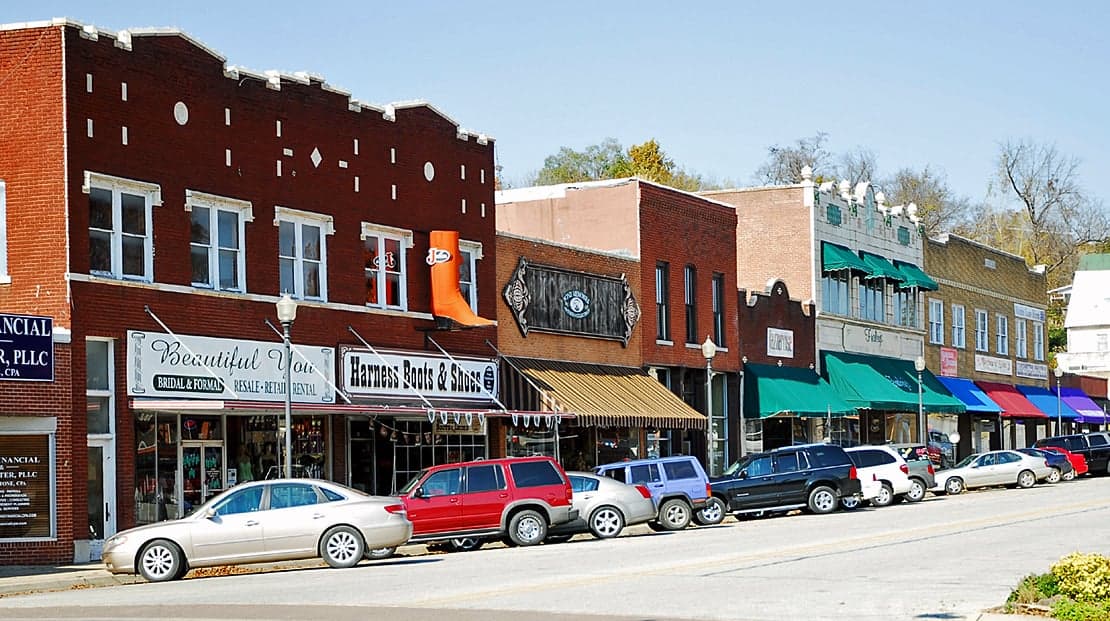
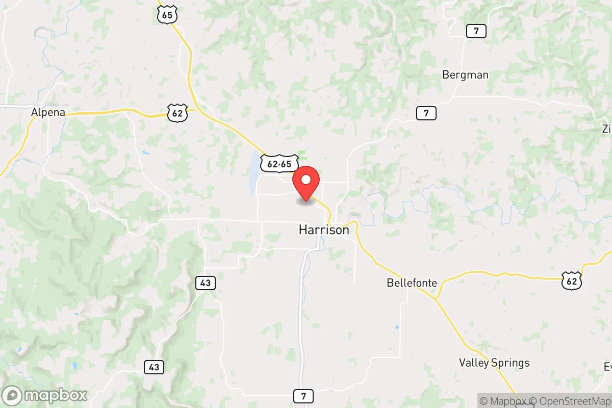
Harrison, Arkansas, sits in a geographic pocket that offers genuine strategic depth for those thinking long-term about resilience, self-sufficiency, and distance from the chaos of urban collapse. Nestled in the Ozark Mountains of Boone County, this town of roughly 13,000 people benefits from a location that is far enough from major metropolitan targets—yet close enough to access critical resources if you plan ahead. For a conservative-leaning relocator who views civic unrest, supply chain disruptions, and mass casualty events as real possibilities, Harrison presents a mix of natural advantages and hard trade-offs that demand a clear-eyed assessment.
Geographic position and natural advantages for long-term security
Harrison’s primary strategic asset is its position in the rugged Ozark terrain, which provides natural barriers against large-scale movement and surveillance. The area is roughly 100 miles from Springfield, Missouri, 120 miles from Little Rock, and 150 miles from Memphis—distances that put it outside the immediate blast radius of any major city but still within a day’s drive for resupply or evacuation if needed. The surrounding hills, dense forests, and winding two-lane roads create a natural choke-point system; anyone approaching from the south or east must navigate narrow valleys and steep grades, which slows vehicle traffic and makes ambush or defense more manageable. Boone County’s population density is about 40 people per square mile, compared to over 1,000 per square mile in a place like Dallas or St. Louis. That low density means fewer eyes, less competition for resources, and a much lower probability of being caught in a mass casualty event triggered by urban unrest or a terrorist attack. The Ozarks also sit atop the Springfield Plateau aquifer, which provides reliable groundwater access for wells—a critical factor when municipal water systems fail. For a prepper, the ability to drill a well and have year-round water from a protected source is non-negotiable, and Harrison’s geology supports that.
Risks, exposures, and proximity to fallout-relevant landmarks
No location is a fortress, and Harrison has real vulnerabilities that a strategic relocator must weigh. The most obvious risk is its proximity to the Buffalo National River and the Ozark National Forest—while these are beautiful assets, they also attract tourists and transient populations during normal times, and could become gathering points for displaced people during a crisis. More critically, Harrison lies about 90 miles from the Arkansas Nuclear One power plant near Russellville, which is a pressurized water reactor facility. In the event of a catastrophic failure—whether from sabotage, earthquake, or grid collapse—the prevailing wind patterns in the region could carry fallout into Boone County within hours. A 2023 NRC study noted that the plant’s emergency planning zone extends 10 miles, but actual fallout patterns can reach 50 miles or more depending on weather. That’s a sobering reality for anyone planning a long-term bug-in. Additionally, Harrison is within 200 miles of the Lake City Army Ammunition Plant in Missouri and the Pine Bluff Arsenal in Arkansas, both of which are potential targets for sabotage or attack during a mass casualty event. The town itself has no major military bases or critical infrastructure that would make it a primary target, but its location along U.S. Highway 65 and Arkansas Highway 7 means it sits on a north-south corridor that could see heavy traffic from fleeing urban populations. A strategic relocator should plan for the possibility of roadblocks, checkpoints, or refugee flows within the first 72 hours of a major event.
Practical resilience for a relocator: food, water, energy, and defensibility
For the individual or family serious about self-reliance, Harrison offers a workable baseline but requires significant preparation. The growing season in Boone County runs about 180 days, with average last frost in mid-April and first frost in mid-October—enough time for a solid vegetable garden, but not for year-round outdoor growing without a greenhouse. The soil is rocky and alkaline in many areas, so raised beds or imported topsoil are almost mandatory for serious food production. Water is the strong suit: the area averages 45 inches of rainfall annually, and the Ozark aquifer provides clean groundwater at depths of 100 to 300 feet. A hand-pump or solar-powered well setup is feasible for most properties, and the county has no major water rights restrictions for domestic use. Energy resilience is more challenging. Harrison’s electric grid is served by North Arkansas Electric Cooperative, which has a decent reliability record but is still vulnerable to ice storms and grid-wide blackouts. Solar potential is moderate—the area gets about 4.5 peak sun hours per day—but tree cover on many properties limits panel placement. Wood heating is a practical alternative: the surrounding national forests offer ample firewood, and the county has no burn bans that would prevent responsible harvesting. Defensibility is where Harrison shines. The hilly terrain and dense tree lines provide natural cover and concealment. Many properties in the area sit at the end of gravel roads with limited sightlines from main routes. A well-chosen parcel with a single access point, a creek or spring, and a southern exposure for solar can be made highly defensible with modest improvements. The local sheriff’s office is small—about 30 deputies for the entire county—so during a breakdown of civil order, you are largely on your own. That’s a feature, not a bug, for those who prefer to rely on their own capabilities rather than government response.
The overall strategic picture for Harrison is one of cautious optimism for the prepared relocator. It offers genuine geographic isolation, abundant water, and a low population density that reduces the risk of being caught in a mass casualty event or urban firestorm. The trade-offs are real: proximity to a nuclear power plant, a major highway corridor, and limited local law enforcement mean that a survival plan must account for both natural and man-made threats. For a conservative individual or family willing to invest in well drilling, solar backup, and a defensible property layout, Harrison provides a solid foundation. It is not a prepper paradise—there is no perfect location—but it is a place where a serious, disciplined approach to resilience can pay off. The key is to move before the crisis, not after.
* Values derived from national, state, county, city and local statistics and may differ in a specific area. Last updated: 2026-04-30T01:37:21.000Z
Narrative content on this page is AI-generated and may contain mistakes. Verify any details that matter before acting on them.
ReloMaps may earn a commission from affiliate links at no extra cost to you.