
Photo: Wikipedia
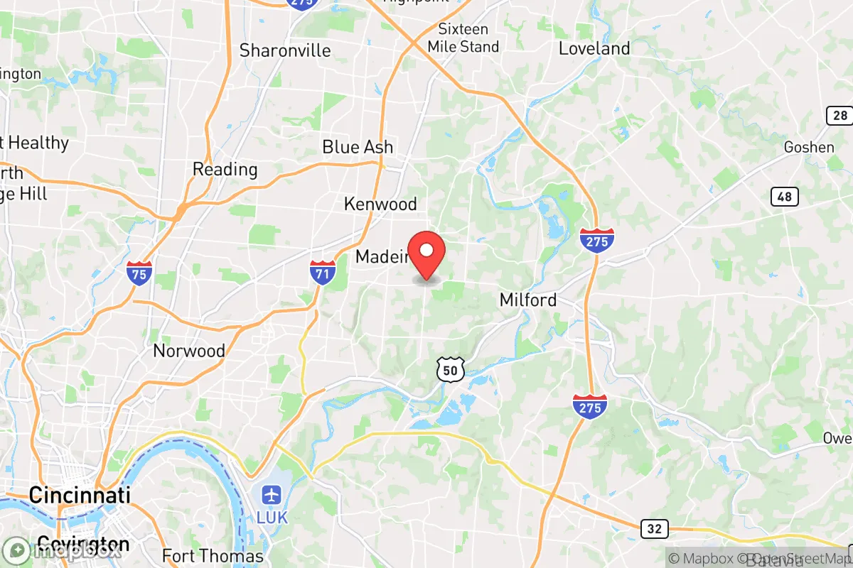
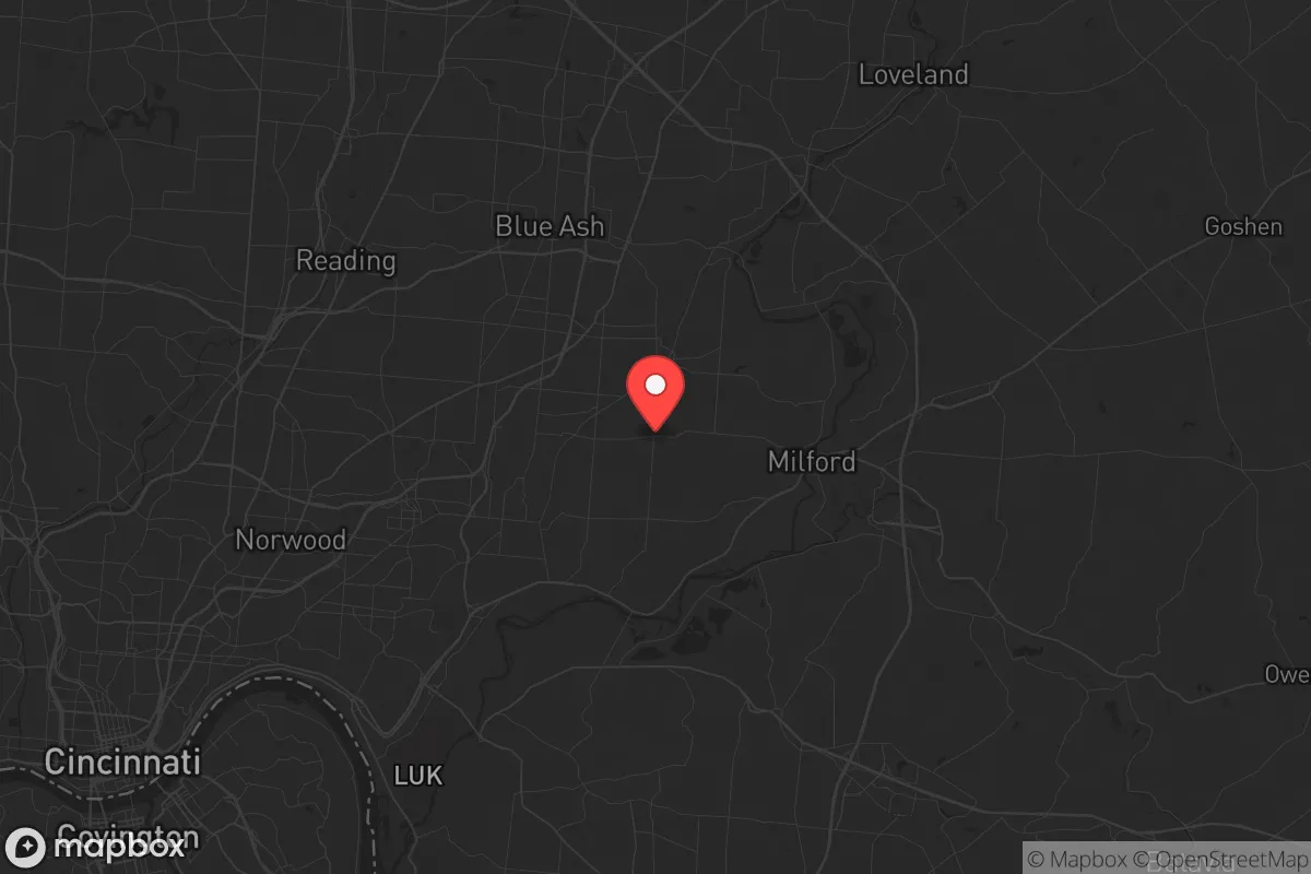
Strategic Assessment of Indian Hill, OH
Meaningful friction. Expect exposure to either population pressure, blast zones, or natural disaster risk. Consider buying a retreat property.
What does the Strategic Assessment tell us?
Our Strategic Assessment grades tactical survivability of an area. Major population centers, military targets, fallout zones, natural disasters, and border exposure all drive risk — lower exposure means a more defensible position in a crisis.
This is heavily inspired by Joel Skousen's Strategic Relocation book. Highly recommended you checkout the book ($)What does this tell us?
Our Strategic Assessment grades tactical survivability of an area. Major population centers, military targets, fallout zones, natural disasters, and border exposure all drive risk — lower exposure means a more defensible position in a crisis.
This is heavily inspired by Joel Skousen's Strategic Relocation book. Highly recommended you checkout the book ($)Strategic Pillars

Key Distances
Regional Safe Places
Below is our recommended "safe zones" in Ohio and the surrounding area based on our strategic heuristics. For most people, it's unrealistic to live in a “safe zone” full-time due to work, family or other personal reasons. They tend to be more rural. However, many of these areas are perfect for second homes and retreat properties that double as a vacation home or even a short-term rental.

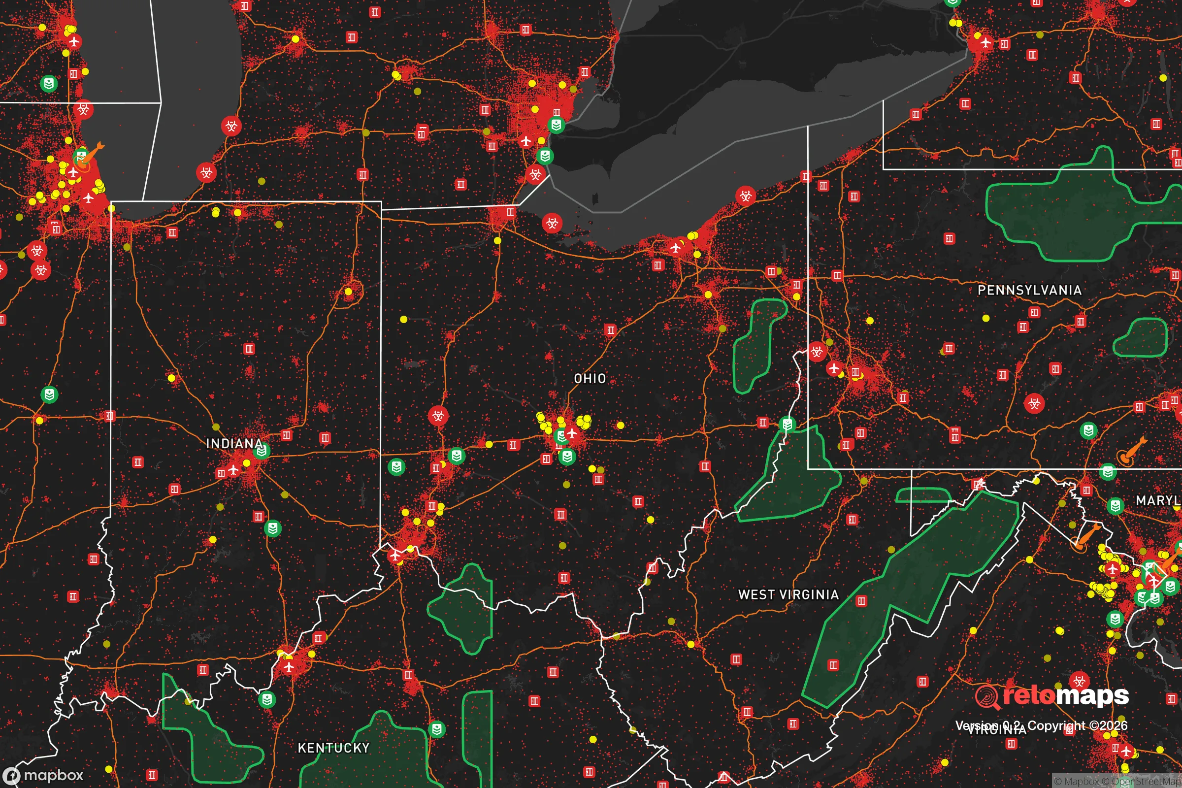
Important Note: For informational purposes only. This does not mean nothing bad ever happens in the green zones. Please use common sense. This is based on public data and modeled with AI. We tried to take a conservative approach but mistakes happen. We update this regularly as new information becomes available.
Solar Generator Recommendations
Backup power matters more here than in safer locations. We've picked three solar generators across budgets and capacity tiers — start with the budget unit if you only need a few essentials, or step up if you want to run a fridge and HVAC for days at a time.

Jackery Portable Power Station Explorer 300
Budget OptionPower on the Go: Weighing only 11 lbs, it's convenient to set up and store with book-sized foldable solar panels

BLUETTI Portable Power Station AC180
Designed for both indoor and outdoor scenarios, AC180 is highly capable as it has a robost capacity and continuous output power.

EF ECOFLOW DELTA Pro Ultra Power Station
Upgraded PickEcoFlow DELTA Pro Ultra is a whole-home energy system designed to grow with your family. Integrated with the Smart Home Panel 2, it scales to meet your evolving energy needs — keeping your home powered, intelligent, and secure through every stage of life.
We earn a commission, at no additional cost to you.
Strategic Assessment Analysis
Indian Hill, Ohio, offers a strategic relocation option for those prioritizing long-term resilience, but it comes with trade-offs that demand clear-eyed assessment. This affluent village, roughly 15 miles northeast of downtown Cincinnati, sits atop the rolling hills of the Little Miami River valley, providing natural elevation and separation from the urban core. For a conservative-leaning individual or family concerned with civic unrest, mass casualty events, and societal breakdown, Indian Hill’s key advantage is its inherent defensibility and low population density—roughly 1,200 residents spread over 18 square miles—combined with proximity to critical infrastructure. However, its closeness to a major metropolitan area and potential fallout targets means you cannot treat it as a remote bunker; it’s a buffer-zone stronghold that requires active preparation.
Geographic position and natural advantages for long-term survival
Indian Hill’s geography is its strongest card. The village sits on the uplands of the Little Miami River gorge, with elevations reaching 850 feet above sea level, offering natural drainage and vantage points. The surrounding terrain—steep wooded hillsides, narrow winding roads, and limited through-access—creates a natural choke point. Only a handful of arterial roads connect Indian Hill to the outside world: Miami Road (SR-126), Camargo Road, and Shawnee Run Road. In a grid-down or unrest scenario, these can be monitored or blocked with minimal effort. The Little Miami River forms the village’s eastern boundary, providing a reliable water source and a natural barrier. The area is part of the Clermont County and Hamilton County line, which means you’re outside the immediate urban sprawl but still within a 20-minute drive of Cincinnati’s medical and logistical hubs. The Indian Hill Metropolitan Park District and adjacent Withrow Nature Preserve offer thousands of acres of wooded cover, game habitat, and potential foraging grounds. For a prepper, this is a solid foundation: elevation, water, limited access, and green space.
Risks, exposures, and proximity to fallout-relevant landmarks
The elephant in the room is Cincinnati. Indian Hill is only 12 miles from downtown Cincinnati, which houses multiple high-value targets: the John A. Roebling Suspension Bridge, the Great American Ball Park, the Duke Energy Convention Center, and the Cincinnati/Northern Kentucky International Airport (CVG) just across the river. In a mass casualty event or EMP strike, the blast and fallout zones for a major city are a real concern. While Indian Hill’s elevation and distance provide some buffer, prevailing winds from the west could carry fallout from a ground burst near the city. The Fernald Feed Materials Production Center (a former uranium processing site) is about 20 miles northwest in Crosby Township—now a Superfund site, but still a potential secondary hazard if disturbed. The Zimmer Nuclear Power Station near Moscow, Ohio, is roughly 30 miles southeast; a meltdown there would put Indian Hill in the plume path depending on wind direction. Closer to home, the Norfolk Southern rail line runs through nearby Milford, carrying hazardous materials through the valley. The 2023 East Palestine derailment showed that rail accidents can create localized toxic zones. On the plus side, Indian Hill’s low population density means fewer people to compete with for resources during a crisis, but the village’s wealth also makes it a potential target for looting if civil order collapses. The Indian Hill Police Department is well-funded and responsive, but in a widespread breakdown, they’ll be stretched thin.
Practical resilience for a relocator: food, water, energy, and defensibility
For a family or individual serious about self-sufficiency, Indian Hill offers a mixed bag. Water is abundant: the Little Miami River is a reliable surface source, but it’s also a public recreation area, meaning you’ll have company. Private wells are common in the area—many homes on larger lots have them—but you’ll need a hand pump or solar-powered backup if the grid goes down. The village’s water supply comes from Cincinnati Water Works, which draws from the Ohio River; that system is vulnerable to contamination or disruption. Food production is feasible on the larger estate lots (2-5 acres typical), but most residents rely on grocery stores like Kroger in nearby Madeira or Whole Foods in Kenwood. Those will empty fast in a crisis. You’ll want to establish a substantial pantry and consider a greenhouse or raised beds. Energy resilience is decent: Duke Energy provides grid power, but tree-covered lines are prone to outages from ice storms or wind. Many homes already have whole-house generators—a must. Solar is viable but limited by tree canopy; you’d need a clearing or roof-mounted panels with battery storage. Defensibility is where Indian Hill shines. The village’s layout—winding roads, dense woods, and large lots—makes it hard for a mob to sweep through. Neighbors tend to know each other, and the Indian Hill Community Association fosters a strong social fabric. But don’t mistake affluence for preparedness: most residents are professionals, not preppers. You’ll likely be one of the few with a stockpile and a plan. The closest hospital is Christ Hospital in Mount Auburn (15 minutes), but in a mass casualty event, that facility will be overwhelmed. A trauma kit, training, and a relationship with a local doctor are wise.
The overall strategic picture for Indian Hill is that of a high-value buffer zone—not a remote retreat, but a defensible enclave with access to resources. Its proximity to Cincinnati is a double-edged sword: you get medical, logistical, and supply-chain advantages in normal times, but those same assets become liabilities during unrest or disaster. For a conservative-leaning relocator who wants to stay within striking distance of a major city for work or family but maintain a hardened position, Indian Hill works. You’ll need to invest in water independence, food storage, backup power, and security measures. The community’s wealth and low crime rate are assets, but they also mean you’ll be surrounded by people who may not share your survivalist mindset. If you’re looking for a place to ride out a short-term crisis (weeks to months), Indian Hill is solid. For a long-term collapse scenario, you’d want more land, more isolation, and a stronger local network—but as a strategic foothold in the Ohio River Valley, it’s one of the better options within a 30-mile radius of a major city. Just don’t expect to go unnoticed. Prepare accordingly.
* Values derived from national, state, county, city and local statistics and may differ in a specific area. Last updated: 2026-04-27T14:30:04.000Z
Narrative content on this page is AI-generated and may contain mistakes. Verify any details that matter before acting on them.
ReloMaps may earn a commission from affiliate links at no extra cost to you.