Photo: Wikipedia
Strategic Assessment of Kaunakakai, HI
Strong survivability profile. Good buffer from population centers, with manageable environmental and tactical risks.
What does the Strategic Assessment tell us?
Our Strategic Assessment grades tactical survivability of an area. Major population centers, military targets, fallout zones, natural disasters, and border exposure all drive risk — lower exposure means a more defensible position in a crisis.
This is heavily inspired by Joel Skousen's Strategic Relocation book. Highly recommended you checkout the book ($)What does this tell us?
Our Strategic Assessment grades tactical survivability of an area. Major population centers, military targets, fallout zones, natural disasters, and border exposure all drive risk — lower exposure means a more defensible position in a crisis.
This is heavily inspired by Joel Skousen's Strategic Relocation book. Highly recommended you checkout the book ($)Strategic Pillars

Key Distances
Regional Safe Places
Below is our recommended "safe zones" in Hawaii and the surrounding area based on our strategic heuristics. For most people, it's unrealistic to live in a “safe zone” full-time due to work, family or other personal reasons. They tend to be more rural. However, many of these areas are perfect for second homes and retreat properties that double as a vacation home or even a short-term rental.


Important Note: For informational purposes only. This does not mean nothing bad ever happens in the green zones. Please use common sense. This is based on public data and modeled with AI. We tried to take a conservative approach but mistakes happen. We update this regularly as new information becomes available.
Solar Generator Recommendations
Backup power matters more here than in safer locations. We've picked three solar generators across budgets and capacity tiers — start with the budget unit if you only need a few essentials, or step up if you want to run a fridge and HVAC for days at a time.

Jackery Portable Power Station Explorer 300
Budget OptionPower on the Go: Weighing only 11 lbs, it's convenient to set up and store with book-sized foldable solar panels

BLUETTI Portable Power Station AC180
Designed for both indoor and outdoor scenarios, AC180 is highly capable as it has a robost capacity and continuous output power.

EF ECOFLOW DELTA Pro Ultra Power Station
Upgraded PickEcoFlow DELTA Pro Ultra is a whole-home energy system designed to grow with your family. Integrated with the Smart Home Panel 2, it scales to meet your evolving energy needs — keeping your home powered, intelligent, and secure through every stage of life.
We earn a commission, at no additional cost to you.
Strategic Assessment Analysis
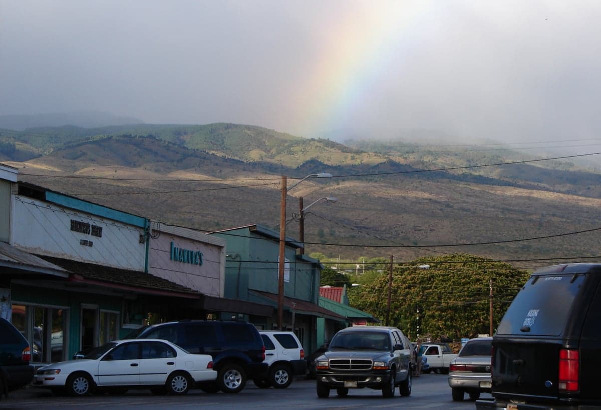
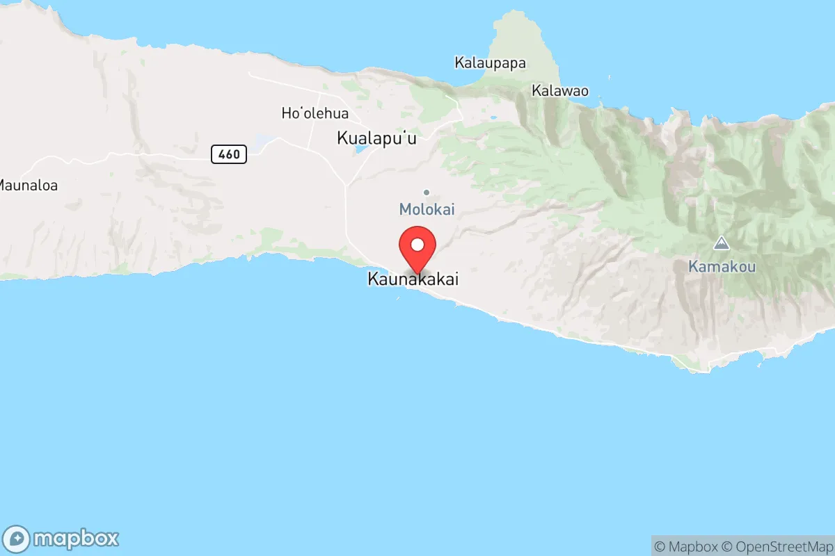
Kaunakakai, the small county seat of Molokai, offers a strategic paradox for the conservative prepper: extreme isolation that buffers against cascading urban collapse, but at the cost of severe logistical fragility. Located on the south-central coast of Molokai, this town of roughly 2,000 people sits at the heart of an island that has deliberately resisted mass tourism and development. For those serious about avoiding the fallout zones of Honolulu (60 miles southeast) or the military-industrial complex of Oahu, Kaunakakai presents a genuine off-grid option—but only if you can solve the supply-chain riddle that defines life here. The island’s low population density (about 28 people per square mile) and lack of major infrastructure make it a natural redoubt, but also a place where a single barge failure could turn a survival retreat into a starvation trap.
Geographic isolation and natural buffer zones
Molokai’s geography is the prepper’s first and most important asset. The island is separated from Oahu by the 26-mile-wide Kaiwi Channel, a body of water that effectively blocks any spontaneous movement of people, supplies, or civil unrest from Honolulu’s 350,000-plus metro area. To the east, the even wider Pailolo Channel separates Molokai from Maui’s tourist-heavy west coast. Kaunakakai itself sits on a flat coastal plain backed by the 4,000-foot Molokai volcano ridge, which creates a natural defensive barrier—any approach from the north must cross steep, undeveloped terrain. The island’s only airport (MKK) is a single-runway facility with no commercial jet service; the only harbor is Kaunakakai Wharf, a shallow-draft facility that handles one or two barges per week. This means any large-scale evacuation or supply run is physically impossible without days of notice and specialized maritime assets. For a relocator concerned with mass casualty events or government overreach, this isolation is a double-edged sword: it keeps trouble out, but it also keeps you in.
Risks, exposures, and proximity to strategic targets
The primary risk for Kaunakakai is not direct attack but collateral effects from nearby strategic assets. Molokai lies within 70 miles of the Pacific Missile Range Facility (PMRF) on Kauai, a major Navy installation that would be a high-priority target in any peer-level conflict. The island also sits directly under the flight path of military aircraft operating from Kaneohe Bay Marine Corps Base and Hickam Air Force Base on Oahu. In a crisis scenario—whether nuclear exchange, EMP event, or widespread civil unrest—Kaunakakai would likely experience secondary effects: communications blackouts from EMP, refugee boat landings from Oahu or Maui, and potential contamination from fallout if prevailing winds shift. The island’s single road (Highway 460) runs along the south coast and is vulnerable to landslides and tsunami damage; the north shore is largely inaccessible by vehicle. There is no hospital on Molokai—only a small clinic in Kaunakakai that can handle basic emergencies. A serious injury or illness requires medevac to Oahu, which becomes impossible if air transport is grounded. For the prepper, this means medical self-sufficiency is non-negotiable, not optional.
Practical resilience: food, water, energy, and defensibility
Kaunakakai’s practical resilience is a mixed bag that demands serious upfront investment. The island has abundant rainfall on the windward (north) side, but the south coast where Kaunakakai sits is dry, receiving only about 25 inches annually. Municipal water comes from a single aquifer and is distributed via a vulnerable above-ground pipeline system—a single break or contamination event would leave the town dry. Rainwater catchment is common among locals and should be considered mandatory for any relocator. Food production is the critical weakness: Molokai imports roughly 90% of its food via barge, and local agriculture is limited to small-scale taro patches, some cattle ranching, and backyard gardens. The island’s soil is thin and rocky on the south coast, requiring raised beds or imported topsoil for serious gardening. Hunting is possible—feral pigs and axis deer are plentiful in the forest reserves—but requires a state license and familiarity with rugged terrain. Energy comes from a diesel-fired power plant in Kaunakakai, with no natural gas pipeline and limited solar adoption. For defensibility, the town’s layout is a double-edged sword: the single road in and out can be monitored, but it also means no escape route if the harbor or airport is compromised. The local population is tight-knit and suspicious of outsiders, which can be an asset (community watch) or a liability (social friction) depending on how you integrate.
The overall strategic picture for a conservative relocator
Kaunakakai is not a beginner’s prepper location. It demands a high level of self-reliance, significant capital for infrastructure (water catchment, solar panels, food storage), and a willingness to accept that you are trading convenience for security. The upside is real: you are as far from the urban chaos of Honolulu as you can get without leaving the state, and the island’s lack of economic opportunity means it will never attract the kind of population growth that creates civil unrest. The downside is equally real: a single supply chain disruption turns your retreat into a survival scenario within weeks, and medical emergencies become life-threatening events. For the conservative single or family who has the skills, the budget, and the temperament to go fully off-grid, Kaunakakai offers a defensible, low-profile base that most people will overlook. But if you are looking for a place where you can maintain a comfortable middle-class lifestyle while prepping on the side, this is not it. Molokai will test you, and it will do so without warning or apology.
* Values derived from national, state, county, city and local statistics and may differ in a specific area. Last updated: 2026-05-15T21:54:01.000Z
Narrative content on this page is AI-generated and may contain mistakes. Verify any details that matter before acting on them.
ReloMaps may earn a commission from affiliate links at no extra cost to you.