Photo: Wikipedia
Strategic Assessment of Kekaha, HI
Strong survivability profile. Good buffer from population centers, with manageable environmental and tactical risks.
What does the Strategic Assessment tell us?
Our Strategic Assessment grades tactical survivability of an area. Major population centers, military targets, fallout zones, natural disasters, and border exposure all drive risk — lower exposure means a more defensible position in a crisis.
This is heavily inspired by Joel Skousen's Strategic Relocation book. Highly recommended you checkout the book ($)What does this tell us?
Our Strategic Assessment grades tactical survivability of an area. Major population centers, military targets, fallout zones, natural disasters, and border exposure all drive risk — lower exposure means a more defensible position in a crisis.
This is heavily inspired by Joel Skousen's Strategic Relocation book. Highly recommended you checkout the book ($)Strategic Pillars

Key Distances
Regional Safe Places
Below is our recommended "safe zones" in Hawaii and the surrounding area based on our strategic heuristics. For most people, it's unrealistic to live in a “safe zone” full-time due to work, family or other personal reasons. They tend to be more rural. However, many of these areas are perfect for second homes and retreat properties that double as a vacation home or even a short-term rental.


Important Note: For informational purposes only. This does not mean nothing bad ever happens in the green zones. Please use common sense. This is based on public data and modeled with AI. We tried to take a conservative approach but mistakes happen. We update this regularly as new information becomes available.
Solar Generator Recommendations
Backup power matters more here than in safer locations. We've picked three solar generators across budgets and capacity tiers — start with the budget unit if you only need a few essentials, or step up if you want to run a fridge and HVAC for days at a time.

Jackery Portable Power Station Explorer 300
Budget OptionPower on the Go: Weighing only 11 lbs, it's convenient to set up and store with book-sized foldable solar panels

BLUETTI Portable Power Station AC180
Designed for both indoor and outdoor scenarios, AC180 is highly capable as it has a robost capacity and continuous output power.

EF ECOFLOW DELTA Pro Ultra Power Station
Upgraded PickEcoFlow DELTA Pro Ultra is a whole-home energy system designed to grow with your family. Integrated with the Smart Home Panel 2, it scales to meet your evolving energy needs — keeping your home powered, intelligent, and secure through every stage of life.
We earn a commission, at no additional cost to you.
Strategic Assessment Analysis
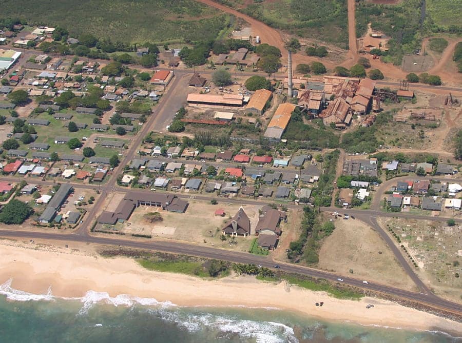
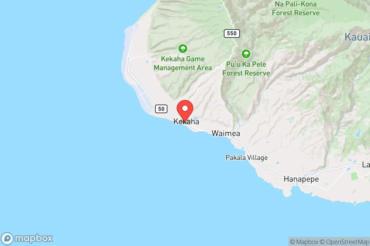
Kekaha, on Kauai's far western shore, offers a strategic paradox: extreme isolation that buffers against cascading national crises, yet proximity to a major military installation that could become a liability. For a relocator prioritizing resilience over convenience, this small town of roughly 1,700 people sits at the end of Highway 50, roughly 30 miles from Lihue and 15 miles from the Pacific Missile Range Facility (PMRF) at Barking Sands. Its location provides natural defensibility—bounded by the Pacific Ocean to the west, the Waimea River to the east, and the steep slopes of the Waimea Canyon and Kokee State Park to the north—but that same geography creates a single-point-of-failure access problem. The 2020 Census data shows a population that is roughly 40% Native Hawaiian or Pacific Islander, 30% White, and 20% Asian, with a median household income around $55,000, well below the state average of $83,000. The town's economy is heavily tied to PMRF, sugar plantation history (now defunct), and small-scale tourism, meaning any disruption to federal funding or tourism flows would hit hard. For a conservative-leaning prepper, Kekaha represents a high-risk, high-reward outpost: superb natural buffers against societal collapse, but with a single military target that could draw unwanted attention.
Geographic position and natural advantages for long-term survival
Kekaha's primary strategic asset is its position at the terminus of a dead-end road system. Highway 50 ends at the PMRF gate, meaning the only way in or out by land is the same two-lane road that runs through Waimea, Hanapepe, and into Lihue. This creates a natural chokepoint that could be defended with minimal manpower—a single bridge over the Waimea River, roughly 2 miles east of town, is the only land access point. The surrounding terrain offers multiple fallback options: the Kokee State Park and Alakai Swamp wilderness areas to the north provide dense forest cover, reliable rainfall, and elevation (up to 4,000 feet) for communication relays and defensive positions. The Na Pali Coast to the northwest is inaccessible by road, offering a rugged escape route for those with maritime capability. The climate is semi-arid compared to the rest of Kauai—Kekaha receives only about 20 inches of rain annually, versus 50+ inches in Lihue—which means less mold, fewer tropical diseases, and better solar exposure for off-grid power. The prevailing trade winds from the northeast provide natural ventilation and reduce the risk of airborne contaminants settling. For a relocator, the ability to grow food in the drier climate is limited without irrigation, but the Waimea River and nearby irrigation ditches (remnants of the sugar plantation era) provide a reliable freshwater source that could be gravity-fed to gardens. The town's elevation at roughly 30 feet above sea level offers some protection against storm surge, though tsunami risk remains a concern given the flat coastal plain.
Risks, exposures, and proximity to fallout-relevant landmarks
The elephant in the room is the Pacific Missile Range Facility, a 1,100-square-mile testing range for ballistic missile defense systems, including the Aegis Ashore system and SM-3 interceptors. PMRF is a high-value target in any peer-level conflict, particularly with China or North Korea, given its role in testing hypersonic weapons and missile defense. The base employs roughly 1,200 military and 1,000 civilian personnel, meaning a significant transient population that could become a liability during an evacuation. The base's location directly adjacent to Kekaha (the town's western edge abuts the PMRF boundary) means any kinetic strike on the facility would likely devastate the town. Additionally, the base's radar arrays and communication towers could be targeted for electromagnetic pulse (EMP) attacks, which would knock out electronics across western Kauai. The proximity to Lihue Airport (30 miles) and Nawiliwili Harbor (35 miles) introduces secondary risks: these are likely evacuation and resupply points for federal assets during a crisis, drawing crowds and potential conflict. The Waimea River floodplain is another concern—heavy rainfall events (increasing with climate change) can cause rapid flooding, as seen in the 2018 Kauai floods that damaged roads and homes in nearby Hanapepe. For a prepper, the single road access is both a strength and a weakness: it can be blocked by a single accident, landslide, or military checkpoint, cutting off Kekaha entirely. The nearest hospital is Kauai Veterans Memorial Hospital in Waimea (5 miles), a small 25-bed facility with limited trauma capability; serious injuries would require medevac to Lihue or Oahu, which may not be available during a crisis.
Practical resilience for a relocator: food, water, energy, and defensibility
Water security is Kekaha's strongest asset. The Waimea River flows year-round, and the old sugar plantation irrigation system (the Kekaha Ditch) still carries water from the mountains to the coastal plain. A relocator with basic plumbing skills could tap into this system or dig a shallow well (the water table is 10-20 feet deep in most areas). Rainwater catchment is viable but less productive than in wetter parts of the island—expect 20-30 gallons per 100 square feet of roof per month during the dry season. Food production is the weak link. The dry, sandy soil is poor for most vegetables without heavy amendment; traditional Hawaiian taro patches (lo'i) exist but require consistent water flow. The ocean provides protein—spearfishing, net fishing, and crab trapping are viable year-round, but require skill and equipment. The nearby mountains offer wild pigs, goats, and axis deer (introduced species), but hunting pressure is moderate and access requires a permit from the state. For long-term food security, a relocator would need to invest in raised beds, hydroponics, or aquaponics, with imported soil and nutrients. Energy is manageable: Kauai has high solar insolation (5.5 peak sun hours per day), and the island's electric cooperative (KIUC) has a high renewable penetration (60%+), meaning grid power is relatively stable. Off-grid solar with battery storage is practical, but parts and expertise are limited on the west side—plan to bring your own system or have a relationship with a Lihue-based installer. Defensibility is excellent for a small group. The town's layout—a few blocks of single-family homes along the coast, with cane fields and scrubland to the east—means a perimeter could be established with minimal effort. The PMRF security forces could be a double-edged sword: they provide a deterrent against casual looters, but their presence also marks the area as a target. For a relocator, the ideal setup would be a property on the eastern edge of town (toward Waimea) with a view of the single access road, a well, solar panels, and a 6-month food supply. The nearest major supply point for bulk goods is Costco in Lihue, a 45-minute drive that could become impossible during a crisis.
The overall strategic picture for Kekaha is one of extreme trade-offs. It offers some of the best natural defensibility in Hawaii—a dead-end road, abundant water, rugged escape terrain, and a small, tight-knit community that would likely band together under stress. But it sits directly adjacent to a high-value military target that could be struck in the opening hours of a major conflict, and its single road access makes evacuation or resupply a nightmare if that road is compromised. For a prepper who values isolation and is willing to accept the risk of being near a missile defense facility, Kekaha could work as a long-term retreat—but only with serious investment in self-sufficiency, particularly in food production and medical capability. The conservative calculus here is clear: the federal government's presence (PMRF) provides some stability in peacetime but becomes a liability in wartime. If the goal is to ride out a societal collapse or localized disaster without drawing attention, Kekaha's obscurity is an asset. If the concern is a major power conflict, the town's location is a liability. The smart move for a relocator would be to secure a property with a defensible position, establish relationships with local farmers and fishermen, and maintain a low profile—Kekaha is not a place for preppers who want to broadcast their preparations. It is a place for those who understand that survival in the Pacific means accepting the ocean as both a barrier and a trap.
* Values derived from national, state, county, city and local statistics and may differ in a specific area. Last updated: 2026-05-15T21:57:28.000Z
Narrative content on this page is AI-generated and may contain mistakes. Verify any details that matter before acting on them.
ReloMaps may earn a commission from affiliate links at no extra cost to you.