Photo: Wikipedia
Strategic Assessment of Kingman, AZ
Meaningful friction. Expect exposure to either population pressure, blast zones, or natural disaster risk. Consider buying a retreat property.
What does the Strategic Assessment tell us?
Our Strategic Assessment grades tactical survivability of an area. Major population centers, military targets, fallout zones, natural disasters, and border exposure all drive risk — lower exposure means a more defensible position in a crisis.
This is heavily inspired by Joel Skousen's Strategic Relocation book. Highly recommended you checkout the book ($)What does this tell us?
Our Strategic Assessment grades tactical survivability of an area. Major population centers, military targets, fallout zones, natural disasters, and border exposure all drive risk — lower exposure means a more defensible position in a crisis.
This is heavily inspired by Joel Skousen's Strategic Relocation book. Highly recommended you checkout the book ($)Strategic Pillars

Key Distances
Regional Safe Places
Below is our recommended "safe zones" in Arizona and the surrounding area based on our strategic heuristics. For most people, it's unrealistic to live in a “safe zone” full-time due to work, family or other personal reasons. They tend to be more rural. However, many of these areas are perfect for second homes and retreat properties that double as a vacation home or even a short-term rental.
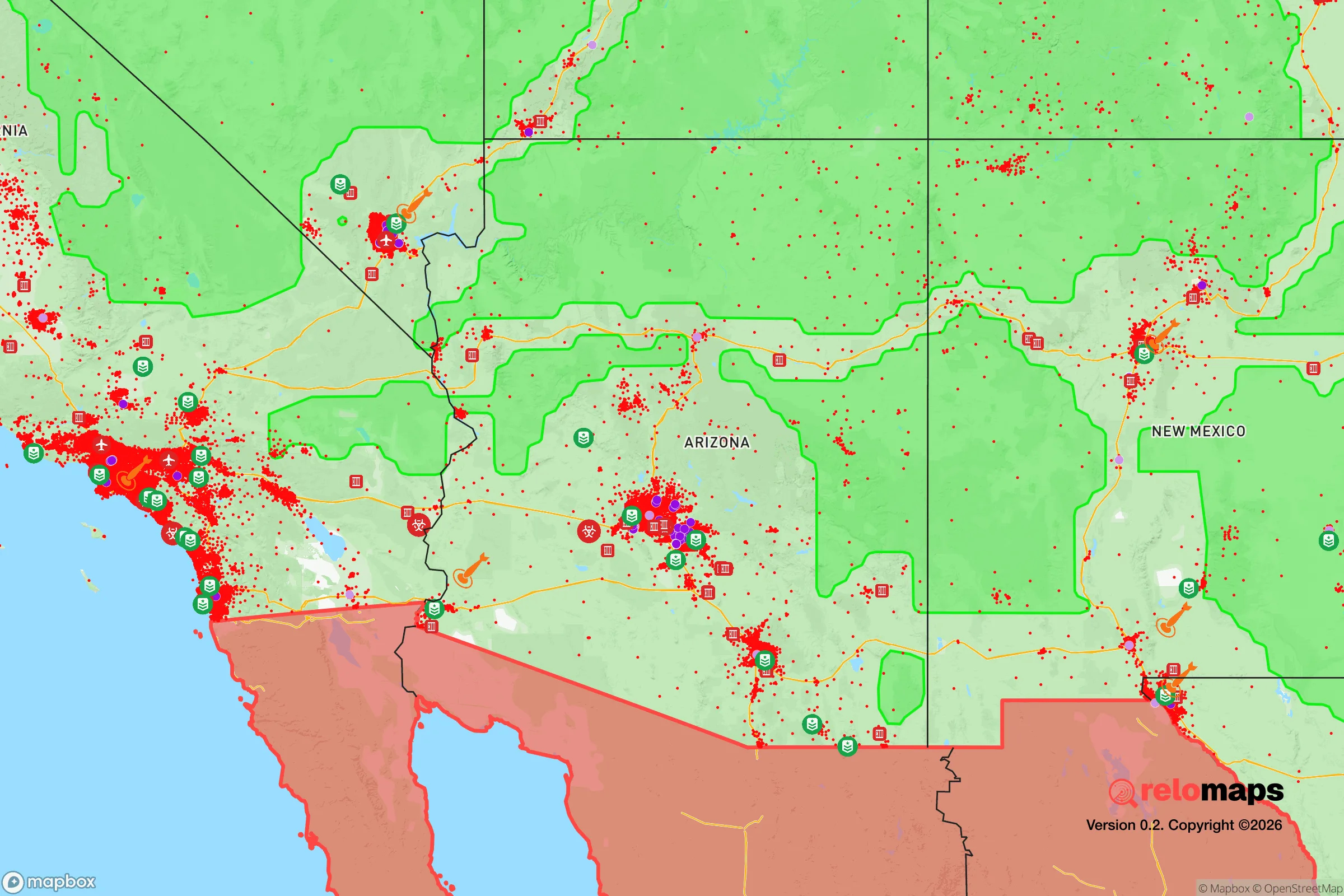
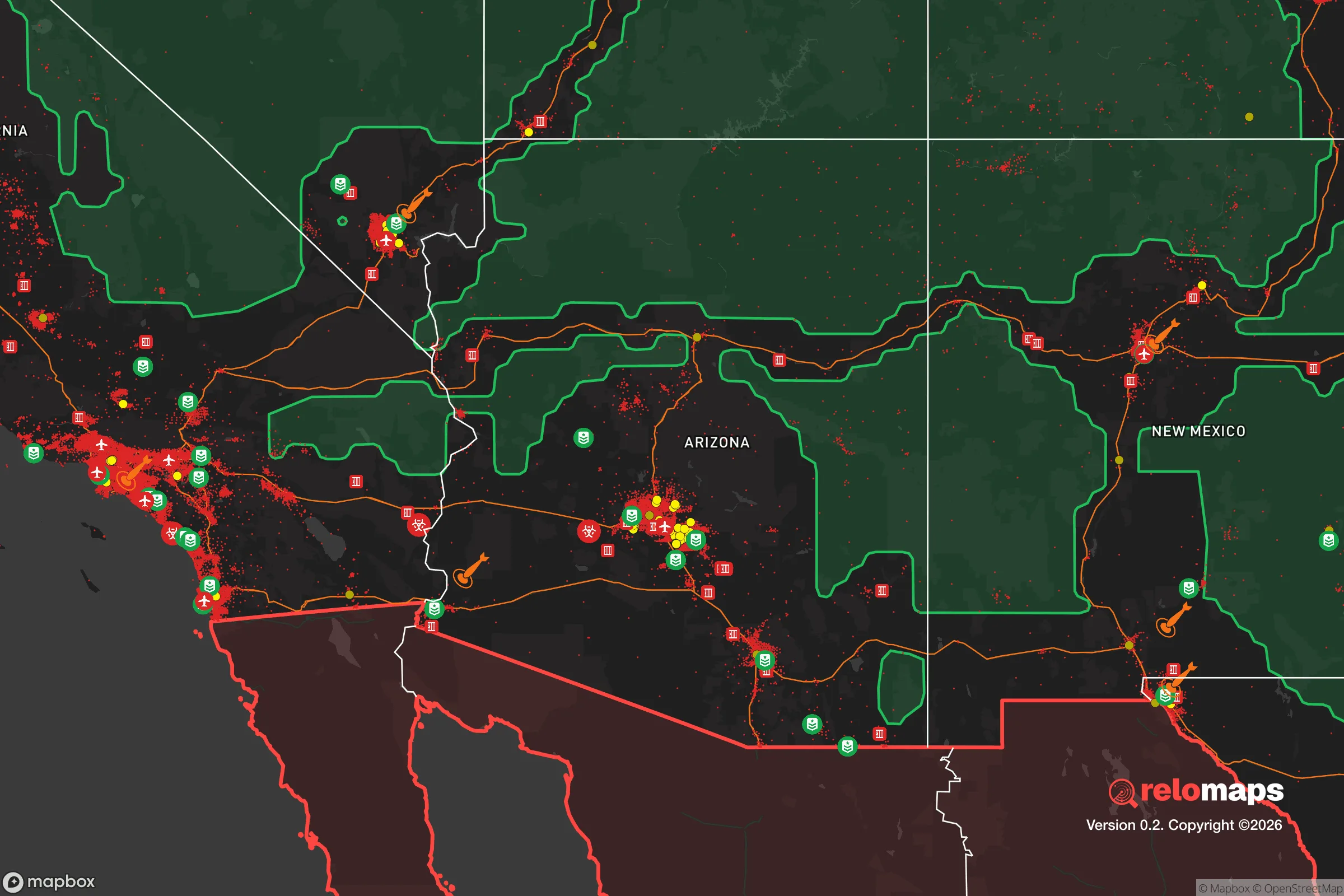
Important Note: For informational purposes only. This does not mean nothing bad ever happens in the green zones. Please use common sense. This is based on public data and modeled with AI. We tried to take a conservative approach but mistakes happen. We update this regularly as new information becomes available.
Solar Generator Recommendations
Backup power matters more here than in safer locations. We've picked three solar generators across budgets and capacity tiers — start with the budget unit if you only need a few essentials, or step up if you want to run a fridge and HVAC for days at a time.

Jackery Portable Power Station Explorer 300
Budget OptionPower on the Go: Weighing only 11 lbs, it's convenient to set up and store with book-sized foldable solar panels

BLUETTI Portable Power Station AC180
Designed for both indoor and outdoor scenarios, AC180 is highly capable as it has a robost capacity and continuous output power.

EF ECOFLOW DELTA Pro Ultra Power Station
Upgraded PickEcoFlow DELTA Pro Ultra is a whole-home energy system designed to grow with your family. Integrated with the Smart Home Panel 2, it scales to meet your evolving energy needs — keeping your home powered, intelligent, and secure through every stage of life.
We earn a commission, at no additional cost to you.
Strategic Assessment Analysis
Kingman, Arizona, sits as a strategic outlier in the Southwest—a place where the resilience equation tilts in your favor if you’re thinking about long-term stability, self-sufficiency, and distance from the chaos of major population centers. Its location along the historic Route 66 and I-40 corridor gives it a logistical edge, but the real draw is what’s missing: the density, the political friction, and the vulnerability of coastal or border-adjacent cities. For a conservative-leaning relocator—whether single or raising a family—Kingman offers a rare combination of geographic isolation, access to critical infrastructure, and a community that still values self-reliance over government dependency. This isn’t a utopia, but it’s a solid base camp for weathering what’s coming.
Geographic position and natural advantages for long-term stability
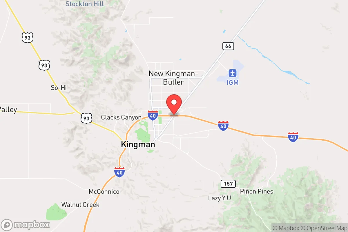
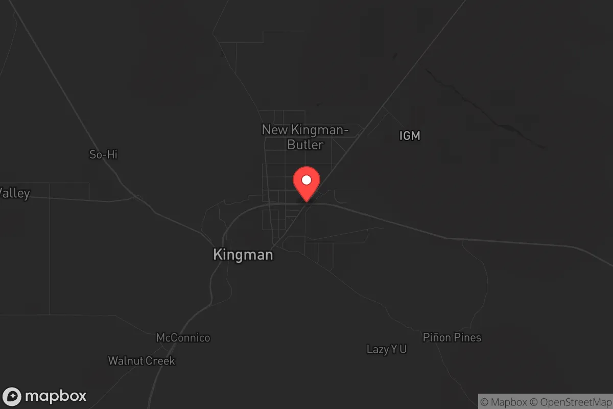
Kingman’s position in northwestern Arizona, roughly 100 miles southeast of Las Vegas and 150 miles northwest of Phoenix, places it in a sweet spot: close enough to access major supply chains and medical facilities, but far enough to avoid the immediate fallout of urban collapse. The city sits at an elevation of 3,300 feet, which means a four-season climate without the extreme heat of Phoenix or the snowpack of Flagstaff—practical for year-round living and food storage. The surrounding Hualapai Mountains and Cerbat Mountains provide natural barriers that slow movement and create defensible terrain, while the vast Mojave Desert to the west acts as a buffer against any rapid population surge from California. Water is the critical variable here, and Kingman sits over the Hualapai Valley aquifer, a groundwater source that, while not infinite, is less contested than the Colorado River allocations further east. The area’s low population density—roughly 30,000 in the city proper, with Mohave County at about 12 people per square mile—means less competition for resources during a crisis. For a prepper, this is the kind of geography that buys you time and options.
Risks, exposures, and proximity to fallout-relevant landmarks
No location is risk-free, and Kingman has its share of exposures that demand honest assessment. The most immediate concern is the proximity to Interstate 40 and the Burlington Northern Santa Fe railway, both of which carry hazardous materials—including crude oil, chemicals, and military-grade equipment—through the heart of town. A derailment or truck accident could create a localized evacuation zone, but that’s a manageable risk compared to what lies further afield. The Nevada National Security Site (formerly the Nevada Test Site) is about 120 miles northwest, and while it’s no longer conducting atmospheric tests, the underground facilities and stored materials make it a potential target in a major conflict. Closer to home, the Davis Dam and Hoover Dam are roughly 60 miles north and 90 miles northwest, respectively; a catastrophic failure or targeted attack on either would send water and debris down the Colorado River corridor, but Kingman sits high enough on the plateau to avoid direct flooding. The real vulnerability is the city’s reliance on the I-40 bridge over the Colorado River at Topock—a single chokepoint that, if compromised, would sever the main supply route from California and force a 150-mile detour through Laughlin or Needles. For a relocator, this means stockpiling supplies and having a secondary route plan, not abandoning the area.
Practical resilience for a relocator: food, water, energy, and defensibility
When you strip away the rhetoric, resilience comes down to four things: water, food, power, and the ability to hold your ground. Kingman scores well on all four, but only if you’re intentional. The municipal water supply comes from the Hualapai Valley aquifer and is treated at the Hilltop Water Treatment Plant, but a grid-down scenario would require private wells or rainwater catchment—both feasible given the area’s 8-10 inches of annual rainfall and the ability to drill 200-400 feet for a well (costing roughly $8,000-$15,000). The soil in the surrounding valleys is alkaline but workable for drought-tolerant crops like beans, squash, and amaranth, and the growing season runs from April to October. For energy, the area is served by UniSource Energy, but solar is the obvious play: Kingman averages 280 sunny days per year, and off-grid solar setups are common among the local prepper community. Defensibility is where Kingman really shines. The city’s layout—a compact downtown surrounded by low-density subdivisions and open BLM land—means you can choose a property with clear sightlines, limited access points, and neighbors who are likely armed and self-sufficient. Mohave County has a strong gun culture and a sheriff’s office that takes Second Amendment rights seriously, which translates to a lower risk of civil unrest spilling into your neighborhood. For families, the local schools are average (Kingman Unified School District scores around 3 out of 10 on GreatSchools), but homeschooling and co-ops are common, and the community is tight-knit enough that you’ll know who to trust.
The overall strategic picture for a conservative relocator
Kingman isn’t a bug-out location for the end of the world—it’s a living, working town where you can build a life that’s already prepared for disruptions. The trade-offs are real: you’re trading the amenities of a major city for space, silence, and a lower target profile. The local economy is anchored by freight, mining, and a growing logistics sector (Amazon has a distribution center here), which means jobs are available but wages lag behind Phoenix or Vegas. The political climate leans heavily conservative—Mohave County voted +30 points for Trump in 2020—and the culture reflects that: churches are full, flags fly, and the local government is skeptical of federal overreach. For a single individual or a parent looking to raise kids away from the cultural rot of coastal cities, Kingman offers a rare combination of affordability (median home price around $350,000), geographic buffer, and a community that still believes in neighborly self-defense. The risks—water scarcity, supply chain chokepoints, proximity to rail and highway hazards—are manageable with planning. If you’re serious about resilience, Kingman deserves a hard look. It’s not the safest place in America, but it’s one of the smartest for someone who wants to be ready without living in a bunker.
* Values derived from national, state, county, city and local statistics and may differ in a specific area. Last updated: 2026-04-22T11:26:40.000Z
Narrative content on this page is AI-generated and may contain mistakes. Verify any details that matter before acting on them.
ReloMaps may earn a commission from affiliate links at no extra cost to you.