Photo: Wikipedia
Strategic Assessment of Leander, TX
Meaningful friction. Expect exposure to either population pressure, blast zones, or natural disaster risk. Consider buying a retreat property.
What does the Strategic Assessment tell us?
Our Strategic Assessment grades tactical survivability of an area. Major population centers, military targets, fallout zones, natural disasters, and border exposure all drive risk — lower exposure means a more defensible position in a crisis.
This is heavily inspired by Joel Skousen's Strategic Relocation book. Highly recommended you checkout the book ($)What does this tell us?
Our Strategic Assessment grades tactical survivability of an area. Major population centers, military targets, fallout zones, natural disasters, and border exposure all drive risk — lower exposure means a more defensible position in a crisis.
This is heavily inspired by Joel Skousen's Strategic Relocation book. Highly recommended you checkout the book ($)Strategic Pillars

Key Distances
Regional Safe Places
Below is our recommended "safe zones" in Texas and the surrounding area based on our strategic heuristics. For most people, it's unrealistic to live in a “safe zone” full-time due to work, family or other personal reasons. They tend to be more rural. However, many of these areas are perfect for second homes and retreat properties that double as a vacation home or even a short-term rental.


Important Note: For informational purposes only. This does not mean nothing bad ever happens in the green zones. Please use common sense. This is based on public data and modeled with AI. We tried to take a conservative approach but mistakes happen. We update this regularly as new information becomes available.
Solar Generator Recommendations
Backup power matters more here than in safer locations. We've picked three solar generators across budgets and capacity tiers — start with the budget unit if you only need a few essentials, or step up if you want to run a fridge and HVAC for days at a time.

Jackery Portable Power Station Explorer 300
Budget OptionPower on the Go: Weighing only 11 lbs, it's convenient to set up and store with book-sized foldable solar panels

BLUETTI Portable Power Station AC180
Designed for both indoor and outdoor scenarios, AC180 is highly capable as it has a robost capacity and continuous output power.

EF ECOFLOW DELTA Pro Ultra Power Station
Upgraded PickEcoFlow DELTA Pro Ultra is a whole-home energy system designed to grow with your family. Integrated with the Smart Home Panel 2, it scales to meet your evolving energy needs — keeping your home powered, intelligent, and secure through every stage of life.
We earn a commission, at no additional cost to you.
Strategic Assessment Analysis
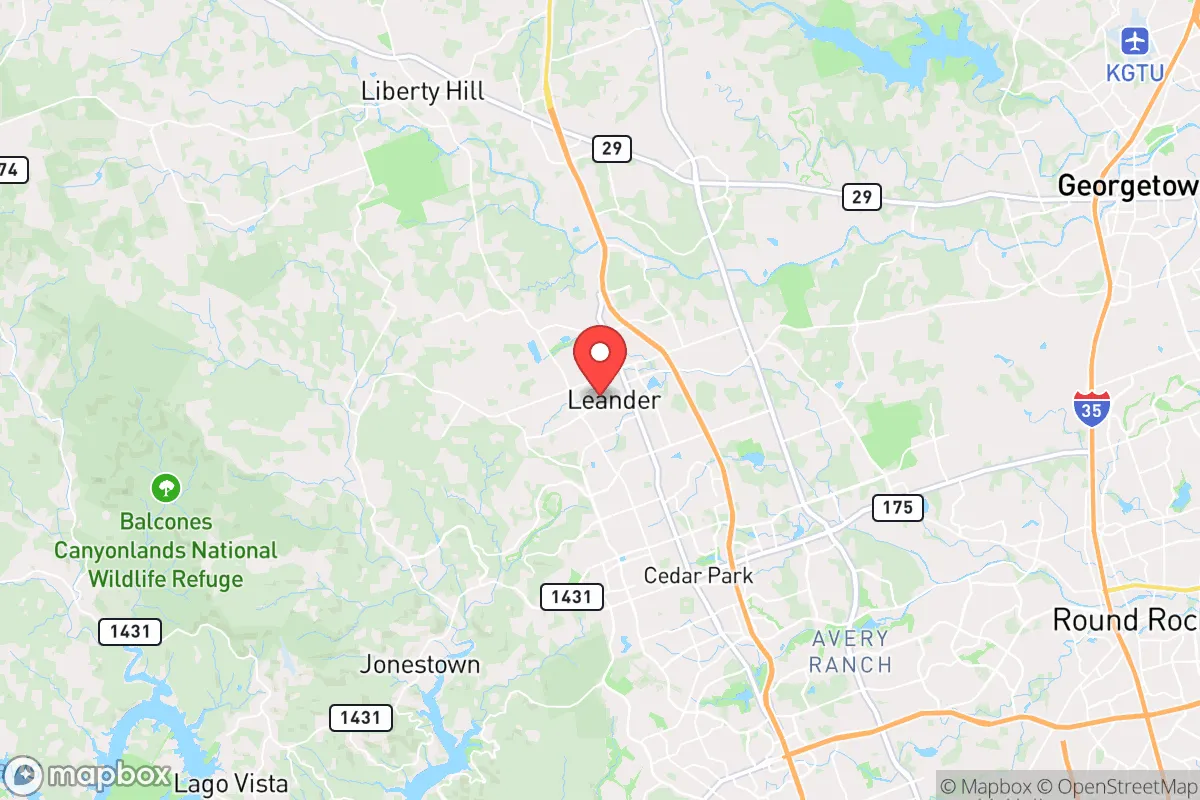
Leander, Texas, sits in a strategic sweet spot that resilience-minded relocators should take seriously: close enough to Austin for supply runs and employment, but far enough out that you aren't caught in the blast radius of a major metro collapse. The city’s position along the rapidly growing I-35 corridor gives it access to critical infrastructure, while its location on the eastern edge of the Texas Hill Country offers natural defensibility and water resources that many flatland suburbs lack. For a conservative-leaning individual or family looking to hedge against civic unrest, supply chain disruptions, or mass casualty events, Leander presents a compelling mix of proximity and buffer—provided you understand where the real risks lie.
Geographic position and natural advantages for long-term stability
Leander’s geography is its strongest card. Situated at roughly 1,000 feet elevation on the Balcones Escarpment, the area benefits from the rocky, hilly terrain of the Hill Country, which naturally limits large-scale encroachment and provides multiple escape routes if I-35 or US 183 become choked. The city sits just north of the Colorado River watershed, with Lake Travis and Lake Georgetown both within a 20- to 30-minute drive—critical for a prepper’s water security plan. The underlying Edwards Aquifer also feeds numerous springs and wells in the region, giving off-grid property owners a viable water source if municipal systems fail. Leander’s position also places it outside the 50-mile “danger zone” from the Austin metro’s core, meaning a major event downtown—whether a terrorist attack, grid collapse, or civil disorder—would likely leave Leander intact as a staging area rather than a primary target. The area’s natural drainage and elevation also reduce flood risk compared to low-lying suburbs like Round Rock or Pflugerville, though flash flooding in low-lying creeks remains a concern during heavy rain events.
Risks, exposures, and proximity to fallout-relevant landmarks
No location is without vulnerabilities, and Leander has several that a serious prepper must account for. The most obvious is its proximity to Austin—roughly 25 miles south—which means any large-scale disaster in the capital city (civil unrest, a dirty bomb, a pandemic surge) will send a wave of refugees north along I-35 and US 183. Leander’s population has exploded from roughly 15,000 in 2000 to over 70,000 today, and that density creates choke points: the main evacuation routes (US 183 and RM 2243) can gridlock within minutes during a panic. The city also sits within 100 miles of the South Texas Nuclear Project (STP) near Bay City, a two-reactor facility that, while not an immediate fallout zone, could become a contamination concern if a catastrophic failure occurred under prevailing southerly winds. Additionally, the nearby Austin-Bergstrom International Airport and the massive Dell Diamond event venue in Round Rock are potential soft targets for coordinated attacks. On the infrastructure side, Leander’s power grid is part of the ERCOT system, which has proven fragile during winter storms (see: 2021’s Uri) and summer heat waves. A prolonged grid-down scenario would leave most of Leander without power for days, though the city’s newer subdivisions are increasingly incorporating natural gas backup generators—a trend worth noting for relocators.
Practical resilience for a relocator: food, water, energy, and defensibility
For a family or individual serious about self-sufficiency, Leander offers a mixed but workable picture. Water security is the strongest asset: the Hill Country’s limestone aquifers mean that many rural properties within Leander’s ETJ (extra-territorial jurisdiction) can drill a private well at depths of 200–400 feet, yielding 10–20 gallons per minute—enough for a household and small garden. Municipal water comes from the Brushy Creek Regional Utility Authority, which draws from Lake Georgetown, a reservoir with roughly 30,000 acre-feet of storage; in a drought, this supply is prioritized for residential use over agriculture. Food production is viable but not effortless: the area’s rocky caliche soil requires raised beds or imported topsoil for serious gardening, but the long growing season (March through November) allows for three-season harvests of tomatoes, peppers, squash, and greens. Local farmers’ markets in Leander and nearby Cedar Park offer backup produce, but a prepper should plan to supplement with freeze-dried stores and a deep pantry. Energy resilience is improving: Leander’s newer homes often include solar-ready roofs, and the city’s building codes now encourage battery storage. However, most existing homes lack whole-house backup, so a portable generator with a transfer switch is a near-mandatory investment. Defensibility is moderate: the city’s layout—a mix of suburban subdivisions and rural acreage—means that a well-chosen property on a cul-de-sac or with a long driveway offers natural standoff. The Williamson County Sheriff’s Office has a strong presence, with response times under 10 minutes in most areas, but in a SHTF scenario, neighbors will matter more than law enforcement. Leander’s conservative culture (the county voted +24 R in 2024) means a higher likelihood of like-minded, armed neighbors—a factor that cannot be overstated for community defense.
The overall strategic picture for Leander is one of calculated opportunity. It is not a remote bunker location—you will have neighbors, traffic, and the constant hum of a growing exurb. But for a relocator who wants to stay within striking distance of Austin’s medical and logistical resources while maintaining a buffer from its risks, Leander checks most boxes. The key is to buy with resilience in mind: prioritize a property with well water, solar potential, and a defensible layout; build relationships with local prepper groups and church communities; and keep a vehicle capable of navigating backroads if the interstates clog. Leander won’t save you from a nationwide collapse, but it will give you a fighting chance to ride out the first 72 hours—and that’s more than most suburbs can claim.
* Values derived from national, state, county, city and local statistics and may differ in a specific area. Last updated: 2026-05-29T21:31:32.000Z
Narrative content on this page is AI-generated and may contain mistakes. Verify any details that matter before acting on them.
ReloMaps may earn a commission from affiliate links at no extra cost to you.