Photo: Wikipedia
Strategic Assessment of Lindale, TX
Meaningful friction. Expect exposure to either population pressure, blast zones, or natural disaster risk. Consider buying a retreat property.
What does the Strategic Assessment tell us?
Our Strategic Assessment grades tactical survivability of an area. Major population centers, military targets, fallout zones, natural disasters, and border exposure all drive risk — lower exposure means a more defensible position in a crisis.
This is heavily inspired by Joel Skousen's Strategic Relocation book. Highly recommended you checkout the book ($)What does this tell us?
Our Strategic Assessment grades tactical survivability of an area. Major population centers, military targets, fallout zones, natural disasters, and border exposure all drive risk — lower exposure means a more defensible position in a crisis.
This is heavily inspired by Joel Skousen's Strategic Relocation book. Highly recommended you checkout the book ($)Strategic Pillars

Key Distances
Regional Safe Places
Below is our recommended "safe zones" in Texas and the surrounding area based on our strategic heuristics. For most people, it's unrealistic to live in a “safe zone” full-time due to work, family or other personal reasons. They tend to be more rural. However, many of these areas are perfect for second homes and retreat properties that double as a vacation home or even a short-term rental.


Important Note: For informational purposes only. This does not mean nothing bad ever happens in the green zones. Please use common sense. This is based on public data and modeled with AI. We tried to take a conservative approach but mistakes happen. We update this regularly as new information becomes available.
Solar Generator Recommendations
Backup power matters more here than in safer locations. We've picked three solar generators across budgets and capacity tiers — start with the budget unit if you only need a few essentials, or step up if you want to run a fridge and HVAC for days at a time.

Jackery Portable Power Station Explorer 300
Budget OptionPower on the Go: Weighing only 11 lbs, it's convenient to set up and store with book-sized foldable solar panels

BLUETTI Portable Power Station AC180
Designed for both indoor and outdoor scenarios, AC180 is highly capable as it has a robost capacity and continuous output power.

EF ECOFLOW DELTA Pro Ultra Power Station
Upgraded PickEcoFlow DELTA Pro Ultra is a whole-home energy system designed to grow with your family. Integrated with the Smart Home Panel 2, it scales to meet your evolving energy needs — keeping your home powered, intelligent, and secure through every stage of life.
We earn a commission, at no additional cost to you.
Strategic Assessment Analysis
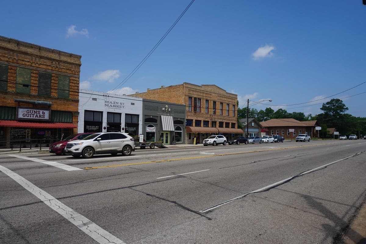
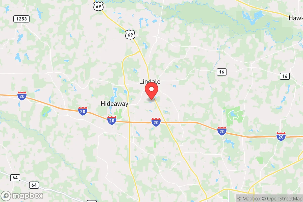
Lindale, Texas, offers a compelling strategic position for those prioritizing resilience and self-sufficiency, sitting roughly 90 miles east of Dallas and 20 miles north of Tyler. Its location places it outside the immediate blast radius and likely fallout zones of major metropolitan targets, while still providing access to regional supply chains and medical infrastructure. The area’s population of roughly 6,000, combined with a low-density rural character, reduces the risks of cascading social collapse seen in dense urban centers. For a relocator with a prepper mindset, Lindale represents a buffer zone—close enough to resources, far enough from the bullseye.
Geographic position and natural advantages for long-term security
Lindale sits in the Piney Woods region of East Texas, a landscape of rolling hills, dense forests, and abundant water. The area’s elevation averages around 400 feet, which provides modest terrain advantages for line-of-sight and defensibility without the isolation of mountainous regions. The Neches River and Lake Palestine are within 15 miles, offering reliable surface water sources for filtration and irrigation. The region’s clay-loam soils support small-scale agriculture, and the growing season stretches from March to November, enabling year-round food production. The dense tree cover provides natural concealment and reduces thermal signature from aerial surveillance, a factor often overlooked in standard relocation guides. The proximity to the Sabine National Forest (about 60 miles east) offers a potential bug-out option, though Lindale itself is already sufficiently rural for most preparedness scenarios.
Risk exposures, fallout proximity, and infrastructure vulnerabilities
The primary strategic weakness of Lindale is its proximity to the Dallas-Fort Worth metroplex, a Tier 1 target for any nuclear exchange or coordinated attack. While Lindale is outside the 5 PSI overpressure zone for a ground burst on Dallas (roughly 50-mile radius), it lies within the moderate fallout corridor depending on wind patterns. The nearby Tyler Pounds Regional Airport (20 miles south) is a secondary target, though its military utility is limited. The area is also within 100 miles of the Comanche Peak Nuclear Power Plant (near Glen Rose), which, while not a likely primary target, could become a secondary fallout source in a broader conflict. On the natural disaster front, East Texas faces tornado risk (EF2-EF3 events are not uncommon) and occasional flooding from the Neches River basin. The region’s power grid is part of the ERCOT system, which has demonstrated fragility during winter storms (e.g., 2021’s Uri), making off-grid energy a necessity, not a luxury. The I-20 corridor, which runs just south of Lindale, is a major evacuation route that could become a choke point during a crisis, so alternative routes via US-69 and FM-16 should be pre-planned.
Practical resilience: food, water, energy, and defensibility for a relocator
For a relocator establishing a homestead, Lindale’s practical resilience is above average. Water is the first pillar: the area’s average annual rainfall of 45 inches supports rainwater catchment systems, and shallow wells (typically 100-200 feet) yield potable water with minimal treatment. The local water table is reliable, and many rural properties already have well permits. For food, the growing season and soil quality allow for vegetable gardens, fruit orchards (peaches, apples, and blackberries thrive), and small livestock like chickens or goats. The Tyler Farmers Market and local feed stores (e.g., Lindale Feed & Seed) provide supply lines for seeds, tools, and animal feed. Energy resilience requires investment: the grid is prone to outages, but solar potential is moderate (4.5-5 peak sun hours per day), and propane delivery is common for backup generation. Wood heating is viable given the forested landscape, but firewood permits are required on public land. Defensibility is mixed: the rural layout offers natural standoff, but the lack of natural barriers (mountains, rivers wide enough to impede vehicles) means a determined group could approach from multiple directions. The local law enforcement presence is limited—Smith County Sheriff’s Office covers the area, with response times of 15-30 minutes in rural zones—so a well-stocked armory and a neighborhood watch network are practical investments. The community itself is small and largely conservative, which tends to foster mutual aid among like-minded residents, but vetting neighbors before a crisis is essential.
The overall strategic picture for Lindale is one of calculated trade-offs. It avoids the existential risks of major cities while retaining access to their medical and logistical resources. The natural environment supports long-term subsistence, but the infrastructure vulnerabilities (grid, water treatment, supply chains) demand proactive hardening. For a single individual or family willing to invest in off-grid systems and community building, Lindale offers a defensible, resource-rich base within a day’s drive of multiple fallback zones. It is not a fortress, but it is a viable platform for weathering the next decade’s uncertainties—provided you arrive with your own water storage, solar panels, and a plan for the first 72 hours when the lights go out and the roads clog.
* Values derived from national, state, county, city and local statistics and may differ in a specific area. Last updated: 2026-04-29T02:39:52.000Z
Narrative content on this page is AI-generated and may contain mistakes. Verify any details that matter before acting on them.
ReloMaps may earn a commission from affiliate links at no extra cost to you.