Photo: Wikipedia
Strategic Assessment of Lowell, MA
Multiple tactical vulnerabilities. Population density, target proximity, or disaster risk are likely compounding. A retreat property and exit planning is required.
What does the Strategic Assessment tell us?
Our Strategic Assessment grades tactical survivability of an area. Major population centers, military targets, fallout zones, natural disasters, and border exposure all drive risk — lower exposure means a more defensible position in a crisis.
This is heavily inspired by Joel Skousen's Strategic Relocation book. Highly recommended you checkout the book ($)What does this tell us?
Our Strategic Assessment grades tactical survivability of an area. Major population centers, military targets, fallout zones, natural disasters, and border exposure all drive risk — lower exposure means a more defensible position in a crisis.
This is heavily inspired by Joel Skousen's Strategic Relocation book. Highly recommended you checkout the book ($)Strategic Pillars

Key Distances
Regional Safe Places
Below is our recommended "safe zones" in Massachusetts and the surrounding area based on our strategic heuristics. For most people, it's unrealistic to live in a “safe zone” full-time due to work, family or other personal reasons. They tend to be more rural. However, many of these areas are perfect for second homes and retreat properties that double as a vacation home or even a short-term rental.


Important Note: For informational purposes only. This does not mean nothing bad ever happens in the green zones. Please use common sense. This is based on public data and modeled with AI. We tried to take a conservative approach but mistakes happen. We update this regularly as new information becomes available.
Solar Generator Recommendations
Backup power matters more here than in safer locations. We've picked three solar generators across budgets and capacity tiers — start with the budget unit if you only need a few essentials, or step up if you want to run a fridge and HVAC for days at a time.

Jackery Portable Power Station Explorer 300
Budget OptionPower on the Go: Weighing only 11 lbs, it's convenient to set up and store with book-sized foldable solar panels

BLUETTI Portable Power Station AC180
Designed for both indoor and outdoor scenarios, AC180 is highly capable as it has a robost capacity and continuous output power.

EF ECOFLOW DELTA Pro Ultra Power Station
Upgraded PickEcoFlow DELTA Pro Ultra is a whole-home energy system designed to grow with your family. Integrated with the Smart Home Panel 2, it scales to meet your evolving energy needs — keeping your home powered, intelligent, and secure through every stage of life.
We earn a commission, at no additional cost to you.
Strategic Assessment Analysis
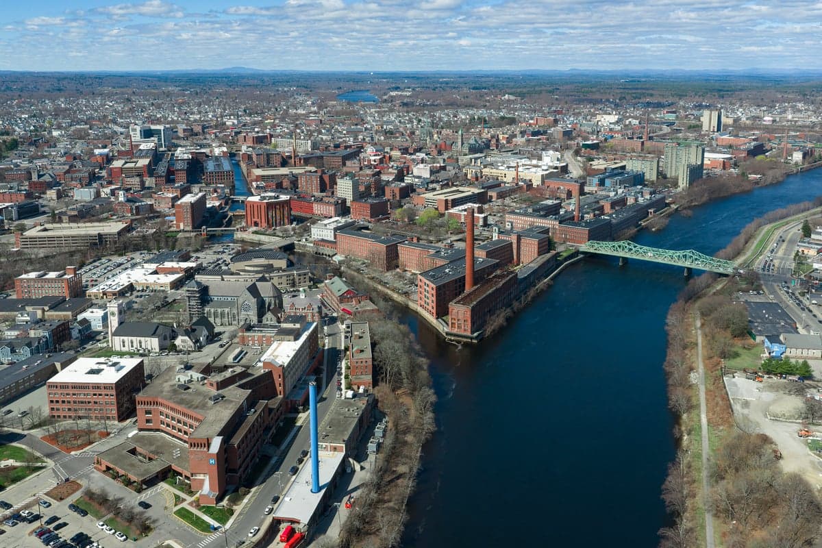
Lowell, Massachusetts, presents a mixed bag for the strategic relocator operating from a prepper or survivalist mindset. Its historical resilience as a former industrial powerhouse is now overshadowed by its position within the dense Boston-Worcester-Manchester corridor, a region that would be a primary target for any large-scale disruption, whether from civil unrest, economic collapse, or a mass casualty event. While the city itself offers some structural advantages—like a robust water supply from the Merrimack River and a legacy of brick-and-beam construction that could be repurposed—its proximity to high-value federal and military assets, dense population centers, and critical infrastructure choke points makes it a high-risk location for anyone seeking true strategic depth. For the conservative-leaning individual or family prioritizing long-term security and self-sufficiency, Lowell is a location that demands a very clear-eyed assessment of its liabilities before any relocation decision is made.
Geographic position and natural advantages for long-term security
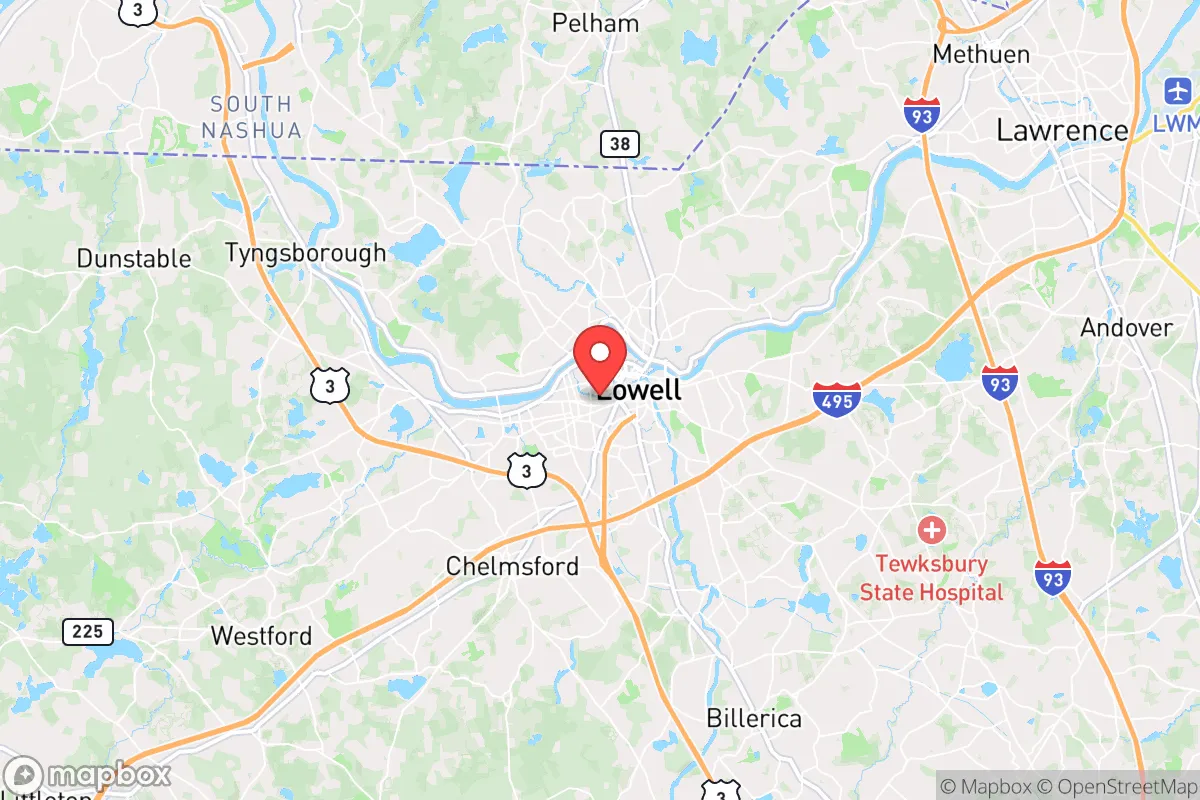
Lowell sits at the confluence of the Merrimack and Concord Rivers, roughly 25 miles northwest of Boston. This riverine position is a double-edged sword. On the plus side, the Merrimack provides a substantial, year-round water source—critical for any extended grid-down scenario. The city's historic canal system, originally built to power its textile mills, could theoretically be adapted for micro-hydro generation or gravity-fed water distribution in a localized recovery effort. The surrounding topography is gently rolling, with the Middlesex Fells Reservation and numerous state parks to the east and south offering some wooded buffer, though nothing approaching true wilderness. The land is not particularly defensible; it's a river valley with established suburban sprawl. For a relocator, the natural advantage is almost entirely water access. The disadvantage is that Lowell is a natural transportation hub—Interstates 93, 95, and 495 all converge nearby, and the city is a major commuter rail terminus. In a crisis, these same routes that bring people in for work would become evacuation chokepoints or vectors for looting and refugee movement. The city's position within the Boston CSA means it is within the primary fallout and secondary blast radius of any major event targeting the Northeast corridor, including potential strikes on Hanscom Air Force Base (15 miles south) or the Portsmouth Naval Shipyard (40 miles east).
Risks, exposures, and proximity to fallout-relevant landmarks
This is where Lowell's strategic calculus turns sharply negative. The city is less than 30 miles from the Boston financial district and Logan International Airport, both high-probability targets for any coordinated attack or civil unrest event. The concentration of federal buildings, biotech labs (especially in Cambridge and Kendall Square), and the region's power grid interconnects make the entire Boston metro area a high-value target. Lowell itself hosts the Lowell National Historical Park, a federal facility, and the University of Massachusetts Lowell, a public research university with a growing defense and cybersecurity focus. While not a primary target, these institutions make the city a secondary concern. More critically, the city's population density—over 115,000 people in roughly 14 square miles—creates a severe vulnerability. In a mass casualty event or pandemic scenario, this density would accelerate transmission and overwhelm local medical resources. Lowell General Hospital is a solid community hospital, but it is not a Level 1 trauma center; the nearest major trauma centers are in Boston, which would be inaccessible during a crisis. The city's reliance on the I-93 and I-495 corridors for supply chains means that any disruption to those highways—whether from a natural disaster, a coordinated attack, or civil unrest—would cut off food, fuel, and medical resupply within 48 hours. The Merrimack River itself is a flood risk; major floods in 1936 and 2006 caused significant damage, and climate change projections suggest increased frequency of extreme precipitation events.
Practical resilience for a relocator: food, water, energy, and defensibility
For a relocator looking to establish a sustainable household, Lowell offers a few practical starting points but falls short on the core prepper requirements. Water is the one clear advantage: the city's water supply comes from the Merrimack River and is treated at the Lowell Regional Water Utility. In a grid-down scenario, the river itself is a reliable source, but it requires robust filtration and boiling—the river carries industrial runoff and upstream sewage. A well is not a realistic option for most city lots. Food security is poor. The city has a handful of farmers' markets and community gardens, but the surrounding agricultural land is mostly suburban or developed. The nearest significant farmland is in the Merrimack Valley to the north (around Dracut and Tyngsborough) or in the Nashoba Valley to the west. For a relocator, you would need to secure a property with at least 1-2 acres of arable land within a 20-minute drive to have any meaningful food production capacity, and those properties are increasingly expensive and competitive. Energy resilience is also a concern. The city's grid is served by National Grid, and while there are some solar installations, the region's cloudy winters and tree cover limit solar yield. Natural gas is the primary heating fuel, and a disruption to the gas supply would leave most homes without heat. Wood heating is possible but requires sourcing and storage space. Defensibility is the weakest link. Lowell is a dense, walkable city with narrow streets and a historic core that offers good cover but also creates kill zones and limited fields of fire. The city's police department is professional but would be overwhelmed in a widespread event. The surrounding suburbs (Chelmsford, Tewksbury, Billerica) offer slightly better defensibility with larger lots and more rural character, but they are still within the same vulnerable corridor. For a single individual or family, the best practical approach would be to rent a secure apartment in a brick building with a basement and a backup water supply, while maintaining a bug-out location further north (e.g., the White Mountains of New Hampshire, about 90 minutes away).
The overall strategic picture for Lowell is one of calculated risk with a low ceiling for true security. It is not a location for a long-term, self-sufficient homestead or a retreat. Its value lies in its access to water, its historic infrastructure that could be adapted for community-scale recovery, and its proximity to Boston's job market for those who need to maintain a professional career while building resilience. However, for the conservative prepper who views the current trajectory of the country with concern—who sees the potential for cascading failures from economic collapse, civil unrest, or a mass casualty event—Lowell is a high-exposure location that offers little strategic depth. The city's density, its position on major transportation corridors, and its proximity to primary target zones in Boston make it a location to approach with caution. If you are determined to relocate to the region, the smarter play is to look at the exurbs north of the city, such as Pelham, New Hampshire, or the hill towns of western Massachusetts, where you can gain distance from the urban core while still maintaining a reasonable commute. Lowell itself is best viewed as a resource hub—a place to access supplies, medical care, and community networks—but not as a primary residence for anyone serious about long-term survival and security.
* Values derived from national, state, county, city and local statistics and may differ in a specific area. Last updated: 2026-05-02T01:37:53.000Z
Narrative content on this page is AI-generated and may contain mistakes. Verify any details that matter before acting on them.
ReloMaps may earn a commission from affiliate links at no extra cost to you.