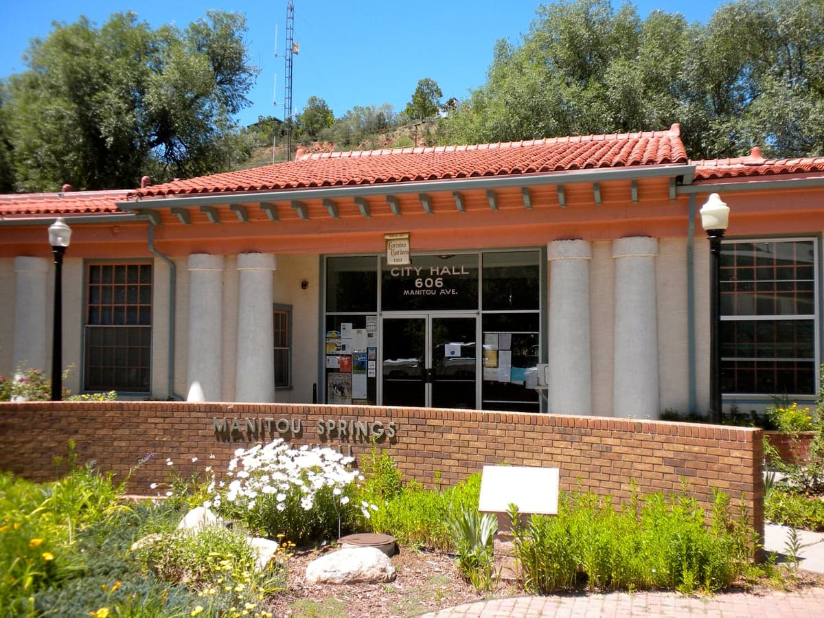
Photo: Wikipedia
Strategic Assessment of Manitou Springs, CO
Multiple tactical vulnerabilities. Population density, target proximity, or disaster risk are likely compounding. A retreat property and exit planning is required.
What does the Strategic Assessment tell us?
Our Strategic Assessment grades tactical survivability of an area. Major population centers, military targets, fallout zones, natural disasters, and border exposure all drive risk — lower exposure means a more defensible position in a crisis.
This is heavily inspired by Joel Skousen's Strategic Relocation book. Highly recommended you checkout the book ($)What does this tell us?
Our Strategic Assessment grades tactical survivability of an area. Major population centers, military targets, fallout zones, natural disasters, and border exposure all drive risk — lower exposure means a more defensible position in a crisis.
This is heavily inspired by Joel Skousen's Strategic Relocation book. Highly recommended you checkout the book ($)Strategic Pillars

Key Distances
Regional Safe Places
Below is our recommended "safe zones" in Colorado and the surrounding area based on our strategic heuristics. For most people, it's unrealistic to live in a “safe zone” full-time due to work, family or other personal reasons. They tend to be more rural. However, many of these areas are perfect for second homes and retreat properties that double as a vacation home or even a short-term rental.


Important Note: For informational purposes only. This does not mean nothing bad ever happens in the green zones. Please use common sense. This is based on public data and modeled with AI. We tried to take a conservative approach but mistakes happen. We update this regularly as new information becomes available.
Solar Generator Recommendations
Backup power matters more here than in safer locations. We've picked three solar generators across budgets and capacity tiers — start with the budget unit if you only need a few essentials, or step up if you want to run a fridge and HVAC for days at a time.

Jackery Portable Power Station Explorer 300
Budget OptionPower on the Go: Weighing only 11 lbs, it's convenient to set up and store with book-sized foldable solar panels

BLUETTI Portable Power Station AC180
Designed for both indoor and outdoor scenarios, AC180 is highly capable as it has a robost capacity and continuous output power.

EF ECOFLOW DELTA Pro Ultra Power Station
Upgraded PickEcoFlow DELTA Pro Ultra is a whole-home energy system designed to grow with your family. Integrated with the Smart Home Panel 2, it scales to meet your evolving energy needs — keeping your home powered, intelligent, and secure through every stage of life.
We earn a commission, at no additional cost to you.
Strategic Assessment Analysis
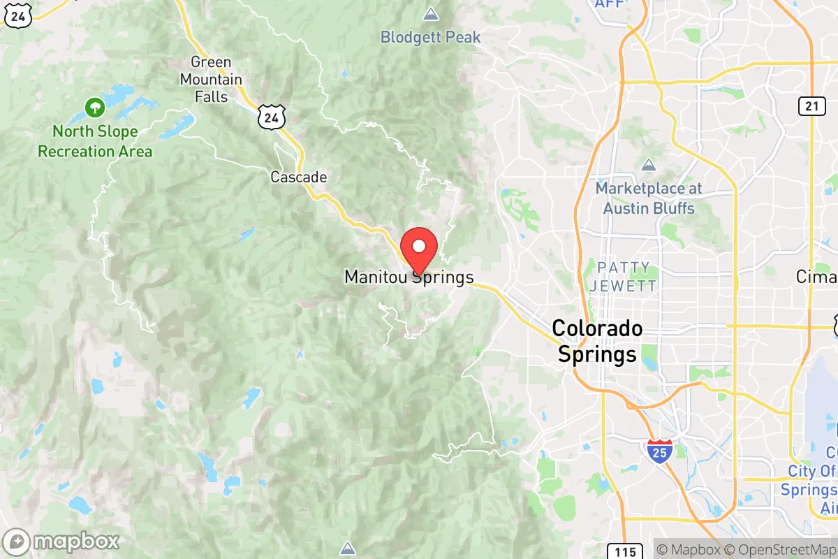
Manitou Springs offers a compelling strategic position for those prioritizing resilience, but it is not without significant trade-offs. Nestled at the base of Pikes Peak and just west of Colorado Springs, this small town of roughly 5,000 people benefits from a natural choke point geography—U.S. Highway 24 is the primary artery in and out, which can be a liability in a mass evacuation but a defensive asset if you control the high ground. The area’s elevation (over 6,300 feet) and rugged terrain provide natural barriers against the kind of sprawling suburban chaos that plagues Front Range cities like Denver, 70 miles north. For a relocator with a prepper mindset, the key question is whether the town’s isolation and access to mountain resources outweigh its proximity to a major military hub and potential fallout targets.
Geographic position and natural defensive advantages
Manitou Springs sits in a narrow canyon at the eastern edge of the Rocky Mountains, giving it a distinct strategic advantage over flatter, more exposed areas. The town is flanked by steep hillsides and the Pike National Forest to the west, which offers immediate access to remote wilderness, water sources, and game. The natural terrain creates a funnel effect: anyone approaching from the east must pass through the bottleneck of Highway 24, which can be monitored or blocked with relative ease. This defensibility is rare for a town that is still within 15 minutes of a major city’s resources—Colorado Springs has hospitals, supply chains, and a population of nearly 500,000. However, that proximity cuts both ways. In a collapse scenario, Manitou Springs could become a refuge for those fleeing the city, overwhelming its limited infrastructure. The town’s small footprint and limited road network mean that a determined group could hold the perimeter, but only if residents are organized and prepared to enforce access control.
Risks, exposures, and proximity to fallout-relevant landmarks
The single biggest strategic liability for Manitou Springs is its location near Peterson Space Force Base and Schriever Air Force Base, both within 20 miles east. These are high-value military installations that would be primary targets in a nuclear exchange or major conflict. Colorado Springs also hosts the U.S. Air Force Academy and NORAD’s Cheyenne Mountain Complex, the latter of which is literally adjacent to Manitou Springs—the complex’s blast-hardened entrance is just a few miles up the mountain. While NORAD is designed to survive a direct hit, the surrounding area would be subject to electromagnetic pulse (EMP) effects, ground shock, and potential secondary targeting. Fallout patterns from a strike on the Springs would likely drift eastward due to prevailing winds, sparing Manitou Springs the worst of the radioactive debris, but the initial blast and EMP could still disrupt electronics and infrastructure. Additionally, the town sits in a flood-prone canyon; heavy rain or a dam failure at nearby Rampart Reservoir could wash out roads and homes. Wildfire risk is also high—the 2012 Waldo Canyon Fire burned within a mile of town, and the 2020 Cameron Peak Fire demonstrated how quickly mountain communities can become isolated.
Practical resilience for a relocator: food, water, energy, and defensibility
For a prepper looking to establish a long-term hold, Manitou Springs has mixed marks. Water is the strongest asset: the town draws from natural mineral springs and mountain runoff, and the surrounding Pike National Forest has numerous creeks and streams. However, surface water requires treatment—giardia and other pathogens are common. A good Berkey filter or UV system is non-negotiable. Food security is weaker. The town has a small grocery store (Manitou Springs City Market) and a few local farms, but most food is trucked in from the east. In a supply chain disruption, shelves would empty within days. Gardening is possible but limited by the short growing season (last frost in May, first in September) and rocky soil. Energy is a vulnerability: the grid is above-ground and exposed to wind, ice, and fire. Solar is viable—the area gets over 300 sunny days per year—but battery storage is essential for winter nights. Propane and wood are the primary backup heat sources; most older homes have fireplaces, but newer builds may not. Defensibility is good for a small group but poor for a large community. The canyon layout means you can see threats coming from the east, but the west side is open to foot traffic from the forest. A perimeter would need to cover multiple trailheads and drainage channels. The town’s culture leans liberal and tourist-oriented—many residents are artists, retirees, or seasonal workers—so a survivalist mindset is not the norm. You would likely be on your own or in a small network of like-minded individuals.
Overall, Manitou Springs is a high-risk, high-reward location for strategic relocation. Its natural defenses and water access are genuine advantages, but the proximity to military targets and the vulnerability of its supply lines make it a poor choice for those seeking true isolation. If you are willing to invest in off-grid energy, water treatment, and a solid perimeter plan, the town could serve as a base for retreating into the mountains during a crisis. However, for a conservative-leaning prepper who values low profile and distance from federal assets, the area may feel too close to the bullseye. A better bet might be the San Luis Valley or the Western Slope, where population density is lower and strategic targets are fewer. Manitou Springs is a beautiful place with real resilience potential—but only if you are prepared to navigate its unique risks with eyes wide open.
* Values derived from national, state, county, city and local statistics and may differ in a specific area. Last updated: 2026-04-29T00:41:38.000Z
Narrative content on this page is AI-generated and may contain mistakes. Verify any details that matter before acting on them.
ReloMaps may earn a commission from affiliate links at no extra cost to you.