
Photo: Wikipedia
Strategic Assessment of Marlborough, MA
Multiple tactical vulnerabilities. Population density, target proximity, or disaster risk are likely compounding. A retreat property and exit planning is required.
What does the Strategic Assessment tell us?
Our Strategic Assessment grades tactical survivability of an area. Major population centers, military targets, fallout zones, natural disasters, and border exposure all drive risk — lower exposure means a more defensible position in a crisis.
This is heavily inspired by Joel Skousen's Strategic Relocation book. Highly recommended you checkout the book ($)What does this tell us?
Our Strategic Assessment grades tactical survivability of an area. Major population centers, military targets, fallout zones, natural disasters, and border exposure all drive risk — lower exposure means a more defensible position in a crisis.
This is heavily inspired by Joel Skousen's Strategic Relocation book. Highly recommended you checkout the book ($)Strategic Pillars

Key Distances
Regional Safe Places
Below is our recommended "safe zones" in Massachusetts and the surrounding area based on our strategic heuristics. For most people, it's unrealistic to live in a “safe zone” full-time due to work, family or other personal reasons. They tend to be more rural. However, many of these areas are perfect for second homes and retreat properties that double as a vacation home or even a short-term rental.


Important Note: For informational purposes only. This does not mean nothing bad ever happens in the green zones. Please use common sense. This is based on public data and modeled with AI. We tried to take a conservative approach but mistakes happen. We update this regularly as new information becomes available.
Solar Generator Recommendations
Backup power matters more here than in safer locations. We've picked three solar generators across budgets and capacity tiers — start with the budget unit if you only need a few essentials, or step up if you want to run a fridge and HVAC for days at a time.

Jackery Portable Power Station Explorer 300
Budget OptionPower on the Go: Weighing only 11 lbs, it's convenient to set up and store with book-sized foldable solar panels

BLUETTI Portable Power Station AC180
Designed for both indoor and outdoor scenarios, AC180 is highly capable as it has a robost capacity and continuous output power.

EF ECOFLOW DELTA Pro Ultra Power Station
Upgraded PickEcoFlow DELTA Pro Ultra is a whole-home energy system designed to grow with your family. Integrated with the Smart Home Panel 2, it scales to meet your evolving energy needs — keeping your home powered, intelligent, and secure through every stage of life.
We earn a commission, at no additional cost to you.
Strategic Assessment Analysis
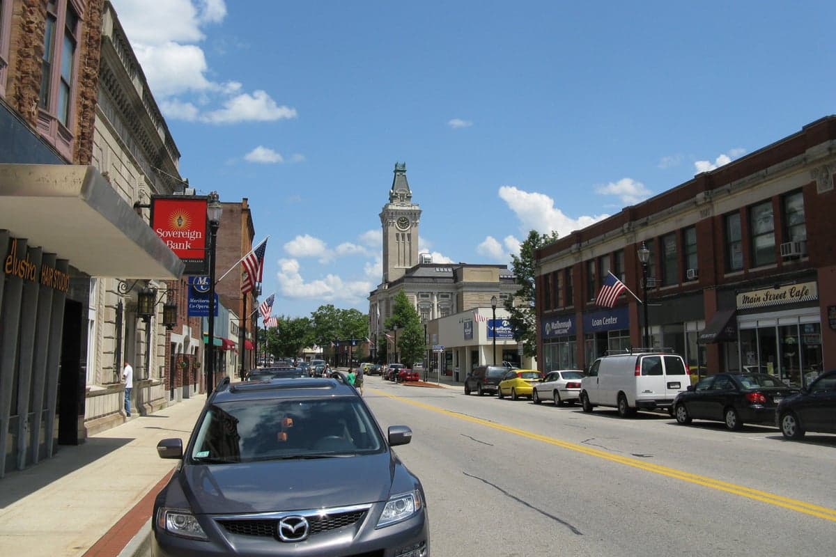
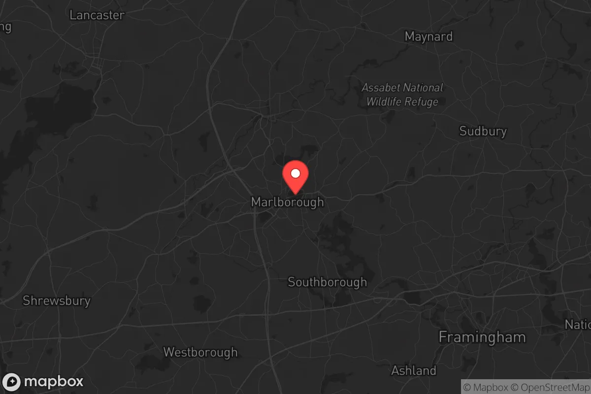
Marlborough, Massachusetts, sits in a precarious but potentially advantageous position for those serious about strategic relocation. Wedged between the Boston metro sprawl and the more rural reaches of Central Massachusetts, it offers a blend of proximity to economic hubs and a buffer from the densest urban chaos. For a prepper or survivalist with a conservative bent, the key question isn't whether Marlborough is a bunker—it's whether it provides enough breathing room to ride out the first wave of a crisis while still being close enough to resources to matter. The answer is mixed, but leans toward a qualified "yes" for those who plan ahead.
Geographic position and natural advantages for long-term stability
Marlborough's location along the I-495 belt, roughly 30 miles west of Boston, gives it a critical edge: it's far enough from the coast to avoid the worst of a hurricane storm surge or a sea-level-rise scenario, yet close enough to major highways (I-90, I-495, Route 20) to allow rapid evacuation or supply runs if needed. The city sits on the Assabet River watershed, with access to several small lakes and reservoirs—Lake Williams, Fort Meadow Reservoir, and the Sudbury River system—which provide decentralized water sources that aren't dependent on a single municipal plant. The terrain is gently rolling, with pockets of forest and farmland to the west and north, offering natural cover and some defensible chokepoints along secondary roads. For a relocator, this means you're not trapped in a valley or floodplain, and you have multiple egress routes if the main arteries clog. The region's four-season climate also works in your favor: cold winters discourage mass migration from warmer zones during a collapse, and the growing season, though short, is reliable enough for small-scale food production if you secure a plot with decent soil.
Risks, exposures, and proximity to fallout-relevant landmarks
The biggest liability for Marlborough is its proximity to high-value targets. Boston is only 30 miles east, and the city lies within the fallout plume zone of any major event at the Boston Harbor port, Logan International Airport, or the numerous biotech and defense contractors along the I-95 corridor. Hanscom Air Force Base (Bedford) is about 15 miles northeast, and the Massachusetts Military Reservation on Cape Cod is farther but still within a worst-case fallout radius depending on wind patterns. More immediately, Marlborough itself hosts a cluster of data centers and tech firms (e.g., Dell EMC, TJX headquarters) that could become secondary targets or looting magnets during civil unrest. The city's population of roughly 40,000 is dense enough that a localized disaster—a chemical spill on I-495, a train derailment on the CSX line that runs through town—could quickly overwhelm local emergency services. On the plus side, Marlborough's fire and police departments are well-funded by Massachusetts standards, and the city has a mutual-aid agreement with surrounding towns. But in a widespread crisis, those resources will be stretched thin. The real risk is being caught between the urban collapse of Boston and the rural resource-hoarding of Central Mass—a no-man's-land that could see heavy transient traffic.
Practical resilience for a relocator: food, water, energy, and defensibility
For a single individual or family looking to hunker down, Marlborough offers a mixed bag. Water is the strongest suit: the city's municipal supply comes from the Sudbury Reservoir and several wells, but a prepper should have a backup plan—rainwater catchment is viable with average annual precipitation of 48 inches, and the Assabet River is fishable but requires treatment for industrial runoff. Food security is weaker. Marlborough has a handful of community gardens and farmers' markets (e.g., the Marlborough Farmers Market at the Senior Center), but the soil in many residential lots is thin and rocky; you'd need raised beds or a greenhouse to produce meaningful calories. The city's zoning allows backyard chickens and small livestock in most residential areas, but be prepared for neighbor complaints if you're not discreet. Energy is a bright spot: Massachusetts has net metering and solar incentives, and many homes in Marlborough have south-facing roofs suitable for panels. A generator is non-negotiable, as winter nor'easters routinely knock out power for days. Defensibility is the hardest sell. Marlborough is a typical suburban grid—cul-de-sacs, strip malls, and a downtown with narrow streets. A determined group could block off a few key intersections (e.g., Main Street at Route 20, or the I-495 on-ramps), but the town is too porous to hold against a determined mob. Your best bet is a home on the western edge, near the Sudbury Valley or the Berlin town line, where lot sizes increase and tree cover thickens. Avoid the apartment complexes near the Solomon Pond Mall—they'll be looting magnets.
The overall strategic picture for Marlborough is one of calculated risk. It's not a fortress, and it's not a remote homestead. What it offers is a middle ground: a place where you can maintain a professional career (especially in tech or healthcare) while building a resilient household that can weather a few weeks of grid-down chaos or a localized riot. The conservative prepper will appreciate that Marlborough's tax base is solid, its schools are decent (Marlborough High School has a strong JROTC program), and its police are not defunded. But the long-term viability depends on your willingness to invest in off-grid infrastructure and to build relationships with neighbors who share your mindset. If you're looking for a bug-out location, look farther west—to the Berkshires or New Hampshire. If you're looking for a place to live and prepare while staying close to economic opportunity, Marlborough is a workable base camp. Just don't expect it to survive a direct hit from a major event. Plan for the first 72 hours to be the most dangerous, and have a secondary retreat lined up in the hill towns beyond Worcester. That's the honest assessment.
* Values derived from national, state, county, city and local statistics and may differ in a specific area. Last updated: 2026-04-24T04:55:14.000Z
Narrative content on this page is AI-generated and may contain mistakes. Verify any details that matter before acting on them.
ReloMaps may earn a commission from affiliate links at no extra cost to you.