
Photo: Wikipedia
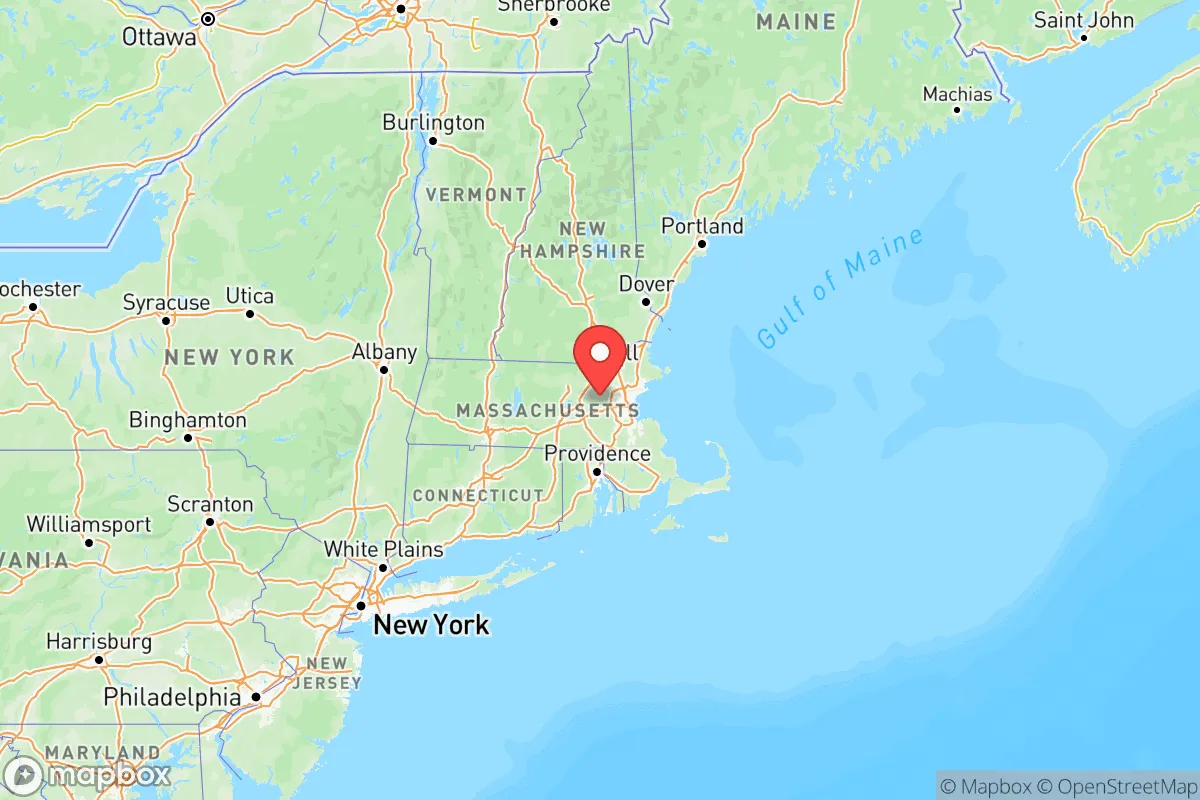
Strategic Assessment of Massachusetts
High tactical risk. This location is likely close to major population centers, strategic targets, or sits in a high-disaster corridor. A retreat property and careful exit planning is required.
What does the Strategic Assessment tell us?
Our Strategic Assessment grades tactical survivability of an area. Major population centers, military targets, fallout zones, natural disasters, and border exposure all drive risk — lower exposure means a more defensible position in a crisis.
This is heavily inspired by Joel Skousen's Strategic Relocation book. Highly recommended you checkout the book ($)What does this tell us?
Our Strategic Assessment grades tactical survivability of an area. Major population centers, military targets, fallout zones, natural disasters, and border exposure all drive risk — lower exposure means a more defensible position in a crisis.
This is heavily inspired by Joel Skousen's Strategic Relocation book. Highly recommended you checkout the book ($)Regional Safe Places
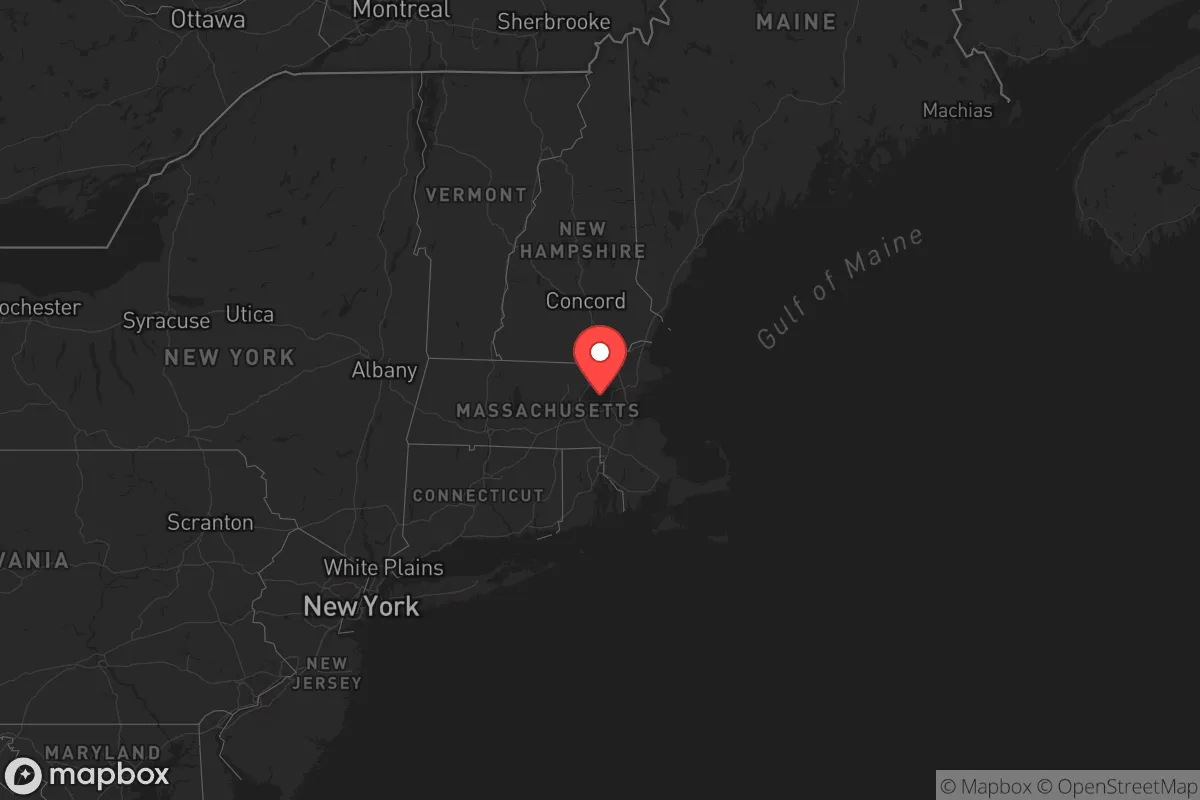
Below is our recommended "safe zones" in Massachusetts and the surrounding area based on our strategic heuristics. For most people, it's unrealistic to live in a “safe zone” full-time due to work, family or other personal reasons. They tend to be more rural. However, many of these areas are perfect for second homes and retreat properties that double as a vacation home or even a short-term rental.


Important Note: For informational purposes only. This does not mean nothing bad ever happens in the green zones. Please use common sense. This is based on public data and modeled with AI. We tried to take a conservative approach but mistakes happen. We update this regularly as new information becomes available.
Solar Generator Recommendations
Backup power matters more here than in safer locations. We've picked three solar generators across budgets and capacity tiers — start with the budget unit if you only need a few essentials, or step up if you want to run a fridge and HVAC for days at a time.

Jackery Portable Power Station Explorer 300
Budget OptionPower on the Go: Weighing only 11 lbs, it's convenient to set up and store with book-sized foldable solar panels

BLUETTI Portable Power Station AC180
Designed for both indoor and outdoor scenarios, AC180 is highly capable as it has a robost capacity and continuous output power.

EF ECOFLOW DELTA Pro Ultra Power Station
Upgraded PickEcoFlow DELTA Pro Ultra is a whole-home energy system designed to grow with your family. Integrated with the Smart Home Panel 2, it scales to meet your evolving energy needs — keeping your home powered, intelligent, and secure through every stage of life.
We earn a commission, at no additional cost to you.
Strategic Assessment Analysis
Massachusetts offers a complex strategic picture for the conservative relocator focused on resilience. While the state’s political climate leans heavily progressive, its geographic position provides genuine hard-asset advantages that a prepper can leverage. The state sits at the northeastern edge of the Eastern Seaboard, far from the major fault lines, hurricane-prone Gulf Coast, and the sprawling urban corridors of the Mid-Atlantic. Its coastline, while exposed, is dotted with natural harbors and protected bays, and its interior is a mix of rugged hills, dense forests, and working farmland. For someone thinking about long-term stability, Massachusetts is not a retreat into the wilderness—it’s a calculated position on the edge of a volatile system, where proximity to maritime trade routes and a robust energy infrastructure can be turned into a strategic asset if you know where to look.
Geographic position and natural advantages for long-term security
Massachusetts sits at the northern terminus of the I-95 corridor, roughly 200 miles from New York City and 450 miles from Washington, D.C. That distance is a double-edged sword: it’s far enough to avoid the immediate fallout of a major event in those cities, but close enough that supply chains and evacuation routes could be disrupted. The state’s real advantage is its coastline. The Port of Boston is a major deepwater port, but for a prepper, the smaller ports like New Bedford and Gloucester are more interesting—they’re active fishing hubs with working waterfronts, meaning fresh seafood and maritime trade can be accessed even if inland supply chains break down. The interior offers the Berkshire Mountains in the west, which provide elevation, cooler temperatures, and a natural barrier against coastal storm surge. The Connecticut River Valley, running through the center of the state, is fertile agricultural land that supports dairy, apples, and vegetables. For a relocator, the western half of the state—towns like Pittsfield, North Adams, or Great Barrington—offers defensible terrain with lower population density and access to the Appalachian Trail corridor, which can serve as a wilderness escape route if needed.
Risks, exposures, and proximity to fallout-relevant landmarks
The biggest risk in Massachusetts is its density of high-value targets. The state is home to Hanscom Air Force Base near Bedford, a major research and command hub for the U.S. Air Force, and Westover Air Reserve Base in Chicopee, which houses C-5 Galaxy cargo aircraft. Both are potential primary or secondary targets in a conflict scenario. The Pilgrim Nuclear Power Station in Plymouth, though decommissioned, still stores spent fuel on-site, creating a radiological hazard zone within a 10-mile radius. The Boston metropolitan area itself is a dense urban target with over 4.5 million people, a major financial center, and the Port of Boston—a likely chokepoint in any maritime disruption. For a prepper, living within 50 miles of Boston or near any military installation increases exposure to evacuation chaos, supply shortages, and potential secondary effects from a strike. The state also has a high concentration of research universities (MIT, Harvard) and biotech labs, which could be targets for industrial sabotage or civil unrest. Flooding is a real concern along the coast and in river valleys, especially with nor’easters and sea-level rise. The western hills are safer from flooding but still face winter storms that can knock out power for days.
Practical resilience for a relocator: food, water, energy, and defensibility
Massachusetts has a mixed record on practical resilience. Water is abundant—the state has over 3,000 lakes and ponds, and the Quabbin Reservoir in the central part of the state is one of the largest unfiltered water supplies in the country, serving Boston. For a relocator, a property with a private well or access to a surface water source is feasible, especially in the western counties. Food production is limited but viable. The state has about 7,000 farms, mostly small-scale, concentrated in the Connecticut River Valley and the Pioneer Valley around Amherst and Northampton. You can find local meat, dairy, and produce, but Massachusetts imports roughly 85% of its food, so a supply chain disruption would hit hard. Energy is a bright spot. The state has a mix of natural gas, nuclear (though Pilgrim is gone), and increasing renewables. The LNG terminal in Everett (near Boston) is a critical import point for natural gas, but that’s a vulnerability—if it goes offline, heating in winter becomes a crisis. For a prepper, solar panels with battery storage are a solid investment, especially in the western hills where grid reliability is lower. Defensibility varies by location. The western Berkshires offer rugged terrain, limited road access (only a few major highways like I-90 and Route 2), and small towns where you can build a community. The eastern part of the state is flat, densely populated, and hard to secure. Gun laws are restrictive—Massachusetts requires a license to carry, has an assault weapons ban, and limits magazine capacity. That’s a significant downside for a prepper who values self-defense. You’ll need to plan around that legally or consider neighboring states like New Hampshire for more permissive laws.
The overall strategic picture for Massachusetts is one of calculated risk. It’s not a survivalist paradise—the politics, gun laws, and population density in the east are real liabilities. But for a relocator who chooses the western half of the state, the combination of abundant water, defensible terrain, working ports, and proximity to New England’s food-producing regions creates a viable fallback position. The key is to avoid the obvious targets: stay away from Boston, military bases, and the nuclear storage site. Focus on towns like Williamstown or Lenox in the Berkshires, or Shelburne Falls in the hill towns of Franklin County. These areas offer low population density, natural barriers, and a slower pace of life that can absorb shocks better than the suburbs. Massachusetts is a hedge, not a haven—it gives you access to maritime resources and a robust energy grid while keeping you far enough from the worst fallout zones. If you’re willing to work around the legal and political constraints, it’s a defensible corner of the Northeast that can hold its own when things go sideways.
Top 10 Cities by Strategic Assessment in Massachusetts
 1C-
1C- 2C-
2C- 3C-
3C- 4D+
4D+ 5D+
5D+ 6D+
6D+ 7D+
7D+ 8D+
8D+ 9D
9D 10D
10D* Values derived from national, state, county, city and local statistics and may differ in a specific area. Last updated: 2026-04-18T22:53:10.000Z
Narrative content on this page is AI-generated and may contain mistakes. Verify any details that matter before acting on them.
ReloMaps may earn a commission from affiliate links at no extra cost to you.