Photo: Wikipedia
Strategic Assessment of Millsap, TX
Meaningful friction. Expect exposure to either population pressure, blast zones, or natural disaster risk. Consider buying a retreat property.
What does the Strategic Assessment tell us?
Our Strategic Assessment grades tactical survivability of an area. Major population centers, military targets, fallout zones, natural disasters, and border exposure all drive risk — lower exposure means a more defensible position in a crisis.
This is heavily inspired by Joel Skousen's Strategic Relocation book. Highly recommended you checkout the book ($)What does this tell us?
Our Strategic Assessment grades tactical survivability of an area. Major population centers, military targets, fallout zones, natural disasters, and border exposure all drive risk — lower exposure means a more defensible position in a crisis.
This is heavily inspired by Joel Skousen's Strategic Relocation book. Highly recommended you checkout the book ($)Strategic Pillars

Key Distances
Regional Safe Places
Below is our recommended "safe zones" in Texas and the surrounding area based on our strategic heuristics. For most people, it's unrealistic to live in a “safe zone” full-time due to work, family or other personal reasons. They tend to be more rural. However, many of these areas are perfect for second homes and retreat properties that double as a vacation home or even a short-term rental.


Important Note: For informational purposes only. This does not mean nothing bad ever happens in the green zones. Please use common sense. This is based on public data and modeled with AI. We tried to take a conservative approach but mistakes happen. We update this regularly as new information becomes available.
Solar Generator Recommendations
Backup power matters more here than in safer locations. We've picked three solar generators across budgets and capacity tiers — start with the budget unit if you only need a few essentials, or step up if you want to run a fridge and HVAC for days at a time.

Jackery Portable Power Station Explorer 300
Budget OptionPower on the Go: Weighing only 11 lbs, it's convenient to set up and store with book-sized foldable solar panels

BLUETTI Portable Power Station AC180
Designed for both indoor and outdoor scenarios, AC180 is highly capable as it has a robost capacity and continuous output power.

EF ECOFLOW DELTA Pro Ultra Power Station
Upgraded PickEcoFlow DELTA Pro Ultra is a whole-home energy system designed to grow with your family. Integrated with the Smart Home Panel 2, it scales to meet your evolving energy needs — keeping your home powered, intelligent, and secure through every stage of life.
We earn a commission, at no additional cost to you.
Strategic Assessment Analysis
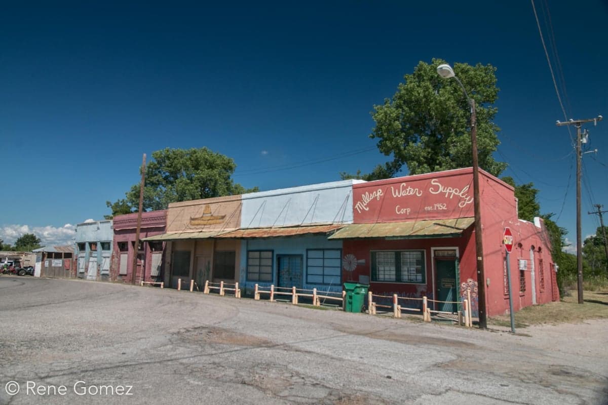
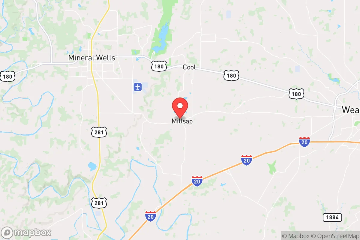
Millsap, Texas, offers a compelling strategic position for those prioritizing resilience and self-sufficiency, sitting roughly 40 miles west of Fort Worth in Parker County. This places it outside the immediate blast radius and primary fallout zones of a major metropolitan target, while still providing access to the economic and logistical resources of the Dallas-Fort Worth metroplex when conditions are stable. The town's small population—around 400 residents within the city limits, with a broader unincorporated area—means fewer people competing for resources during a crisis, and its location along U.S. Route 180 provides a viable east-west corridor that avoids the congestion of Interstate 20. For a relocator assessing long-term survivability, Millsap represents a balance of rural isolation and practical connectivity, though its proximity to the Barnett Shale natural gas fields and regional infrastructure demands careful evaluation.
Geographic position and natural advantages for long-term survival
Millsap sits in the Cross Timbers ecoregion, a transitional zone between the rolling plains and the more arid west Texas, offering a mix of oak-juniper woodlands and open pasture. This terrain provides natural cover and defensible positions, with numerous draws and creek bottoms that can serve as water sources or concealment routes. The area's elevation—roughly 1,000 feet above sea level—offers slight vantage points over the surrounding prairie, useful for observation without being a prominent topographic target. The Brazos River lies about 15 miles to the south, a reliable water source that can be accessed via secondary roads, while the Palo Pinto Mountains to the west provide additional rugged terrain for retreat if needed. The local climate supports a growing season of roughly 230 days, allowing for extended food production, and the region's limestone-based soils are suitable for root vegetables and drought-tolerant crops. For a prepper, the key natural advantage is the area's position on the edge of the urban corridor: close enough to monitor threats from the metroplex, but far enough to avoid the initial chaos of a collapse event.
Risks, exposures, and proximity to fallout-relevant landmarks
The primary strategic risk for Millsap is its location within the broader Dallas-Fort Worth target set. While the town itself is not a high-value target, it lies within the fallout plume zone for a ground burst on Fort Worth's Naval Air Station Joint Reserve Base (about 30 miles east) or the Dallas Federal Reserve (about 50 miles east). Prevailing winds in north Texas are from the south-southeast, meaning fallout from a strike on the metroplex would likely drift north and west, potentially affecting Millsap depending on wind direction at the time. Additionally, the Barnett Shale natural gas fields have extensive pipeline infrastructure running through Parker County, including compressor stations and storage facilities near Aledo and Weatherford. A deliberate attack on energy infrastructure—or a cascading failure from a grid collapse—could create secondary hazards like gas explosions or prolonged loss of pressure for heating. The town's proximity to Interstate 20 (about 10 miles south) and U.S. 180 means that during a mass evacuation from the metroplex, these roads could become chokepoints or vectors for desperate populations. The positive side: Millsap is far enough from major military installations, nuclear power plants (Comanche Peak is 50 miles east), and chemical facilities to avoid immediate blast or toxic release zones. The risk profile is moderate but manageable with proper planning—specifically, having a bug-out location further west (e.g., into the Palo Pinto Mountains) and maintaining situational awareness of wind patterns.
Practical resilience for a relocator: food, water, energy, and defensibility
Water availability is the most critical factor for long-term survival in Millsap. The town relies on groundwater from the Trinity Aquifer, with most residents using private wells. Well depths in the area range from 200 to 400 feet, and yields are generally adequate for household use and small-scale irrigation, but drought conditions can lower the water table. A hand-pump or solar-powered pump backup is essential, as grid failure would render electric pumps useless. Surface water from creeks like Rock Creek and the Brazos River is available but requires treatment—boiling, filtration, or chemical purification—due to agricultural runoff and livestock use. For food, the local agricultural base is strong: Parker County is known for cattle, hay, and pecans, and there are several small farms within a 10-mile radius that could be bartered with or recruited into a mutual aid network. The town has a single grocery store (a Brookshire's in nearby Weatherford, 12 miles east) but for preppers, establishing a garden and seed bank is more reliable. Energy resilience is mixed: the area is served by Oncor Electric Delivery, which has a history of outages during winter storms (notably the 2021 freeze) and summer heat waves. Solar potential is good, with an average of 230 sunny days per year, but battery storage is necessary for nighttime and cloudy periods. Natural gas is available in some rural areas, but reliance on pipeline delivery is a vulnerability. Defensibility is a strong point: Millsap's layout is a classic small town with a central crossroads, surrounded by open ranchland that provides clear sightlines. The local population is predominantly rural and conservative, with a high rate of firearm ownership and a culture of self-reliance. The Parker County Sheriff's Office has a substation in Millsap, but response times in a widespread emergency could be hours. Establishing a neighborhood watch or community defense group is a practical step, as the town's isolation works both ways—it's hard for outsiders to approach unnoticed, but help is also far away.
The overall strategic picture for Millsap is one of calculated viability for the prepared relocator. It avoids the worst of the urban threat envelope while retaining access to the resources and information flow of the metroplex during stable periods. The natural environment supports subsistence living, the community is ideologically aligned with self-sufficiency, and the infrastructure risks are manageable with modest investment in backups. The primary vulnerability is the fallout corridor from a strike on DFW, which requires a pre-planned retreat route to the west or south. For a single individual or family willing to drill wells, install solar, and build local relationships, Millsap offers a defensible base of operations that can weather both slow-burn societal decay and acute crisis events. It is not a fortress, but it is a solid starting point for those who understand that resilience is a process, not a purchase.
* Values derived from national, state, county, city and local statistics and may differ in a specific area. Last updated: 2026-05-09T03:35:10.000Z
Narrative content on this page is AI-generated and may contain mistakes. Verify any details that matter before acting on them.
ReloMaps may earn a commission from affiliate links at no extra cost to you.