Photo: Wikipedia
Strategic Assessment of Moab, UT
Strong survivability profile. Good buffer from population centers, with manageable environmental and tactical risks.
What does the Strategic Assessment tell us?
Our Strategic Assessment grades tactical survivability of an area. Major population centers, military targets, fallout zones, natural disasters, and border exposure all drive risk — lower exposure means a more defensible position in a crisis.
This is heavily inspired by Joel Skousen's Strategic Relocation book. Highly recommended you checkout the book ($)What does this tell us?
Our Strategic Assessment grades tactical survivability of an area. Major population centers, military targets, fallout zones, natural disasters, and border exposure all drive risk — lower exposure means a more defensible position in a crisis.
This is heavily inspired by Joel Skousen's Strategic Relocation book. Highly recommended you checkout the book ($)Strategic Pillars

Key Distances
Regional Safe Places
Below is our recommended "safe zones" in Utah and the surrounding area based on our strategic heuristics. For most people, it's unrealistic to live in a “safe zone” full-time due to work, family or other personal reasons. They tend to be more rural. However, many of these areas are perfect for second homes and retreat properties that double as a vacation home or even a short-term rental.


Important Note: For informational purposes only. This does not mean nothing bad ever happens in the green zones. Please use common sense. This is based on public data and modeled with AI. We tried to take a conservative approach but mistakes happen. We update this regularly as new information becomes available.
Solar Generator Recommendations
Backup power matters more here than in safer locations. We've picked three solar generators across budgets and capacity tiers — start with the budget unit if you only need a few essentials, or step up if you want to run a fridge and HVAC for days at a time.

Jackery Portable Power Station Explorer 300
Budget OptionPower on the Go: Weighing only 11 lbs, it's convenient to set up and store with book-sized foldable solar panels

BLUETTI Portable Power Station AC180
Designed for both indoor and outdoor scenarios, AC180 is highly capable as it has a robost capacity and continuous output power.

EF ECOFLOW DELTA Pro Ultra Power Station
Upgraded PickEcoFlow DELTA Pro Ultra is a whole-home energy system designed to grow with your family. Integrated with the Smart Home Panel 2, it scales to meet your evolving energy needs — keeping your home powered, intelligent, and secure through every stage of life.
We earn a commission, at no additional cost to you.
Strategic Assessment Analysis
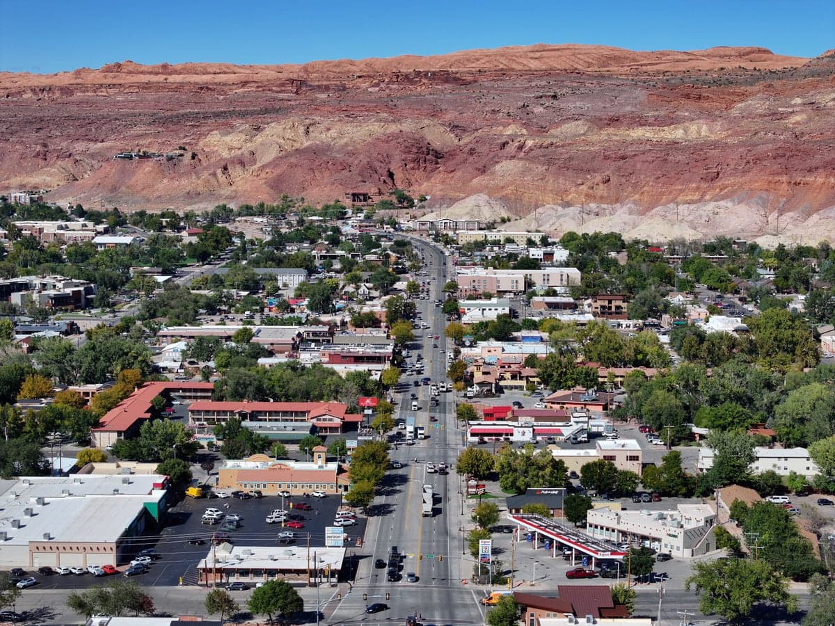
Moab, Utah, offers a unique strategic profile for those prioritizing resilience and self-sufficiency, but it is not a simple "bug-out" paradise. Its isolation is both its greatest asset and its most significant liability, demanding a clear-eyed assessment of trade-offs. For the conservative-leaning relocator concerned with civic unrest, supply chain collapse, or mass casualty events, Moab presents a defensible redoubt with serious logistical constraints that must be engineered around, not ignored.
Geographic isolation and natural defensive advantages
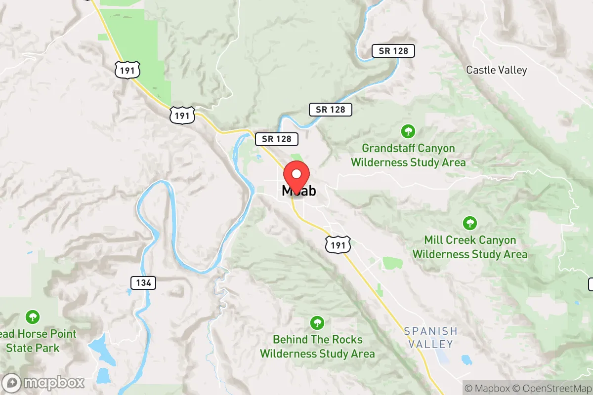
Moab sits in a natural bowl surrounded by the La Sal Mountains to the east and the Colorado River canyon country to the west, creating a physical buffer that few other towns in the lower 48 can match. The nearest major population centers are Grand Junction, Colorado (110 miles northeast) and Salt Lake City (235 miles northwest), meaning that in a scenario of urban unrest or mass evacuation, Moab is far from the immediate chaos. The town itself is small—roughly 5,500 permanent residents—which limits the risk of a cascading social collapse within the community. The surrounding public lands, including Arches and Canyonlands National Parks, are vast and difficult to traverse without local knowledge, providing a natural perimeter that would slow any organized threat. However, this isolation cuts both ways: the single paved artery, US-191, is the only practical road in and out, and it can be easily blocked or interdicted. For a prepper, the defensibility of the terrain is real, but the choke points are equally real.
Risks, exposures, and proximity to fallout-relevant landmarks
Moab's distance from major cities is a strong positive, but it is not immune to fallout-related dangers. The town lies roughly 150 miles downwind of the Intermountain Power Project in Delta, Utah—a coal-fired plant that, while not a nuclear target, is a critical energy node that could be contested in a conflict. More concerning is the proximity to the Moab Uranium Mill Tailings Pile, a Superfund site just north of town that contains 16 million tons of radioactive waste. In a conventional war or a major earthquake (the region is seismically active), a breach of this containment could render the immediate area uninhabitable for generations. Additionally, the Colorado River, which runs through Moab, is a strategic water asset that could draw unwanted attention from state or federal actors in a crisis. The nearby Potash Plant and the U.S. Highway 191 corridor are also potential targets for sabotage or military interdiction. For the survivalist, these are not deal-breakers, but they demand a relocation plan that accounts for a worst-case scenario involving the tailings pile.
Practical resilience for a relocator: food, water, energy, and defensibility
Water is Moab's most critical vulnerability. The town relies entirely on the Colorado River and a shallow alluvial aquifer, both of which are subject to drought, upstream diversion, and contamination. A well-drilled prepper could secure a private well, but the water table is dropping, and permits are increasingly restricted. For food, the growing season is short (roughly 150 days) and the soil is sandy and alkaline, making large-scale gardening difficult without significant soil amendment and hoop houses. Local agriculture is minimal—a few small farms and orchards—so the town is heavily dependent on trucked-in supplies from Grand Junction. In a long-term grid-down scenario, Moab would face severe food insecurity. Energy is a mixed picture: the area has excellent solar potential (over 300 sunny days per year), but the grid is fragile and prone to outages from wildfire or winter storms. Natural gas is available but piped in from outside. For defensibility, the town's layout is a double-edged sword: the compact core is easy to patrol, but the surrounding canyon country offers countless avenues for infiltration by a determined adversary. A small, well-armed group could hold the town, but a larger force would find it untenable.
For the single individual or family, the practical takeaway is that Moab requires a high degree of self-sufficiency in water storage, solar generation, and food preservation. The local community is small and, by Utah standards, relatively conservative, but it is also transient and tourism-dependent, meaning that in a crisis, many residents would leave or become a liability. The nearest major medical facility is in Grand Junction, a two-hour drive, which is a serious concern for trauma or chronic illness. The town's police force is small, and the Grand County Sheriff's Office is stretched thin, so security in a collapse scenario would fall on private citizens. For the prepper who can afford to build a fully off-grid homestead with a well, solar array, and a year's worth of supplies, Moab offers a defensible location with a low population density. For anyone expecting to rely on local resources or community support, it is a high-risk bet.
The overall strategic picture for Moab is one of a remote outpost with genuine natural defenses but severe logistical vulnerabilities. It is not a place for the unprepared or the under-resourced. For the conservative relocator who values isolation, low population density, and a climate that supports solar energy and dry storage, Moab is a viable option—but only if you arrive with your own water, power, and food systems already in place. The town's dependence on a single road, a fragile grid, and a contaminated river means that resilience here is engineered, not inherited. If you can afford to build a self-sufficient compound in the surrounding canyons, Moab offers a defensible redoubt far from the urban collapse zones. If you are looking for a ready-made community with existing infrastructure, look elsewhere. This is a location for the serious prepper who understands that isolation is a double-edged sword and that the price of security is constant vigilance and self-reliance.
* Values derived from national, state, county, city and local statistics and may differ in a specific area. Last updated: 2026-05-14T04:51:50.000Z
Narrative content on this page is AI-generated and may contain mistakes. Verify any details that matter before acting on them.
ReloMaps may earn a commission from affiliate links at no extra cost to you.