
Photo: Wikipedia
Strategic Assessment of Monroe, NC
Meaningful friction. Expect exposure to either population pressure, blast zones, or natural disaster risk. Consider buying a retreat property.
What does the Strategic Assessment tell us?
Our Strategic Assessment grades tactical survivability of an area. Major population centers, military targets, fallout zones, natural disasters, and border exposure all drive risk — lower exposure means a more defensible position in a crisis.
This is heavily inspired by Joel Skousen's Strategic Relocation book. Highly recommended you checkout the book ($)What does this tell us?
Our Strategic Assessment grades tactical survivability of an area. Major population centers, military targets, fallout zones, natural disasters, and border exposure all drive risk — lower exposure means a more defensible position in a crisis.
This is heavily inspired by Joel Skousen's Strategic Relocation book. Highly recommended you checkout the book ($)Strategic Pillars

Key Distances
Regional Safe Places
Below is our recommended "safe zones" in North Carolina and the surrounding area based on our strategic heuristics. For most people, it's unrealistic to live in a “safe zone” full-time due to work, family or other personal reasons. They tend to be more rural. However, many of these areas are perfect for second homes and retreat properties that double as a vacation home or even a short-term rental.


Important Note: For informational purposes only. This does not mean nothing bad ever happens in the green zones. Please use common sense. This is based on public data and modeled with AI. We tried to take a conservative approach but mistakes happen. We update this regularly as new information becomes available.
Solar Generator Recommendations
Backup power matters more here than in safer locations. We've picked three solar generators across budgets and capacity tiers — start with the budget unit if you only need a few essentials, or step up if you want to run a fridge and HVAC for days at a time.

Jackery Portable Power Station Explorer 300
Budget OptionPower on the Go: Weighing only 11 lbs, it's convenient to set up and store with book-sized foldable solar panels

BLUETTI Portable Power Station AC180
Designed for both indoor and outdoor scenarios, AC180 is highly capable as it has a robost capacity and continuous output power.

EF ECOFLOW DELTA Pro Ultra Power Station
Upgraded PickEcoFlow DELTA Pro Ultra is a whole-home energy system designed to grow with your family. Integrated with the Smart Home Panel 2, it scales to meet your evolving energy needs — keeping your home powered, intelligent, and secure through every stage of life.
We earn a commission, at no additional cost to you.
Strategic Assessment Analysis
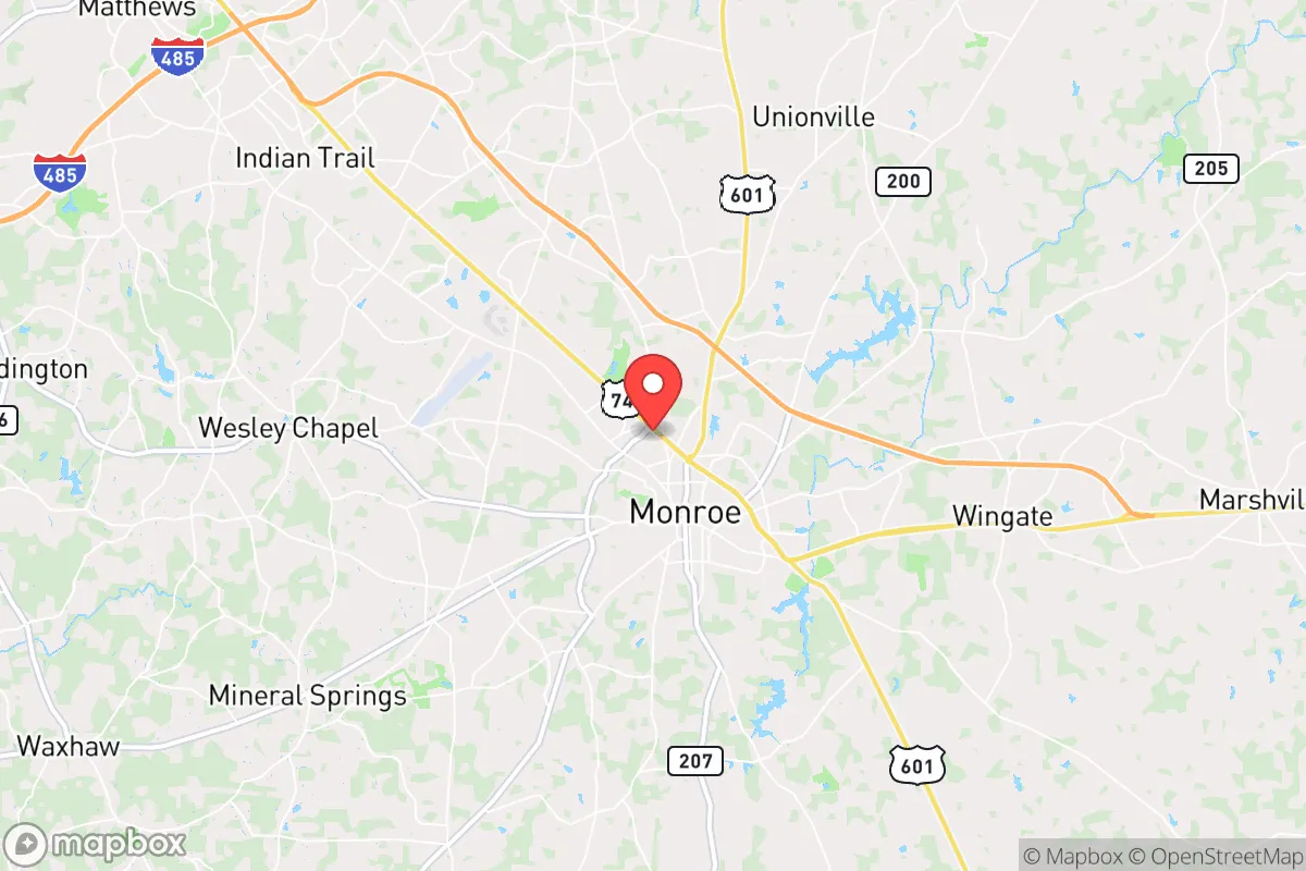
Monroe, North Carolina, offers a strategic blend of proximity to major infrastructure and a buffer from the most acute risks of urban collapse, making it a viable relocation target for those prioritizing preparedness. Sitting roughly 25 miles southeast of Charlotte, the city provides access to the economic engine of the Piedmont while maintaining a distinct separation from the immediate fallout zones of a major metropolitan target. For a conservative-minded prepper, Monroe’s position along the U.S. 74 corridor and its status as the Union County seat present a calculated trade-off: enough distance to avoid the first wave of chaos, but close enough to leverage resources if the grid holds.
Geographic position and natural advantages for long-term survival
Monroe’s geography is defined by its location in the Carolina Piedmont, a region of rolling hills, mixed hardwood forests, and clay-based soils that offer moderate defensibility and resource potential. The area sits at an elevation of roughly 590 feet, which provides some relief from coastal storm surges and the worst of hurricane flooding, though it’s not immune to heavy rain events. The Yadkin-Pee Dee River basin runs through the county, with several smaller creeks and tributaries—like Richardson Creek and the Rocky River—providing surface water sources that could be developed for off-grid use. The natural terrain is not mountainous, but the gentle hills and wooded patches create natural chokepoints and visual cover, which is useful for a retreat property. The climate is humid subtropical, with hot summers and mild winters, meaning a year-round growing season for food production, though the humidity can complicate long-term food storage without proper drying or canning infrastructure. The area’s natural advantages are modest but real: decent rainfall (around 45 inches annually), a long growing season (roughly 220 days), and soil that, while acidic, can be amended for subsistence gardening. For a relocator, the key takeaway is that Monroe’s geography doesn’t offer dramatic natural barriers, but it provides enough water and arable land to sustain a small group if the supply chain falters.
Risks, exposures, and proximity to fallout-relevant landmarks
The most significant risk for Monroe is its proximity to Charlotte, a major financial hub and transportation nexus that would be a high-priority target in any large-scale conflict or terrorist event. Charlotte Douglas International Airport, the interstates (I-85, I-77), and the city’s banking infrastructure make it a likely candidate for kinetic or cyber attacks. Monroe sits within the 25- to 30-mile radius of Charlotte’s urban core, which means that in a nuclear or radiological event, the fallout plume could reach the area depending on wind patterns. The prevailing winds in the region are from the southwest, which would push fallout toward the northeast—potentially sparing Monroe in some scenarios, but not reliably. Additionally, Monroe is within 50 miles of the Catawba Nuclear Station (about 30 miles northwest), a commercial power plant that, while well-regulated, represents a fixed-site hazard. A meltdown or sabotage event at that facility could contaminate water supplies and force evacuation. On the plus side, Monroe is not near any major military bases, chemical plants, or large-scale ammunition storage facilities that would draw direct strikes. The risk profile is moderate: you’re not in the blast zone, but you’re in the shadow of a major target. For a prepper, this means you need a solid plan for evacuation or shelter-in-place with adequate filtration and supplies for at least two weeks of isolation. The area’s lack of natural barriers also means that civil unrest in Charlotte could spill over via U.S. 74, with looters or refugees moving southeast along the corridor. Monroe’s police force and Union County Sheriff’s Office are well-funded relative to rural counties, but they would be overwhelmed in a mass casualty event. The strategic calculus here is that Monroe is a buffer zone, not a fortress—you’re trading some risk for access to resources.
Practical resilience for a relocator: food, water, energy, and defensibility
For a relocator focused on practical resilience, Monroe’s infrastructure offers a mixed bag. The city’s water supply comes from the Yadkin-Pee Dee River basin, treated at the Monroe Water Treatment Plant, which serves roughly 35,000 customers. In a grid-down scenario, the plant would lose pumping capability, so you need a backup plan: rainwater catchment, well drilling (the water table is generally accessible at 50-150 feet), or surface water filtration from the Rocky River. The local soil is clay-heavy, which is poor for drainage but excellent for building earthworks or berms for defensibility. Food production is viable, with a long growing season supporting corn, beans, squash, and leafy greens, but you’ll need to amend the soil with compost or raised beds. The area has a strong agricultural heritage—Union County was historically a farming hub—so local knowledge and seed stock are available if you network with the remaining farm families. Energy resilience is a weak point: Duke Energy provides the grid, which is reliable in normal times but vulnerable to cyber attacks and EMP. Solar potential is decent, with about 4.5 peak sun hours per day, but you’ll need battery storage to handle the cloudy spells. Natural gas is available in the city limits, but rural properties rely on propane or wood. Defensibility is moderate: Monroe’s layout is a typical Southern small town with a grid street pattern, but the surrounding rural areas offer better options for a retreat property with standoff distance. The best parcels are on the eastern side of the county, away from the Charlotte corridor, where you can get 5-10 acres with tree cover and a creek. The local gun culture is strong—North Carolina is a shall-issue state for concealed carry, and Union County has a high rate of firearm ownership—which is a plus for community defense, but it also means you’re not alone in your preparedness mindset. The biggest practical concern is the lack of a robust local manufacturing base; most goods come from Charlotte’s distribution centers, so a supply chain disruption would hit Monroe hard within a week. Stockpiling food, medicine, and ammunition is non-negotiable here.
The overall strategic picture for Monroe is that of a calculated compromise. It’s not a remote mountain redoubt, but it’s also not a high-risk urban core. For a conservative-minded relocator who wants to stay within striking distance of Charlotte’s job market while maintaining a credible preparedness posture, Monroe offers a workable middle ground. The risks from Charlotte’s target value and the Catawba nuclear plant are real but manageable with proper planning—think fallout shelters, water filtration, and a bug-out route east toward the Sandhills or south toward South Carolina. The area’s agricultural potential, decent water access, and strong community of like-minded individuals make it a solid choice for those who are serious about resilience but not ready to go full off-grid in the mountains. If you’re willing to invest in infrastructure—well, solar, and a good fence—Monroe can serve as a long-term base that balances access with security. Just don’t expect it to be a safe haven in a worst-case scenario; it’s a staging ground, not a fortress. For the prepper who understands that no location is perfect, Monroe is a defensible bet in a volatile region.
* Values derived from national, state, county, city and local statistics and may differ in a specific area. Last updated: 2026-05-03T20:25:02.000Z
Narrative content on this page is AI-generated and may contain mistakes. Verify any details that matter before acting on them.
ReloMaps may earn a commission from affiliate links at no extra cost to you.