
Photo: Wikipedia
Strategic Assessment of Mecklenburg County
Multiple tactical vulnerabilities. Population density, target proximity, or disaster risk are likely compounding. A retreat property and exit planning is required.
What does the Strategic Assessment tell us?
Our Strategic Assessment grades tactical survivability of an area. Major population centers, military targets, fallout zones, natural disasters, and border exposure all drive risk — lower exposure means a more defensible position in a crisis.
This is heavily inspired by Joel Skousen's Strategic Relocation book. Highly recommended you checkout the book ($)What does this tell us?
Our Strategic Assessment grades tactical survivability of an area. Major population centers, military targets, fallout zones, natural disasters, and border exposure all drive risk — lower exposure means a more defensible position in a crisis.
This is heavily inspired by Joel Skousen's Strategic Relocation book. Highly recommended you checkout the book ($)Strategic Pillars

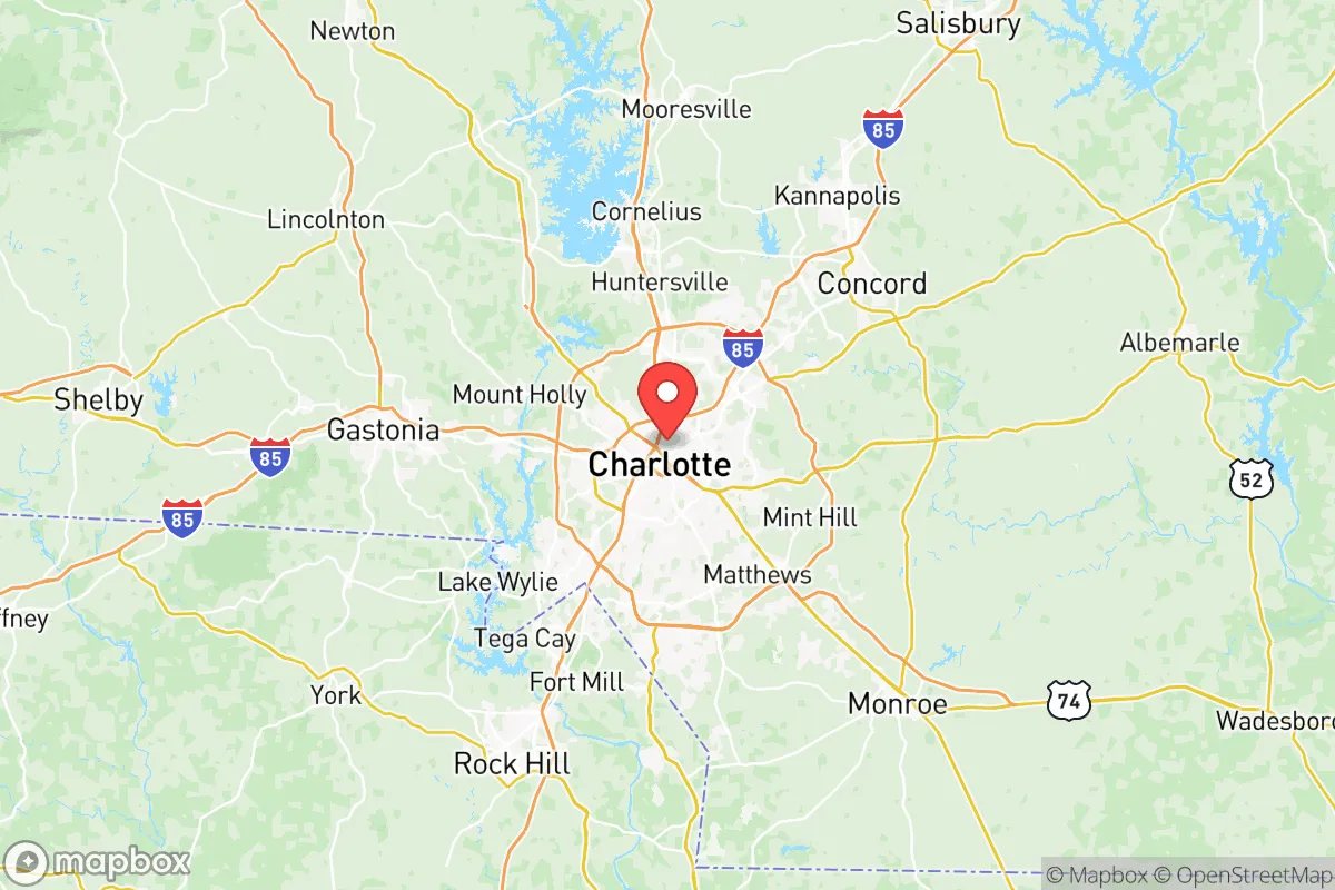
Key Distances
Strategic Assessment Analysis
Mecklenburg County, anchored by Charlotte, presents a complex strategic picture for the conservative relocator weighing resilience against proximity to risk. While the county’s economic engine and transportation hub status offer undeniable advantages, its dense urban core, major infrastructure targets, and vulnerability to cascading failures from regional shocks make it a high-risk, high-reward proposition for those prioritizing self-sufficiency and security. The key is understanding that Charlotte’s strengths—its banking sector, airport, and interstate network—are also its greatest liabilities in a crisis scenario.
Geographic position and natural advantages for long-term security
Mecklenburg County sits in the Piedmont region of North Carolina, roughly equidistant from the Appalachian Mountains to the west and the Atlantic coast to the east. This inland position provides a natural buffer against hurricane storm surge, a threat that plagues coastal cities like Wilmington or Charleston. The county’s terrain is rolling hills with decent drainage, reducing flood risk compared to flat coastal plains, though low-lying areas near the Catawba River and its reservoirs—like Lake Wylie and Mountain Island Lake—can see localized flooding after heavy rain. The climate is humid subtropical, with four distinct seasons, which supports year-round gardening and livestock grazing if you secure land with southern exposure. The major natural advantage is water: the Catawba River system, managed by Duke Energy, provides a reliable surface water source for the region, though it’s heavily regulated and vulnerable to upstream contamination or drought. For a relocator, the county’s position along I-85 and I-77 offers quick access to both the mountains (for retreat or resource gathering) and the coast (for trade or evacuation), but that same connectivity makes it a chokepoint for refugee flows during a regional emergency.
Risks, exposures, and proximity to fallout-relevant landmarks
This is where the strategic picture gets sobering. Mecklenburg County is home to Charlotte Douglas International Airport (CLT), one of the busiest airports in the world and a clear target for any mass-casualty event or terrorist strike. The airport sits just west of Uptown Charlotte, meaning a major incident there could paralyze the city’s core and disrupt supply chains for days. The county also hosts multiple rail yards and intermodal facilities along the Norfolk Southern and CSX lines, which handle hazardous materials—including chemicals and fuels—that could become secondary hazards in a derailment or attack. McGuire Nuclear Station, located about 20 miles northwest of Charlotte in Huntersville, is a dual-reactor facility on Lake Norman. While its security perimeter is robust, any major incident—whether sabotage, earthquake, or aircraft impact—would force a mandatory evacuation zone extending well into northern Mecklenburg County. The county’s dense urban core, with over 1.1 million residents, creates a massive target for civil unrest or cascading infrastructure failure. The Bank of America Corporate Center and the Wells Fargo headquarters in Uptown are symbolic targets that could draw coordinated attacks during a period of national instability. Additionally, the county’s reliance on just a few major interstates (I-85, I-77, I-485) means any bridge or tunnel failure—or a coordinated blockade—could trap residents inside the urbanized area. For a prepper, the concentration of population and critical infrastructure within a 10-mile radius of Uptown is a red flag.
Practical resilience for a relocator: food, water, energy, and defensibility
For a single individual or family looking to establish a resilient homestead, Mecklenburg County offers a mixed bag. Food security is a challenge: the county is heavily suburbanized, with most land zoned for residential or commercial use. While there are pockets of farmland in the northern and eastern parts—around Huntersville, Cornelius, and Mint Hill—the soil is predominantly clay-heavy Piedmont dirt, requiring significant amendment for productive gardening. Local farmers’ markets exist, but they’re not a reliable crisis supply. Water security is better: the Catawba River and its reservoirs provide ample surface water, but you’ll need a private well or a rainwater catchment system to avoid dependence on municipal treatment plants, which are vulnerable to cyberattack or contamination. Duke Energy’s grid is the primary power source, and while solar adoption is growing, the county’s tree canopy can limit panel efficiency. A backup generator with fuel storage is non-negotiable. Defensibility is the weakest link: the county’s suburban sprawl means most homes are on quarter-acre lots with neighbors within shouting distance. Rural properties with acreage are available but expensive—expect $500,000+ for 5-10 acres in the Steele Creek or Providence areas. The terrain offers limited natural chokepoints; the Catawba River is a barrier but also a potential avenue of approach. For a relocator, the best defensive posture is to buy land in the northern part of the county near the Iredell County line, where lot sizes increase and population density drops. Even then, you’re within 30 minutes of Charlotte’s urban core, meaning you’ll be in the path of any mass evacuation.
The overall strategic picture for Mecklenburg County is one of calculated risk. It’s not a place for a full-blown survivalist retreat—the population density, infrastructure targets, and proximity to nuclear power and major transport hubs make it a high-exposure zone. But for a relocator who values economic opportunity, access to medical care, and a moderate climate, and who is willing to invest in hardening a property in the county’s outer ring, it can work as a base of operations. The key is to avoid the urban core, secure a private water source, and maintain a low profile. If you’re looking for a place to ride out a national crisis, Mecklenburg County is a gamble—one that requires constant vigilance and a solid exit plan toward the mountains or the rural counties to the north and west.
* Values derived from national, state, county, city and local statistics and may differ in a specific area. Last updated: 2026-05-11T21:46:51.000Z
Narrative content on this page is AI-generated and may contain mistakes. Verify any details that matter before acting on them.
ReloMaps may earn a commission from affiliate links at no extra cost to you.