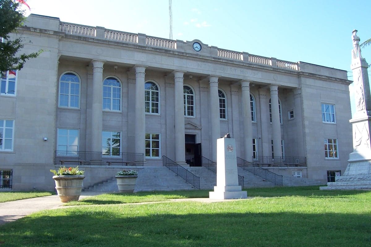
Photo: Wikipedia
Strategic Assessment of Rutherford County
Workable tactical position. Some exposure to population density or targets, but generally defensible in a crisis.
What does the Strategic Assessment tell us?
Our Strategic Assessment grades tactical survivability of an area. Major population centers, military targets, fallout zones, natural disasters, and border exposure all drive risk — lower exposure means a more defensible position in a crisis.
This is heavily inspired by Joel Skousen's Strategic Relocation book. Highly recommended you checkout the book ($)What does this tell us?
Our Strategic Assessment grades tactical survivability of an area. Major population centers, military targets, fallout zones, natural disasters, and border exposure all drive risk — lower exposure means a more defensible position in a crisis.
This is heavily inspired by Joel Skousen's Strategic Relocation book. Highly recommended you checkout the book ($)Strategic Pillars

Key Distances
Strategic Assessment Analysis
Rutherford County, North Carolina, offers a strategic mix of mountain-terrain security and practical access to the broader Southeast, making it a serious contender for relocation-minded individuals weighing resilience and self-sufficiency. The county seat, Rutherfordton, along with the towns of Forest City and Spindale, anchors a region that has quietly become a hub for light manufacturing and logistics, yet it retains a distinctly rural character. For a family or individual prioritizing preparedness, the county’s position in the thermal belt of the Blue Ridge foothills provides a meaningful advantage: milder winters and a longer growing season than the higher elevations to the west, which directly supports year-round food production.
Geographic position and natural advantages for long-term security
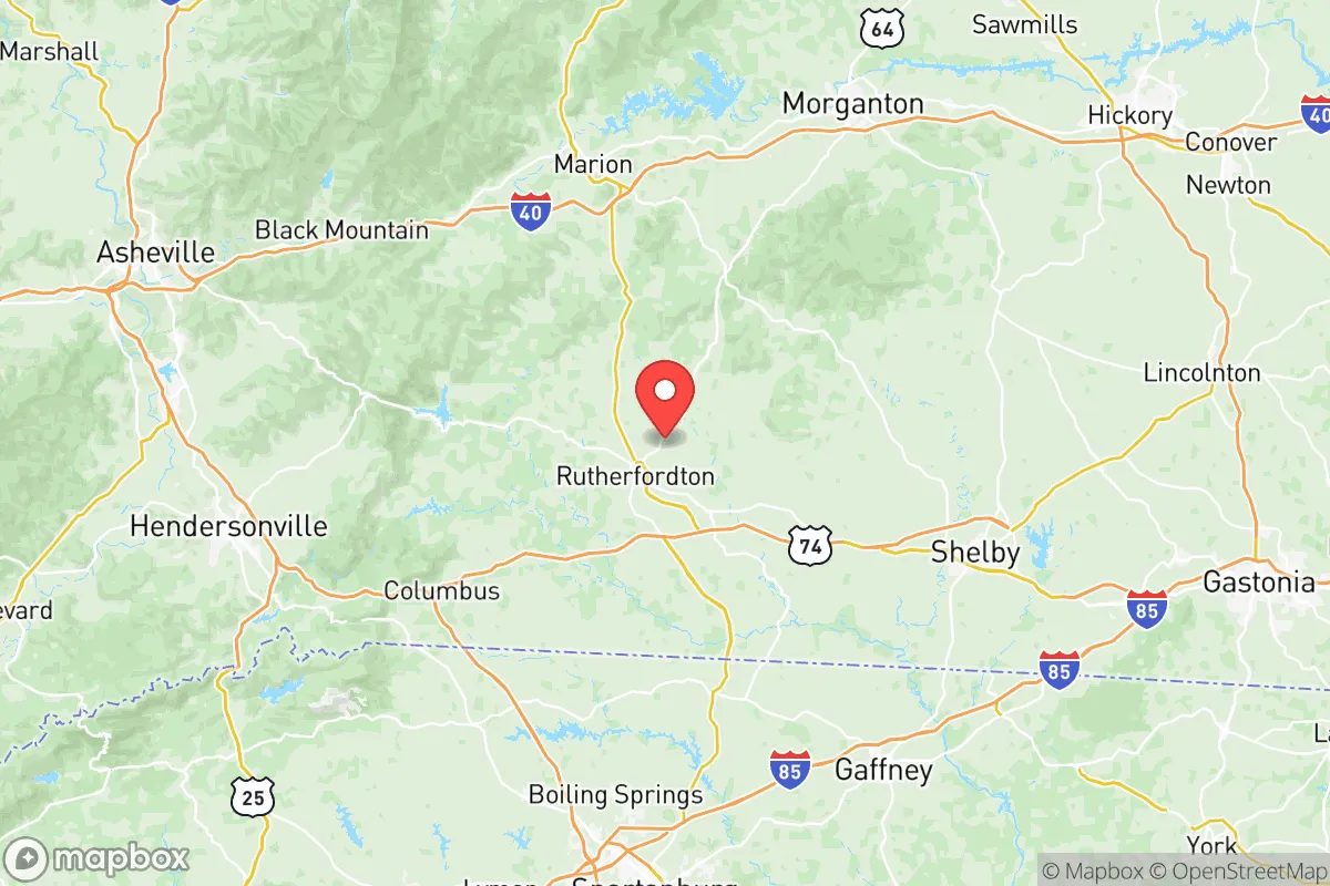
Rutherford County sits at the eastern edge of the Blue Ridge Mountains, roughly 70 miles southeast of Asheville and about 60 miles northwest of Charlotte. This placement is the core of its strategic value: it is close enough to major urban employment centers and medical facilities—like Mission Hospital in Asheville or Atrium Health in Charlotte—but far enough to avoid the sprawl, congestion, and target density of those metros. The county is bisected by the Broad River, which flows through the Lake Lure and Chimney Rock area in the county’s western end, providing a natural water source that is more defensible and less industrialized than the river systems near the coast. The terrain itself is a mix of rolling hills and steeper mountain slopes, which naturally funnels travel through a limited number of corridors—primarily US-74 and US-221—making the area easier to monitor and control in a disruption scenario than open flatland.
The elevation range, from roughly 800 feet in the eastern part of the county near the Cleveland County line to over 3,000 feet at Hickory Nut Gorge, offers microclimate diversity. A relocator can choose a valley-bottom property for easier access and milder winters, or a higher-elevation parcel for better line-of-sight and natural defensibility. The county’s location in the thermal belt means that cold air drains away from south-facing slopes, which is a practical advantage for orchards, gardens, and even passive solar heating. For a preparedness-minded reader, this is not just scenic variety; it is a functional buffer against the extremes that plague both the coastal plain and the high mountains.
Risk exposure and proximity to fallout-relevant landmarks
No location in the eastern United States is entirely free of risk, and Rutherford County’s vulnerabilities are worth a clear-eyed assessment. The most significant man-made risk is not a local one but the proximity to the Charlotte metro area, which is a major financial hub and transportation node. In a worst-case scenario involving a nuclear exchange, Charlotte’s infrastructure—including the Duke Energy nuclear station at McGuire, located on Lake Norman about 50 miles to the east—would be a primary target. Fallout patterns are wind-dependent, but prevailing westerly winds mean that Rutherford County is generally upwind of Charlotte, which is a favorable factor. However, the county is not far from the Savannah River Site, a Department of Energy nuclear facility in South Carolina roughly 90 miles to the south, which has been a historical cleanup and storage site; a major incident there could push contamination northward depending on the weather.
Natural risks are more immediate and more frequent. The county sits in a zone that experiences occasional tornadoes, particularly in the spring, and the mountainous terrain can produce flash flooding in the Broad River and its tributaries, especially around Lake Lure and the towns of Ruth and Ellenboro. The 2024 remnants of Hurricane Helene caused significant flooding in the western part of the county, a reminder that even inland mountain areas are not immune to tropical moisture. Wildfire risk is moderate but real, particularly in the drier months of late fall, when the combination of mountain winds and dry brush can create fast-moving fires in the Chimney Rock area. For a relocator, the practical takeaway is that the county’s risks are manageable with standard preparedness—elevated building sites, flood-aware property selection, and a defensible space perimeter—rather than existential threats that would require abandoning the area.
Practical resilience for a relocator: food, water, energy, and defensibility
Rutherford County’s practical resilience for daily life and crisis scenarios is strong, particularly when compared to suburban or exurban locations closer to Charlotte. The agricultural base is real and accessible: the county has over 1,200 farms, with a strong presence of cattle, poultry, and row crops like soybeans and corn. The local farmers’ markets in Rutherfordton and Forest City operate seasonally, and the region’s proximity to the agricultural heartland of Cleveland and Lincoln counties means that a robust local food network exists outside of the industrial supply chain. For a family looking to produce its own food, the growing season runs from roughly mid-April to mid-October, and the thermal belt effect extends the shoulder seasons for cold-hardy crops like kale, carrots, and brassicas.
Water is a genuine asset here. The Broad River and its tributaries, including the Green River and Second Broad River, provide surface water that is generally clean and well-managed by local utilities. The county’s groundwater is also reliable, with most rural parcels capable of supporting a drilled well at depths of 100 to 300 feet. For a relocator, this means that a property with a well and a septic system is not a luxury but a baseline for self-sufficiency. Energy resilience is improving: Duke Energy serves the county, and while grid outages do occur during winter ice storms and summer thunderstorms, the mountainous terrain means that outages are typically localized and restored within hours to a day. Solar potential is moderate—the county receives about 4.5 peak sun hours per day—which is sufficient for a well-designed off-grid or hybrid system, particularly with battery storage to cover the frequent cloudy days.
Defensibility is where Rutherford County’s geography shines. The limited road network, with US-74 as the primary east-west artery and US-221 as the main north-south route, creates natural chokepoints that a prepared community could monitor. The county’s low population density—roughly 67,000 residents across 566 square miles—means that a rural property can offer significant standoff distance from neighbors, which is a double-edged sword: it provides privacy and security but also means that self-reliance is not optional. The local culture is already oriented toward self-sufficiency, with a strong hunting and fishing tradition, a high rate of home gardening, and a network of small hardware and farm supply stores in Rutherfordton and Forest City that cater to a practical, hands-on population. The county’s emergency services, including the Rutherford County Sheriff’s Office and local volunteer fire departments, are competent but spread thin; a relocator should not expect rapid response in a rural setting and should plan accordingly.
The overall strategic picture for Rutherford County is favorable for a resilience-focused relocator, with the caveat that it is not a remote mountain redoubt. It is a working, middle-American county that offers a genuine balance of access and security: close enough to Charlotte’s medical and economic resources to be practical, far enough to avoid the worst of urban fragility, and blessed with water, arable land, and a defensible terrain. The risks—flooding in the western valleys, occasional tornadoes, and the distant but real shadow of Charlotte’s target status—are manageable with thoughtful property selection and standard preparedness measures. For a single individual or family that wants a place where self-sufficiency is culturally normal rather than eccentric, Rutherford County deserves serious consideration as a long-term base of operations.

* Values derived from national, state, county, city and local statistics and may differ in a specific area. Last updated: 2026-10-09T03:10:58.000Z
Narrative content on this page is AI-generated and may contain mistakes. Verify any details that matter before acting on them.
ReloMaps may earn a commission from affiliate links at no extra cost to you.

