Photo: Wikipedia
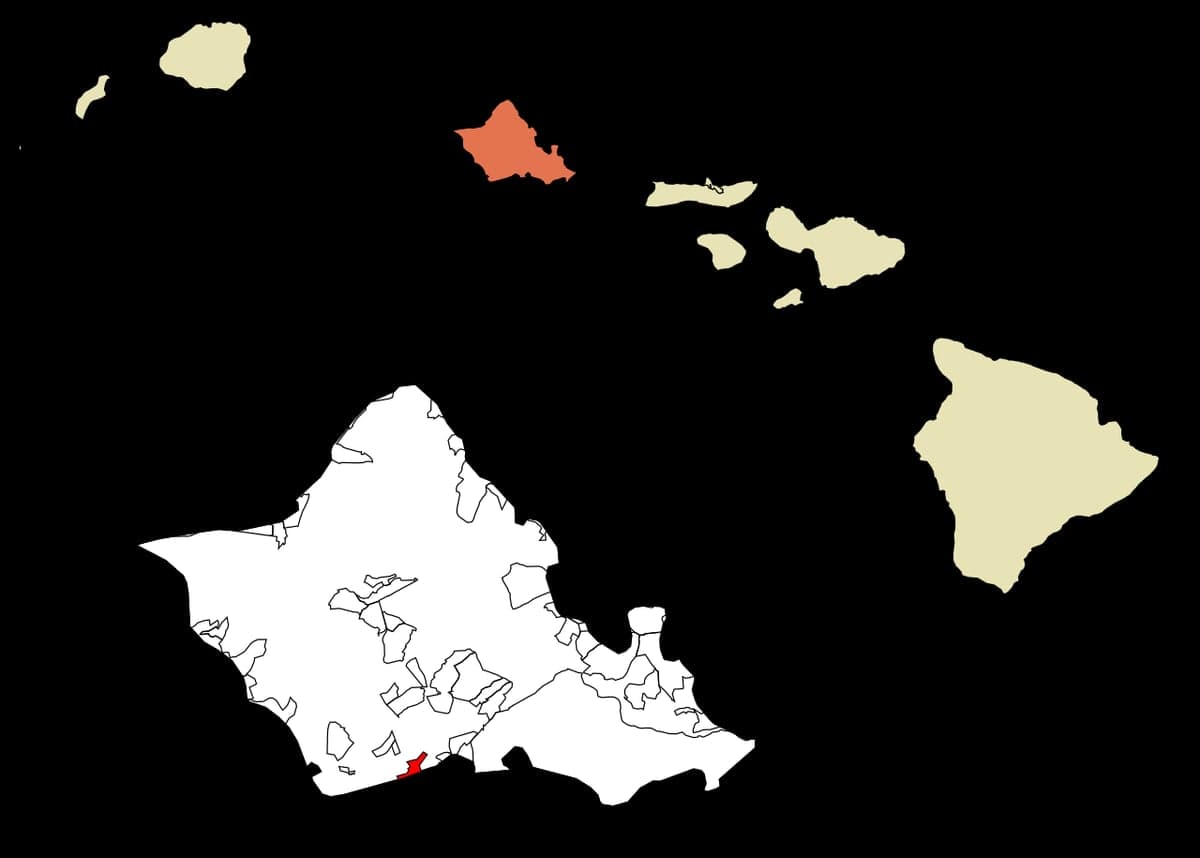
Strategic Assessment of Ocean Pointe, HI
Meaningful friction. Expect exposure to either population pressure, blast zones, or natural disaster risk. Consider buying a retreat property.
What does the Strategic Assessment tell us?
Our Strategic Assessment grades tactical survivability of an area. Major population centers, military targets, fallout zones, natural disasters, and border exposure all drive risk — lower exposure means a more defensible position in a crisis.
This is heavily inspired by Joel Skousen's Strategic Relocation book. Highly recommended you checkout the book ($)What does this tell us?
Our Strategic Assessment grades tactical survivability of an area. Major population centers, military targets, fallout zones, natural disasters, and border exposure all drive risk — lower exposure means a more defensible position in a crisis.
This is heavily inspired by Joel Skousen's Strategic Relocation book. Highly recommended you checkout the book ($)Strategic Pillars

Key Distances
Regional Safe Places
Below is our recommended "safe zones" in Hawaii and the surrounding area based on our strategic heuristics. For most people, it's unrealistic to live in a “safe zone” full-time due to work, family or other personal reasons. They tend to be more rural. However, many of these areas are perfect for second homes and retreat properties that double as a vacation home or even a short-term rental.


Important Note: For informational purposes only. This does not mean nothing bad ever happens in the green zones. Please use common sense. This is based on public data and modeled with AI. We tried to take a conservative approach but mistakes happen. We update this regularly as new information becomes available.
Solar Generator Recommendations
Backup power matters more here than in safer locations. We've picked three solar generators across budgets and capacity tiers — start with the budget unit if you only need a few essentials, or step up if you want to run a fridge and HVAC for days at a time.

Jackery Portable Power Station Explorer 300
Budget OptionPower on the Go: Weighing only 11 lbs, it's convenient to set up and store with book-sized foldable solar panels

BLUETTI Portable Power Station AC180
Designed for both indoor and outdoor scenarios, AC180 is highly capable as it has a robost capacity and continuous output power.

EF ECOFLOW DELTA Pro Ultra Power Station
Upgraded PickEcoFlow DELTA Pro Ultra is a whole-home energy system designed to grow with your family. Integrated with the Smart Home Panel 2, it scales to meet your evolving energy needs — keeping your home powered, intelligent, and secure through every stage of life.
We earn a commission, at no additional cost to you.
Strategic Assessment Analysis
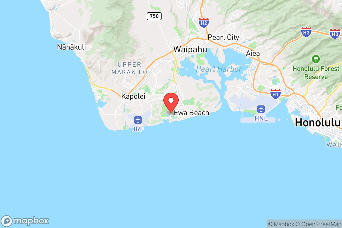
Ocean Pointe, located on the southwestern shore of Oahu, offers a unique strategic position for those prioritizing resilience and preparedness in an increasingly uncertain world. This master-planned community sits roughly 20 miles west of Honolulu, placing it far enough from the urban core to avoid the worst fallout of a major disruption—whether from civil unrest, a natural disaster, or a systemic collapse—while still being close enough to access critical resources if needed. Its location on the leeward (dry) side of the island means it is less prone to the heavy rainfall and flooding that plague windward areas, and the community’s modern infrastructure, built largely after 2000, provides a structural advantage over older, more vulnerable neighborhoods. For a relocator with a survivalist mindset, Ocean Pointe is not a bug-out location but a calculated compromise: a defensible suburban enclave with proximity to the sea, a stable climate, and a layout that discourages casual foot traffic.
Geographic position and natural advantages for long-term security
Ocean Pointe’s geography is its strongest asset for a prepper. The community is situated on a flat coastal plain that rises gently toward the Waianae Range to the west, providing natural barriers against storm surges and tsunami inundation—most of the developed area sits at 10–20 feet above sea level, well above the typical tsunami run-up zone for this coast. The leeward location means the area receives only about 20 inches of rain annually, compared to over 100 inches on the windward side, which reduces the risk of landslides, flash floods, and mold-related infrastructure failures. The nearby Ewa Plain offers open agricultural land that could be repurposed for food production in a collapse scenario, and the community’s proximity to Barbers Point Harbor (a deep-draft commercial port) and Kalaeloa Airport (a former naval air station) provides alternative logistics nodes if Honolulu’s main port and airport become compromised. For a relocator, this means Ocean Pointe is not a remote fortress but a well-positioned base with multiple escape routes: the H-1 freeway east to Honolulu, the Farrington Highway west to the Waianae coast, and the ocean itself for small-craft evacuation. The trade-off is that the area is not defensible in the classic sense—it is a flat, open suburb—but its grid layout and limited entry points (primarily via Fort Weaver Road and the H-1) make it easier to monitor and control than a dense urban neighborhood.
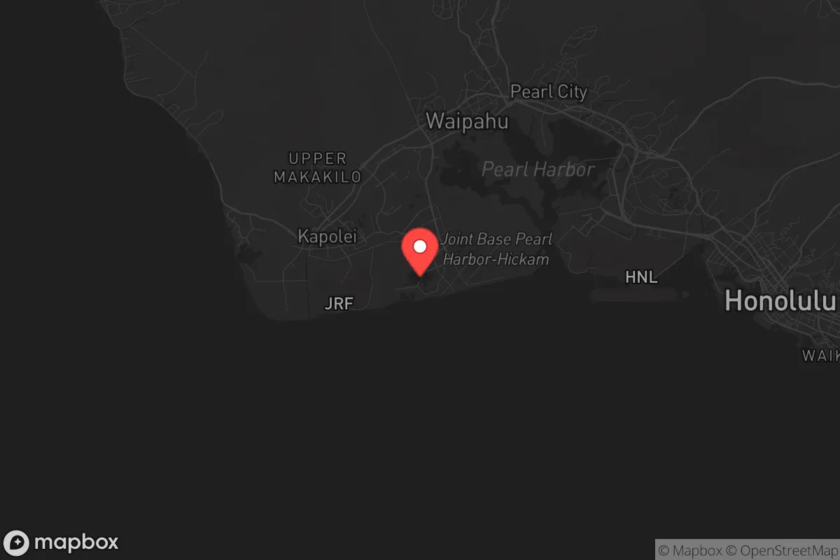
Risks, exposures, and proximity to fallout-relevant landmarks
No strategic assessment is honest without acknowledging the downsides, and Ocean Pointe has several that a survivalist must weigh. The most immediate risk is its proximity to Pearl Harbor and Joint Base Pearl Harbor-Hickam, located just 8 miles to the east. In a major conflict—especially one involving a near-peer adversary like China—these military installations would be primary targets for conventional strikes, cyberattacks, or even a limited nuclear exchange. The prevailing trade winds blow from the northeast, meaning fallout from a strike on Pearl Harbor would likely be carried away from Ocean Pointe toward the ocean, but a ground burst or a dirty bomb could still contaminate the area depending on wind shifts. Additionally, the community sits within 5 miles of the Kapolei urban core, which is Oahu’s second-largest commercial center and a likely target for looting or civil unrest during a breakdown. The Waianae Coast to the west has a history of socioeconomic challenges and gang activity, which could spill over if law enforcement collapses. On the natural disaster front, Ocean Pointe is in a tsunami evacuation zone for the southern coast, though the risk is moderate compared to more exposed areas like the North Shore. The bigger concern is hurricane vulnerability: the leeward coast is less protected from storm surge than windward areas, and a Category 3+ hurricane making landfall near Barbers Point could flood low-lying sections of the community. For a relocator, the key takeaway is that Ocean Pointe is not a remote safe haven—it is a suburban buffer zone that requires active monitoring of threats from both the military-industrial complex to the east and the less stable areas to the west.
Practical resilience for a relocator: food, water, energy, and defensibility
For a single individual or family looking to hunker down, Ocean Pointe’s practical resilience is a mixed bag. The community is served by the Honolulu Board of Water Supply, which draws from the Pearl Harbor aquifer—one of the most reliable freshwater sources on the island. In a prolonged grid-down scenario, this water supply could be compromised by saltwater intrusion or contamination, so a prepper should plan for at least two weeks of stored water (the general guideline is one gallon per person per day). The area’s soil is primarily clay and coral-based, which is poor for traditional gardening without significant amendment, but the nearby Ewa Plain has a history of sugarcane and pineapple cultivation, suggesting that with raised beds and composting, small-scale food production is feasible. Energy resilience is a challenge: Ocean Pointe is entirely dependent on the Hawaiian Electric grid, which is vulnerable to both natural disasters and fuel supply disruptions (Hawaii imports roughly 80% of its energy as petroleum). Solar panels with battery storage are a must for any serious prepper here, and the community’s homeowners’ association (HOA) rules may restrict visible installations, so a ground-mounted system in a backyard or a portable solar generator is a practical workaround. Defensibility is the weakest link: Ocean Pointe is a suburban subdivision with open streets, no perimeter walls, and a mix of single-family homes and townhouses. The HOA does provide some neighborhood watch-style security, but in a collapse scenario, the community would rely on mutual aid among residents rather than any formal defense. The best strategy for a relocator is to choose a home on a cul-de-sac or at the end of a dead-end street, which reduces traffic flow and makes it easier to establish a perimeter. A secondary bug-out location in the Waianae Mountains (e.g., near Makaha or the Kaena Point area) would provide a fallback if Ocean Pointe becomes untenable.
Overall, Ocean Pointe presents a calculated strategic picture for the conservative-minded relocator who values preparedness without total isolation. It is not a remote bunker—it is a modern suburb with decent infrastructure, a stable climate, and a location that balances access to resources with distance from the highest-risk urban zones. The community’s biggest vulnerabilities are its proximity to military targets and its dependence on centralized systems for water, power, and food. For a single individual or family willing to invest in solar backup, water storage, and a small garden, Ocean Pointe offers a livable base that can weather most disruptions short of a direct nuclear strike or a complete societal collapse. The key is to treat it as a forward operating base rather than a final redoubt: maintain situational awareness of events in Honolulu and Pearl Harbor, build relationships with like-minded neighbors, and have a pre-planned evacuation route to the west or into the mountains. In a world where the state of the country and the globe grows more precarious by the year, Ocean Pointe is a pragmatic choice—not a perfect one, but one that gives a prepared individual a fighting chance.
* Values derived from national, state, county, city and local statistics and may differ in a specific area. Last updated: 2026-04-24T07:05:37.000Z
Narrative content on this page is AI-generated and may contain mistakes. Verify any details that matter before acting on them.
ReloMaps may earn a commission from affiliate links at no extra cost to you.