

Photo: Wikipedia
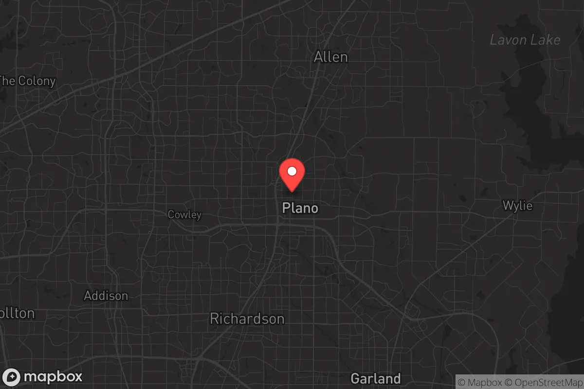
Strategic Assessment of Plano, TX
Multiple tactical vulnerabilities. Population density, target proximity, or disaster risk are likely compounding. A retreat property and exit planning is required.
What does the Strategic Assessment tell us?
Our Strategic Assessment grades tactical survivability of an area. Major population centers, military targets, fallout zones, natural disasters, and border exposure all drive risk — lower exposure means a more defensible position in a crisis.
This is heavily inspired by Joel Skousen's Strategic Relocation book. Highly recommended you checkout the book ($)What does this tell us?
Our Strategic Assessment grades tactical survivability of an area. Major population centers, military targets, fallout zones, natural disasters, and border exposure all drive risk — lower exposure means a more defensible position in a crisis.
This is heavily inspired by Joel Skousen's Strategic Relocation book. Highly recommended you checkout the book ($)Strategic Pillars

Key Distances
Regional Safe Places
Below is our recommended "safe zones" in Texas and the surrounding area based on our strategic heuristics. For most people, it's unrealistic to live in a “safe zone” full-time due to work, family or other personal reasons. They tend to be more rural. However, many of these areas are perfect for second homes and retreat properties that double as a vacation home or even a short-term rental.


Important Note: For informational purposes only. This does not mean nothing bad ever happens in the green zones. Please use common sense. This is based on public data and modeled with AI. We tried to take a conservative approach but mistakes happen. We update this regularly as new information becomes available.
Solar Generator Recommendations
Backup power matters more here than in safer locations. We've picked three solar generators across budgets and capacity tiers — start with the budget unit if you only need a few essentials, or step up if you want to run a fridge and HVAC for days at a time.

Jackery Portable Power Station Explorer 300
Budget OptionPower on the Go: Weighing only 11 lbs, it's convenient to set up and store with book-sized foldable solar panels

BLUETTI Portable Power Station AC180
Designed for both indoor and outdoor scenarios, AC180 is highly capable as it has a robost capacity and continuous output power.

EF ECOFLOW DELTA Pro Ultra Power Station
Upgraded PickEcoFlow DELTA Pro Ultra is a whole-home energy system designed to grow with your family. Integrated with the Smart Home Panel 2, it scales to meet your evolving energy needs — keeping your home powered, intelligent, and secure through every stage of life.
We earn a commission, at no additional cost to you.
Strategic Assessment Analysis
Plano, Texas, presents a complex strategic picture for the conservative prepper: it offers exceptional economic resilience and infrastructure, but its location within the Dallas-Fort Worth (DFW) metroplex introduces severe vulnerabilities that cannot be ignored. For the single individual or family prioritizing long-term survival and self-reliance, Plano’s advantages in job stability, medical access, and supply chain logistics are counterbalanced by its proximity to high-value targets, dense population corridors, and the inherent fragility of a suburban grid. This assessment weighs those factors to help you decide if Plano is a staging ground or a liability in a deteriorating national landscape.
Geographic position and natural advantages for long-term stability
Plano sits roughly 20 miles north of downtown Dallas, squarely within the North Texas region, which offers a few genuine natural advantages. The area is not prone to hurricanes, earthquakes, or wildfires at the scale seen in California or the Gulf Coast. The primary natural threat is severe weather—tornadoes and straight-line winds—which are manageable with a reinforced safe room and a solid storm plan. The terrain is flat to gently rolling, with clay-based soil that supports limited but viable gardening if amended. The region sits atop the Trinity Aquifer, and while municipal water is treated and reliable, the water table is accessible for private wells in the more rural fringes of Collin County, though Plano itself is fully suburbanized. The climate is a double-edged sword: hot summers stress energy and water systems, but the growing season is long enough for serious food production. For a relocator, the key geographic advantage is distance from coastal ports and major fault lines, reducing the risk of natural disaster cascades. However, the area’s flatness and lack of natural barriers mean that any regional crisis—whether economic collapse or civil unrest—will spread quickly across the metroplex with no defensible chokepoints.
Risks, exposures, and proximity to fallout-relevant landmarks
This is where Plano’s strategic calculus turns sharply negative for the prepper. The DFW metroplex is home to over 7.5 million people, making it the fourth-largest metropolitan area in the United States. Plano itself has a population of roughly 290,000, with a density of over 3,800 people per square mile. In a mass casualty event, civil unrest, or grid-down scenario, that density becomes a liability. Plano is within a 30-minute drive of multiple high-value targets: DFW International Airport (a major logistics and military transport hub), the Dallas Federal Reserve Bank, several Fortune 500 headquarters (including Toyota North America, J.C. Penney, and Frito-Lay), and major data centers. In a conflict scenario, these are likely to be primary or secondary targets for disruption. Additionally, the city is crisscrossed by major highways—US-75, the Sam Rayburn Tollway, and the George Bush Turnpike—which will become choke points or escape corridors during an evacuation. The proximity to Dallas itself means that any urban unrest, from riots to supply chain collapse, will ripple northward into Plano within hours. For the survivalist, Plano is not a retreat; it is a forward operating base with no fallback position unless you have a secondary property well outside the metroplex.
Practical resilience for a relocator: food, water, energy, and defensibility
On paper, Plano’s infrastructure is robust. The city has its own municipal utility, Plano Municipal Utility, and is served by multiple water sources including the North Texas Municipal Water District. The electrical grid is part of the ERCOT system, which has shown fragility during winter storms (notably 2021’s Winter Storm Uri) and summer heat waves. For a relocator, energy resilience requires a backup generator or solar-plus-battery system, as grid outages are increasingly common during peak demand. Natural gas is widely available, but in a prolonged crisis, gas lines could be compromised. Water storage is critical: Plano’s municipal supply is treated and reliable, but a contamination event or pump failure would leave residents dependent on stored water or local sources like Lake Lavon, which is 15 minutes east. Food resilience is poor for the average resident—most rely on grocery stores within a 5-mile radius. However, the city has a strong network of farmers’ markets and a growing number of community gardens, and the soil can support raised-bed vegetable production. For long-term food security, you would need to establish a home garden and build relationships with local producers in Collin County’s rural fringe. Defensibility is the weakest link. Plano is a suburban grid of cul-de-sacs and arterial roads, with no natural high ground or perimeter. Homes in the older, tree-lined neighborhoods near downtown offer better concealment and multiple egress routes, while newer master-planned communities like West Plano are more exposed with single-entry points. For a single individual or family, a home with a basement or reinforced safe room is a non-negotiable upgrade, as is a neighborhood with low traffic volume and multiple exit paths.
The overall strategic picture for Plano is one of calculated risk. It offers unmatched economic opportunity, world-class medical care (with several major hospitals within 15 minutes), and a stable local government with low crime rates relative to the national average. For the conservative prepper who is still building capital or maintaining a professional career, Plano can serve as a base of operations—but only if you treat it as a temporary staging ground rather than a final retreat. The city’s density, proximity to high-value targets, and lack of natural defensibility mean that the smart play is to use Plano for income and resources while developing a secondary property in a lower-density, more defensible location within 100 miles, such as the Hill Country or the Piney Woods of East Texas. If you are unwilling or unable to maintain that dual-property strategy, Plano’s risks will likely outweigh its rewards in a serious long-term crisis. Prepare accordingly: store at least 90 days of food and water, invest in off-grid power, and have a bug-out plan that gets you north or east of the metroplex within two hours. Plano can keep you safe in a storm, but it cannot keep you safe in a collapse.
* Values derived from national, state, county, city and local statistics and may differ in a specific area. Last updated: 2026-04-16T16:01:12.000Z
Narrative content on this page is AI-generated and may contain mistakes. Verify any details that matter before acting on them.
ReloMaps may earn a commission from affiliate links at no extra cost to you.