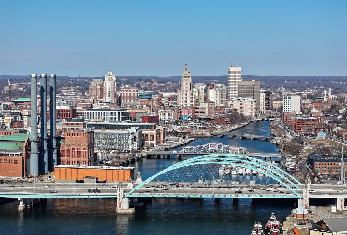
Photo: Wikipedia
Strategic Assessment of Providence, RI
Multiple tactical vulnerabilities. Population density, target proximity, or disaster risk are likely compounding. A retreat property and exit planning is required.
What does the Strategic Assessment tell us?
Our Strategic Assessment grades tactical survivability of an area. Major population centers, military targets, fallout zones, natural disasters, and border exposure all drive risk — lower exposure means a more defensible position in a crisis.
This is heavily inspired by Joel Skousen's Strategic Relocation book. Highly recommended you checkout the book ($)What does this tell us?
Our Strategic Assessment grades tactical survivability of an area. Major population centers, military targets, fallout zones, natural disasters, and border exposure all drive risk — lower exposure means a more defensible position in a crisis.
This is heavily inspired by Joel Skousen's Strategic Relocation book. Highly recommended you checkout the book ($)Strategic Pillars

Key Distances
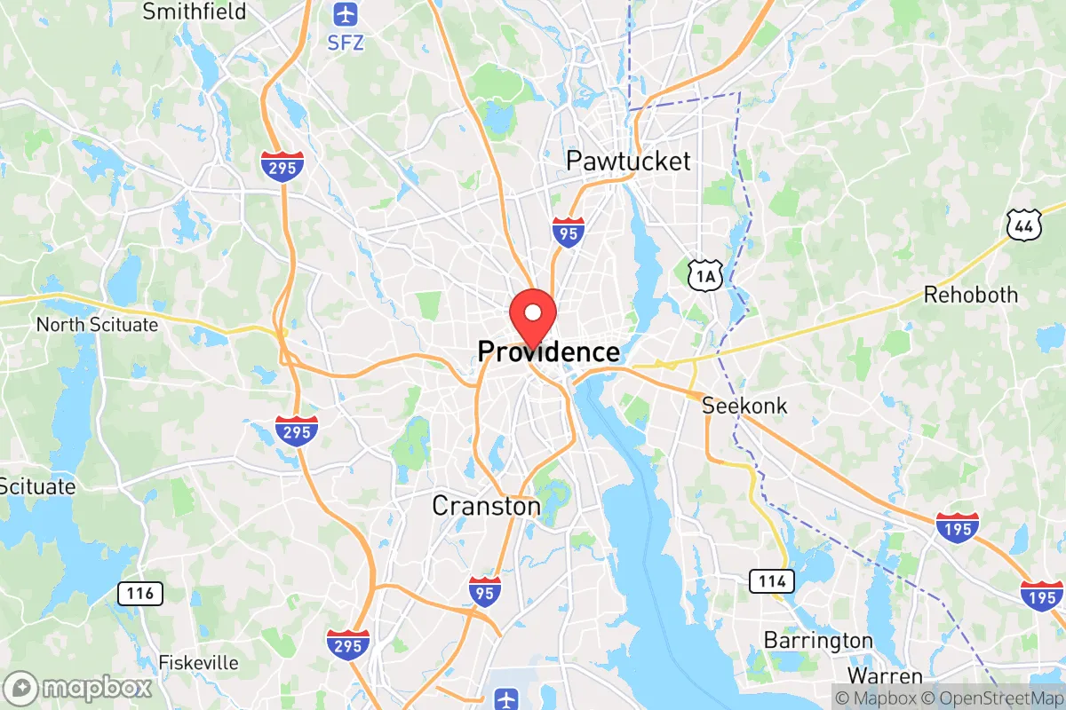
Regional Safe Places
Below is our recommended "safe zones" in Rhode Island and the surrounding area based on our strategic heuristics. For most people, it's unrealistic to live in a “safe zone” full-time due to work, family or other personal reasons. They tend to be more rural. However, many of these areas are perfect for second homes and retreat properties that double as a vacation home or even a short-term rental.


Important Note: For informational purposes only. This does not mean nothing bad ever happens in the green zones. Please use common sense. This is based on public data and modeled with AI. We tried to take a conservative approach but mistakes happen. We update this regularly as new information becomes available.
Solar Generator Recommendations
Backup power matters more here than in safer locations. We've picked three solar generators across budgets and capacity tiers — start with the budget unit if you only need a few essentials, or step up if you want to run a fridge and HVAC for days at a time.

Jackery Portable Power Station Explorer 300
Budget OptionPower on the Go: Weighing only 11 lbs, it's convenient to set up and store with book-sized foldable solar panels

BLUETTI Portable Power Station AC180
Designed for both indoor and outdoor scenarios, AC180 is highly capable as it has a robost capacity and continuous output power.

EF ECOFLOW DELTA Pro Ultra Power Station
Upgraded PickEcoFlow DELTA Pro Ultra is a whole-home energy system designed to grow with your family. Integrated with the Smart Home Panel 2, it scales to meet your evolving energy needs — keeping your home powered, intelligent, and secure through every stage of life.
We earn a commission, at no additional cost to you.
Strategic Assessment Analysis
Providence, Rhode Island, presents a deeply conflicted strategic picture for the conservative prepper or survivalist. On one hand, its location on Narragansett Bay offers access to marine resources and a temperate climate that avoids the extremes of the interior. On the other, it sits squarely in the densest corridor of the Northeast Megalopolis, within a 50-mile radius of Boston, Worcester, and the Connecticut coast, making it a high-probability target for any cascading failure, civil unrest, or mass casualty event originating from those urban centers. The city’s resilience is not in its isolation—it has none—but in its potential as a waypoint or a temporary staging area before a more permanent retreat inland.
Geographic position and natural advantages for a strategic relocation
Providence’s primary strategic asset is its access to Narragansett Bay and the Atlantic. In a grid-down or supply-chain collapse scenario, the bay provides a potential route for waterborne resupply, fishing, and desalination if you have the gear. The city itself sits at the confluence of three rivers—the Providence, Moshassuck, and Woonasquatucket—which, while heavily industrialized and polluted in their lower reaches, offer fresh water sources upstream in the northern suburbs. The surrounding terrain is hilly and wooded, with the Scituate Reservoir (the state’s largest freshwater body) about 15 miles west, providing a critical water security buffer. However, the topography is not defensible: the city is a low-lying coastal plain, with no natural chokepoints or high ground to control approaches. The climate is a double-edged sword: mild winters reduce heating fuel demands, but the region is prone to nor’easters, coastal flooding, and the occasional hurricane, which could compound a crisis by disrupting transportation and power for days or weeks.
Risks, exposures, and proximity to fallout-relevant landmarks
This is where Providence’s strategic calculus collapses for the prepper. The city is within 45 miles of Boston’s Logan Airport, the Port of Boston, and the naval installations at Newport and Quonset Point. In any major conflict or terror event, these are high-value targets for conventional or asymmetric strikes. Providence itself hosts the Port of Providence, a major petroleum and chemical handling facility, and the I-95/I-195 interchange, a critical logistics chokepoint. A single truck bomb or cyberattack on the port could cripple fuel distribution across southern New England. The city’s population density—over 190,000 people packed into 18 square miles—makes it a nightmare for civil unrest. The 2020 protests saw significant property damage and looting in downtown Providence, and the city’s police force is underfunded and politically constrained. For the conservative relocator, the risk of being caught in a mass casualty event—whether from a bridge collapse, a refinery explosion, or a coordinated attack on the urban core—is unacceptably high. The proximity to the Pilgrim Nuclear Power Station (25 miles south, now decommissioned but still storing spent fuel) and the Seabrook Station (50 miles north, still active) adds a radiological exposure vector that cannot be ignored.
Practical resilience for a relocator: food, water, energy, and defensibility
For a single individual or family looking to hunker down, Providence is a poor choice. Food security is virtually nonexistent within city limits—the city has no significant agricultural land, and the few community gardens are vulnerable to looting. The Rhode Island Community Food Bank reports that 1 in 8 residents already face food insecurity; in a crisis, that ratio would spike, and the city’s 311,000 residents would be competing for supplies from a handful of grocery stores. Water is marginally better: the Providence Water Supply Board draws from the Scituate Reservoir, which is protected by a security force and has a 60-day supply in storage. But the distribution system is aging and vulnerable to contamination or sabotage. Energy is a major vulnerability: National Grid’s gas and electric infrastructure is above-ground and exposed to storms and vandalism. Solar with battery backup is feasible on residential rooftops, but the city’s building stock is old and often shaded by dense tree cover. Defensibility is the dealbreaker. Providence is a compact, walkable city with narrow streets and row houses—great for pre-industrial defense, terrible for modern security. There is no rural buffer; the suburbs of Cranston, Warwick, and Pawtucket are contiguous and equally dense. A relocator would need to fortify a single-family home with steel doors, window bars, and a perimeter alarm, and even then, a determined mob or organized group could overwhelm it. The only realistic defensive posture is to use Providence as a temporary base while scouting a retreat property in the western part of the state—places like Foster, Scituate, or Glocester, where acreage is available and the population density drops below 200 per square mile.
The overall strategic picture for Providence is clear: it is a high-risk, low-reward location for the conservative prepper. Its coastal access and water resources are genuine advantages, but they are outweighed by the city’s vulnerability to cascading failures from Boston, its own critical infrastructure, and the sheer density of people who would become desperate in a crisis. For a single individual or family, the smart play is to treat Providence as a reconnaissance zone—a place to build relationships with rural landowners in western Rhode Island or eastern Connecticut, stockpile supplies at a remote cabin, and only use the city for short-term resupply or medical access. If you are determined to live in Providence itself, you must accept that you are betting on the stability of a system that is already showing cracks. The prudent move is to look further inland, toward the Berkshires or the White Mountains, where the fallout risks are lower and the defensibility is real. Providence is a beautiful, historic city, but in a world of increasing uncertainty, it is not a place to make a stand.
* Values derived from national, state, county, city and local statistics and may differ in a specific area. Last updated: 2026-04-30T04:53:38.000Z
Narrative content on this page is AI-generated and may contain mistakes. Verify any details that matter before acting on them.
ReloMaps may earn a commission from affiliate links at no extra cost to you.