Photo: Wikipedia
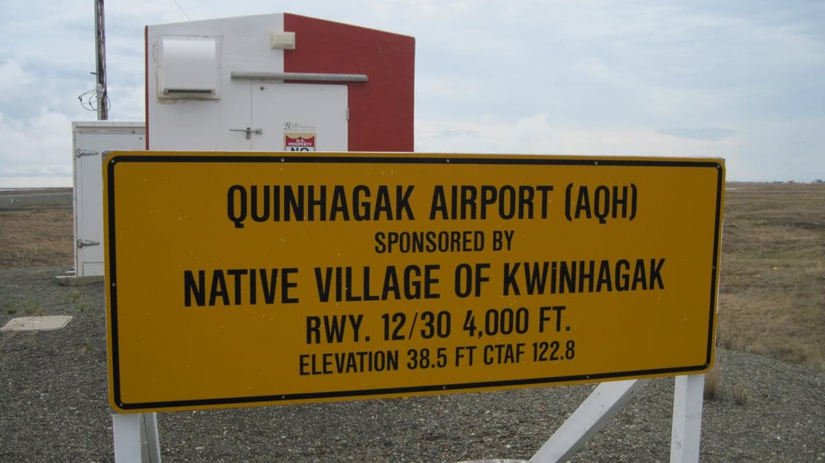
Strategic Assessment of Quinhagak, AK
Strong survivability profile. Good buffer from population centers, with manageable environmental and tactical risks.
What does the Strategic Assessment tell us?
Our Strategic Assessment grades tactical survivability of an area. Major population centers, military targets, fallout zones, natural disasters, and border exposure all drive risk — lower exposure means a more defensible position in a crisis.
This is heavily inspired by Joel Skousen's Strategic Relocation book. Highly recommended you checkout the book ($)What does this tell us?
Our Strategic Assessment grades tactical survivability of an area. Major population centers, military targets, fallout zones, natural disasters, and border exposure all drive risk — lower exposure means a more defensible position in a crisis.
This is heavily inspired by Joel Skousen's Strategic Relocation book. Highly recommended you checkout the book ($)Strategic Pillars

Key Distances
Regional Safe Places
Below is our recommended "safe zones" in Alaska and the surrounding area based on our strategic heuristics. For most people, it's unrealistic to live in a “safe zone” full-time due to work, family or other personal reasons. They tend to be more rural. However, many of these areas are perfect for second homes and retreat properties that double as a vacation home or even a short-term rental.
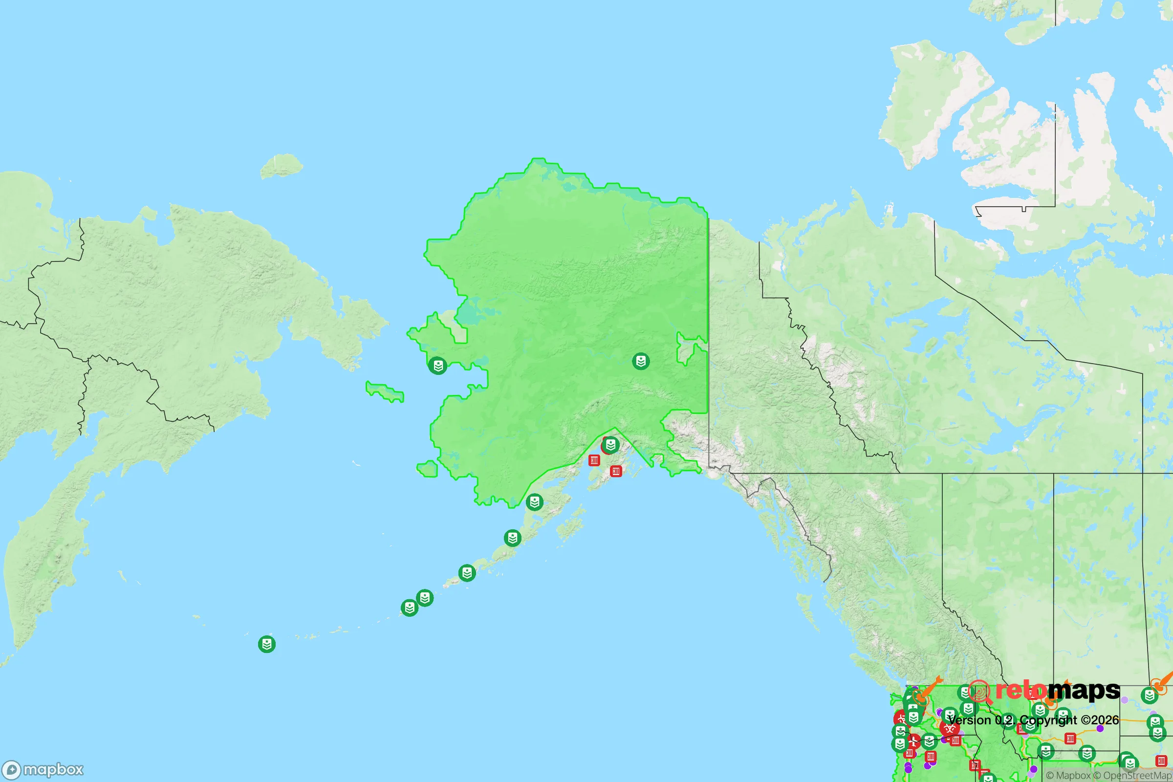
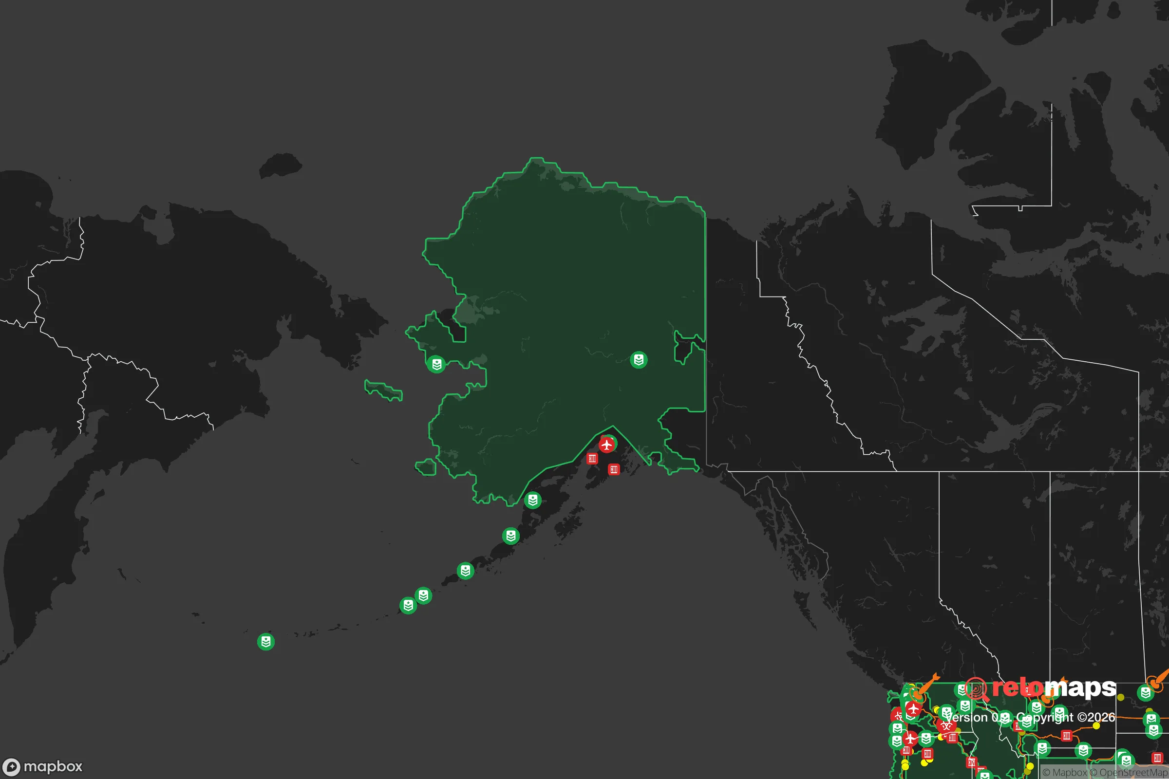
Important Note: For informational purposes only. This does not mean nothing bad ever happens in the green zones. Please use common sense. This is based on public data and modeled with AI. We tried to take a conservative approach but mistakes happen. We update this regularly as new information becomes available.
Solar Generator Recommendations
Backup power matters more here than in safer locations. We've picked three solar generators across budgets and capacity tiers — start with the budget unit if you only need a few essentials, or step up if you want to run a fridge and HVAC for days at a time.

Jackery Portable Power Station Explorer 300
Budget OptionPower on the Go: Weighing only 11 lbs, it's convenient to set up and store with book-sized foldable solar panels

BLUETTI Portable Power Station AC180
Designed for both indoor and outdoor scenarios, AC180 is highly capable as it has a robost capacity and continuous output power.

EF ECOFLOW DELTA Pro Ultra Power Station
Upgraded PickEcoFlow DELTA Pro Ultra is a whole-home energy system designed to grow with your family. Integrated with the Smart Home Panel 2, it scales to meet your evolving energy needs — keeping your home powered, intelligent, and secure through every stage of life.
We earn a commission, at no additional cost to you.
Strategic Assessment Analysis
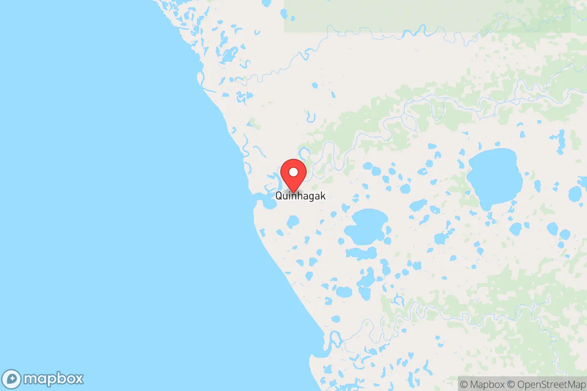
Quinhagak, Alaska, offers a strategic relocation option for those prioritizing physical and societal resilience, sitting roughly 700 miles southwest of Anchorage on the Bering Sea coast. Its extreme isolation—accessible only by air or seasonal barge—provides a natural buffer against the cascading failures of urban infrastructure, civil unrest, or mass casualty events that could destabilize the Lower 48. For a conservative-leaning individual or family seeking to opt out of fragile population centers, Quinhagak represents a hard reset: a place where self-reliance isn't a hobby but a daily necessity, and where the nearest Walmart is a 90-minute flight away.
Geographic position and natural advantages for long-term security
Quinhagak sits at the mouth of the Kanektok River, a world-class salmon fishery that provides a reliable, renewable protein source. The surrounding Yukon-Kuskokwim Delta is a vast, roadless tundra landscape—no roads connect Quinhagak to any other community. This geographic isolation is a double-edged sword but a clear advantage for preppers: there are no choke points for refugees to flee through, no major highways for looters to travel, and no nearby cities that could become epicenters of disease or violence. The nearest settlement of any size is Bethel, about 70 miles northeast, itself a small hub of roughly 6,000 people. The Bering Sea coastline offers a natural defensive perimeter, and the cold, wet climate discourages casual visitors. For those concerned about fallout from a nuclear event, Quinhagak’s position—far from any strategic targets like missile silos, military bases, or major ports—means fallout risk is minimal compared to anywhere in the Lower 48. The prevailing winds from the west also push any Pacific-origin contamination away from the coast, though a major transpacific event would still require monitoring.
Risks, exposures, and proximity to fallout-relevant landmarks
The primary risk in Quinhagak is not man-made but environmental: the community sits on permafrost that is actively thawing, causing coastal erosion and structural instability. The village has already lost several feet of shoreline in recent decades, and relocation of the entire community inland has been discussed for years. Any long-term investment in Quinhagak must account for the possibility that the current townsite becomes uninhabitable within 20–30 years. Additionally, the village is entirely dependent on air and barge for fuel, ammunition, medical supplies, and manufactured goods. A disruption to global shipping—whether from war, pandemic, or economic collapse—would cut off resupply within weeks. There are no strategic military targets within 200 miles; the nearest Air Force base is Joint Base Elmendorf-Richardson near Anchorage, far beyond any plausible fallout zone. However, the community’s proximity to the Bering Strait—a potential chokepoint for global shipping in a conflict between the U.S. and Russia—means that Quinhagak could become a staging area for military activity in a major war, though this remains speculative. For a relocator, the real exposure is not fallout but supply chain fragility: you must bring everything you need for years, not months.
Practical resilience for a relocator: food, water, energy, and defensibility
Food security in Quinhagak is exceptional by modern American standards. The Kanektok River and Bering Sea provide salmon, halibut, and crab; the tundra yields berries, greens, and caribou; and subsistence hunting for moose, seal, and waterfowl is a cultural norm. A motivated family can harvest 500+ pounds of salmon per season, enough to feed two adults for a year when properly smoked or canned. Gardening is possible in raised beds or greenhouses during the brief but intense summer, though permafrost limits root crops. Water comes from the Kanektok River or local wells, but treatment is essential—boiling or filtration is standard. Energy is the weak link: the village relies on diesel generators for electricity, with fuel delivered by barge once a year. Solar panels are viable only from May to August due to extreme seasonal light variation; wind turbines are more consistent but require maintenance. Defensibility is high: the village is compact (roughly 700 residents), and everyone knows everyone. Outsiders are immediately noticed. The lack of roads means any approach is by boat, plane, or foot across open tundra—all easily monitored. Firearms are common for subsistence hunting, and the local Yup’ik culture values community cooperation over confrontation. For a single individual or family, integrating into the village’s subsistence economy is the only path to long-term survival; attempting to live as a hermit would be both impractical and socially dangerous.
The overall strategic picture for Quinhagak is one of extreme trade-offs. It offers perhaps the highest natural buffer against societal collapse of any location in the United States—no urban unrest, no fallout zones, no supply chain dependencies that can’t be mitigated with careful planning. But that buffer comes at a cost: you must be prepared to live without modern medical care, without Amazon deliveries, and without the option to leave quickly. The nearest hospital is in Bethel, a medevac flight away. The climate is harsh—winters average 10°F with 60+ mph winds—and the isolation can break those not mentally prepared for it. For a conservative relocator who values self-sufficiency, community cohesion, and distance from the chaos of the Lower 48, Quinhagak is a viable but demanding option. It is not a retreat for the faint of heart or the under-resourced. It is a place where you must arrive with skills, supplies, and a willingness to adapt to a subsistence lifestyle that most Americans have never experienced. If you can do that, Quinhagak offers a level of security that no gated community or rural homestead in the contiguous states can match.
* Values derived from national, state, county, city and local statistics and may differ in a specific area. Last updated: 2026-04-19T19:34:55.000Z
Narrative content on this page is AI-generated and may contain mistakes. Verify any details that matter before acting on them.
ReloMaps may earn a commission from affiliate links at no extra cost to you.