
Photo: Wikipedia
Strategic Assessment of Saguache, CO
Strong survivability profile. Good buffer from population centers, with manageable environmental and tactical risks.
What does the Strategic Assessment tell us?
Our Strategic Assessment grades tactical survivability of an area. Major population centers, military targets, fallout zones, natural disasters, and border exposure all drive risk — lower exposure means a more defensible position in a crisis.
This is heavily inspired by Joel Skousen's Strategic Relocation book. Highly recommended you checkout the book ($)What does this tell us?
Our Strategic Assessment grades tactical survivability of an area. Major population centers, military targets, fallout zones, natural disasters, and border exposure all drive risk — lower exposure means a more defensible position in a crisis.
This is heavily inspired by Joel Skousen's Strategic Relocation book. Highly recommended you checkout the book ($)Strategic Pillars

Key Distances
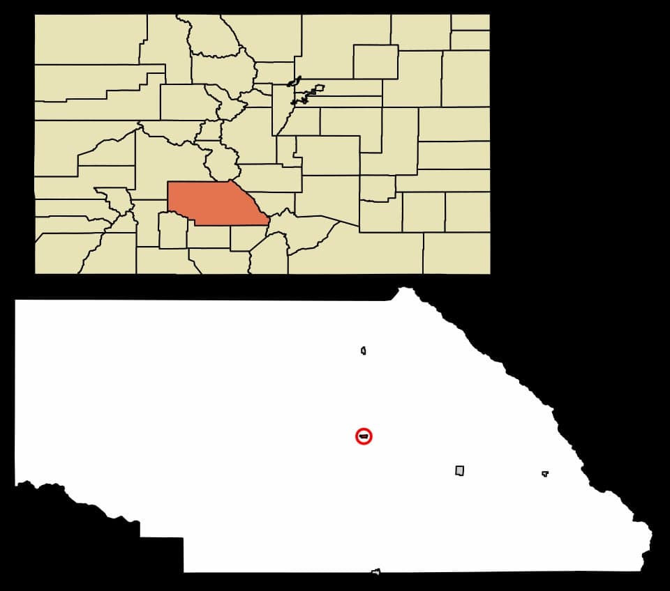
Regional Safe Places
Below is our recommended "safe zones" in Colorado and the surrounding area based on our strategic heuristics. For most people, it's unrealistic to live in a “safe zone” full-time due to work, family or other personal reasons. They tend to be more rural. However, many of these areas are perfect for second homes and retreat properties that double as a vacation home or even a short-term rental.


Important Note: For informational purposes only. This does not mean nothing bad ever happens in the green zones. Please use common sense. This is based on public data and modeled with AI. We tried to take a conservative approach but mistakes happen. We update this regularly as new information becomes available.
Solar Generator Recommendations
Backup power matters more here than in safer locations. We've picked three solar generators across budgets and capacity tiers — start with the budget unit if you only need a few essentials, or step up if you want to run a fridge and HVAC for days at a time.

Jackery Portable Power Station Explorer 300
Budget OptionPower on the Go: Weighing only 11 lbs, it's convenient to set up and store with book-sized foldable solar panels

BLUETTI Portable Power Station AC180
Designed for both indoor and outdoor scenarios, AC180 is highly capable as it has a robost capacity and continuous output power.

EF ECOFLOW DELTA Pro Ultra Power Station
Upgraded PickEcoFlow DELTA Pro Ultra is a whole-home energy system designed to grow with your family. Integrated with the Smart Home Panel 2, it scales to meet your evolving energy needs — keeping your home powered, intelligent, and secure through every stage of life.
We earn a commission, at no additional cost to you.
Strategic Assessment Analysis
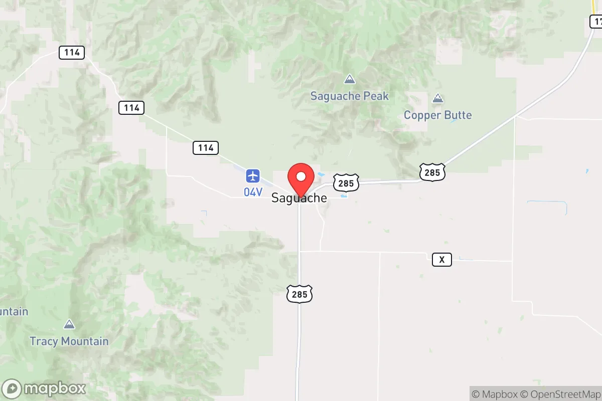
Saguache, Colorado, sits in a high desert valley at 7,700 feet, offering a combination of geographic isolation and resource access that makes it a serious candidate for those prioritizing long-term resilience. The town’s population hovers around 500, and the entire Saguache County has fewer than 7,000 residents, meaning you’re not competing with crowds for water, land, or attention. Its position along U.S. Highway 285 provides a single reliable corridor to the Front Range, but the surrounding San Luis Valley and Sangre de Cristo mountains create natural chokepoints that slow outside movement—a double-edged sword that works in your favor if you’re already inside the bubble.
Geographic position and natural advantages for self-sufficiency
Saguache sits in the northern San Luis Valley, a vast, flat basin ringed by the Sangre de Cristo range to the east and the San Juan Mountains to the west. This geography gives you a 360-degree view of approaching threats, whether weather or human, and limits approach routes to a handful of passes and highways. The valley floor is arid but irrigated by the Rio Grande and its tributaries, with the Saguache Creek running directly through town. The area receives roughly 10 inches of precipitation annually, but the underlying aquifer—the San Luis Valley’s massive groundwater system—is one of the largest in the West. For a relocator, that means you’re not dependent on a single reservoir or snowpack; you can drill a well and tap into a deep, renewable source. The growing season is short (about 100 days), but the valley’s volcanic soils are fertile, and local farms produce alfalfa, barley, and potatoes. You can supplement with greenhouse growing, and the high altitude means low humidity and minimal pest pressure. The surrounding national forests (Rio Grande and San Isabel) provide timber, game, and forage, though you’ll need to learn the terrain—elevation changes from 7,500 to 14,000 feet mean you can hunt elk in the morning and fish trout by afternoon.
Risks, exposures, and proximity to fallout-relevant landmarks
The biggest risk in Saguache is its distance from major medical and logistical support. The nearest hospital with a trauma center is in Alamosa, 45 minutes south, or Salida, an hour north. For serious emergencies, you’re looking at a two-hour drive to Colorado Springs or Pueblo. That’s a hard reality for families with young children or aging parents—you need to stock advanced medical supplies and have a plan for evacuation if things go sideways. The area is also seismically quiet, but the San Luis Valley sits on a fault system that could produce a 6.0-magnitude quake every few centuries; the last notable one was in 1973. Wildfire risk is moderate—the valley floor is too dry to burn intensely, but the surrounding forests have seen major fires (the 2013 West Fork Fire burned 110,000 acres in the Rio Grande National Forest). Flooding is rare but possible during spring snowmelt if Saguache Creek overruns its banks. The real exposure is human: Saguache is 90 miles from the Colorado-New Mexico border, and the valley is a known corridor for drug trafficking and illegal immigration. The local sheriff’s office has four deputies for the entire county, so you are your own first responder. For fallout-relevant landmarks, the nearest major population centers are Colorado Springs (150 miles, population 500,000) and Denver (200 miles, 2.9 million). Neither is close enough to pose a direct fallout risk from a nuclear event, but both are within the blast radius of a major EMP or coordinated attack. The San Luis Valley’s isolation actually works in your favor here—you’re far enough from any strategic target (military bases, missile silos, major infrastructure) that you’re unlikely to be a secondary target. The nearest military installation is Fort Carson, 140 miles northeast, and the nearest nuclear-related site is the Waste Isolation Pilot Plant (WIPP) in New Mexico, 200 miles south. Neither is a direct threat, but both could become refugee magnets in a crisis.
Practical resilience for a relocator: food, water, energy, and defensibility
Water is Saguache’s strongest card. The valley’s aquifer is deep and renewable, and well permits are relatively easy to obtain for agricultural use. You can drill a domestic well for around $10,000–$15,000, and the water table sits at 50–100 feet in most areas. That gives you a reliable, off-grid water source that doesn’t depend on municipal treatment plants or pipelines. For food, the valley’s agricultural base means you can buy locally grown produce, meat, and dairy directly from farmers. The Saguache County Farmers Market runs June through October, and there are several u-pick operations for berries and apples. You can also hunt deer and elk on public land (over 1 million acres of national forest within an hour’s drive), and fish the Rio Grande and its tributaries for brown and rainbow trout. For energy, the valley gets over 300 days of sunshine per year, making solar a no-brainer. Net metering is available through San Luis Valley Rural Electric Cooperative, and you can install a 10kW system for around $20,000 after federal tax credits. Wind is also viable—the valley is consistently breezy, and small-scale turbines can supplement solar in winter. Defensibility is mixed. The town itself is wide open—flat terrain, no natural barriers, and a single main road. But the surrounding ranches and foothills offer good positions for a retreat. You can buy 20–40 acres of irrigated land for $150,000–$300,000, or dry land for half that. The key is to choose a property with a clear line of sight to approach routes and a backup water source (well or creek). The local culture is conservative and self-reliant—most residents own firearms, and the county has a strong tradition of mutual aid. You won’t be welcomed as an outsider unless you show competence and respect, but once accepted, you’ll have a network of people who know how to fix a tractor, treat a wound, and keep their mouths shut.
The overall strategic picture for Saguache is one of trade-offs. You get genuine isolation, abundant water, and a low population density that makes it hard for any outside force to control. You also get harsh winters, limited medical access, and a long drive to anything resembling a city. For a single individual or a family willing to invest in infrastructure—solar, well, greenhouse, medical stockpile—this is one of the most defensible positions in the lower 48. You’re far enough from the chaos of the Front Range to avoid the initial wave of any disaster, but close enough to monitor events and make decisions. The valley’s agricultural base means you can produce your own food, and the local culture means you’ll have allies who share your values. The downsides are real: you need to be physically capable, financially prepared, and mentally ready for isolation. If you’re looking for a place to ride out the next decade of instability, Saguache offers a solid foundation—just don’t expect anyone to come rescue you. That’s the point.
* Values derived from national, state, county, city and local statistics and may differ in a specific area. Last updated: 2026-05-16T10:07:49.000Z
Narrative content on this page is AI-generated and may contain mistakes. Verify any details that matter before acting on them.
ReloMaps may earn a commission from affiliate links at no extra cost to you.