Photo: Wikipedia
Strategic Assessment of Salem, MA
Multiple tactical vulnerabilities. Population density, target proximity, or disaster risk are likely compounding. A retreat property and exit planning is required.
What does the Strategic Assessment tell us?
Our Strategic Assessment grades tactical survivability of an area. Major population centers, military targets, fallout zones, natural disasters, and border exposure all drive risk — lower exposure means a more defensible position in a crisis.
This is heavily inspired by Joel Skousen's Strategic Relocation book. Highly recommended you checkout the book ($)What does this tell us?
Our Strategic Assessment grades tactical survivability of an area. Major population centers, military targets, fallout zones, natural disasters, and border exposure all drive risk — lower exposure means a more defensible position in a crisis.
This is heavily inspired by Joel Skousen's Strategic Relocation book. Highly recommended you checkout the book ($)Strategic Pillars

Key Distances
Regional Safe Places
Below is our recommended "safe zones" in Massachusetts and the surrounding area based on our strategic heuristics. For most people, it's unrealistic to live in a “safe zone” full-time due to work, family or other personal reasons. They tend to be more rural. However, many of these areas are perfect for second homes and retreat properties that double as a vacation home or even a short-term rental.


Important Note: For informational purposes only. This does not mean nothing bad ever happens in the green zones. Please use common sense. This is based on public data and modeled with AI. We tried to take a conservative approach but mistakes happen. We update this regularly as new information becomes available.
Solar Generator Recommendations
Backup power matters more here than in safer locations. We've picked three solar generators across budgets and capacity tiers — start with the budget unit if you only need a few essentials, or step up if you want to run a fridge and HVAC for days at a time.

Jackery Portable Power Station Explorer 300
Budget OptionPower on the Go: Weighing only 11 lbs, it's convenient to set up and store with book-sized foldable solar panels

BLUETTI Portable Power Station AC180
Designed for both indoor and outdoor scenarios, AC180 is highly capable as it has a robost capacity and continuous output power.

EF ECOFLOW DELTA Pro Ultra Power Station
Upgraded PickEcoFlow DELTA Pro Ultra is a whole-home energy system designed to grow with your family. Integrated with the Smart Home Panel 2, it scales to meet your evolving energy needs — keeping your home powered, intelligent, and secure through every stage of life.
We earn a commission, at no additional cost to you.
Strategic Assessment Analysis
Salem, Massachusetts, presents a complex strategic picture for the conservative prepper or survivalist. While its deep-water port and historic infrastructure offer some theoretical resilience, its location on a peninsula, extreme population density, and proximity to Boston create a set of vulnerabilities that outweigh most advantages for a long-term relocation. The city’s very identity as a tourist and commuter hub makes it a high-risk zone for civil unrest, supply chain disruption, and mass casualty events, not a defensible redoubt.
Geographic position and natural advantages for long-term survival
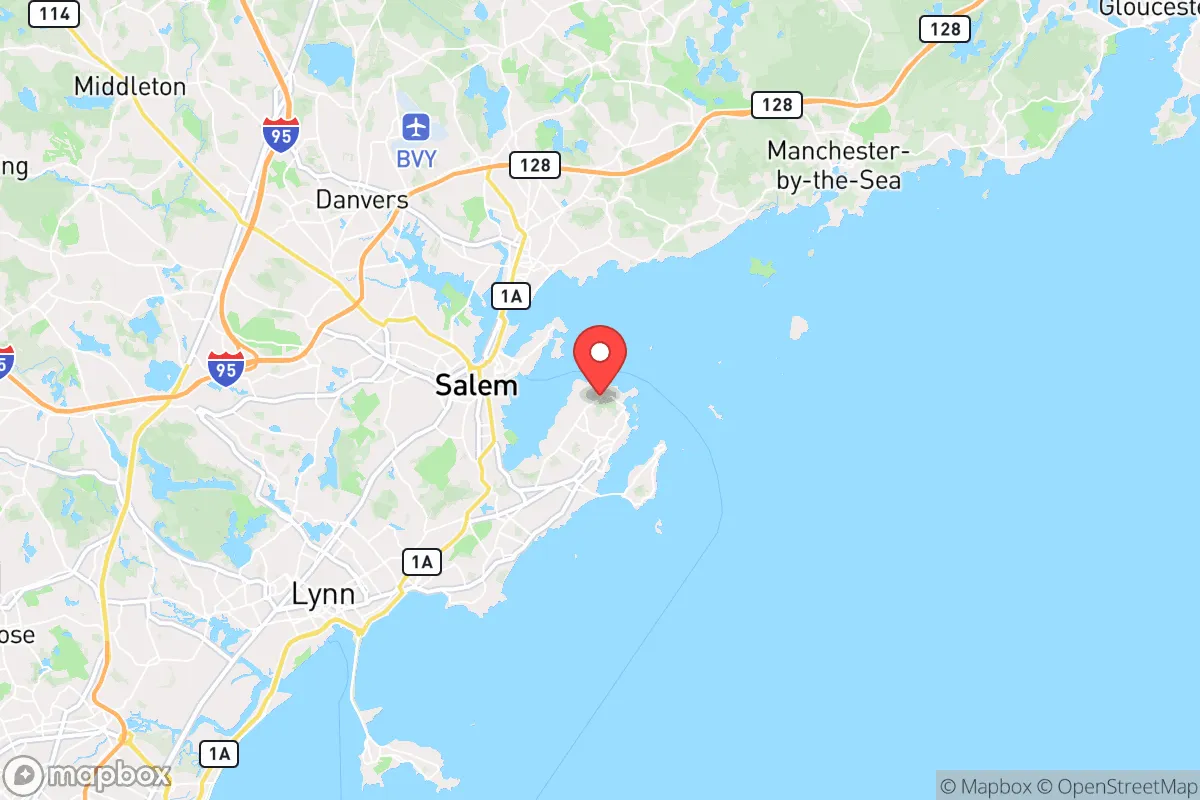
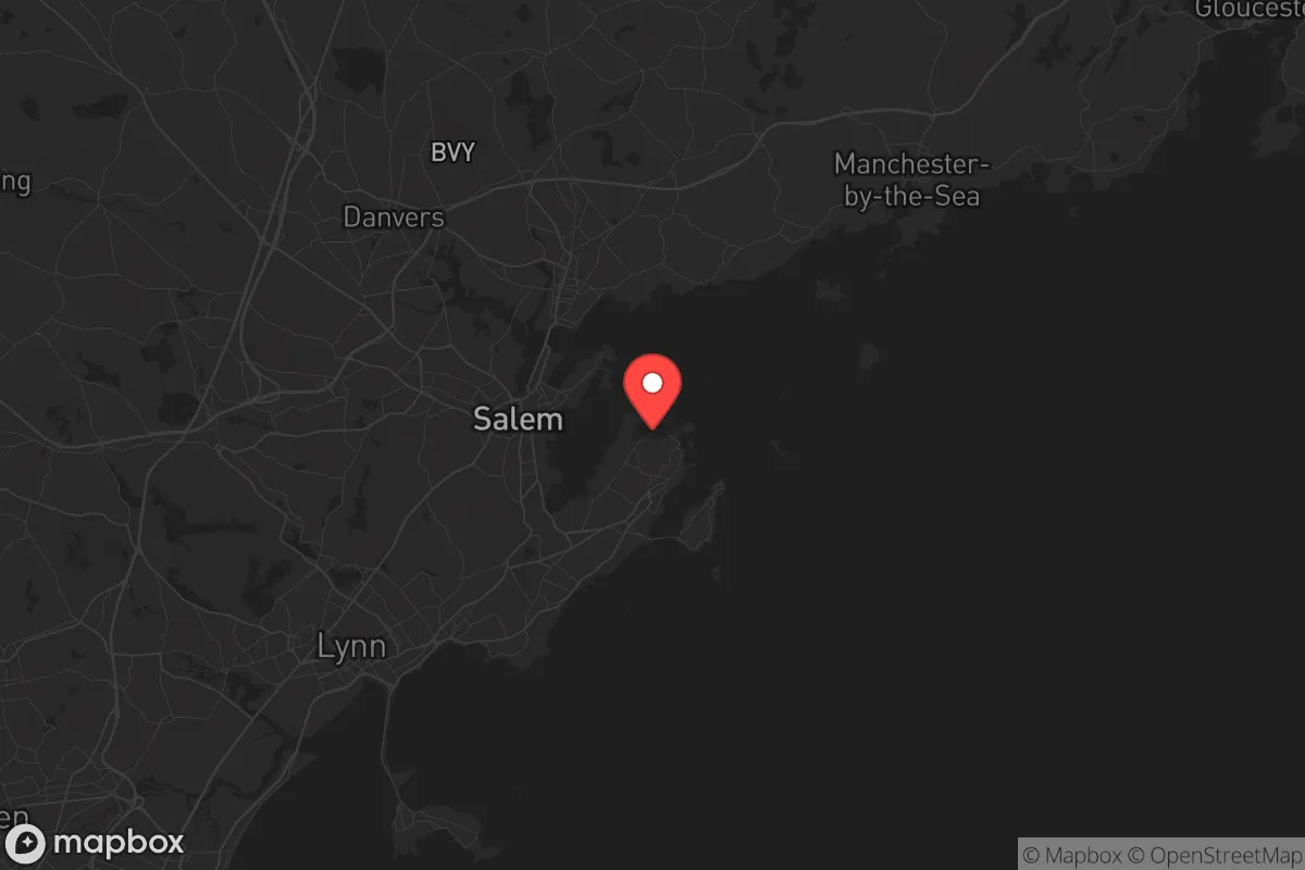
Salem sits on a peninsula jutting into Salem Sound, with the Atlantic Ocean to the east and the North River to the west. This geography provides a natural chokepoint: only a handful of road bridges and causeways connect the city to the mainland, primarily via Route 1A and the Salem-Beverly Bridge. In a collapse scenario, these bridges become immediate bottlenecks for evacuation and equally immediate targets for control by hostile groups or government checkpoints. The maritime access is a double-edged sword—it offers potential for fishing and small-boat transport, but the harbor is shallow and silting, limiting large-vessel use. The city’s elevation is low, with much of the downtown and waterfront areas sitting at 10–20 feet above sea level, making it vulnerable to storm surge and sea-level rise, a long-term concern for any fixed infrastructure. The surrounding North Shore region has some forested areas and farmland, but Salem itself is almost entirely built out, with minimal arable land or natural water sources beyond the municipal supply. The Beverly-Salem water treatment plant draws from the Ipswich River, a surface source that is vulnerable to contamination, drought, or sabotage. For a prepper, the lack of defensible high ground, limited egress routes, and dependence on a single water source are major red flags.
Risks, exposures, and proximity to fallout-relevant landmarks
Salem’s location is a strategic liability. It lies just 15 miles northeast of Boston, a primary target for any major terrorist attack, EMP strike, or civil unrest event. The city is directly under the flight paths of Logan International Airport, and the nearby US Coast Guard Base Boston and Naval Weapons Station Earle (in Colts Neck, New Jersey, but with regional logistics) are secondary targets. The Salem Harbor Power Station, a natural gas and oil-fired plant, is a critical infrastructure point that could be a target for sabotage or a source of cascading failure. The city’s dense, walkable downtown—packed with tourists during peak seasons—would become a death trap in a panic event. The MBTA commuter rail and ferry services make Salem a bedroom community for Boston, meaning a sudden evacuation of the city would funnel hundreds of thousands of people through the same few bridges and roads. The Salem Maritime National Historic Site and the Peabody Essex Museum are cultural landmarks that could attract looting or become rallying points for protest. The Salem Willows park and the Winter Island area offer some open space, but they are not defensible. The Salem State University campus, with its student population, could become a focal point for unrest. The North Shore Medical Center is a regional hospital, but it would be overwhelmed in a mass casualty event. The Salem Police Department and Salem Fire Department are professional but under-resourced for a city of 45,000 that swells to over 100,000 on Halloween. The Essex County Sheriff’s Department has a presence, but the county jail is in Middleton, not Salem. The Massachusetts National Guard armories in nearby Danvers and Reading could be mobilized, but their loyalty in a civil unrest scenario is uncertain. The Salem Common and Lafayette Park are open spaces that would become refugee camps, not safe zones.
Practical resilience for a relocator: food, water, energy, and defensibility
For a single individual or family looking to hunker down, Salem is a poor choice. Food security is virtually nonexistent. The city has no significant agricultural land, and the few community gardens are small and vulnerable. The Salem Farmers’ Market is seasonal and relies on external supply chains. The Stop & Shop and Market Basket in nearby Danvers would be stripped within hours of a crisis. Water security is a critical weakness. The municipal water system is fed by the Ipswich River and treated at the Beverly-Salem plant. A single point of failure—a power outage, a chemical spill, or a deliberate attack—would leave the city without potable water. Private wells are rare in the dense urban core. Energy resilience is poor. The Salem Harbor station is a single plant; a grid failure would leave the city dark. Solar panels are possible but limited by the dense tree canopy and historic district restrictions. Defensibility is a nightmare. The peninsula layout means any attacker only needs to control the bridges to bottle up the entire population. The dense, narrow streets of the McIntire Historic District are a maze that favors ambush but also makes movement and supply runs dangerous. The Salem Waterfront and Derby Wharf are exposed. The Salem Woods and Forest River Park offer some cover but are not large enough for sustainable hunting or foraging. The Salem YMCA and Salem Public Library could serve as community gathering points, but they are not hardened shelters. The Salem Armory is a historic building, not a functional defensive structure. The Salem Hospital has a helipad, but that’s a one-way ticket out, not a sustainable solution. The Salem Ferry to Boston is a liability, not an asset, as it would be commandeered by authorities or looters. The Salem-Beverly Bridge is a drawbridge, meaning it can be raised to cut off road access, but that also traps residents. The Kernwood Bridge and Lafayette Street Bridge are the other egress points, all easily blocked.
The overall strategic picture for Salem is grim for the survivalist. It is a high-density, low-resilience urban island with a single point of failure for water, energy, and egress. Its proximity to Boston makes it a secondary target and a funnel for refugees. The city’s historic charm and tourist economy are irrelevant in a collapse scenario. For a conservative prepper seeking a defensible, self-sufficient location, Salem is a place to avoid. The North Shore of Massachusetts has better options—inland towns like Boxford or Georgetown with more land, well water, and fewer chokepoints. Salem’s only strategic value is as a temporary staging point for a maritime evacuation, but that requires a boat, a plan, and a destination. For long-term resilience, look elsewhere. The Salem area is a beautiful place to visit for history, but it is a dangerous place to live when the lights go out.
* Values derived from national, state, county, city and local statistics and may differ in a specific area. Last updated: 2026-04-23T06:47:15.000Z
Narrative content on this page is AI-generated and may contain mistakes. Verify any details that matter before acting on them.
ReloMaps may earn a commission from affiliate links at no extra cost to you.