Photo: Wikipedia
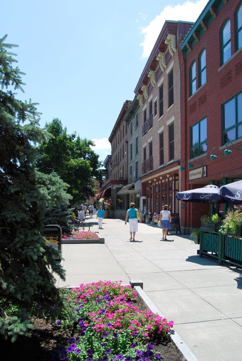
Strategic Assessment of Saratoga Springs, NY
Meaningful friction. Expect exposure to either population pressure, blast zones, or natural disaster risk. Consider buying a retreat property.
What does the Strategic Assessment tell us?
Our Strategic Assessment grades tactical survivability of an area. Major population centers, military targets, fallout zones, natural disasters, and border exposure all drive risk — lower exposure means a more defensible position in a crisis.
This is heavily inspired by Joel Skousen's Strategic Relocation book. Highly recommended you checkout the book ($)What does this tell us?
Our Strategic Assessment grades tactical survivability of an area. Major population centers, military targets, fallout zones, natural disasters, and border exposure all drive risk — lower exposure means a more defensible position in a crisis.
This is heavily inspired by Joel Skousen's Strategic Relocation book. Highly recommended you checkout the book ($)Strategic Pillars

Key Distances
Regional Safe Places
Below is our recommended "safe zones" in New York and the surrounding area based on our strategic heuristics. For most people, it's unrealistic to live in a “safe zone” full-time due to work, family or other personal reasons. They tend to be more rural. However, many of these areas are perfect for second homes and retreat properties that double as a vacation home or even a short-term rental.


Important Note: For informational purposes only. This does not mean nothing bad ever happens in the green zones. Please use common sense. This is based on public data and modeled with AI. We tried to take a conservative approach but mistakes happen. We update this regularly as new information becomes available.
Solar Generator Recommendations
Backup power matters more here than in safer locations. We've picked three solar generators across budgets and capacity tiers — start with the budget unit if you only need a few essentials, or step up if you want to run a fridge and HVAC for days at a time.

Jackery Portable Power Station Explorer 300
Budget OptionPower on the Go: Weighing only 11 lbs, it's convenient to set up and store with book-sized foldable solar panels

BLUETTI Portable Power Station AC180
Designed for both indoor and outdoor scenarios, AC180 is highly capable as it has a robost capacity and continuous output power.

EF ECOFLOW DELTA Pro Ultra Power Station
Upgraded PickEcoFlow DELTA Pro Ultra is a whole-home energy system designed to grow with your family. Integrated with the Smart Home Panel 2, it scales to meet your evolving energy needs — keeping your home powered, intelligent, and secure through every stage of life.
We earn a commission, at no additional cost to you.
Strategic Assessment Analysis
Saratoga Springs, New York, presents a complex strategic picture for the conservative prepper or survivalist. Its historic wealth and tourism-driven economy mask a location that sits uncomfortably close to major population centers and critical infrastructure, creating a paradox of apparent stability and genuine vulnerability. While the area’s natural beauty and local food networks offer some resilience, the proximity to the Capital District and the New York City–Albany–Montreal corridor introduces significant risks that a serious relocator must weigh carefully. The city’s liberal political leanings and dependence on seasonal visitors also raise questions about social cohesion during a prolonged crisis, making it a location that demands thorough, scenario-based planning rather than a simple thumbs-up or thumbs-down.
Geographic position and natural advantages for a strategic retreat
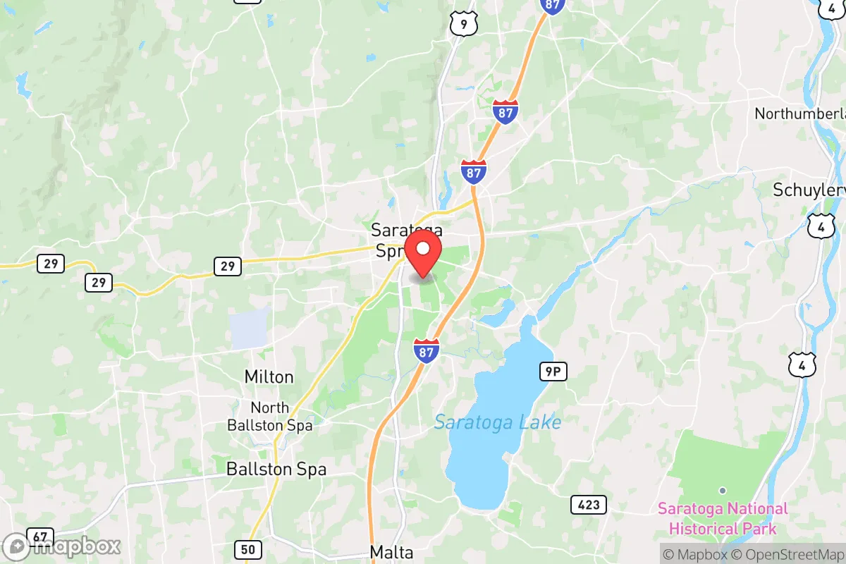
Saratoga Springs sits at the edge of the Adirondack Park, one of the largest protected wilderness areas in the contiguous United States, offering a massive buffer of forested, sparsely populated land to the north and west. This proximity provides a potential escape route into deep woods with abundant water, game, and timber, which is a genuine asset for anyone planning a bug-out location or a long-term retreat. The region’s geology includes the Saratoga Lake and the Hudson River, both reliable freshwater sources, and the area’s rolling hills and valleys offer some natural defensibility against large-scale movement. However, the city itself is located in a valley along the I-87 corridor, a major north-south artery that funnels traffic from New York City through Albany and into Canada. This makes Saratoga Springs a natural chokepoint and a likely target for refugees, looters, or military convoys during a major event. The area’s famous mineral springs are a novelty, not a practical water source for a grid-down scenario, and the local aquifer is heavily tapped by the bottled-water industry, which could become a point of contention.
Risks, exposures, and proximity to fallout-relevant landmarks
The single greatest strategic liability of Saratoga Springs is its location within the Albany–Schenectady–Troy metropolitan area, which houses over 1.1 million people. In a mass evacuation or civil unrest scenario, that population would likely flow north along I-87, directly through Saratoga Springs. The city is also less than 30 miles from the Knolls Atomic Power Laboratory in Niskayuna, a Department of Energy facility involved in naval nuclear propulsion research. While not a commercial reactor, any incident there could create a localized fallout zone. Additionally, the Albany International Airport and the Port of Albany are major logistics hubs that could become targets for sabotage or military action. The New York State Thruway (I-90) intersects I-87 just south of Saratoga, creating a massive transportation nexus that would be a priority for state and federal control. The city’s reliance on tourism—the Saratoga Race Course alone draws hundreds of thousands of visitors annually—means that a sudden collapse would leave a transient population stranded, competing with locals for resources. The political climate in Saratoga County has shifted leftward in recent years, with the city itself voting heavily Democratic, which could create friction with a conservative-minded relocator seeking like-minded community.
Practical resilience for a relocator: food, water, energy, and defensibility
On the positive side, Saratoga Springs sits in the heart of New York’s dairy and apple country, with numerous farms, farmers’ markets, and CSAs within a 20-minute drive. The Saratoga Farmers’ Market operates year-round, and the surrounding Washington and Rensselaer counties have strong agricultural traditions. For a relocator willing to invest in land, growing seasons run roughly 150 days, suitable for cold-hardy crops like potatoes, squash, and root vegetables. Water is plentiful from the Hudson River and Saratoga Lake, but both are vulnerable to upstream contamination from industrial sites in Albany and Troy. A deep well on private property is the only reliable long-term solution. Energy infrastructure is a mixed bag: the grid is served by National Grid, which has a history of storm-related outages, and the region’s reliance on natural gas for heating makes it vulnerable to supply disruptions. Solar potential is moderate, with about 160 sunny days per year, but winter cloud cover can limit generation. Defensibility is poor within the city itself—dense neighborhoods, tourist crowds, and a heavy police presence make it hard to secure a property. The best bet is to buy land in the surrounding towns like Greenfield, Wilton, or Moreau, where acreage is still affordable and you can establish a perimeter. The local gun culture is present but not as robust as in rural Pennsylvania or upstate New York’s North Country; New York’s strict SAFE Act limits magazine capacity and certain firearms, so a relocator must comply with state laws or risk legal trouble.
The overall strategic picture for a conservative prepper
Saratoga Springs is a location that offers genuine natural resources and a strong local food network, but it is fundamentally compromised by its proximity to major population centers and critical infrastructure. For a single individual or a family willing to live on the outskirts—say, in the rural townships north of the city—it could serve as a viable base of operations, provided you have a well, solar panels, and a solid bug-out plan for the Adirondacks. The area’s wealth and tourism create a veneer of stability that could shatter quickly during a grid-down event, as the transient population becomes a liability. The political and cultural environment is increasingly hostile to conservative values, which may isolate you socially and make it harder to build a trusted network. If your primary concern is long-term survival in a worst-case scenario, you would be better served by locations further from the I-87 corridor, such as the Finger Lakes region or the Adirondack interior. Saratoga Springs is a calculated risk—it has assets, but the liabilities are real and growing. Do your own recon, talk to locals, and never assume the tourist-friendly facade will hold when the lights go out.
* Values derived from national, state, county, city and local statistics and may differ in a specific area. Last updated: 2026-05-01T05:23:08.000Z
Narrative content on this page is AI-generated and may contain mistakes. Verify any details that matter before acting on them.
ReloMaps may earn a commission from affiliate links at no extra cost to you.