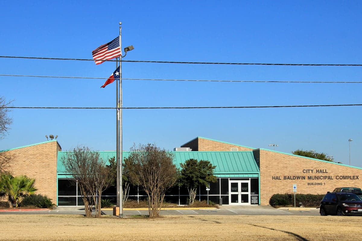
Photo: Wikipedia
Strategic Assessment of Schertz, TX
Multiple tactical vulnerabilities. Population density, target proximity, or disaster risk are likely compounding. A retreat property and exit planning is required.
What does the Strategic Assessment tell us?
Our Strategic Assessment grades tactical survivability of an area. Major population centers, military targets, fallout zones, natural disasters, and border exposure all drive risk — lower exposure means a more defensible position in a crisis.
This is heavily inspired by Joel Skousen's Strategic Relocation book. Highly recommended you checkout the book ($)What does this tell us?
Our Strategic Assessment grades tactical survivability of an area. Major population centers, military targets, fallout zones, natural disasters, and border exposure all drive risk — lower exposure means a more defensible position in a crisis.
This is heavily inspired by Joel Skousen's Strategic Relocation book. Highly recommended you checkout the book ($)Strategic Pillars

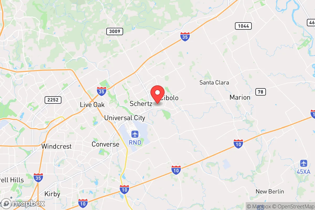
Key Distances
Regional Safe Places
Below is our recommended "safe zones" in Texas and the surrounding area based on our strategic heuristics. For most people, it's unrealistic to live in a “safe zone” full-time due to work, family or other personal reasons. They tend to be more rural. However, many of these areas are perfect for second homes and retreat properties that double as a vacation home or even a short-term rental.


Important Note: For informational purposes only. This does not mean nothing bad ever happens in the green zones. Please use common sense. This is based on public data and modeled with AI. We tried to take a conservative approach but mistakes happen. We update this regularly as new information becomes available.
Solar Generator Recommendations
Backup power matters more here than in safer locations. We've picked three solar generators across budgets and capacity tiers — start with the budget unit if you only need a few essentials, or step up if you want to run a fridge and HVAC for days at a time.

Jackery Portable Power Station Explorer 300
Budget OptionPower on the Go: Weighing only 11 lbs, it's convenient to set up and store with book-sized foldable solar panels

BLUETTI Portable Power Station AC180
Designed for both indoor and outdoor scenarios, AC180 is highly capable as it has a robost capacity and continuous output power.

EF ECOFLOW DELTA Pro Ultra Power Station
Upgraded PickEcoFlow DELTA Pro Ultra is a whole-home energy system designed to grow with your family. Integrated with the Smart Home Panel 2, it scales to meet your evolving energy needs — keeping your home powered, intelligent, and secure through every stage of life.
We earn a commission, at no additional cost to you.
Strategic Assessment Analysis
Schertz, Texas, sits in a strategic sweet spot that many relocators overlook: close enough to San Antonio and Austin to access their economic engines, but far enough from their urban cores to avoid the worst of a collapse scenario. The city’s position along Interstate 35 and near the intersection of several major freight corridors gives it logistical advantages for supply movement, but that same highway becomes a liability if mass evacuation or civil unrest erupts. For a conservative-leaning individual or family thinking long-term about resilience, Schertz offers a mixed bag—solid geographic fundamentals paired with real exposure to the fallout of nearby population centers.
Geographic position and natural advantages for long-term stability
Schertz sits on the Balcones Escarpment, a geological transition zone that provides slightly elevated terrain compared to the flood-prone coastal plains south of San Antonio. This elevation reduces the risk of catastrophic flooding from hurricanes or tropical storms—a real concern for Gulf Coast cities like Houston face annually. The area’s underlying Edwards Aquifer recharge zone means groundwater is accessible, though not unlimited, and requires careful management. The climate is semi-arid, with hot summers and mild winters, which reduces the risk of prolonged power outages from ice storms or blizzards. The region’s limestone bedrock also offers natural shielding from electromagnetic pulse (EMP) effects, though no structure is fully immune. For a prepper, the land’s natural drainage and relatively stable geology are quiet advantages—you won’t be fighting mudslides or sinkholes when things go sideways.
Risks, exposures, and proximity to fallout-relevant landmarks that matter in a crisis
The biggest vulnerability for Schertz is its location along I-35 corridor position. It sits directly on I-35, a major north-south artery that connects the Texas-Mexico border to the Dallas-Fort Worth metroplex. In a national emergency—whether a pandemic, civil unrest, or supply chain collapse—this highway becomes a chokepoint and a target. Mass migration from San Antonio (30 minutes south) or Austin (45 minutes north) could turn Schertz into a bottleneck. The city is also within 20 miles of Randolph Air Force Base and Joint Base San Antonio-Lackland, both of which are high-value military installations. While these bases provide economic stability, they also make the area a potential target for any adversary seeking to disrupt U.S. military logistics. Additionally, the nearby San Antonio International Airport and the Port of San Antonio (a former Air Force base turned industrial hub) are likely fallout zones in a major conflict. For a relocator, the proximity to these assets is a double-edged sword: you benefit from the infrastructure in peacetime, but you’re in the first to feel the ripple effects of any attack or disruption.
Practical resilience for a relocator: food, water, energy, and defensibility
Schertz’s suburban layout—mostly single-family homes on quarter-acre to half-acre lots—offers a reasonable defensibility if you’re willing to invest in perimeter hardening. The city’s grid pattern and cul-de-sacs make it easier to control access points easier to monitor than a sprawling rural property, but you’re still within earshot of neighbors. Water access is the most critical concern. The city draws from the Edwards Aquifer, which is managed by the Edwards Aquifer Authority and subject to pumping restrictions during drought. A well is possible on larger lots, but many subdivisions are on municipal water. For a prepper, a rainwater catchment system and a backup well are non-negotiable here. Food security is moderate: the area has several grocery chains (H-E-B, Walmart) and a farmers’ market, but local agriculture is limited. The surrounding Guadalupe County has some ranches produce some beef and some produce, but you’re not in the breadbasket. Energy is more promising. Texas’s ERCOT grid is notoriously fragile during winter storms (see 2021), but Schertz’s proximity to natural gas pipelines and the nearby Braunig Power Plant provides some redundancy. Solar panels are common, but solar panels with battery storage are a viable investment given the region’s 220+ sunny days per year. Defensibility wise, the city’s police force is well-funded and responsive, but in a collapse scenario, you’re in a SDPA but in a collapse scenario, you’re relying on your own first responder. The lack of natural barriers (mountains, rivers) means you’re relying on community cohesion and physical barriers—fencing, reinforced doors, and a good line of sight from your property.
The overall strategic picture for a conservative relocator
Schertz is not a bug-out location. It’s a suburban buffer zone that works best for someone who wants to maintain a normal life while building layered resilience. The area’s economic base is strong—jobs in healthcare, manufacturing, and logistics are stable—and the school system (Schertz-Cibolo-Universal City ISD) is rated above average, which matters for families. But the strategic calculus depends on your threat model. If you’re worried about a long-term economic decline or localized unrest, Schertz offers a reasonable balance of access and distance. If you’re preparing for a full-scale societal collapse or nuclear war, the proximity to military targets and major highways makes it a dangerous place to be. The smart prepping. The smart play is to treat Schertz as a base camp: live here, build your supplies, and have a secondary plan for retreat further into the Hill Country (west of San Antonio) if the situation deteriorates. For a conservative family looking to plant roots without being naive about the world’s trajectory, Schertz is a solid B+—but not final—answer—choice. It’s a place to prepare, not to hide.
* Values derived from national, state, county, city and local statistics and may differ in a specific area. Last updated: 2026-05-14T18:38:12.000Z
Narrative content on this page is AI-generated and may contain mistakes. Verify any details that matter before acting on them.
ReloMaps may earn a commission from affiliate links at no extra cost to you.