Photo: Wikipedia
Strategic Assessment of Spring, TX
Meaningful friction. Expect exposure to either population pressure, blast zones, or natural disaster risk. Consider buying a retreat property.
What does the Strategic Assessment tell us?
Our Strategic Assessment grades tactical survivability of an area. Major population centers, military targets, fallout zones, natural disasters, and border exposure all drive risk — lower exposure means a more defensible position in a crisis.
This is heavily inspired by Joel Skousen's Strategic Relocation book. Highly recommended you checkout the book ($)What does this tell us?
Our Strategic Assessment grades tactical survivability of an area. Major population centers, military targets, fallout zones, natural disasters, and border exposure all drive risk — lower exposure means a more defensible position in a crisis.
This is heavily inspired by Joel Skousen's Strategic Relocation book. Highly recommended you checkout the book ($)Strategic Pillars

Key Distances
Regional Safe Places
Below is our recommended "safe zones" in Texas and the surrounding area based on our strategic heuristics. For most people, it's unrealistic to live in a “safe zone” full-time due to work, family or other personal reasons. They tend to be more rural. However, many of these areas are perfect for second homes and retreat properties that double as a vacation home or even a short-term rental.

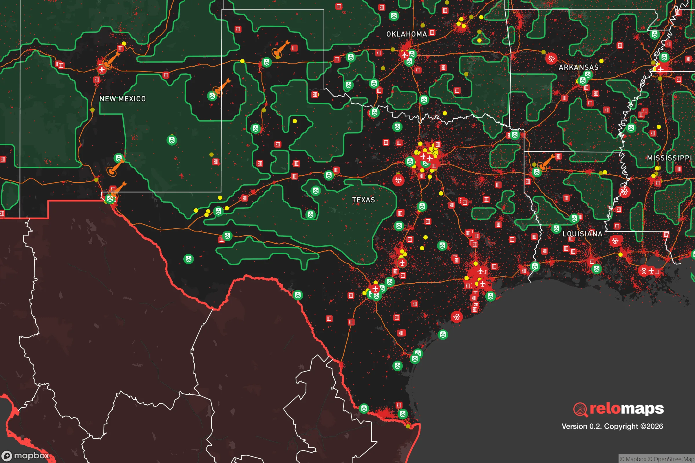


Important Note: For informational purposes only. This does not mean nothing bad ever happens in the green zones. Please use common sense. This is based on public data and modeled with AI. We tried to take a conservative approach but mistakes happen. We update this regularly as new information becomes available.
Solar Generator Recommendations
Backup power matters more here than in safer locations. We've picked three solar generators across budgets and capacity tiers — start with the budget unit if you only need a few essentials, or step up if you want to run a fridge and HVAC for days at a time.

Jackery Portable Power Station Explorer 300
Budget OptionPower on the Go: Weighing only 11 lbs, it's convenient to set up and store with book-sized foldable solar panels

BLUETTI Portable Power Station AC180
Designed for both indoor and outdoor scenarios, AC180 is highly capable as it has a robost capacity and continuous output power.

EF ECOFLOW DELTA Pro Ultra Power Station
Upgraded PickEcoFlow DELTA Pro Ultra is a whole-home energy system designed to grow with your family. Integrated with the Smart Home Panel 2, it scales to meet your evolving energy needs — keeping your home powered, intelligent, and secure through every stage of life.
We earn a commission, at no additional cost to you.
Strategic Assessment Analysis
Spring, Texas, offers a mixed strategic picture for the relocation-minded reader focused on resilience and self-sufficiency. Its primary advantage is a location that balances proximity to Houston’s economic engine with a semi-rural buffer that provides some geographic breathing room. However, that same proximity introduces significant vulnerabilities, from hurricane storm surge to the concentrated infrastructure risks of a major metropolitan area. For a family or individual weighing disaster readiness, Spring is best understood as a compromise location—close enough to benefit from urban resources, far enough to avoid the worst of a direct hit, but not so remote as to be truly self-contained.
Geographic position and natural advantages for a resilient lifestyle
Spring sits roughly 30 miles north of downtown Houston, straddling the boundary between the Piney Woods and the Gulf Coastal Plain. This position offers several natural advantages. The area is elevated relative to Houston proper—much of Spring sits at 120 to 150 feet above sea level—which significantly reduces the risk of catastrophic flooding from storm surge or river overflow. While the 2017 Tax Day flood and Hurricane Harvey did cause localized flooding in low-lying neighborhoods near Spring Creek and the San Jacinto River, the vast majority of Spring’s residential areas are outside the 100-year floodplain. This is a meaningful distinction from much of Harris County, where flood risk is a near-certainty. The region’s clay soils drain poorly, but the higher elevation means water moves through rather than pooling for weeks. The surrounding Sam Houston National Forest, just 15 miles north, provides a substantial natural buffer and a potential source of timber, game, and forage for those with the skills to use it. The area’s aquifer—the Gulf Coast Aquifer system—is deep and generally reliable, though it is under increasing strain from population growth. For a relocator, the key takeaway is that Spring’s geography offers a genuine flood-risk advantage over Houston, but it is not immune to water issues.
Risks, exposures, and proximity to fallout-relevant landmarks
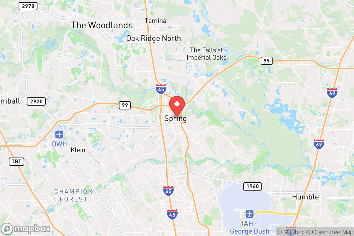
The most significant strategic risk for Spring is its proximity to Houston’s industrial and energy infrastructure. The Houston Ship Channel, roughly 35 miles south, is one of the largest petrochemical complexes in the world, containing refineries, chemical plants, and liquefied natural gas terminals. A major accident, terrorist attack, or natural disaster at these facilities could produce a toxic plume or fire hazard that would affect Spring depending on wind direction. The area is also within 50 miles of the San Jacinto River Waste Pits Superfund site, a legacy dioxin contamination zone that has already caused localized health concerns. On the man-made risk side, Spring is directly under the flight paths of George Bush Intercontinental Airport (IAH), located just 10 miles south. While this is convenient for travel, it also means the area is within the blast radius of a potential aircraft incident or deliberate attack on the airport. For the resilience-minded reader, the presence of IAH and the Ship Channel are the two most concerning fixed risks. Natural hazards are more predictable: hurricane-force winds can reach Spring from a Category 3 or higher storm making landfall near Galveston, and tornadoes are a seasonal threat, though the area’s topography does not funnel them as severely as in the Plains. The 2021 Winter Storm Uri exposed the region’s vulnerability to prolonged cold, with widespread power outages and water system failures. That event was a wake-up call for many residents, and it demonstrated that Spring’s infrastructure is not hardened for extreme cold events, which are becoming more frequent with climate volatility.
Practical resilience for a relocator: food, water, energy, and defensibility
For a family or individual looking to build a self-sufficient homestead, Spring presents both opportunities and constraints. Water is the most critical factor. The area receives about 50 inches of rainfall annually, which is ample for rainwater catchment systems. A 1,000-square-foot roof can collect roughly 30,000 gallons per year, enough to meet the needs of a small household with careful management. However, the local groundwater is often high in iron and sulfur, requiring filtration for potable use. Municipal water comes from the San Jacinto River Authority and is generally reliable, but the 2021 freeze showed that surface water treatment plants can fail when power is lost. A well is a viable option in many parts of Spring, but drilling depths vary from 200 to 800 feet, and permits are required. Food production is feasible but not effortless. The growing season is long—typically February through November—and the soil, while acidic and sandy, can be amended for vegetables, fruit trees, and poultry. The Sam Houston National Forest offers hunting opportunities for deer, feral hogs, and turkey, but public land access is limited and competition is high. For those serious about food security, a 5- to 10-acre property in the northern part of Spring or into Montgomery County is far more practical than a suburban lot. Energy resilience is a mixed bag. Solar is viable—the area gets about 200 sunny days per year—but hurricane clouds and summer thunderstorms can reduce generation for days at a time. Battery backup is essential, and a generator running on propane or natural gas is a common supplement. The local grid is operated by Entergy Texas and CenterPoint Energy, both of which have faced criticism for slow restoration after storms. Off-grid living is possible but requires significant upfront investment. Defensibility is the weakest link. Spring is a sprawling suburban area with no natural chokepoints or defensible terrain. The population density—roughly 1,200 people per square mile in the urbanized area—means that a collapse scenario would involve close proximity to neighbors, many of whom may not be prepared. The nearest hardened retreat locations are in the Hill Country, 150 miles west, or in East Texas, 100 miles north. For a relocator, the practical advice is to prioritize a property with a well, a septic system, and a southern-facing roof for solar, and to accept that Spring is a “bug-in or bug-out” location rather than a long-term fortress.
Overall, Spring, Texas, is a reasonable choice for the resilience-minded relocator who wants to stay connected to Houston’s job market while maintaining a buffer from its worst risks. The area’s flood elevation, rainfall, and growing season are genuine assets. But the proximity to the Ship Channel, IAH, and a dense suburban population means that Spring is not a standalone survival location. It is a staging ground—a place to build skills, store supplies, and wait out short-term disruptions, with the understanding that a major event would likely require a secondary plan. For a family that values both opportunity and preparedness, Spring offers a workable middle ground, provided the relocator goes in with eyes open about the trade-offs.

* Values derived from national, state, county, city and local statistics and may differ in a specific area. Last updated: 2026-07-30T01:58:28.000Z
Narrative content on this page is AI-generated and may contain mistakes. Verify any details that matter before acting on them.
ReloMaps may earn a commission from affiliate links at no extra cost to you.

