
Photo: Wikipedia
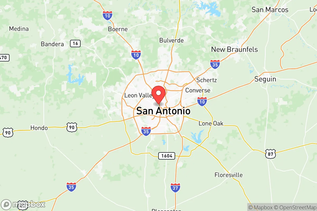
Strategic Assessment of Bexar County
Multiple tactical vulnerabilities. Population density, target proximity, or disaster risk are likely compounding. A retreat property and exit planning is required.
What does the Strategic Assessment tell us?
Our Strategic Assessment grades tactical survivability of an area. Major population centers, military targets, fallout zones, natural disasters, and border exposure all drive risk — lower exposure means a more defensible position in a crisis.
This is heavily inspired by Joel Skousen's Strategic Relocation book. Highly recommended you checkout the book ($)What does this tell us?
Our Strategic Assessment grades tactical survivability of an area. Major population centers, military targets, fallout zones, natural disasters, and border exposure all drive risk — lower exposure means a more defensible position in a crisis.
This is heavily inspired by Joel Skousen's Strategic Relocation book. Highly recommended you checkout the book ($)Strategic Pillars

Key Distances
Strategic Assessment Analysis
Bexar County, anchored by San Antonio, presents a complex strategic picture for those prioritizing resilience and preparedness. Its location offers a mix of genuine advantages—distance from coastal hurricane landfalls and a robust local economy—and significant liabilities, primarily its proximity to major population centers and critical infrastructure that could become fallout-relevant landmarks in a crisis. For a conservative-leaning relocator focused on self-sufficiency and avoiding the worst of societal breakdown, Bexar County is a calculated trade-off, not a safe haven, but one that can be managed with the right property choices and mindset.
Geographic position and natural advantages for long-term stability
Bexar County sits at the intersection of I-10 and I-35, two major interstate corridors that connect the entire southern U.S. This is a double-edged sword: excellent for supply movement in normal times, but a potential chokepoint or target during unrest. The county’s natural advantages are real but often overstated. It lies in the Texas Hill Country transition zone, meaning the terrain is rolling limestone hills with decent drainage—far better than the flood-prone coastal plains. The Edwards Aquifer runs beneath much of the county, providing a reliable, if heavily managed, groundwater source. However, this aquifer is already over-allocated for municipal and agricultural use, and during a prolonged drought or infrastructure collapse, water rights could become a flashpoint. The climate is semi-arid, with hot summers and mild winters, which reduces the risk of freeze-related crop loss but also means wildfire risk is moderate, especially in the western parts of the county near Helotes and Bandera County. The lack of major rivers or lakes within the county limits means surface water storage is limited to smaller reservoirs like Braunig Lake and Calaveras Lake, both of which are used for cooling by power plants—a potential contamination risk in a disaster.
Risks, exposures, and proximity to fallout-relevant landmarks
This is where the analysis gets serious. Bexar County is not a remote redoubt; it’s a major metropolitan area of over 2 million people. The primary risk is proximity to Joint Base San Antonio (JBSA), which includes Lackland AFB, Fort Sam Houston, and Randolph AFB. These are high-value military installations that would be primary targets in any conventional or asymmetric conflict. A strike on JBSA would produce a massive fallout zone affecting the entire county, especially the southern and central corridors. Additionally, the county is within 150 miles of Houston’s refinery corridor (the Houston Ship Channel and Texas City), a concentration of petrochemical infrastructure that is a prime target for sabotage or attack. A major release from that corridor could contaminate water supplies and create toxic plumes that drift inland. On the ground, the county has its own industrial risks: the Valero refinery in San Antonio and the Port of San Antonio (a former air force base now used for logistics and manufacturing) are both potential targets or sources of secondary hazards. For the prepper, the sheer density of population in San Antonio itself is the biggest liability. In a grid-down scenario or civil unrest, the city’s 1.5 million residents would be competing for the same limited resources—food, water, fuel, and medical care. The suburban sprawl of Converse, Schertz, and Universal City offers slightly better defensibility than downtown, but these areas are still within easy driving distance of the urban core, meaning they’d see refugee flows and looting.
Practical resilience for a relocator: food, water, energy, and defensibility
If you’re serious about relocating to Bexar County for preparedness, you need to be very specific about where you land. The western and northern fringes—areas like Helotes, Fair Oaks Ranch, and the unincorporated parts of Bexar County near Medina County—offer the best balance of proximity to resources and defensibility. These areas have larger lot sizes (1-5 acres common), lower population density, and better access to groundwater via private wells. However, well drilling is expensive and permits are required; you cannot just dig a hole. Rainwater harvesting is legal and encouraged, but the semi-arid climate means you’ll need substantial storage (5,000+ gallons) to get through a dry summer. For food, the county has a strong agricultural heritage, but most of it is now commercial row crops (corn, cotton) or cattle ranching. Small-scale gardening is viable with irrigation, but the soil is alkaline and rocky in many areas, requiring raised beds or significant amendment. Local food production is not a given; you’ll need to plan for a greenhouse or hoop house to extend the growing season. Energy resilience is mixed. The county is served by CPS Energy, a municipally owned utility that has a decent reliability record, but the grid is still part of ERCOT, which has proven vulnerable to winter storms (think 2021). Solar is a strong option here—the county gets over 220 sunny days per year—but battery storage is essential for grid-down scenarios. Natural gas is widely available in suburban areas, but a propane tank is a better bet for off-grid cooking and heating. Defensibility is the hardest factor. Bexar County is not a natural fortress. The terrain is rolling hills with limited chokepoints. The best you can do is choose a property with a long driveway, good sightlines, and a perimeter that can be secured with fencing or natural barriers. Avoid properties near major highways (I-10, I-35, Loop 1604) as they become evacuation routes and looting corridors. The county’s law enforcement presence is strong, but in a widespread crisis, they will be overwhelmed. Your security plan must be self-reliant.
The overall strategic picture for Bexar County is one of calculated risk. It is not a bug-out location for a complete societal collapse—the population density and target value are too high. But for a relocator who wants to maintain a career in a growing economy while building a resilient homestead, the western and northern fringes offer a viable middle ground. You get access to San Antonio’s medical infrastructure (multiple Level 1 trauma centers), a strong job market (military, healthcare, tech), and a conservative political culture that generally supports Second Amendment rights and property freedom. The trade-off is that you are living within striking distance of major military and industrial targets, and you will be competing with millions of others for resources in a crisis. The key is to treat Bexar County as a base of operations, not a final redoubt. Have a secondary plan for a deeper retreat into the Hill Country (Kerrville, Junction) if the situation deteriorates. If you can manage that dual-layer strategy, Bexar County can work. If you’re looking for a single location to ride out the worst, look further west.
* Values derived from national, state, county, city and local statistics and may differ in a specific area. Last updated: 2026-05-10T18:10:41.000Z
Narrative content on this page is AI-generated and may contain mistakes. Verify any details that matter before acting on them.
ReloMaps may earn a commission from affiliate links at no extra cost to you.