Photo: Wikipedia
Strategic Assessment of Trinidad, CO
Strong survivability profile. Good buffer from population centers, with manageable environmental and tactical risks.
What does the Strategic Assessment tell us?
Our Strategic Assessment grades tactical survivability of an area. Major population centers, military targets, fallout zones, natural disasters, and border exposure all drive risk — lower exposure means a more defensible position in a crisis.
This is heavily inspired by Joel Skousen's Strategic Relocation book. Highly recommended you checkout the book ($)What does this tell us?
Our Strategic Assessment grades tactical survivability of an area. Major population centers, military targets, fallout zones, natural disasters, and border exposure all drive risk — lower exposure means a more defensible position in a crisis.
This is heavily inspired by Joel Skousen's Strategic Relocation book. Highly recommended you checkout the book ($)Strategic Pillars

Key Distances
Regional Safe Places
Below is our recommended "safe zones" in Colorado and the surrounding area based on our strategic heuristics. For most people, it's unrealistic to live in a “safe zone” full-time due to work, family or other personal reasons. They tend to be more rural. However, many of these areas are perfect for second homes and retreat properties that double as a vacation home or even a short-term rental.


Important Note: For informational purposes only. This does not mean nothing bad ever happens in the green zones. Please use common sense. This is based on public data and modeled with AI. We tried to take a conservative approach but mistakes happen. We update this regularly as new information becomes available.
Solar Generator Recommendations
Backup power matters more here than in safer locations. We've picked three solar generators across budgets and capacity tiers — start with the budget unit if you only need a few essentials, or step up if you want to run a fridge and HVAC for days at a time.

Jackery Portable Power Station Explorer 300
Budget OptionPower on the Go: Weighing only 11 lbs, it's convenient to set up and store with book-sized foldable solar panels

BLUETTI Portable Power Station AC180
Designed for both indoor and outdoor scenarios, AC180 is highly capable as it has a robost capacity and continuous output power.

EF ECOFLOW DELTA Pro Ultra Power Station
Upgraded PickEcoFlow DELTA Pro Ultra is a whole-home energy system designed to grow with your family. Integrated with the Smart Home Panel 2, it scales to meet your evolving energy needs — keeping your home powered, intelligent, and secure through every stage of life.
We earn a commission, at no additional cost to you.
Strategic Assessment Analysis
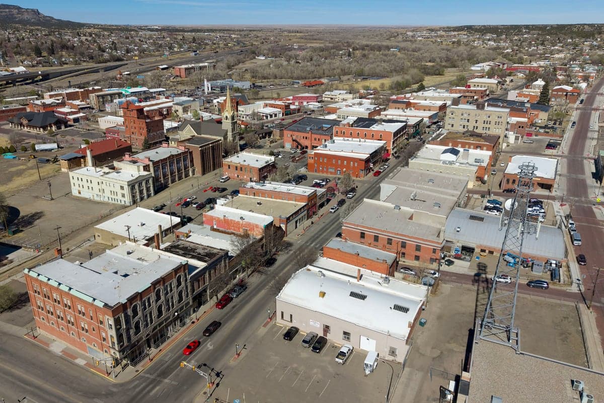
Trinidad, Colorado, sits as a strategic outlier in the southern Colorado plains, offering a blend of geographic isolation and practical resilience that appeals to those planning for long-term stability. Its location near the New Mexico border, combined with a low population density and a historically independent ranching culture, provides a buffer against the cascading failures that often plague urban centers. For a relocator with a prepper or survivalist mindset, Trinidad represents a viable base of operations—one that balances access to essential resources with a meaningful distance from the most likely flashpoints of unrest.
Geographic position and natural advantages for long-term security
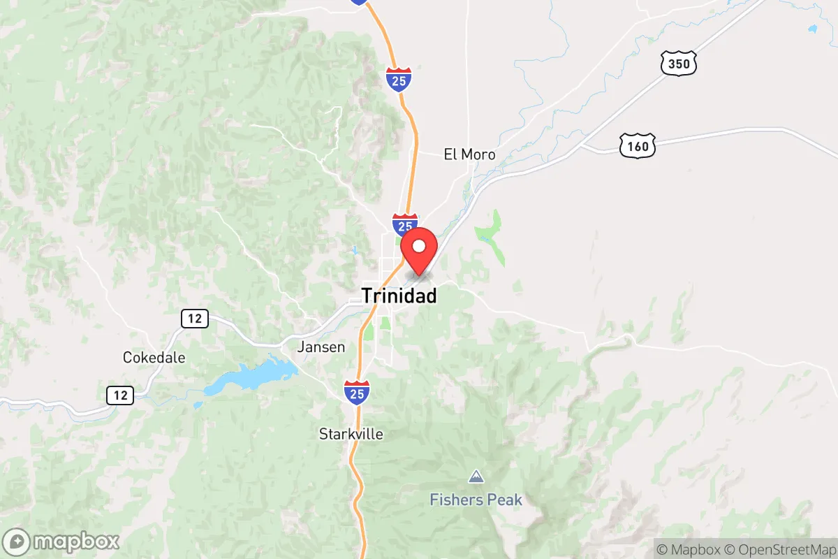
Trinidad’s position at the foot of the Sangre de Cristo Mountains, along the historic Santa Fe Trail, gives it a natural defensive posture. The city sits at roughly 6,000 feet elevation, which offers a moderate climate with four distinct seasons—enough to support agriculture without the extreme cold of higher mountain towns. The surrounding landscape is a mix of high desert plains and forested foothills, providing multiple avenues for retreat, resupply, and observation. The area is far from major metropolitan targets: Denver is about 190 miles north, and Albuquerque is roughly 200 miles south, meaning Trinidad is outside the immediate fallout zones of any major city. The nearby Interstate 25 corridor is a double-edged sword—it provides a route for movement but also a potential vector for displaced populations. However, the terrain around Trinidad narrows into canyons and passes, which could be monitored or controlled more easily than open plains. The region’s low seismic risk and minimal floodplain exposure further reduce the likelihood of natural disasters compounding a man-made crisis.
Risks, exposures, and proximity to fallout-relevant landmarks
No strategic assessment is complete without acknowledging the liabilities. Trinidad’s most significant exposure is its proximity to the Comanche Peak Nuclear Power Plant, located roughly 100 miles southeast near Glen Rose, Texas. While that distance is beyond the immediate lethal fallout zone for a worst-case event, prevailing winds could carry contamination into southern Colorado depending on the season. Additionally, the Rocky Flats Plant (a former nuclear weapons facility northwest of Denver) is far enough away to be a secondary concern, but its legacy contamination and potential as a target for sabotage remain on the radar. The city itself has a small industrial base, including a cement plant and some light manufacturing, but no major chemical or biological facilities that would make it a primary target. The bigger risk is human: Trinidad sits along a major north-south migration route. In a collapse scenario, I-25 could become a funnel for refugees from Denver, Colorado Springs, and Santa Fe. The local population of roughly 8,000 is small enough to absorb some influx, but a sudden surge would strain food, water, and medical resources. The area’s history of coal mining and energy extraction means there are abandoned mine shafts and old infrastructure that could be repurposed for storage or shelter, but also presents hazards like subsidence and groundwater contamination.
Practical resilience for a relocator: food, water, energy, and defensibility
For a relocator looking to establish a self-sufficient homestead or retreat, Trinidad offers several concrete advantages. Water is the first consideration: the Purgatoire River runs through town, and the area receives about 14 inches of annual precipitation—enough for dryland farming with careful management. Groundwater is accessible via wells in many parts of Las Animas County, though permits and depth vary. The local acequia system, a legacy of Spanish settlement, provides irrigation channels that could be restored for community-scale food production. Food security is feasible: the growing season runs from May to September, suitable for cold-hardy crops like potatoes, beans, squash, and grains. The surrounding ranchlands support cattle and bison, and game such as mule deer, elk, and wild turkey is abundant in the nearby San Isabel National Forest. For energy, Trinidad’s high desert climate offers strong solar potential—over 280 sunny days per year—and the area has a history of coal and natural gas extraction, meaning local knowledge and infrastructure for off-grid power are available. Wind is also a viable supplement, particularly on the mesas east of town. Defensibility is moderate: the city itself is laid out in a valley, which creates natural chokepoints at the entrances from the north and south. A small, well-organized group could monitor these approaches. However, the open terrain to the east and west means a determined group could bypass the town entirely. The local culture leans heavily toward self-reliance and firearm ownership, which aligns with a prepper mindset. Las Animas County has some of the lowest property crime rates in Colorado, and the sheriff’s office is known for a no-nonsense approach to law enforcement. That said, the county is also one of the poorest in the state, with limited medical infrastructure—the local hospital, Mount San Rafael, is a critical access facility but not equipped for major trauma or prolonged crisis care. A relocator should plan for serious medical needs to be handled in Pueblo (90 miles north) or Colorado Springs (150 miles north), which are themselves vulnerable in a collapse.
The overall strategic picture for Trinidad is one of cautious viability. It is not a fortress, nor is it a dead end. For a single individual or family willing to invest in off-grid infrastructure, build local relationships, and maintain a low profile, the area offers a solid foundation for weathering moderate-to-severe disruptions. The key trade-off is between isolation and access: Trinidad is far enough from major cities to avoid the initial wave of chaos, but close enough to a major highway to be affected by secondary effects like refugee flow or supply chain collapse. The local economy, historically tied to coal and now pivoting to tourism and cannabis, provides some cash-flow opportunities for those who need to earn a living while preparing. But the real value of Trinidad lies in its combination of water access, arable land, defensible terrain, and a culture that still values independence. For the relocator who sees the current trajectory of the country as unstable and wants a place that can function as a long-term fallback, Trinidad deserves a serious look—just don’t expect it to be a secret for much longer.
* Values derived from national, state, county, city and local statistics and may differ in a specific area. Last updated: 2026-05-02T04:13:00.000Z
Narrative content on this page is AI-generated and may contain mistakes. Verify any details that matter before acting on them.
ReloMaps may earn a commission from affiliate links at no extra cost to you.