Photo: Wikipedia
Strategic Assessment of Rappahannock County
Workable tactical position. Some exposure to population density or targets, but generally defensible in a crisis.
What does the Strategic Assessment tell us?
Our Strategic Assessment grades tactical survivability of an area. Major population centers, military targets, fallout zones, natural disasters, and border exposure all drive risk — lower exposure means a more defensible position in a crisis.
This is heavily inspired by Joel Skousen's Strategic Relocation book. Highly recommended you checkout the book ($)What does this tell us?
Our Strategic Assessment grades tactical survivability of an area. Major population centers, military targets, fallout zones, natural disasters, and border exposure all drive risk — lower exposure means a more defensible position in a crisis.
This is heavily inspired by Joel Skousen's Strategic Relocation book. Highly recommended you checkout the book ($)Strategic Pillars

Key Distances
Strategic Assessment Analysis
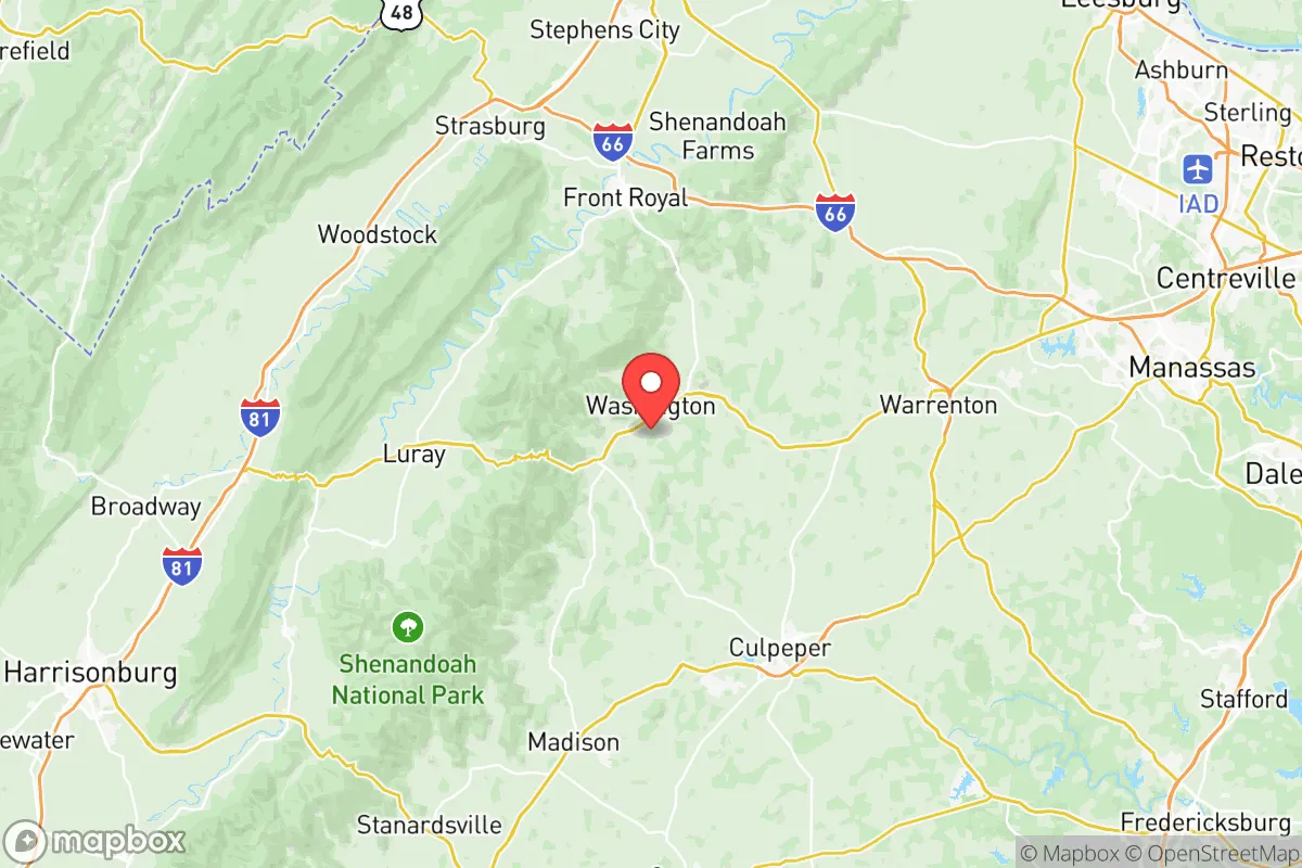
Rappahannock County, Virginia, offers a compelling strategic position for those prioritizing resilience and self-sufficiency, sitting squarely in the Blue Ridge Mountains about 90 minutes from Washington, D.C., yet feeling worlds away from the capital's vulnerabilities. The county's low population density—roughly 7,500 residents spread over 267 square miles—and its location off major interstate corridors provide a natural buffer against both cascading infrastructure failures and the fallout risks associated with dense urban targets. For a relocator weighing disaster readiness, Rappahannock’s combination of rugged terrain, limited through-traffic, and proximity to the Shenandoah National Park creates a defensible pocket that is neither isolated from supply chains nor exposed to the immediate blast zones of high-value strategic assets.
Geographic position and natural advantages for long-term security
Rappahannock County’s geography is its primary strategic asset. The county sits along the eastern slope of the Blue Ridge, with the Shenandoah National Park forming its western border and the Rappahannock River cutting through its center. This placement means the area is shielded from the worst of hurricane storm surge (the coast is 120 miles east) and lies outside the floodplains that plague the Tidewater region. Elevations range from 400 to 2,000 feet, providing natural drainage and cooler summer temperatures that reduce heat-related risks. The county is also far from known seismic zones and has no active fault lines, making it geologically stable. Critically, Rappahannock is not within 50 miles of any major military installation—the closest is Fort Belvoir (70 miles east) and Quantico Marine Corps Base (65 miles east)—and it sits well outside the primary fallout corridors from Washington, D.C., which would drift east-northeast with prevailing winds. The county’s road network is sparse: only two primary routes, U.S. 211 and U.S. 522, cross the area, and both are two-lane roads that can be easily monitored or blocked if needed. This limited access is a double-edged sword—it restricts egress during a crisis but also makes the county harder to target or overrun.
Risks, exposures, and proximity to fallout-relevant landmarks
While Rappahannock avoids the worst of urban fallout, it is not immune to risks. The county lies approximately 70 miles west of the Washington, D.C. metropolitan area, a high-priority target for any strategic adversary. In a nuclear exchange, prevailing winds from the west would carry fallout away from Rappahannock, but a shift in wind direction or a ground burst near D.C. could still deposit radioactive particles within 24-48 hours. The county is also within 100 miles of the Dulles International Airport (a potential secondary target) and the Quantico Marine Corps Base, which houses the FBI Academy and Marine Corps logistics. Natural risks are more immediate: the county sits in a moderate wildfire zone, with dry summers and dense forest cover creating periodic fire hazards. Flash flooding along the Rappahannock River and its tributaries is a recurring issue, particularly in the low-lying areas near the town of Washington (the county seat) and the village of Sperryville. The county has no hospital—the nearest is in Culpeper (20 miles east) or Warrenton (25 miles northeast)—and emergency services are volunteer-based, meaning response times can stretch to 30 minutes in remote hollows. For a relocator, the key takeaway is that Rappahannock’s risks are manageable with preparation: stockpiling water, maintaining a defensible perimeter against wildfire, and having a fallout shelter plan for the unlikely but possible D.C. scenario.
Practical resilience for a relocator: food, water, energy, and defensibility
Rappahannock County offers strong potential for self-sufficiency, but it requires active investment. The county is over 90% rural and agricultural, with dozens of small farms producing beef, poultry, vegetables, and hay. The Rappahannock Farmers Market in Sperryville operates year-round, and the county has a robust network of CSAs and farm stands. For water, the Rappahannock River and its tributaries (including the Thornton River and Hazel River) provide surface water, but the county’s bedrock is primarily granite and gneiss, making well drilling expensive and unpredictable—some wells in the area run dry during summer droughts. The county has no municipal water system outside the tiny town of Washington; most residents rely on private wells and septic systems. Energy resilience is mixed: Rappahannock is served by Rappahannock Electric Cooperative, which has a history of outages during storms (the 2022 derecho left some areas without power for 5 days). Solar adoption is growing but remains low—fewer than 200 residential solar installations countywide as of 2025. Wood heat is common, with the county’s forest cover providing ample fuel. Defensibility is the county’s strongest suit: the terrain is steep and winding, with narrow valleys and ridge lines that create natural chokepoints. The town of Washington sits at the intersection of U.S. 211 and U.S. 522, but the surrounding hollows (like those near Flint Hill and Woodville) are accessible only by single-lane gravel roads that are easily blocked. The county has a low crime rate—violent crime is roughly 1/3 the national average—and a strong community ethos around mutual aid, with active volunteer fire departments and a county emergency services coordinator who runs regular preparedness workshops. For a relocator, the practical picture is clear: Rappahannock offers the land and water resources for long-term self-sufficiency, but you must bring your own solar panels, well pump, and a plan for winter heating.
Overall, Rappahannock County presents a balanced strategic picture for the serious relocator. It avoids the worst fallout zones of the Eastern Seaboard while remaining close enough to D.C. (90 minutes) for occasional supply runs or medical emergencies. The county’s natural defenses—rugged terrain, limited road access, and low population density—make it one of the more defensible locations in the Mid-Atlantic, but its lack of hospital infrastructure, reliance on volunteer emergency services, and moderate wildfire and flood risks demand a proactive approach. For a family or individual willing to invest in off-grid systems and build local connections, Rappahannock offers a rare combination of security, beauty, and practical resilience that is hard to find within a two-hour drive of a major capital. It is not a bug-out location for the unprepared—it is a long-term homestead for those who take readiness seriously.

* Values derived from national, state, county, city and local statistics and may differ in a specific area. Last updated: 2026-09-19T01:45:25.000Z
Narrative content on this page is AI-generated and may contain mistakes. Verify any details that matter before acting on them.
ReloMaps may earn a commission from affiliate links at no extra cost to you.

