Photo: Wikipedia
Strategic Assessment of Wake Forest, NC
Meaningful friction. Expect exposure to either population pressure, blast zones, or natural disaster risk. Consider buying a retreat property.
What does the Strategic Assessment tell us?
Our Strategic Assessment grades tactical survivability of an area. Major population centers, military targets, fallout zones, natural disasters, and border exposure all drive risk — lower exposure means a more defensible position in a crisis.
This is heavily inspired by Joel Skousen's Strategic Relocation book. Highly recommended you checkout the book ($)What does this tell us?
Our Strategic Assessment grades tactical survivability of an area. Major population centers, military targets, fallout zones, natural disasters, and border exposure all drive risk — lower exposure means a more defensible position in a crisis.
This is heavily inspired by Joel Skousen's Strategic Relocation book. Highly recommended you checkout the book ($)Strategic Pillars

Key Distances
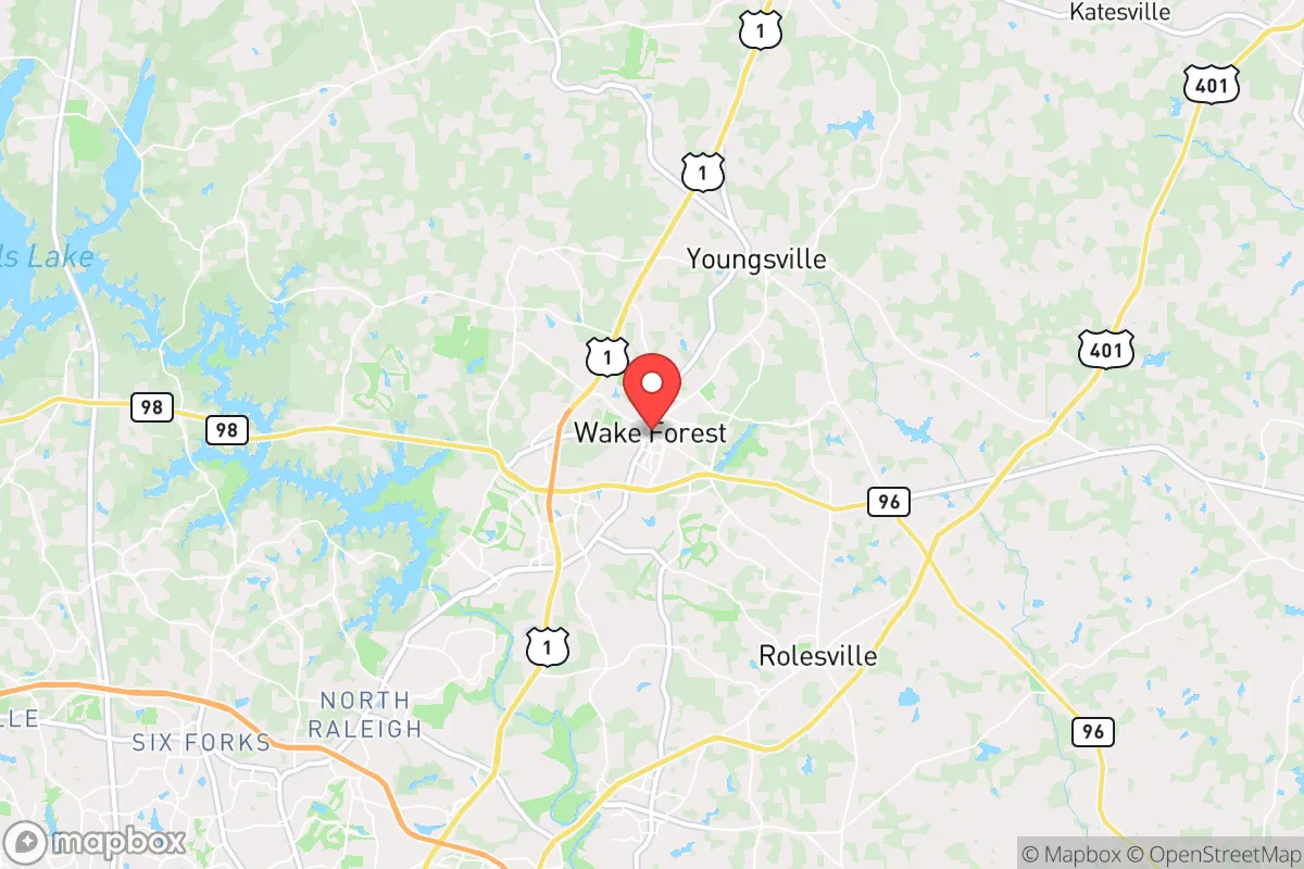
Regional Safe Places
Below is our recommended "safe zones" in North Carolina and the surrounding area based on our strategic heuristics. For most people, it's unrealistic to live in a “safe zone” full-time due to work, family or other personal reasons. They tend to be more rural. However, many of these areas are perfect for second homes and retreat properties that double as a vacation home or even a short-term rental.


Important Note: For informational purposes only. This does not mean nothing bad ever happens in the green zones. Please use common sense. This is based on public data and modeled with AI. We tried to take a conservative approach but mistakes happen. We update this regularly as new information becomes available.
Solar Generator Recommendations
Backup power matters more here than in safer locations. We've picked three solar generators across budgets and capacity tiers — start with the budget unit if you only need a few essentials, or step up if you want to run a fridge and HVAC for days at a time.

Jackery Portable Power Station Explorer 300
Budget OptionPower on the Go: Weighing only 11 lbs, it's convenient to set up and store with book-sized foldable solar panels

BLUETTI Portable Power Station AC180
Designed for both indoor and outdoor scenarios, AC180 is highly capable as it has a robost capacity and continuous output power.

EF ECOFLOW DELTA Pro Ultra Power Station
Upgraded PickEcoFlow DELTA Pro Ultra is a whole-home energy system designed to grow with your family. Integrated with the Smart Home Panel 2, it scales to meet your evolving energy needs — keeping your home powered, intelligent, and secure through every stage of life.
We earn a commission, at no additional cost to you.
Strategic Assessment Analysis
Wake Forest, North Carolina, presents a mixed strategic picture for the conservative prepper: it offers genuine resilience advantages in its inland location and robust local governance, but its proximity to the Raleigh-Durham metroplex introduces significant vulnerabilities that cannot be ignored. The town’s position roughly 20 miles north of downtown Raleigh places it within the blast and fallout shadow of a major population and military target, yet its own infrastructure and community character provide a defensible base for those willing to plan accordingly. For the single individual or family seeking a balance between access to resources and escape from urban chaos, Wake Forest is a viable but not risk-free option—one that demands active preparation rather than passive assumption of safety.
Geographic position and natural advantages for long-term survival
Wake Forest sits in the Piedmont region of North Carolina, a zone of rolling hills, hardwood forests, and clay soils that offers several natural advantages for a prepper household. The town’s elevation averages around 400 feet above sea level, placing it well above the flood-prone coastal plain and far from hurricane storm surge zones—a critical consideration given the increasing frequency of Atlantic tropical systems. The area is also removed from major seismic fault lines and has no significant volcanic or tsunami risk, reducing the likelihood of natural catastrophe compounding man-made disasters. The surrounding landscape is dotted with small farms, woodlots, and rural parcels that can support subsistence gardening, small livestock, and foraging, though the soil is acidic and requires amendment for high-yield crops. Water availability is a moderate positive: the Neuse River flows just east of town, and numerous creeks and ponds dot the area, but surface water is increasingly subject to agricultural runoff and upstream development pollution. Groundwater wells are common in outlying areas, but the town’s municipal supply relies on Falls Lake, a reservoir that also serves Raleigh—a single-point-of-failure vulnerability if the dam were compromised or the water treatment plant targeted. For the relocator, the key natural advantage is the region’s temperate climate: four distinct seasons allow for year-round food production and reduce the extreme temperature stress that can kill the unprepared in winter or summer.
Risks, exposures, and proximity to fallout-relevant landmarks
The single greatest strategic weakness of Wake Forest is its proximity to the Research Triangle—Raleigh, Durham, and Chapel Hill—a metropolitan area of over 2 million people that includes multiple high-value targets. Raleigh is home to the state capitol, the North Carolina National Guard headquarters, and major federal facilities including the EPA’s Research Triangle Park campus and the National Institute of Environmental Health Sciences. Fort Liberty (formerly Fort Bragg), the largest military installation by population in the United States, lies roughly 70 miles southwest—close enough that a ground-penetrating nuclear weapon or large conventional strike on that base would produce fallout that could reach Wake Forest within hours under prevailing westerly winds. The Raleigh-Durham International Airport (RDU) is a civilian hub but also supports military airlift operations, making it a secondary target. Interstate 40 and US-1 run through the region, creating chokepoints that would become impassable during a mass evacuation. Civic unrest in Raleigh would spill north along Capital Boulevard (US-1) within 30 minutes, and the town’s own population of roughly 45,000 would be swelled by refugees from the city. Wake Forest’s police department is professional but small—around 60 sworn officers—and would be overwhelmed in a regional crisis. The town’s hospital, WakeMed North, is a 50-bed facility with limited trauma capacity; serious injuries would require transport to Raleigh, which may be impossible during a grid-down event. For the prepper, the calculus is clear: Wake Forest is close enough to the target zone to be affected by fallout and refugee flows, but far enough to offer a window for evacuation or hardening—if you have a plan and supplies in place before the crisis.
Practical resilience for a relocator: food, water, energy, and defensibility
For the individual or family willing to invest in preparation, Wake Forest offers a workable foundation for self-sufficiency. The town’s zoning allows for backyard chickens and small livestock in most residential areas, and the local farmers’ market operates year-round, providing a source for heirloom seeds, starter plants, and local honey. Grocery stores are plentiful—Harris Teeter, Publix, and Walmart are all within a 10-minute drive—but these supply chains are fragile: a trucker strike, fuel shortage, or cyberattack on the regional distribution network would empty shelves within 72 hours, as seen during the 2020 panic buying. Water storage is essential: the municipal supply is treated with chlorine and fluoride, but a prolonged power outage would stop pumps, and the Falls Lake dam is a single point of failure. A 1,500-gallon cistern or rain barrel system paired with a Berkey or similar gravity filter would provide drinking water for a family of four for months. Energy resilience is moderate: Duke Energy’s grid is aging and prone to outages during ice storms and summer thunderstorms, but solar panels are permitted and net metering is available, allowing for battery backup without going off-grid. Natural gas is piped to most homes, which is useful for cooking and heating but becomes a liability if the pipelines are compromised—a propane tank with a 500-gallon capacity is a better long-term bet. Defensibility is the weakest link: Wake Forest is a suburban town with cul-de-sacs, open floor plans, and large windows—hard to secure against a determined group. A home on the northern or eastern edge, backing onto farmland or forest, offers better perimeter control and escape routes via secondary roads like NC-98 or NC-96. The town’s proximity to the Virginia border (about 45 minutes to South Hill) provides a potential retreat corridor toward the Blue Ridge Mountains, but that route would be clogged during an evacuation. For the relocator, the practical strategy is to treat Wake Forest as a base camp, not a fortress: store six months of food and water, maintain a go-bag with maps and comms gear, and establish a relationship with a rural property owner in Granville or Vance County for a fallback position.
The overall strategic picture for Wake Forest is one of cautious viability for the conservative prepper. The town’s inland location, temperate climate, and local governance offer genuine advantages over coastal or deep-urban alternatives, but the shadow of Raleigh-Durham’s target density and the fragility of suburban infrastructure demand serious preparation. For the single individual or family who can afford the land and the gear, Wake Forest provides a defensible midpoint between isolation and access—but only if you treat it as a starting point, not a destination. The smart play is to buy on the rural fringe, dig a well, install solar, and keep a low profile. The town itself will survive most natural disasters, but the man-made ones—civil unrest, economic collapse, or war—will test its limits. If you’re looking for a place to ride out the storm with a reasonable chance of success, Wake Forest earns a B-minus: not a bunker, but a solid base camp with a fighting chance.
* Values derived from national, state, county, city and local statistics and may differ in a specific area. Last updated: 2026-04-21T16:44:59.000Z
Narrative content on this page is AI-generated and may contain mistakes. Verify any details that matter before acting on them.
ReloMaps may earn a commission from affiliate links at no extra cost to you.