
Photo: Wikipedia
Strategic Assessment of Watertown, WI
Meaningful friction. Expect exposure to either population pressure, blast zones, or natural disaster risk. Consider buying a retreat property.
What does the Strategic Assessment tell us?
Our Strategic Assessment grades tactical survivability of an area. Major population centers, military targets, fallout zones, natural disasters, and border exposure all drive risk — lower exposure means a more defensible position in a crisis.
This is heavily inspired by Joel Skousen's Strategic Relocation book. Highly recommended you checkout the book ($)What does this tell us?
Our Strategic Assessment grades tactical survivability of an area. Major population centers, military targets, fallout zones, natural disasters, and border exposure all drive risk — lower exposure means a more defensible position in a crisis.
This is heavily inspired by Joel Skousen's Strategic Relocation book. Highly recommended you checkout the book ($)Strategic Pillars

Key Distances
Regional Safe Places
Below is our recommended "safe zones" in Wisconsin and the surrounding area based on our strategic heuristics. For most people, it's unrealistic to live in a “safe zone” full-time due to work, family or other personal reasons. They tend to be more rural. However, many of these areas are perfect for second homes and retreat properties that double as a vacation home or even a short-term rental.
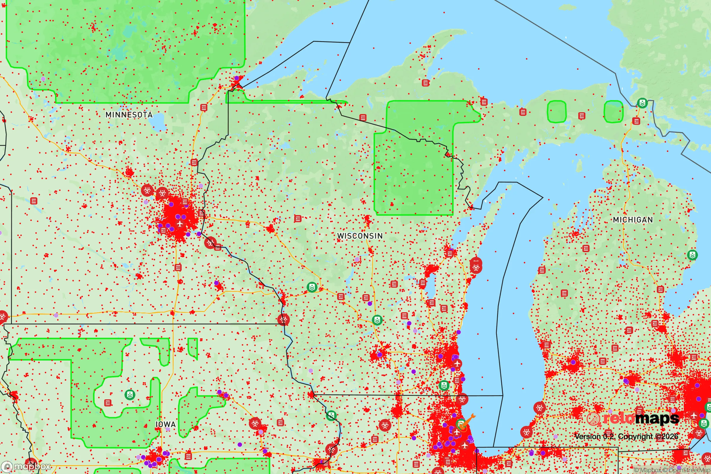

Important Note: For informational purposes only. This does not mean nothing bad ever happens in the green zones. Please use common sense. This is based on public data and modeled with AI. We tried to take a conservative approach but mistakes happen. We update this regularly as new information becomes available.
Solar Generator Recommendations
Backup power matters more here than in safer locations. We've picked three solar generators across budgets and capacity tiers — start with the budget unit if you only need a few essentials, or step up if you want to run a fridge and HVAC for days at a time.

Jackery Portable Power Station Explorer 300
Budget OptionPower on the Go: Weighing only 11 lbs, it's convenient to set up and store with book-sized foldable solar panels

BLUETTI Portable Power Station AC180
Designed for both indoor and outdoor scenarios, AC180 is highly capable as it has a robost capacity and continuous output power.

EF ECOFLOW DELTA Pro Ultra Power Station
Upgraded PickEcoFlow DELTA Pro Ultra is a whole-home energy system designed to grow with your family. Integrated with the Smart Home Panel 2, it scales to meet your evolving energy needs — keeping your home powered, intelligent, and secure through every stage of life.
We earn a commission, at no additional cost to you.
Strategic Assessment Analysis
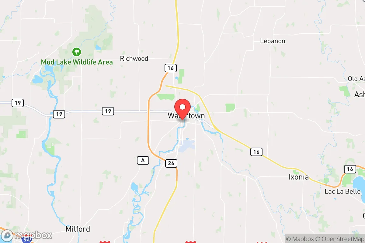
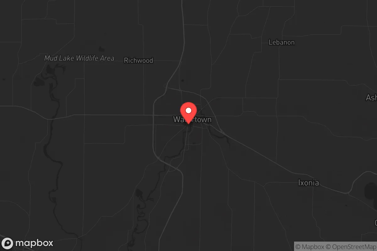
Watertown, Wisconsin, sits in a strategic sweet spot that resilience-minded relocators should take seriously: far enough from Milwaukee and Madison to avoid the immediate blast radius of a major urban collapse, yet close enough to access their medical and logistical resources if they survive intact. The city’s position along the Rock River and its historic industrial base give it a quiet durability that many flashier exurbs lack. For a conservative-leaning individual or family looking to plant roots in a place that can weather civic unrest, supply chain disruptions, or natural disasters, Watertown offers a blend of isolation and connectivity that is increasingly rare in the upper Midwest.
Geographic position and natural advantages for long-term stability
Watertown’s location at the confluence of the Rock and Crawfish rivers provides a reliable freshwater source, a critical asset for any prepper scenario. The city sits roughly 40 miles east of Madison and 50 miles west of Milwaukee, placing it outside the likely fallout zones of a major attack on either urban center while still allowing for resupply runs if conditions permit. The surrounding Jefferson County landscape is a patchwork of dairy farms, woodlots, and small towns—ideal for decentralized food production and low population density. The area’s elevation is modest but sufficient to avoid floodplain risks along the Rock River, and the local soil is fertile enough for subsistence gardening. From a strategic standpoint, Watertown’s position on the Rock River also offers a natural barrier to the east and west, slowing any mass exodus from the cities and giving residents time to secure their perimeter.
Risks, exposures, and proximity to fallout-relevant landmarks
No location is without vulnerabilities, and Watertown has a few that demand attention. The city lies within 100 miles of the Fort McCoy military installation and the Volk Field Air National Guard Base, both of which could become secondary targets in a conflict scenario. More immediately, the I-94 corridor running through nearby Johnson Creek is a major east-west artery that would funnel refugees from Milwaukee and Chicago during a collapse. Watertown itself is bisected by U.S. Highway 26, which connects to both Madison and Fond du Lac—useful for travel, but also a vector for unwanted traffic. The city’s industrial past left behind some brownfield sites along the river, but these are not significant contamination risks compared to the chemical plants near Milwaukee. The real exposure is demographic: Watertown’s population of roughly 24,000 is small enough to manage, but the surrounding county’s 85,000 residents could create pressure on local resources during a prolonged crisis. The city’s hospital, Watertown Regional Medical Center, is a 60-bed facility—adequate for routine care but quickly overwhelmed in a mass casualty event.
Practical resilience for a relocator: food, water, energy, and defensibility
For a relocator focused on self-sufficiency, Watertown offers a workable baseline. The Rock River provides year-round water, though treatment plants would be vulnerable to power loss—meaning a well or a hand-pump on a private lot is a wise investment. The surrounding farmland is active; Jefferson County ranks among Wisconsin’s top dairy producers, and local farmers’ markets operate from May through October. For energy, the city’s grid is served by We Energies and Alliant Energy, both of which have aging infrastructure but reasonable reliability. Solar potential is moderate—Wisconsin averages 180 sunny days per year, so panels need battery backup for winter months. Natural gas is available in most neighborhoods, but a wood-burning stove or pellet stove is a more resilient heating option given the area’s abundant timber. Defensibility is mixed: Watertown’s older neighborhoods have dense street grids that are hard to secure, but the outskirts offer acreage with good sightlines and limited access points. The city’s police force is small—about 30 officers—so community watch and mutual aid networks are essential. For those willing to invest in a rural property within 10 miles of town, the strategic calculus improves significantly: you get the resource access of Watertown without the choke points of its downtown.
The overall strategic picture for Watertown is one of cautious optimism for the prepared relocator. It is not a hardened bunker town, nor does it pretend to be. What it offers is a defensible position with natural resources, a manageable population, and enough distance from major targets to buy time. The conservative-minded individual or family who moves here should plan to build local relationships, stockpile supplies for at least 90 days, and invest in off-grid water and heating systems. Watertown won’t save you from a direct hit on the Midwest, but it gives you a fighting chance to ride out the aftermath of a regional crisis—and that is more than most places in the Milwaukee-Madison corridor can claim.
* Values derived from national, state, county, city and local statistics and may differ in a specific area. Last updated: 2026-04-21T10:39:42.000Z
Narrative content on this page is AI-generated and may contain mistakes. Verify any details that matter before acting on them.
ReloMaps may earn a commission from affiliate links at no extra cost to you.