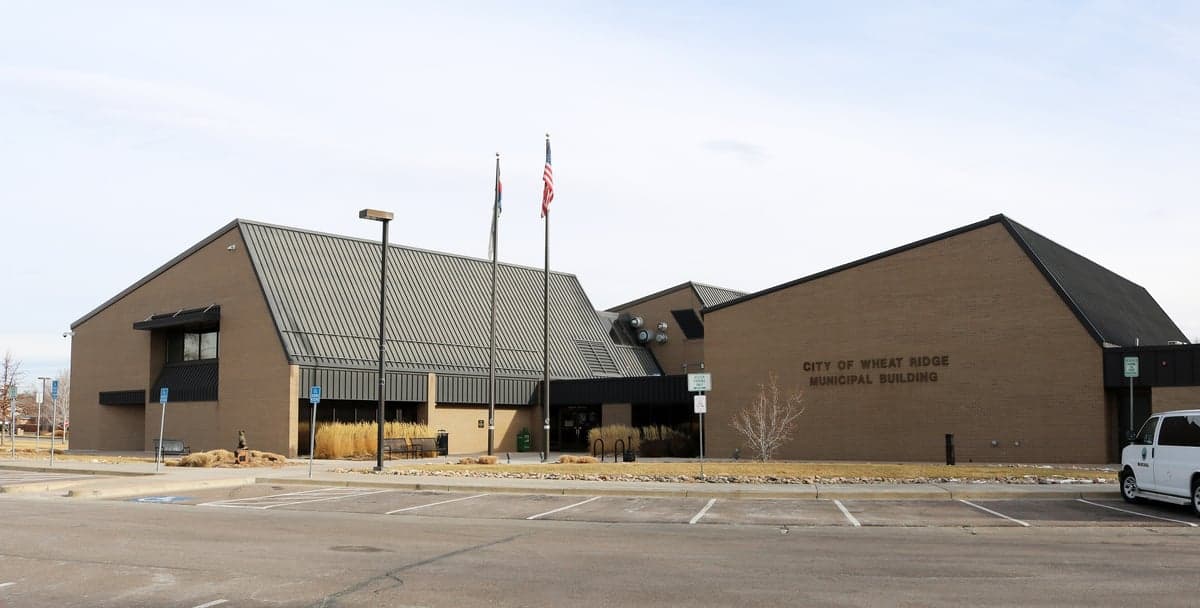
Photo: Wikipedia
Strategic Assessment of Wheat Ridge, CO
Multiple tactical vulnerabilities. Population density, target proximity, or disaster risk are likely compounding. A retreat property and exit planning is required.
What does the Strategic Assessment tell us?
Our Strategic Assessment grades tactical survivability of an area. Major population centers, military targets, fallout zones, natural disasters, and border exposure all drive risk — lower exposure means a more defensible position in a crisis.
This is heavily inspired by Joel Skousen's Strategic Relocation book. Highly recommended you checkout the book ($)What does this tell us?
Our Strategic Assessment grades tactical survivability of an area. Major population centers, military targets, fallout zones, natural disasters, and border exposure all drive risk — lower exposure means a more defensible position in a crisis.
This is heavily inspired by Joel Skousen's Strategic Relocation book. Highly recommended you checkout the book ($)Strategic Pillars

Key Distances
Regional Safe Places
Below is our recommended "safe zones" in Colorado and the surrounding area based on our strategic heuristics. For most people, it's unrealistic to live in a “safe zone” full-time due to work, family or other personal reasons. They tend to be more rural. However, many of these areas are perfect for second homes and retreat properties that double as a vacation home or even a short-term rental.


Important Note: For informational purposes only. This does not mean nothing bad ever happens in the green zones. Please use common sense. This is based on public data and modeled with AI. We tried to take a conservative approach but mistakes happen. We update this regularly as new information becomes available.
Solar Generator Recommendations
Backup power matters more here than in safer locations. We've picked three solar generators across budgets and capacity tiers — start with the budget unit if you only need a few essentials, or step up if you want to run a fridge and HVAC for days at a time.

Jackery Portable Power Station Explorer 300
Budget OptionPower on the Go: Weighing only 11 lbs, it's convenient to set up and store with book-sized foldable solar panels

BLUETTI Portable Power Station AC180
Designed for both indoor and outdoor scenarios, AC180 is highly capable as it has a robost capacity and continuous output power.

EF ECOFLOW DELTA Pro Ultra Power Station
Upgraded PickEcoFlow DELTA Pro Ultra is a whole-home energy system designed to grow with your family. Integrated with the Smart Home Panel 2, it scales to meet your evolving energy needs — keeping your home powered, intelligent, and secure through every stage of life.
We earn a commission, at no additional cost to you.
Strategic Assessment Analysis
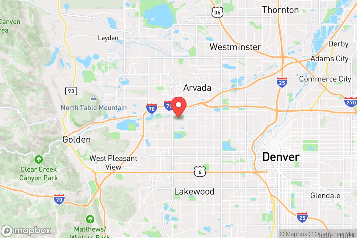
Wheat Ridge, Colorado, sits in a precarious but potentially strategic pocket along the Front Range, roughly 15 minutes west of downtown Denver. Its location offers a blend of suburban buffer and mountain access, but for a relocator with a survivalist mindset, the key question is whether this proximity to a major urban center is a net liability or a manageable risk. The city’s resilience hinges on its ability to serve as a waypoint between the denser metro and the high-country redoubts, but the same geography that provides quick escapes also funnels threats directly toward it.
Geographic position and natural advantages for a strategic relocation
Wheat Ridge occupies a narrow band along the eastern slope of the Rocky Mountains, with the foothills rising immediately to the west. This puts it at the mouth of Clear Creek Canyon, a primary egress route into the mountains via U.S. Highway 6 and Interstate 70. For a prepper, this is a double-edged sword: the canyon offers a direct line to higher, more defensible terrain in places like Idaho Springs or Georgetown, but it also means that any mass evacuation from Denver will choke that corridor within minutes. The city itself sits at roughly 5,400 feet elevation, which provides a slight natural barrier against the worst of a biological aerosol release or ground-level chemical spill, as prevailing winds tend to push urban plumes eastward. The area’s semi-arid climate—around 15 inches of precipitation annually—reduces mold and rot risks for stored supplies, but also means water sourcing is a primary concern. The nearby Clear Creek and the South Platte River are perennial flows, though both are heavily impacted by upstream mining runoff and urban stormwater, making them unreliable for direct consumption without serious filtration.
Risks, exposures, and proximity to fallout-relevant landmarks
The most glaring vulnerability for Wheat Ridge is its position within the Denver-Aurora-Lakewood metropolitan statistical area, home to nearly 3 million people. In a scenario involving civil unrest, mass casualty events, or a coordinated attack, the city lies within the blast and fallout radius of several high-value targets. Denver International Airport is roughly 25 miles east—a primary logistics hub that would be a first-strike target in any conflict involving strategic bombing or EMP delivery. The Rocky Flats National Wildlife Refuge, a former nuclear weapons plant, is only 8 miles northwest; while the site is remediated, its historical contamination and the potential for secondary targeting of nearby infrastructure (like the Jefferson County Government Center) cannot be ignored. Additionally, the I-70 corridor running through Wheat Ridge is a critical east-west artery for fuel and food distribution—any disruption here would cascade into local shortages within 72 hours. The city’s population density of roughly 3,100 people per square mile is moderate by suburban standards, but still high enough that a panic-driven exodus would create gridlock on Wadsworth Boulevard and Kipling Street, the two main north-south thoroughfares.
Practical resilience for a relocator: food, water, energy, and defensibility
For a single individual or family looking to hunker down, Wheat Ridge offers a mixed bag. The city’s water supply comes from Denver Water and the Clear Creek watershed, both of which are vulnerable to upstream contamination or sabotage. Municipal water is treated with chloramine, which requires activated carbon filtration to remove for long-term storage—a detail often overlooked by new arrivals. Private wells are rare within city limits, so any prepper plan must include a minimum of two weeks of stored water per person, with a target of 30 days for serious contingencies. Food resilience is slightly better: the surrounding Jefferson County agricultural area includes several small farms and the Jefferson County Fairgrounds, which could serve as a distribution point in a crisis, but the city itself has no significant food production. The nearest reliable bulk food supplier is the Costco in Arvada, about 10 minutes north, but that location would be stripped within hours of a major event. Energy-wise, Xcel Energy provides grid power, which is moderately reliable but subject to the same vulnerabilities as any urban grid—solar with battery backup is a wise investment here, as the area averages over 300 days of sunshine per year. Defensibility is the weakest link: Wheat Ridge is a flat, grid-patterned suburb with few natural chokepoints. The best option for a secure property is a home backing onto the William F. Hayden Green Mountain Park or the Crown Hill open space, which provide some terrain cover and escape routes into the foothills. However, the city’s proximity to Denver means that any sustained unrest would likely see looting and roaming groups within the first 48 hours, as urban populations spill outward.
The overall strategic picture for a conservative-leaning relocator
Wheat Ridge is not a standalone survival location—it is a transitional zone. For a relocator who values access to urban medical facilities, supply runs, and employment while maintaining a 30-minute escape route to the mountains, it can work as a base of operations. But the conservative prepper mindset demands honest accounting: the city is too close to Denver to be defensible in a long-term collapse, and its water and food dependencies are classic single-point-of-failure risks. The best use of Wheat Ridge is as a staging area for a more remote property in the foothills or Western Slope, where land is cheaper and population density drops below 50 per square mile. If you are committed to the Front Range, prioritize a home with a well, solar panels, and a defensible perimeter—properties in the Applewood or Fairmount neighborhoods offer slightly better terrain than the flat eastern sections. Otherwise, treat Wheat Ridge as a temporary foothold while you scout deeper into the mountains. The strategic value is real, but only if you treat it as a waypoint, not a final destination.
* Values derived from national, state, county, city and local statistics and may differ in a specific area. Last updated: 2026-04-23T02:20:42.000Z
Narrative content on this page is AI-generated and may contain mistakes. Verify any details that matter before acting on them.
ReloMaps may earn a commission from affiliate links at no extra cost to you.