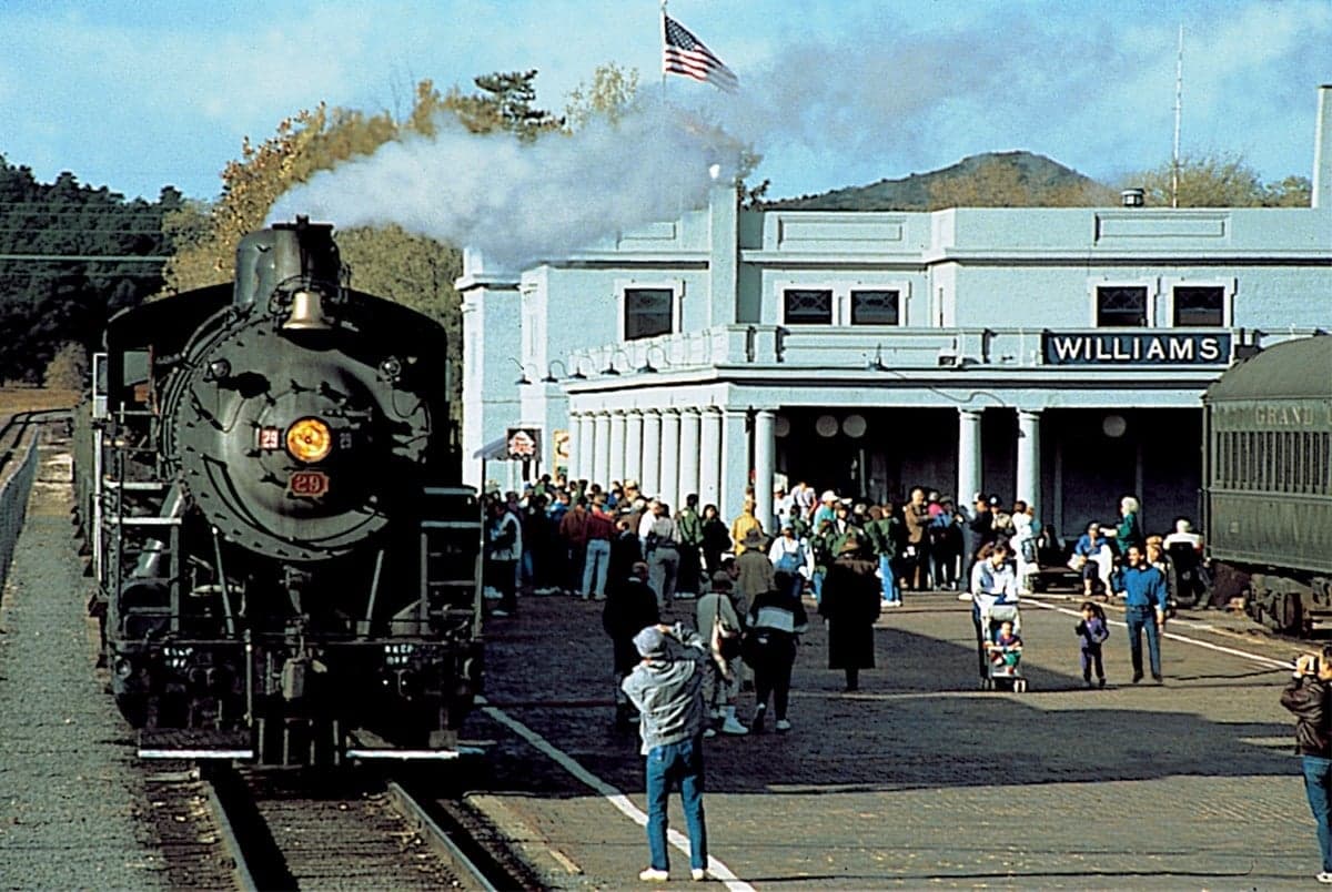
Photo: Wikipedia
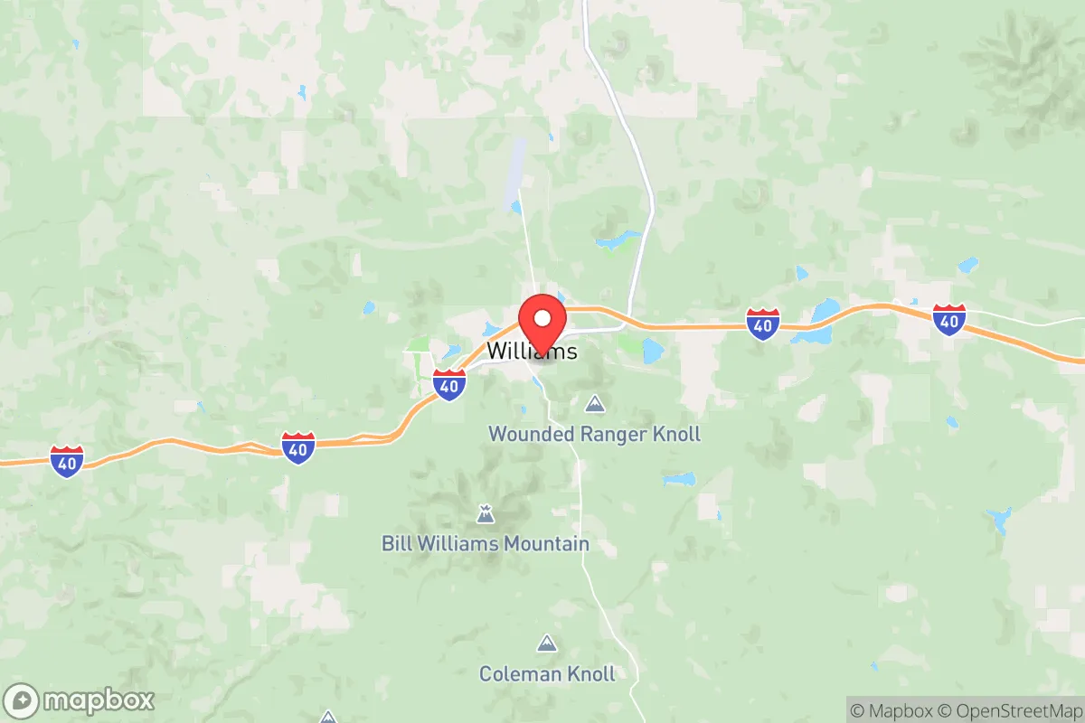
Strategic Assessment of Williams, AZ
Workable tactical position. Some exposure to population density or targets, but generally defensible in a crisis.
What does the Strategic Assessment tell us?
Our Strategic Assessment grades tactical survivability of an area. Major population centers, military targets, fallout zones, natural disasters, and border exposure all drive risk — lower exposure means a more defensible position in a crisis.
This is heavily inspired by Joel Skousen's Strategic Relocation book. Highly recommended you checkout the book ($)What does this tell us?
Our Strategic Assessment grades tactical survivability of an area. Major population centers, military targets, fallout zones, natural disasters, and border exposure all drive risk — lower exposure means a more defensible position in a crisis.
This is heavily inspired by Joel Skousen's Strategic Relocation book. Highly recommended you checkout the book ($)Strategic Pillars

Key Distances
Regional Safe Places
Below is our recommended "safe zones" in Arizona and the surrounding area based on our strategic heuristics. For most people, it's unrealistic to live in a “safe zone” full-time due to work, family or other personal reasons. They tend to be more rural. However, many of these areas are perfect for second homes and retreat properties that double as a vacation home or even a short-term rental.
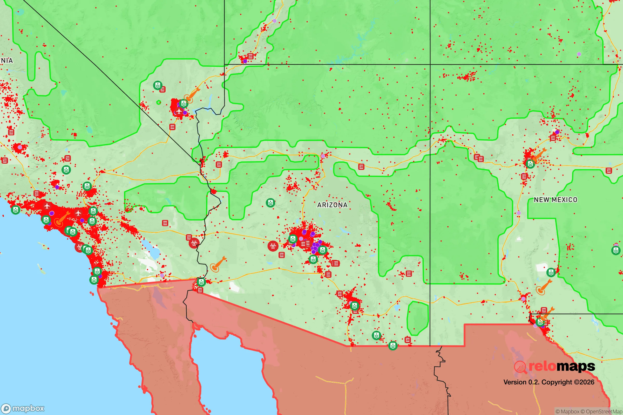
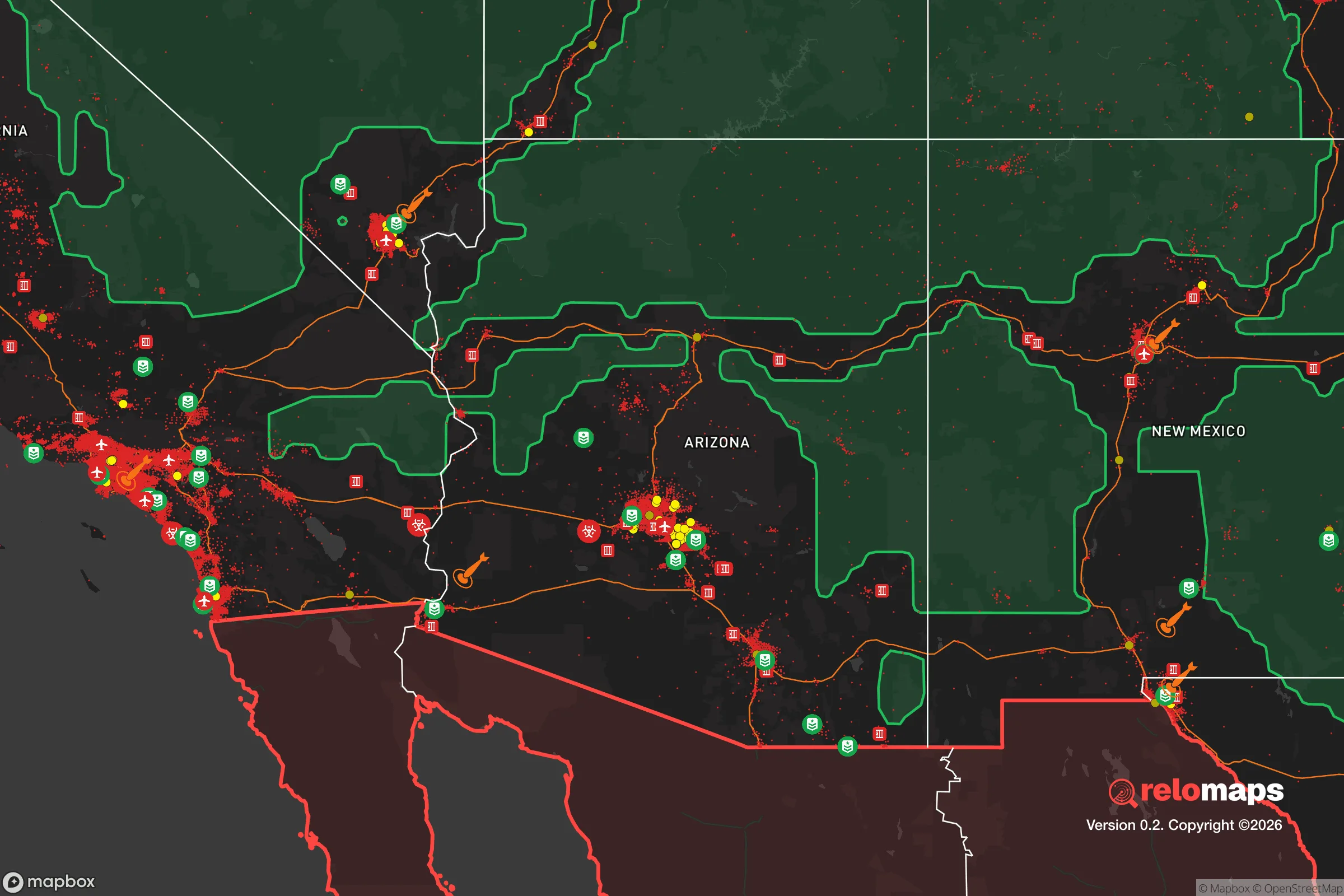
Important Note: For informational purposes only. This does not mean nothing bad ever happens in the green zones. Please use common sense. This is based on public data and modeled with AI. We tried to take a conservative approach but mistakes happen. We update this regularly as new information becomes available.
Solar Generator Recommendations
Backup power matters more here than in safer locations. We've picked three solar generators across budgets and capacity tiers — start with the budget unit if you only need a few essentials, or step up if you want to run a fridge and HVAC for days at a time.

Jackery Portable Power Station Explorer 300
Budget OptionPower on the Go: Weighing only 11 lbs, it's convenient to set up and store with book-sized foldable solar panels

BLUETTI Portable Power Station AC180
Designed for both indoor and outdoor scenarios, AC180 is highly capable as it has a robost capacity and continuous output power.

EF ECOFLOW DELTA Pro Ultra Power Station
Upgraded PickEcoFlow DELTA Pro Ultra is a whole-home energy system designed to grow with your family. Integrated with the Smart Home Panel 2, it scales to meet your evolving energy needs — keeping your home powered, intelligent, and secure through every stage of life.
We earn a commission, at no additional cost to you.
Strategic Assessment Analysis
Williams, Arizona, sits at a strategic crossroads that few relocators fully appreciate: it is the last exit before the Grand Canyon, perched on the southern edge of the Colorado Plateau at roughly 6,800 feet elevation, and it offers a rare combination of isolation and accessibility. For a prepper or survivalist with a conservative worldview, this town represents a solid B+ location—not a fortress, but a defensible, resource-rich base that avoids the worst vulnerabilities of major metro areas while retaining enough infrastructure to make daily life functional. The key trade-off is proximity to Interstate 40 and the BNSF Railway, which are both lifelines and liabilities, but the surrounding geography and low population density tilt the calculus in favor of resilience.
Geographic position and natural advantages for long-term security
Williams occupies a sweet spot in northern Arizona, roughly 30 miles west of Flagstaff and 150 miles north of Phoenix, but it feels far more remote than those distances suggest. The town sits in a high-elevation ponderosa pine forest, with the Kaibab National Forest wrapping around it on three sides, providing natural cover, timber resources, and game habitat. The elevation means summers are mild—average highs in the 80s—and winters bring snow, which is a double-edged sword: it complicates travel but also provides a reliable water source when melted. The Colorado River is about 60 miles north, and the Verde River watershed lies to the south, so surface water is accessible with planning. The terrain is rolling hills and forested ridges, not the sheer cliffs of the canyon itself, which means there are viable routes for foot travel, cache placement, and defensive positions. The area’s volcanic soils support decent agriculture if you’re willing to work with a short growing season—think root vegetables, cold-hardy greens, and some grains—but you won’t be self-sufficient on a suburban lot. The real advantage is the buffer: the nearest major population center, Flagstaff, is a college town of about 77,000, not a sprawling metro, and Phoenix’s 5 million people are separated by two hours of mountain highway and desert. That distance is your insurance against the kind of cascading collapse that hits dense urban grids first.
Risks, exposures, and proximity to fallout-relevant landmarks
No location is immune to risk, and Williams has specific vulnerabilities that a strategic relocator must weigh. The most obvious is Interstate 40, which runs directly through town and carries heavy truck traffic between the West Coast and the interior. In a crisis—whether a supply chain disruption, a mass evacuation from California, or a coordinated attack on infrastructure—that highway becomes a chokepoint and a target. The BNSF transcontinental rail line parallels the interstate, and while rail is less visible, it’s equally critical for fuel, food, and manufactured goods. A derailment or sabotage event on either corridor could isolate Williams or, worse, draw transient populations seeking resources. Additionally, the town is about 90 miles from the San Francisco Peaks, which is an extinct volcanic field, not an active threat, but the region sits in a seismically quiet zone—earthquake risk is low. More concerning is the proximity to national security assets: the U.S. Army’s Yuma Proving Ground is 250 miles southwest, and Luke Air Force Base near Phoenix is a major fighter training hub. Neither is a primary nuclear target in a full-scale exchange, but the I-40 corridor itself could be a secondary target for interdiction strikes. Fallout patterns from a detonation in Phoenix or Las Vegas (about 200 miles west) would depend on wind, but prevailing westerlies mean Williams could see light to moderate fallout within 24-48 hours—enough to require sheltering, not evacuation. The real wildcard is the Palo Verde Nuclear Generating Station, 150 miles south near Phoenix; a catastrophic failure there, while unlikely, would make the entire region a no-go zone for years. For a prepper, this means you need a robust shelter plan, not just a bug-out bag.
Practical resilience for a relocator: food, water, energy, and defensibility
Williams has a small but functional local economy—about 3,200 residents—with a handful of grocery stores, hardware outlets, and a hospital that serves the region. For daily life, you can stock up at Safeway or the local co-op, but long-term food security requires gardening, hunting, and barter networks. The deer population is healthy, and elk are present in the higher forests, but you’ll need a hunting license and a freezer setup. Water is the critical constraint: the town draws from a combination of wells and the Colorado River via the Central Arizona Project, but that system is vulnerable to power outages and political disputes over water rights. A private well is ideal, but drilling depth in this area runs 200-400 feet, and yields vary. Rainwater catchment is legal in Arizona and practical here—annual precipitation is about 22 inches, mostly as snow—so a 1,000-gallon cistern system can cover basic household needs for months. Energy is more straightforward: solar is viable year-round, with good insolation even in winter, and net metering is available through Arizona Public Service. A grid-tied system with battery backup (like a Tesla Powerwall or DIY lithium bank) will keep lights, refrigeration, and communications running through a multi-day outage. Defensibility is where Williams shines: the town is compact, with a single main street and limited entry points from the interstate. The surrounding forest provides cover for perimeter security, and the elevation gives line-of-sight advantages for observation. The local sheriff’s office is responsive but small—about a dozen deputies for the entire county—so community self-defense networks are a realistic necessity, not a paranoid fantasy. The conservative culture here is genuine: most residents own firearms, attend church, and value self-reliance, which means you’ll find allies, not hostility, if you integrate respectfully.
The overall strategic picture for Williams is one of cautious optimism. It is not a hardened bunker location like the remote Montana valleys or the Idaho panhandle, but it offers a livable compromise: you can maintain a professional career remotely (Starlink is available), access medical care in Flagstaff within 40 minutes, and still be 200 miles from the nearest urban collapse zone. The risks from I-40 and the nuclear plant are real but manageable with a solid plan—think 90-day food storage, a water filtration system, and a basement or reinforced room for fallout shelter. For a single individual or a family with school-age children, the trade-offs are acceptable: the schools are small but functional, the crime rate is low, and the community is tight-knit enough that you won’t be anonymous. The biggest mistake a relocator could make here is treating it as a vacation spot rather than a long-term investment in resilience. If you’re willing to dig a well, learn to hunt, and build relationships with your neighbors, Williams can serve as a durable base for weathering the next decade’s uncertainties. It’s not paradise, but it’s a solid, defensible position in a volatile world.
* Values derived from national, state, county, city and local statistics and may differ in a specific area. Last updated: 2026-05-02T04:17:15.000Z
Narrative content on this page is AI-generated and may contain mistakes. Verify any details that matter before acting on them.
ReloMaps may earn a commission from affiliate links at no extra cost to you.