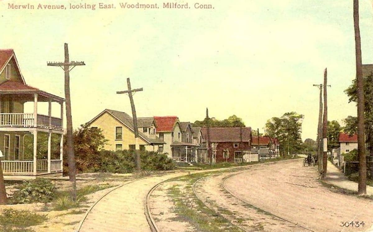
Photo: Wikipedia
Strategic Assessment of Woodmont, CT
High tactical risk. This location is likely close to major population centers, strategic targets, or sits in a high-disaster corridor. A retreat property and careful exit planning is required.
What does the Strategic Assessment tell us?
Our Strategic Assessment grades tactical survivability of an area. Major population centers, military targets, fallout zones, natural disasters, and border exposure all drive risk — lower exposure means a more defensible position in a crisis.
This is heavily inspired by Joel Skousen's Strategic Relocation book. Highly recommended you checkout the book ($)What does this tell us?
Our Strategic Assessment grades tactical survivability of an area. Major population centers, military targets, fallout zones, natural disasters, and border exposure all drive risk — lower exposure means a more defensible position in a crisis.
This is heavily inspired by Joel Skousen's Strategic Relocation book. Highly recommended you checkout the book ($)Strategic Pillars

Key Distances
Regional Safe Places
Below is our recommended "safe zones" in Connecticut and the surrounding area based on our strategic heuristics. For most people, it's unrealistic to live in a “safe zone” full-time due to work, family or other personal reasons. They tend to be more rural. However, many of these areas are perfect for second homes and retreat properties that double as a vacation home or even a short-term rental.


Important Note: For informational purposes only. This does not mean nothing bad ever happens in the green zones. Please use common sense. This is based on public data and modeled with AI. We tried to take a conservative approach but mistakes happen. We update this regularly as new information becomes available.
Solar Generator Recommendations
Backup power matters more here than in safer locations. We've picked three solar generators across budgets and capacity tiers — start with the budget unit if you only need a few essentials, or step up if you want to run a fridge and HVAC for days at a time.

Jackery Portable Power Station Explorer 300
Budget OptionPower on the Go: Weighing only 11 lbs, it's convenient to set up and store with book-sized foldable solar panels

BLUETTI Portable Power Station AC180
Designed for both indoor and outdoor scenarios, AC180 is highly capable as it has a robost capacity and continuous output power.

EF ECOFLOW DELTA Pro Ultra Power Station
Upgraded PickEcoFlow DELTA Pro Ultra is a whole-home energy system designed to grow with your family. Integrated with the Smart Home Panel 2, it scales to meet your evolving energy needs — keeping your home powered, intelligent, and secure through every stage of life.
We earn a commission, at no additional cost to you.
Strategic Assessment Analysis
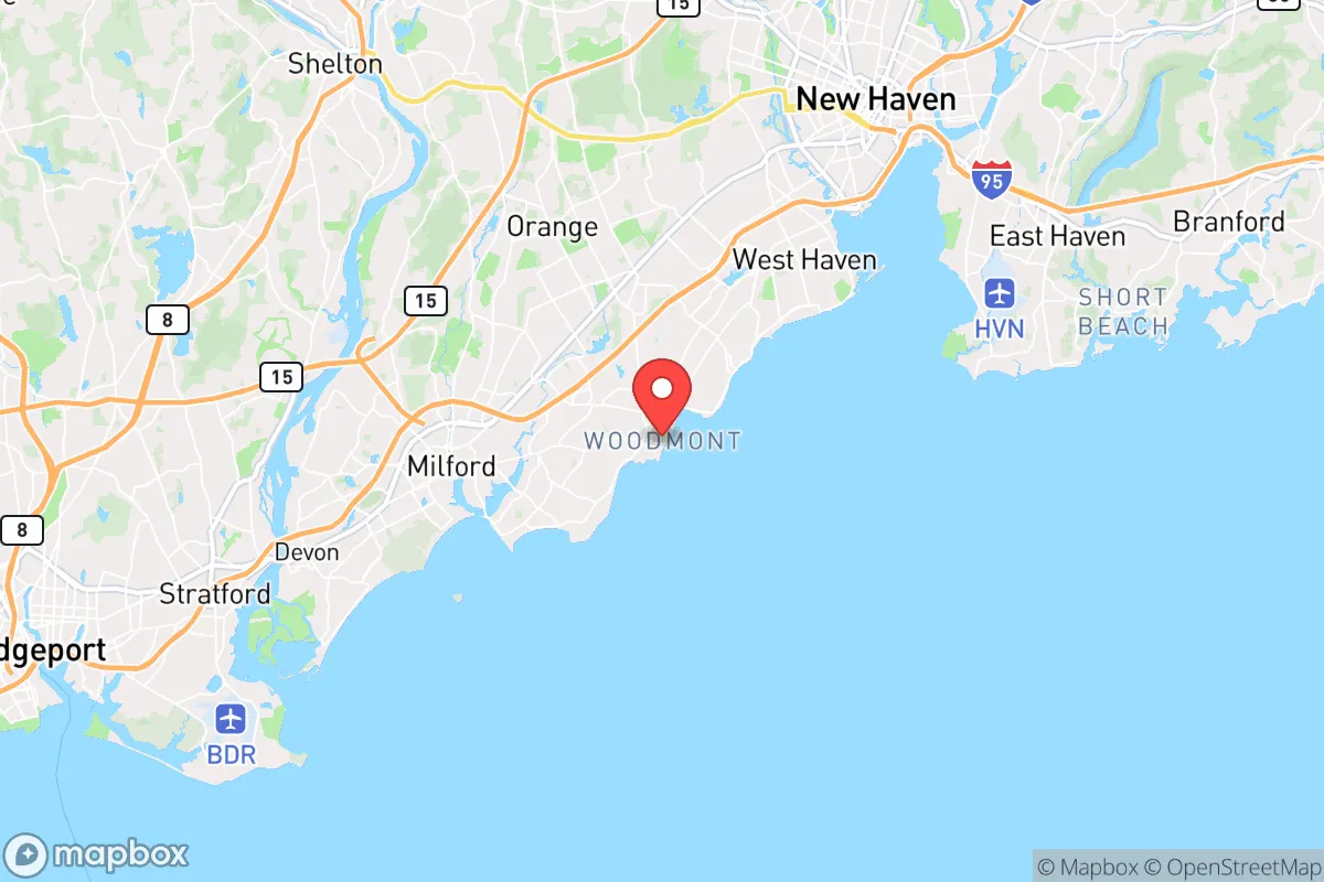
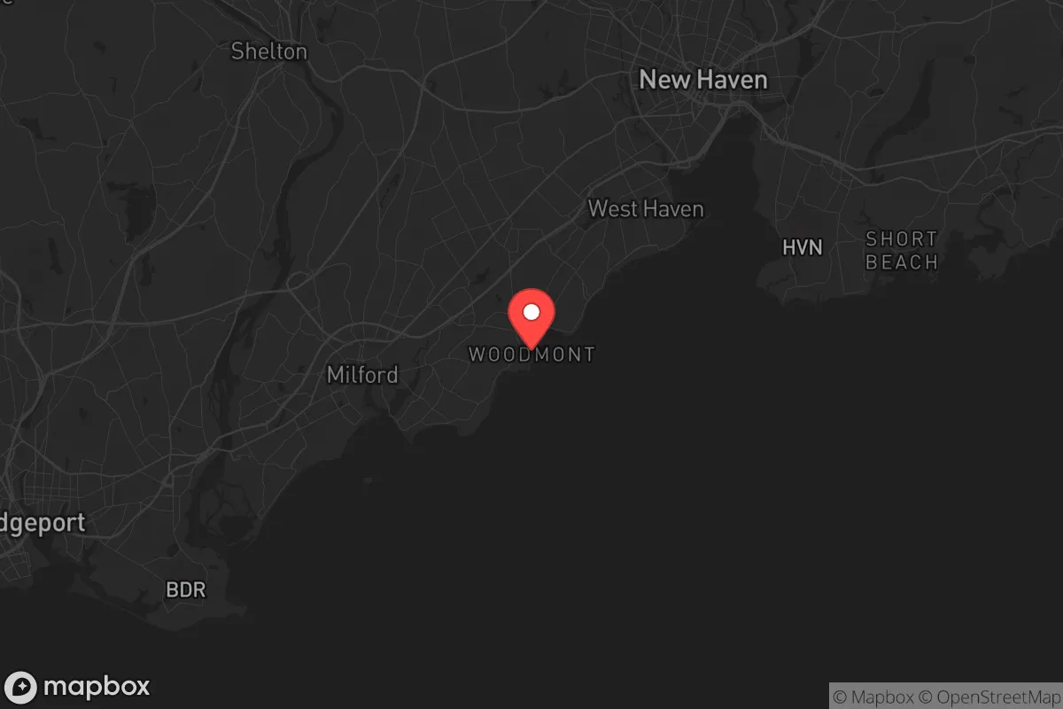
Woodmont, Connecticut, offers a surprisingly resilient position for those prioritizing strategic relocation, blending coastal access with a degree of separation from the most volatile urban centers. This small borough within the city of Milford sits on Long Island Sound, roughly 50 miles from New York City and 15 miles from New Haven, placing it within a zone that balances proximity to resources with a buffer from the worst-case scenarios of civil unrest or mass casualty events. For the prepper or survivalist, Woodmont’s key advantage is its location on a peninsula jutting into the Sound, providing natural chokepoints and a defensible posture that inland suburbs lack, while its water access opens escape routes by boat if road networks become compromised.
Geographic position and natural advantages for long-term security
Woodmont’s geography is its strongest card. The borough sits on a narrow peninsula, with Long Island Sound to the south and the Housatonic River estuary to the west. This layout creates a natural funnel: only a few roads—primarily Naugatuck Avenue and Broadway—connect the area to the mainland, making it easier to monitor and control access during a breakdown of order. The surrounding water provides a reliable barrier against foot traffic and vehicle-borne threats, while the coastline offers multiple points for small-craft evacuation or resupply. The nearby Charles Island, accessible by a tidal sandbar, adds an emergency fallback position, though it’s not a long-term solution due to limited fresh water. The area’s elevation is modest, topping out around 30 feet, but that’s enough to avoid storm surge from all but the most extreme hurricanes—a real concern given the Sound’s history of nor’easters and tropical systems. Woodmont’s position also places it within the New England Upland ecoregion, meaning soils are rocky but support mixed hardwood forests, offering cover and potential for foraging. The borough’s small size—roughly one square mile with a population under 2,000—means a tight-knit community that can organize quickly, a factor often overlooked in prepper calculations. For a relocator, this density of natural advantages is rare within commuting distance of major employment hubs, but it comes with trade-offs in exposure to coastal risks.
Risks, exposures, and proximity to fallout-relevant landmarks
No location is a fortress, and Woodmont has vulnerabilities that demand serious consideration. The most glaring is its proximity to New York City and New Haven, both high-probability targets for a mass casualty event, whether from terrorism, civil unrest, or a coordinated attack. At 50 miles from Manhattan, Woodmont is within the fallout zone for a ground-level nuclear detonation—the prevailing winds from the west would carry radioactive debris directly over the borough within hours. The same applies to the Indian Point Energy Center, 40 miles southwest, though it’s now decommissioned; the spent fuel pools there remain a risk. Closer to home, the Millstone Nuclear Power Station in Waterford, 30 miles east, is an active facility that could become a target or suffer a catastrophic failure. A plume from Millstone under easterly winds would hit Woodmont in under two hours. Beyond nukes, the area’s coastal exposure makes it vulnerable to storm surge from a Category 3 or higher hurricane—the 1938 Great New England Hurricane pushed water 10 feet deep into Milford, and a repeat would flood most of Woodmont’s low-lying streets, cutting off road access and contaminating freshwater sources. The borough’s single main road, Naugatuck Avenue, is a chokepoint that could become a death trap if panicked crowds from Bridgeport or New Haven try to flee north. Civil unrest in those cities, both within 15 miles, could spill over quickly, especially if supply chains collapse. Woodmont’s small police force—Milford PD covers it, with response times of 10-15 minutes in good conditions—won’t hold a perimeter against organized groups. For the survivalist, these risks mean that Woodmont is a secondary retreat, not a primary bug-out location; it’s viable only if you have a plan to move inland within 24 hours of a major event.
Practical resilience for a relocator: food, water, energy, and defensibility
Day-to-day resilience in Woodmont requires active preparation, not passive reliance on infrastructure. Water is the first concern: the borough draws from the Milford municipal system, which sources from the Housatonic River and local reservoirs. A grid-down scenario or contamination event—say, a chemical spill upstream or a saltwater intrusion from storm surge—would cut supply immediately. The Sound is undrinkable without desalination, but the Housatonic estuary offers brackish water that can be filtered with a high-end reverse osmosis system. Rainwater catchment is viable, with the area averaging 48 inches annually, but roofs must be kept clean of bird droppings and salt spray. Food is more manageable: Woodmont has no major farms, but the surrounding Milford area has several community gardens and the Milford Farmers Market operates seasonally. For long-term storage, the borough’s dense residential layout means most homes have basements—ideal for canned goods and freeze-dried stores, but prone to flooding in heavy rains. Energy is a weak point. The grid is above-ground and vulnerable to storms; outages after nor’easters can last 3-5 days. Solar panels are viable—the area gets 200 sunny days per year—but coastal salt air corrodes equipment faster than inland setups. A generator running on propane or diesel is essential, with fuel stored in a locked shed away from the house. Defensibility is mixed. The peninsula layout helps, but the housing stock is mostly older homes with large windows and open floor plans—hard to fortify without significant work. The Woodmont Beach area is a public space that would become a no-go zone during unrest, as it offers no cover. The best defensive setup is a home on the northern edge of the borough, near the Milford town line, where you have a shorter line of retreat to Route 1 or I-95. For a relocator, the practical takeaway is that Woodmont demands a high level of self-sufficiency—you can’t count on the local government for anything beyond basic services in normal times.
The overall strategic picture for Woodmont is one of calculated trade-offs. It’s not a remote mountain redoubt, but it’s not a concrete jungle either. For the conservative-leaning relocator who values community, coastal access, and a buffer from the worst urban chaos, Woodmont offers a viable base—provided you treat it as a launch point, not a final destination. The borough’s strengths—natural chokepoints, water escape routes, a small population—are real, but they’re offset by proximity to high-value targets and coastal hazards. The smart play is to use Woodmont as a primary residence for normal times, with a pre-stocked bug-out location 50-100 miles inland, say in the Litchfield Hills or the Berkshires. That dual-location strategy gives you the best of both worlds: the economic and social benefits of coastal Connecticut during stability, and a rapid retreat to defensible terrain when the balloon goes up. For the serious prepper, Woodmont is a B-minus location—good enough to work with, but only if you’re honest about its limits and plan accordingly.
* Values derived from national, state, county, city and local statistics and may differ in a specific area. Last updated: 2026-04-19T07:40:42.000Z
Narrative content on this page is AI-generated and may contain mistakes. Verify any details that matter before acting on them.
ReloMaps may earn a commission from affiliate links at no extra cost to you.