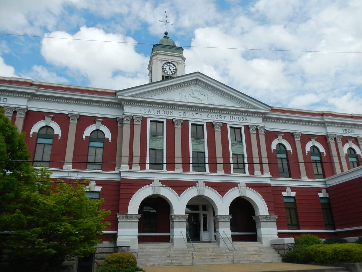
Photo: Wikipedia
Strategic Assessment of Calhoun County
Workable tactical position. Some exposure to population density or targets, but generally defensible in a crisis.
What does the Strategic Assessment tell us?
Our Strategic Assessment grades tactical survivability of an area. Major population centers, military targets, fallout zones, natural disasters, and border exposure all drive risk — lower exposure means a more defensible position in a crisis.
This is heavily inspired by Joel Skousen's Strategic Relocation book. Highly recommended you checkout the book ($)What does this tell us?
Our Strategic Assessment grades tactical survivability of an area. Major population centers, military targets, fallout zones, natural disasters, and border exposure all drive risk — lower exposure means a more defensible position in a crisis.
This is heavily inspired by Joel Skousen's Strategic Relocation book. Highly recommended you checkout the book ($)Strategic Pillars

Key Distances
Strategic Assessment Analysis
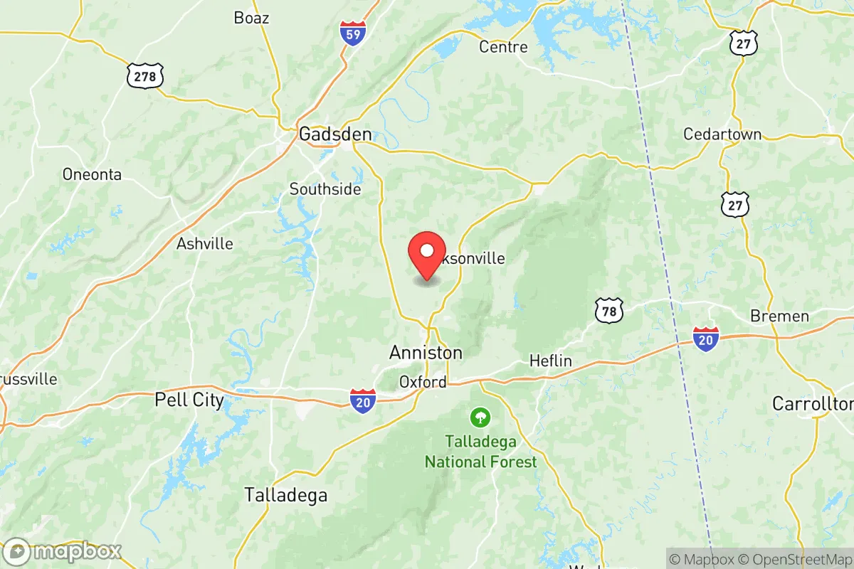
Calhoun County, Alabama, offers a strategic blend of geographic resilience and practical self-sufficiency that appeals to relocators prioritizing disaster readiness and long-term stability. Anchored by the city of Anniston and the towns of Oxford, Jacksonville, and Piedmont, the county sits at the southern edge of the Appalachian foothills, roughly 60 miles east of Birmingham and 90 miles west of Atlanta. This positioning provides meaningful separation from major metropolitan targets while still granting access to regional supply chains and healthcare networks. The county’s terrain—rolling hills, hardwood forests, and the Talladega National Forest to the east—creates natural buffers against both weather extremes and population-density risks, making it a credible option for those evaluating relocation through a lens of preparedness and independence.
Geographic position and natural advantages for long-term stability
Calhoun County’s location in the Ridge and Valley region of Alabama delivers several structural advantages for resilience. The area sits well inland, roughly 200 miles from the Gulf of Mexico, which reduces exposure to hurricane storm surge and the worst of tropical wind fields. The elevation ranges from about 600 to 1,200 feet above sea level, with the highest points near the Talladega National Forest and Cheaha Mountain—Alabama’s highest peak—just east of the county line. This elevation, combined with well-drained, rocky soils, means the county experiences far fewer flooding issues than the Black Belt or coastal plain regions. The Coosa River runs through the western edge of the county, providing a reliable surface water source, while numerous smaller creeks and springs feed into it from the surrounding hills. For a relocator thinking about water security, the county’s average annual rainfall of roughly 52 inches supports rain catchment and well-based systems without the drought risks common in the western U.S. The forested terrain also offers natural cover and defensibility; the Talladega National Forest alone covers over 390,000 acres, much of it within a 30-minute drive of Anniston, providing a potential retreat or resource zone without requiring remote wilderness living.
Risks, exposures, and proximity to fallout-relevant landmarks
No location is without vulnerabilities, and Calhoun County has specific exposures that a serious relocator must weigh. The most prominent is the Anniston Army Depot, a major U.S. Army installation located just west of Anniston that stores and maintains heavy military vehicles, including tanks and artillery. While the depot is a significant local employer and economic anchor, it also represents a potential target in a conflict scenario. Additionally, the former Anniston Chemical Agent Disposal Facility, which completed destruction of chemical weapons stockpiles in 2011, has left behind ongoing groundwater contamination issues in the nearby Sweet Valley and West Anniston areas—a legacy of industrial pollution that affects local water quality and property values. The county is also within 60 miles of the Talladega Superspeedway and the Honda Manufacturing of Alabama plant in Lincoln, both of which could be secondary targets or chokepoints in a disruption scenario. On the natural hazard side, the region sits in a moderate tornado zone; while not as active as the Plains or Mississippi Delta, the county has experienced EF-3 and EF-4 tornadoes, most notably the 2018 Lee County outbreak that struck just south of the county line. Wildfire risk is low but present in the forested eastern areas, particularly during dry late-summer periods. For a relocator prioritizing fallout avoidance, the county’s distance from major nuclear power plants—the nearest is the Browns Ferry plant near Huntsville, roughly 80 miles north—and its lack of large petrochemical infrastructure are net positives compared to areas near Houston’s refinery corridor or the Tennessee Valley.
Practical resilience for a relocator: food, water, energy, and defensibility
For someone serious about self-sufficiency, Calhoun County offers a workable mix of rural access and small-city infrastructure. The county’s agricultural base is modest—row crops are limited by the hilly terrain—but there is strong local production of poultry, cattle, and timber. The Anniston Farmers Market and the Oxford Farmers Market operate seasonally, and the surrounding counties of Cleburne and Cherokee have more extensive farmland, creating a regional food network within a 30- to 45-minute drive. Water access is a standout feature: the Coosa River and its tributaries provide surface water, and the county’s geology supports private wells at reasonable depths (typically 100 to 300 feet) in most areas outside the floodplain. The Anniston Water Works and Sewer Board serves the urban core, but many rural properties rely on well and septic systems, which is a resilience advantage. Energy infrastructure is mixed: Alabama Power serves the county with a grid that has seen moderate reliability, but the area’s forest cover and hills make it susceptible to storm-related outages. Solar potential is good—the county averages about 210 sunny days per year—and the lack of restrictive HOA covenants in unincorporated areas allows for off-grid solar and backup generator installations without legal friction. Defensibility is aided by the terrain: the eastern half of the county is characterized by narrow valleys and ridgelines, which create natural chokepoints and observation points. The town of Piedmont, in the county’s northeast corner, sits in a particularly defensible valley with limited road access, while Jacksonville, home to Jacksonville State University, offers a small-town population center with emergency services and a hospital. For a family or individual, the county’s low population density—roughly 110 people per square mile, compared to Birmingham’s 1,400—reduces competition for resources in a crisis scenario.
Overall, Calhoun County presents a credible strategic option for the relocator who values geographic buffer, water security, and defensible terrain without complete isolation from medical and supply networks. Its proximity to the Anniston Army Depot is a double-edged sword—providing economic stability and potential security presence, but also a target risk that must be honestly assessed. The county’s legacy of industrial contamination in specific pockets means due diligence on property history and well water testing is non-negotiable. For the reader thinking in terms of layered preparedness—where location, terrain, and local resources form the foundation of a long-term plan—Calhoun County offers a realistic, grounded choice that balances risk and reward better than most urban-adjacent areas in the Southeast. It is not a bug-out fantasy; it is a place where a prepared household can build a stable, self-reliant life with eyes open to both the advantages and the liabilities of the ground beneath them.

* Values derived from national, state, county, city and local statistics and may differ in a specific area. Last updated: 2026-10-14T23:47:16.000Z
Narrative content on this page is AI-generated and may contain mistakes. Verify any details that matter before acting on them.
ReloMaps may earn a commission from affiliate links at no extra cost to you.

