Photo: Wikipedia
Strategic Assessment of American Fork, UT
Workable tactical position. Some exposure to population density or targets, but generally defensible in a crisis.
What does the Strategic Assessment tell us?
Our Strategic Assessment grades tactical survivability of an area. Major population centers, military targets, fallout zones, natural disasters, and border exposure all drive risk — lower exposure means a more defensible position in a crisis.
This is heavily inspired by Joel Skousen's Strategic Relocation book. Highly recommended you checkout the book ($)What does this tell us?
Our Strategic Assessment grades tactical survivability of an area. Major population centers, military targets, fallout zones, natural disasters, and border exposure all drive risk — lower exposure means a more defensible position in a crisis.
This is heavily inspired by Joel Skousen's Strategic Relocation book. Highly recommended you checkout the book ($)Strategic Pillars

Key Distances
Regional Safe Places
Below is our recommended "safe zones" in Utah and the surrounding area based on our strategic heuristics. For most people, it's unrealistic to live in a “safe zone” full-time due to work, family or other personal reasons. They tend to be more rural. However, many of these areas are perfect for second homes and retreat properties that double as a vacation home or even a short-term rental.


Important Note: For informational purposes only. This does not mean nothing bad ever happens in the green zones. Please use common sense. This is based on public data and modeled with AI. We tried to take a conservative approach but mistakes happen. We update this regularly as new information becomes available.
Solar Generator Recommendations
Backup power matters more here than in safer locations. We've picked three solar generators across budgets and capacity tiers — start with the budget unit if you only need a few essentials, or step up if you want to run a fridge and HVAC for days at a time.

Jackery Portable Power Station Explorer 300
Budget OptionPower on the Go: Weighing only 11 lbs, it's convenient to set up and store with book-sized foldable solar panels

BLUETTI Portable Power Station AC180
Designed for both indoor and outdoor scenarios, AC180 is highly capable as it has a robost capacity and continuous output power.

EF ECOFLOW DELTA Pro Ultra Power Station
Upgraded PickEcoFlow DELTA Pro Ultra is a whole-home energy system designed to grow with your family. Integrated with the Smart Home Panel 2, it scales to meet your evolving energy needs — keeping your home powered, intelligent, and secure through every stage of life.
We earn a commission, at no additional cost to you.
Strategic Assessment Analysis
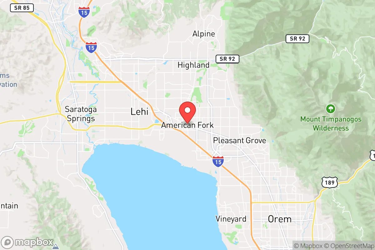
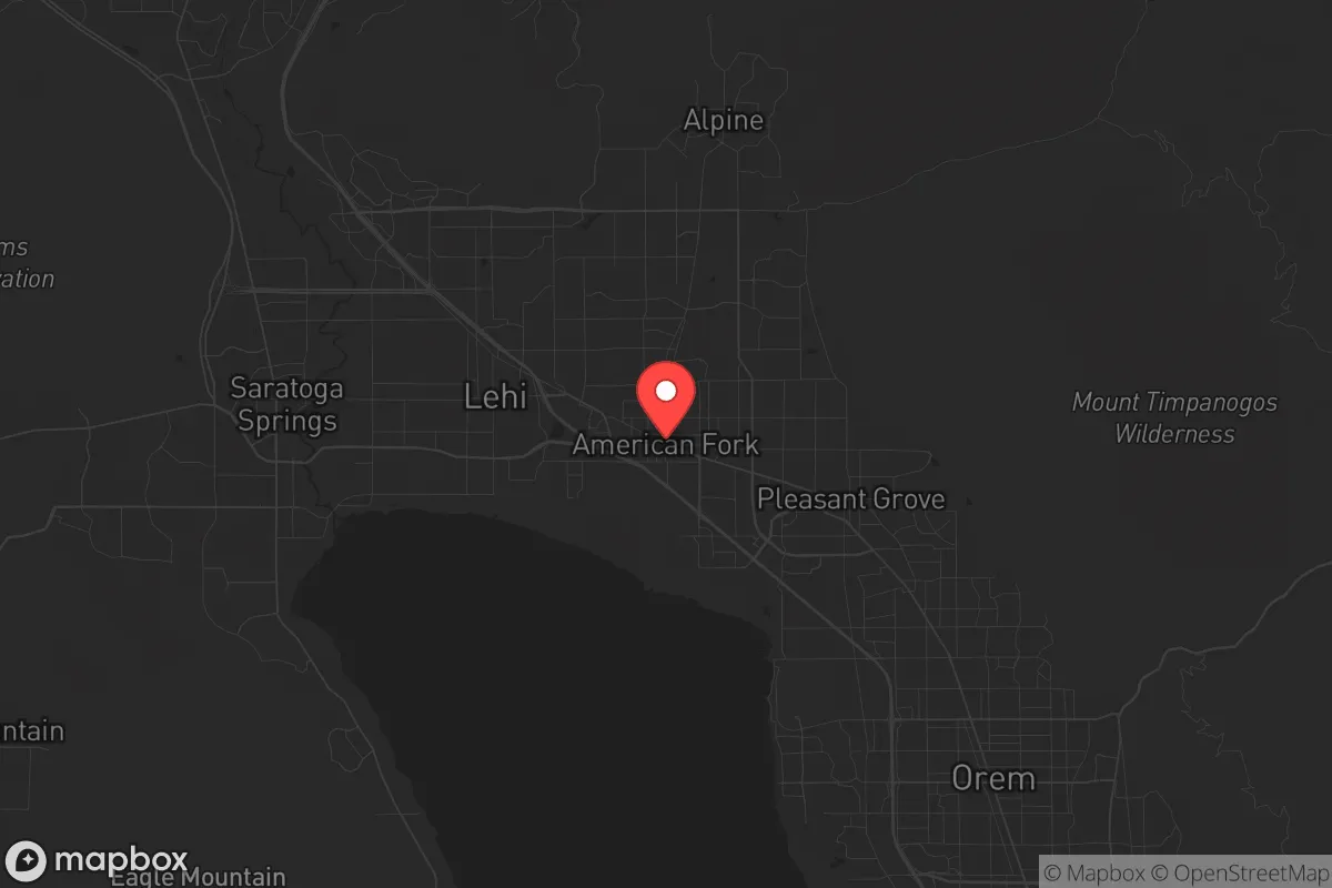
American Fork, Utah, sits in a geographic sweet spot that balances access to resources with a degree of natural separation from the most obvious collapse vectors, but it is not a standalone fortress. The city’s position at the base of the Wasatch Front, roughly 35 miles south of Salt Lake City and 10 miles north of Provo, places it within a dense corridor of nearly 2.5 million people—a double-edged sword for anyone thinking long-term. On one hand, you have proximity to major medical centers, supply chains, and transportation hubs (I-15 runs right through town). On the other, that same corridor is a primary target for any cascading failure, whether economic, social, or kinetic. The key question for a relocator isn’t whether American Fork is safe today—it’s whether the area’s layout, culture, and infrastructure give you a fighting chance when the system hiccups. The answer is cautiously optimistic, provided you understand the trade-offs.
Geographic position and natural advantages for long-term security
American Fork’s geography is defined by its position between the Wasatch Mountains to the east and Utah Lake to the west, creating a natural funnel that channels movement and resources. The eastern bench neighborhoods, climbing toward American Fork Canyon, offer elevation advantages—clear sightlines, defensible terrain, and access to the Uinta-Wasatch-Cache National Forest, which provides a massive backcountry buffer. The canyon itself is a critical asset: it holds the Tibble Fork Reservoir and a network of streams that remain viable water sources even during drought years, though Utah’s ongoing water allocation disputes (the Colorado River Compact and the Great Salt Lake crisis) mean surface water reliability is not guaranteed. The valley floor is fertile—historically agricultural—and the local soil can support gardens and small-scale farming, a significant plus for anyone planning food independence. The area’s 4,600-foot elevation means a cooler, drier climate than the desert south, reducing wildfire risk compared to places like St. George or California, though the mountain slopes do carry a moderate fire hazard in late summer. Snowpack in the Wasatch is the region’s primary water battery, and American Fork’s proximity to that snowpack (via the canyon) gives it a leg up over communities further west that rely entirely on the Jordan River or groundwater.
Risks, exposures, and proximity to fallout-relevant landmarks
The single biggest vulnerability for American Fork is its location within the Wasatch Front’s urban megaplex. The city is 35 miles from Hill Air Force Base (a nuclear-capable logistics hub) and 40 miles from Camp Williams (a major Army training site with ammunition storage). In a conflict scenario involving strategic strikes, these are tier-one targets. The prevailing winds blow from the west and southwest, meaning fallout from a strike on Hill AFB would likely drift toward the Ogden area, not directly over American Fork—but that’s cold comfort if the entire region is disrupted. More immediately, the Wasatch Fault runs directly under the valley floor; a major earthquake (the “Big One” that seismologists warn about) would devastate I-15, the power grid, and natural gas lines, potentially isolating the city for weeks. The 2020 Magna earthquake (5.7 magnitude) was a reminder that even moderate shaking causes structural damage in older buildings. Additionally, American Fork’s proximity to Utah Lake is a mixed bag: the lake is shallow, algae-prone, and contaminated with legacy industrial pollutants (arsenic, selenium) from mining runoff, making it a poor emergency water source without heavy filtration. The I-15 corridor itself is a chokepoint—if civil unrest or a mass casualty event (e.g., a chemical spill or a coordinated attack) closes the freeway, the city’s supply lines for food, fuel, and medical goods are cut. The local hospital, American Fork Hospital, is a 120-bed facility with a Level III trauma center—adequate for routine emergencies but quickly overwhelmed in a regional crisis.
Practical resilience for a relocator: food, water, energy, and defensibility
For a relocator serious about self-sufficiency, American Fork offers a mixed report card. Water is the most critical variable. The city draws from a combination of groundwater wells and surface water from the American Fork River and Tibble Fork Reservoir. During the 2021-2023 drought, the city imposed voluntary conservation measures but never cut residential supply—a sign that the system has some buffer. However, the Central Utah Project, which supplements the region’s water, is vulnerable to interstate legal battles and climate-driven snowpack decline. A prudent prepper would install a rainwater catchment system (the area averages 16 inches of precipitation annually, so it’s not a high-yield option) and secure a property with a private well—the water table in the valley is 100-300 feet deep, and drilling costs run $10,000-$20,000. Food resilience is better: Utah County has a strong agricultural tradition, with local farms producing apples, corn, alfalfa, and livestock. The Spanish Fork Farmers Market and American Fork’s own seasonal market provide local sourcing, but for long-term storage, you’ll want to build relationships with growers in the nearby Goshen Valley or Utah County’s dairy operations. Energy is a bright spot: Rocky Mountain Power’s grid is relatively stable, but solar is a no-brainer here. The valley averages 225 sunny days per year, and net metering policies (though being phased down) still make rooftop solar a viable investment. Battery storage (e.g., Tesla Powerwall or a DIY LiFePO4 setup) is essential for grid-down scenarios. Defensibility is neighborhood-dependent. The bench areas east of I-15 offer natural chokepoints (canyon roads, limited access), while the flat west side near the lake is more porous. The city’s strong LDS (Mormon) cultural presence—roughly 80% of the population—means a high degree of social cohesion and mutual aid networks, which is a double-edged sword: you’ll have neighbors who will share resources and information, but outsiders may face a longer trust-building curve. The Utah County Sheriff’s Office and American Fork Police Department are well-funded and have a reputation for rapid response, but in a widespread collapse, law enforcement will be stretched thin.
The overall strategic picture for American Fork is one of calculated risk. It is not a remote bug-out location—it is a suburban community embedded in a high-value target corridor. But for a relocator who wants to maintain a professional career (the area has a booming tech sector, with companies like Adobe, Qualtrics, and Vivint within commuting distance) while building a resilient homestead, it offers a rare combination: defensible terrain, a water-adjacent mountain watershed, a cooperative cultural base, and a climate that supports year-round food production. The downsides—earthquake risk, proximity to military targets, and dependence on a fragile interstate supply chain—are real but manageable with proper planning. If you secure a property with a well, solar panels, and a garden on the east bench, and you build relationships with your LDS neighbors (who already practice food storage as a religious tenet), you can ride out most disruptions that don’t involve a direct hit on Hill AFB. For those who want to be near enough to civilization to thrive but far enough to survive, American Fork is a solid B+—not a fortress, but a defensible outpost with a community that understands the value of preparation.
* Values derived from national, state, county, city and local statistics and may differ in a specific area. Last updated: 2026-05-03T20:38:01.000Z
Narrative content on this page is AI-generated and may contain mistakes. Verify any details that matter before acting on them.
ReloMaps may earn a commission from affiliate links at no extra cost to you.