
Photo: Wikipedia
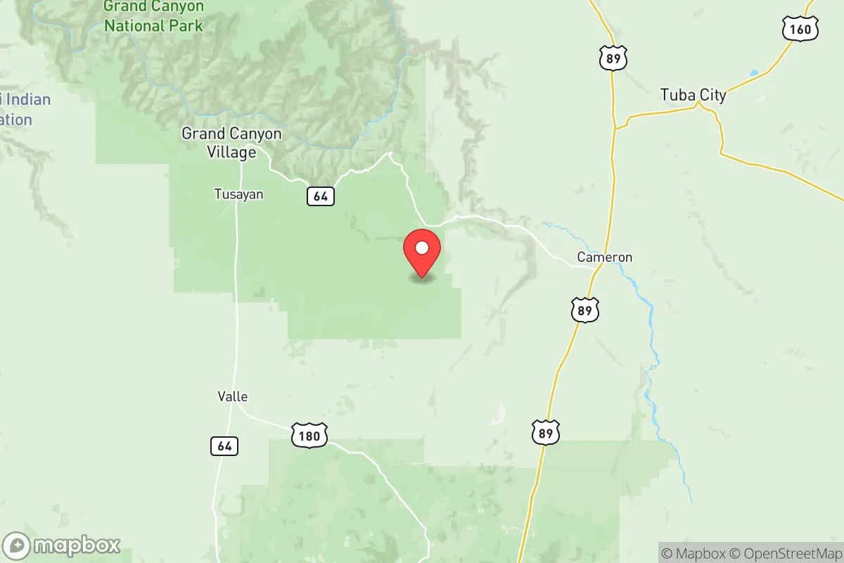
Strategic Assessment of Coconino County
Workable tactical position. Some exposure to population density or targets, but generally defensible in a crisis.
What does the Strategic Assessment tell us?
Our Strategic Assessment grades tactical survivability of an area. Major population centers, military targets, fallout zones, natural disasters, and border exposure all drive risk — lower exposure means a more defensible position in a crisis.
This is heavily inspired by Joel Skousen's Strategic Relocation book. Highly recommended you checkout the book ($)What does this tell us?
Our Strategic Assessment grades tactical survivability of an area. Major population centers, military targets, fallout zones, natural disasters, and border exposure all drive risk — lower exposure means a more defensible position in a crisis.
This is heavily inspired by Joel Skousen's Strategic Relocation book. Highly recommended you checkout the book ($)Strategic Pillars

Key Distances
Strategic Assessment Analysis
Coconino County offers a rare combination of geographic isolation and strategic depth that makes it one of the more resilient relocation options in the Southwest, particularly for those thinking through worst-case scenarios. Stretching from the Grand Canyon’s South Rim down through Flagstaff and into the high desert near Sedona, this county sits at a natural crossroads of elevation, water access, and distance from major population centers. For a conservative-leaning individual or family looking to put distance between themselves and the chaos of coastal cities or the vulnerability of the Interstate 35 corridor, Coconino provides a defensible, resource-rich base that doesn’t require abandoning modern infrastructure entirely.
Geographic position and natural advantages for long-term stability
Coconino County’s physical location is its strongest card. At roughly 18,600 square miles, it’s larger than some states, and its population density hovers around 8 people per square mile outside of Flagstaff. That’s a buffer zone most preppers can only dream of. The county sits on the Colorado Plateau, with elevations ranging from 3,000 feet near the Little Colorado River to over 12,600 feet at Humphreys Peak. This elevation means cooler summers, reliable snowmelt, and a growing season that—while short—supports hardy crops like potatoes, beans, and root vegetables. The presence of the San Francisco Peaks and the Mogollon Rim creates natural barriers that slow movement and provide defensible terrain. For someone scouting fallout-relevant landmarks, note that Coconino is roughly 150 miles from the Palo Verde Nuclear Generating Station near Phoenix—far enough to avoid direct blast or fallout zones in most scenarios, but close enough to monitor. The county also contains Navajo Army Depot (now largely decommissioned but still a known munitions storage site), which could be a target or a resource depending on the event. The key advantage here is that Coconino lacks the high-value industrial targets found in places like Houston’s refinery corridor or the Port of Los Angeles. No major refineries, no nuclear power plants within the county, and no major military bases (though Camp Navajo near Bellemont is a state-owned training site). That reduces the likelihood of being ground zero for a coordinated strike or secondary attack.
Risks, exposures, and proximity to fallout-relevant landmarks
No place is immune, and Coconino has its own set of vulnerabilities. The biggest risk is wildfire—the county has seen massive burns like the 2022 Pipeline Fire and the 2010 Schultz Fire, which destroyed hundreds of homes and threatened Flagstaff’s watershed. Fire risk is highest in the ponderosa pine forests around Flagstaff and the rim communities, but the high desert areas near Page and Fredonia are less prone. Another exposure is the Interstate 40 and BNSF Railway corridors that cut through the county. These are chokepoints for supply chains, and in a crisis, they could become targets or bottlenecks. The Glen Canyon Dam at Page is a double-edged sword: it provides hydroelectric power and a massive water reservoir (Lake Powell), but it’s also a critical infrastructure point that could be targeted or fail structurally. A dam failure would devastate the Colorado River corridor downstream, but Coconino’s high-elevation communities would be largely unaffected. Fallout-wise, the prevailing winds in northern Arizona generally blow from west to east, meaning any release from the Palo Verde plant or a hypothetical strike on Phoenix would likely push contamination toward New Mexico, not up into the mountains. Still, residents should have a plan for sheltering in place for 72 hours, as the county’s rural road network can be impassable after heavy snow or during a mass evacuation. The Navajo Nation borders the county to the east, and while that’s not a risk per se, it does mean that any civil unrest on the reservation could spill over into border towns like Flagstaff and Tuba City.
Practical resilience for a relocator: food, water, energy, and defensibility
For someone serious about self-sufficiency, Coconino delivers on the basics but requires work. Water is the biggest variable. The county sits over the Coconino and Redwall aquifers, which provide reliable groundwater for wells, but drilling depth varies wildly—from 100 feet in some valleys to over 1,000 feet near the rims. Surface water is available from the Little Colorado River, Oak Creek, and numerous springs, but much of it is seasonal or requires treatment. Flagstaff’s municipal water comes from Lake Mary and the Inner Basin, but those sources are vulnerable to drought and fire. For a relocator, buying land with a proven well or access to a spring is non-negotiable. Food production is limited by the short growing season (May to September in most areas) and alkaline soils, but high tunnels and cold frames can extend it. Game is abundant—mule deer, elk, turkey, and small game—and the county has a strong hunting culture. Energy is a mixed bag: solar works well at this elevation (over 300 sunny days per year), but snow cover can reduce winter output. Wood heating is common and practical, given the vast national forests. The Navajo Generating Station near Page (coal-fired) shut down in 2019, so the county now imports most of its electricity from the grid, which is a vulnerability. Off-grid solar with battery backup is the smart play here. Defensibility is excellent in the rural areas—long sightlines, limited road access, and a culture of self-reliance. The county has a strong Second Amendment presence, with multiple gun shops and shooting ranges, and the local sheriff’s office is generally supportive of property rights. However, Flagstaff itself leans left politically, so if you’re looking for a like-minded community, stick to the smaller towns like Williams, Fredonia, or the Munds Park area.
The overall strategic picture for Coconino County is one of calculated trade-offs. You gain distance from the chaos of Phoenix, Las Vegas, and the California coast, but you trade that for a shorter growing season, wildfire risk, and a reliance on personal preparation for water and energy. For a single individual or a family willing to put in the work—digging a well, stacking firewood, learning to hunt—this is one of the most defensible and resource-rich counties in the Southwest. It’s not a bug-out location; it’s a live-in location that can weather most storms, provided you’re not caught flat-footed by a wildfire or a winter storm. The key is to buy land with water, build with fire-resistant materials, and keep a low profile. In a world where the grid is fragile and the cities are tinderboxes, Coconino offers a rare combination of isolation, resources, and community that makes it a serious contender for a strategic relocation.
* Values derived from national, state, county, city and local statistics and may differ in a specific area. Last updated: 2026-05-27T17:34:20.000Z
Narrative content on this page is AI-generated and may contain mistakes. Verify any details that matter before acting on them.
ReloMaps may earn a commission from affiliate links at no extra cost to you.