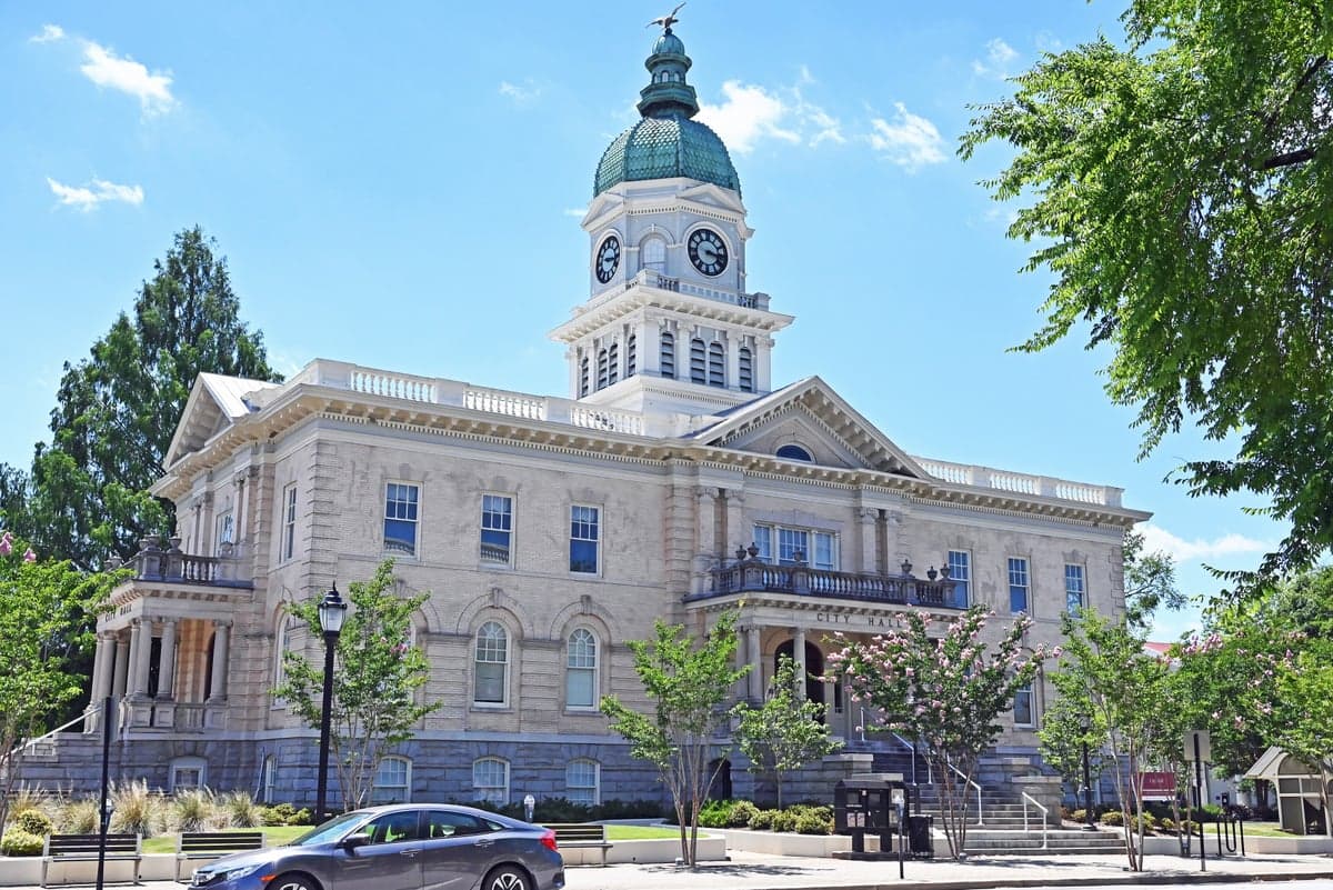
Photo: Wikipedia
Strategic Assessment of Athens, GA
Workable tactical position. Some exposure to population density or targets, but generally defensible in a crisis.
What does the Strategic Assessment tell us?
Our Strategic Assessment grades tactical survivability of an area. Major population centers, military targets, fallout zones, natural disasters, and border exposure all drive risk — lower exposure means a more defensible position in a crisis.
This is heavily inspired by Joel Skousen's Strategic Relocation book. Highly recommended you checkout the book ($)What does this tell us?
Our Strategic Assessment grades tactical survivability of an area. Major population centers, military targets, fallout zones, natural disasters, and border exposure all drive risk — lower exposure means a more defensible position in a crisis.
This is heavily inspired by Joel Skousen's Strategic Relocation book. Highly recommended you checkout the book ($)Strategic Pillars

Key Distances
Regional Safe Places
Below is our recommended "safe zones" in Georgia and the surrounding area based on our strategic heuristics. For most people, it's unrealistic to live in a “safe zone” full-time due to work, family or other personal reasons. They tend to be more rural. However, many of these areas are perfect for second homes and retreat properties that double as a vacation home or even a short-term rental.


Important Note: For informational purposes only. This does not mean nothing bad ever happens in the green zones. Please use common sense. This is based on public data and modeled with AI. We tried to take a conservative approach but mistakes happen. We update this regularly as new information becomes available.
Solar Generator Recommendations
Backup power matters more here than in safer locations. We've picked three solar generators across budgets and capacity tiers — start with the budget unit if you only need a few essentials, or step up if you want to run a fridge and HVAC for days at a time.

Jackery Portable Power Station Explorer 300
Budget OptionPower on the Go: Weighing only 11 lbs, it's convenient to set up and store with book-sized foldable solar panels

BLUETTI Portable Power Station AC180
Designed for both indoor and outdoor scenarios, AC180 is highly capable as it has a robost capacity and continuous output power.

EF ECOFLOW DELTA Pro Ultra Power Station
Upgraded PickEcoFlow DELTA Pro Ultra is a whole-home energy system designed to grow with your family. Integrated with the Smart Home Panel 2, it scales to meet your evolving energy needs — keeping your home powered, intelligent, and secure through every stage of life.
We earn a commission, at no additional cost to you.
Strategic Assessment Analysis
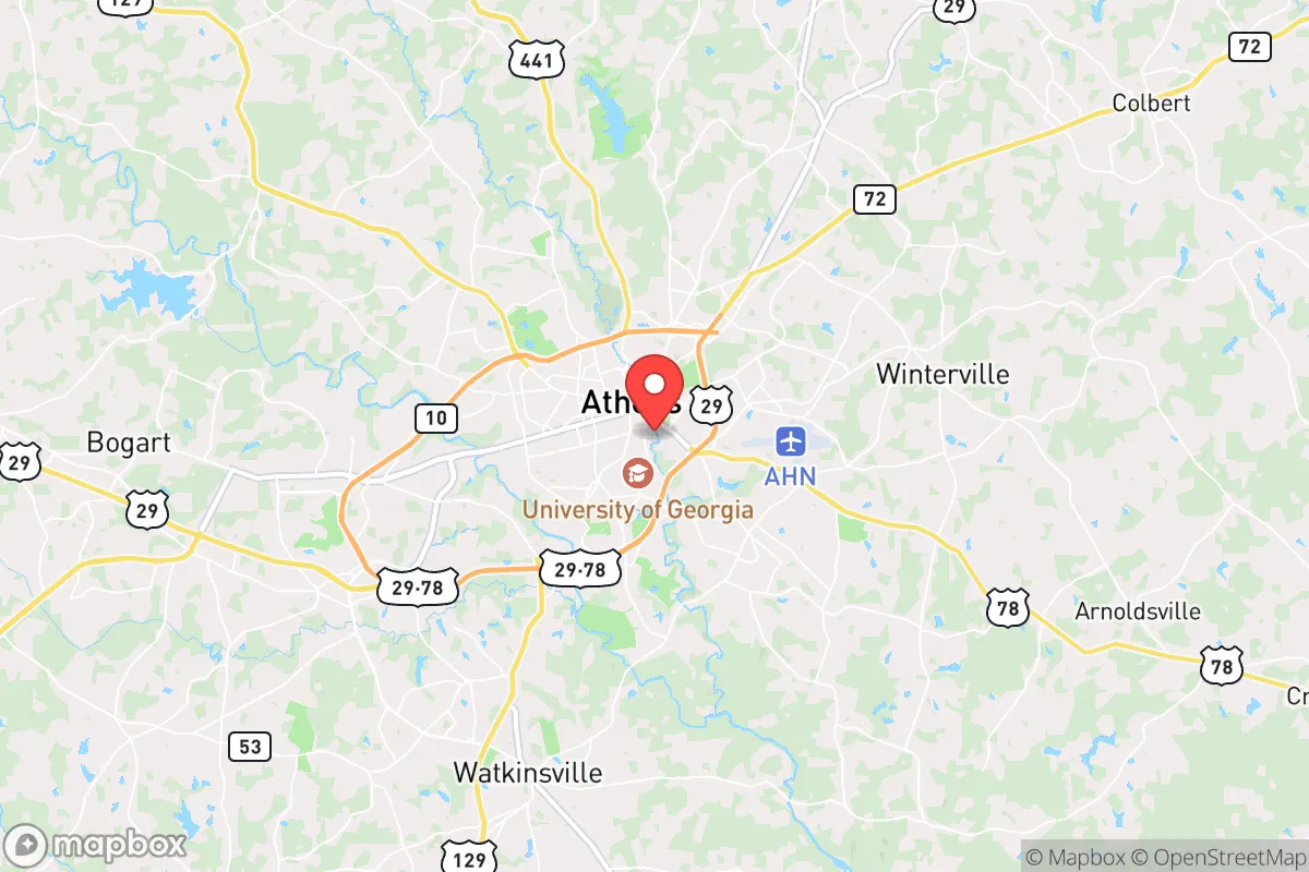
Athens, Georgia, often dismissed as just a college town, actually offers a surprisingly layered strategic position for those thinking long-term about resilience. Nestled roughly 70 miles east of Atlanta and 60 miles west of the Savannah River border with South Carolina, it sits far enough from major metropolitan blast zones to avoid the worst of a high-yield event, yet close enough to access critical supply chains and medical infrastructure in a slow-moving crisis. The city’s location along the Eastern Continental Divide provides natural drainage advantages, and its position within the Piedmont region means rolling hills, hard clay soils, and a temperate climate that supports year-round subsistence agriculture. For a relocator with a prepper mindset, Athens presents a mixed bag: genuine geographic buffers against coastal storm surges and inland fallout corridors, but real exposure to the chaos that could spill out of Atlanta if civil order fractures.
Geographic position and natural advantages for long-term survival
Athens sits on a geological sweet spot. The Piedmont’s granite bedrock and clay subsoil mean well water is generally accessible at moderate depths (50–150 feet), and the region’s average annual rainfall of 48 inches ensures surface water sources like the Oconee River and Lake Chapman remain reliable even during moderate drought. The city’s elevation—around 700 to 800 feet above sea level—puts it above the floodplains that plague coastal Georgia, yet low enough to avoid the severe winter weather that can isolate mountain communities. The surrounding hardwood forests provide ample cover, fuel, and game, with white-tailed deer, turkey, and wild hog populations that could sustain a prepared family indefinitely. Critically, Athens is outside the 50-mile radius of any active nuclear power plant—the nearest is Plant Vogtle near Augusta, roughly 90 miles southeast—which reduces the risk of being caught in an immediate fallout plume from a sabotage or accident scenario. The terrain itself is defensible: the Oconee River forms a natural barrier to the east, and the many rural county roads that spiderweb out from the city offer multiple egress routes toward less populated areas like Greene County or the Oconee National Forest.
Risks, exposures, and proximity to fallout-relevant landmarks
The single greatest vulnerability for Athens is its proximity to Atlanta. In a mass casualty event—whether from a coordinated attack, a pandemic resurgence, or a grid-down scenario—the 70-mile corridor along US-29 and GA-316 would become a funnel for desperate populations fleeing the metro area. Athens itself has a population of roughly 128,000, but Clarke County is one of the most densely populated in the state, and the university (UGA) brings in an additional 40,000 students who would be largely dependent on institutional support systems. The city’s water treatment plant on the North Oconee River is a single point of failure; a targeted cyber or physical attack could compromise municipal supply for weeks. Additionally, Athens lies within 100 miles of the Savannah River Site (a nuclear weapons complex) and within 150 miles of the Port of Savannah, a high-value target for state-actor sabotage. While not in a primary blast zone, the city sits under the prevailing westerly wind patterns that could carry fallout from a strike on Atlanta or Augusta. The rail lines running through Athens—used for freight, including hazardous materials—present a secondary risk: a derailment or intentional release of industrial chemicals could contaminate the water table for years. For the survivalist, the key takeaway is that Athens is a buffer zone, not a redoubt. It offers enough distance to survive the initial shockwave, but not enough isolation to avoid the secondary waves of refugees, resource competition, and supply chain collapse.
Practical resilience for a relocator: food, water, energy, and defensibility
For a family or individual looking to establish a resilient homestead, Athens’ practical assets are real but require deliberate effort to leverage. The growing season runs from mid-March to early November, allowing for two full crop cycles of staples like corn, beans, and squash, plus perennial fruits like muscadine grapes and figs that thrive in the local clay. The Clarke County Cooperative Extension and local seed libraries offer heirloom varieties adapted to the Piedmont, and the presence of the UGA College of Agricultural and Environmental Sciences means a deep bench of local expertise—if you can build relationships before things go sideways. Water is the stronger suit: the Oconee River flows year-round, and the county’s many creeks (Trail Creek, Sandy Creek, McNutt Creek) provide distributed surface water that is less likely to be targeted than a single reservoir. Rainwater catchment is viable, with average monthly rainfall of 3–5 inches even in dry months. Energy resilience is more challenging. Athens is served by Georgia Power, which relies heavily on coal and nuclear, and the local grid is aging. Solar potential is moderate—about 4.5 peak sun hours per day—but the tree canopy that makes the city attractive also limits rooftop production. A ground-mounted array on a rural property outside city limits is the better play. Defensibility is mixed: the city itself is a grid of interconnected neighborhoods with limited chokepoints, but the surrounding rural areas (especially to the east toward Lexington and south toward Watkinsville) offer properties with long driveways, creek boundaries, and wooded sightlines. The presence of the university police, county sheriff, and a state patrol post means law enforcement response times are decent in normal times, but in a collapse scenario, those assets would be overwhelmed by the student population alone. The smart play is to secure a property outside the urban growth boundary—ideally in Oconee or Madison County—while maintaining a secondary cache in the city for resupply runs.
The overall strategic picture for Athens is one of calculated trade-offs. It is not a remote survival bunker, nor is it a high-risk urban kill box. It occupies a middle ground that rewards preparation and penalizes complacency. For the conservative-minded relocator who wants to stay within striking distance of economic opportunity while maintaining a credible retreat option, Athens offers a viable base of operations—provided you treat it as a staging area, not a final destination. The real value lies in the surrounding counties: the farmland, the water, the low population density, and the distance from primary targets. If you can secure land in the Oconee River watershed, build a well and a solar array, and establish a network of like-minded neighbors before the next crisis hits, Athens gives you the best of both worlds—access to a functioning city during stability, and a defensible perimeter when that stability erodes. Just don’t mistake the college town charm for safety. The same infrastructure that makes Athens livable today makes it a target tomorrow. Plan accordingly.
* Values derived from national, state, county, city and local statistics and may differ in a specific area. Last updated: 2026-04-30T03:18:30.000Z
Narrative content on this page is AI-generated and may contain mistakes. Verify any details that matter before acting on them.
ReloMaps may earn a commission from affiliate links at no extra cost to you.