Photo: Wikipedia
Strategic Assessment of Auburn, WA
Multiple tactical vulnerabilities. Population density, target proximity, or disaster risk are likely compounding. A retreat property and exit planning is required.
What does the Strategic Assessment tell us?
Our Strategic Assessment grades tactical survivability of an area. Major population centers, military targets, fallout zones, natural disasters, and border exposure all drive risk — lower exposure means a more defensible position in a crisis.
This is heavily inspired by Joel Skousen's Strategic Relocation book. Highly recommended you checkout the book ($)What does this tell us?
Our Strategic Assessment grades tactical survivability of an area. Major population centers, military targets, fallout zones, natural disasters, and border exposure all drive risk — lower exposure means a more defensible position in a crisis.
This is heavily inspired by Joel Skousen's Strategic Relocation book. Highly recommended you checkout the book ($)Strategic Pillars

Key Distances
Regional Safe Places
Below is our recommended "safe zones" in Washington and the surrounding area based on our strategic heuristics. For most people, it's unrealistic to live in a “safe zone” full-time due to work, family or other personal reasons. They tend to be more rural. However, many of these areas are perfect for second homes and retreat properties that double as a vacation home or even a short-term rental.


Important Note: For informational purposes only. This does not mean nothing bad ever happens in the green zones. Please use common sense. This is based on public data and modeled with AI. We tried to take a conservative approach but mistakes happen. We update this regularly as new information becomes available.
Solar Generator Recommendations
Backup power matters more here than in safer locations. We've picked three solar generators across budgets and capacity tiers — start with the budget unit if you only need a few essentials, or step up if you want to run a fridge and HVAC for days at a time.

Jackery Portable Power Station Explorer 300
Budget OptionPower on the Go: Weighing only 11 lbs, it's convenient to set up and store with book-sized foldable solar panels

BLUETTI Portable Power Station AC180
Designed for both indoor and outdoor scenarios, AC180 is highly capable as it has a robost capacity and continuous output power.

EF ECOFLOW DELTA Pro Ultra Power Station
Upgraded PickEcoFlow DELTA Pro Ultra is a whole-home energy system designed to grow with your family. Integrated with the Smart Home Panel 2, it scales to meet your evolving energy needs — keeping your home powered, intelligent, and secure through every stage of life.
We earn a commission, at no additional cost to you.
Strategic Assessment Analysis
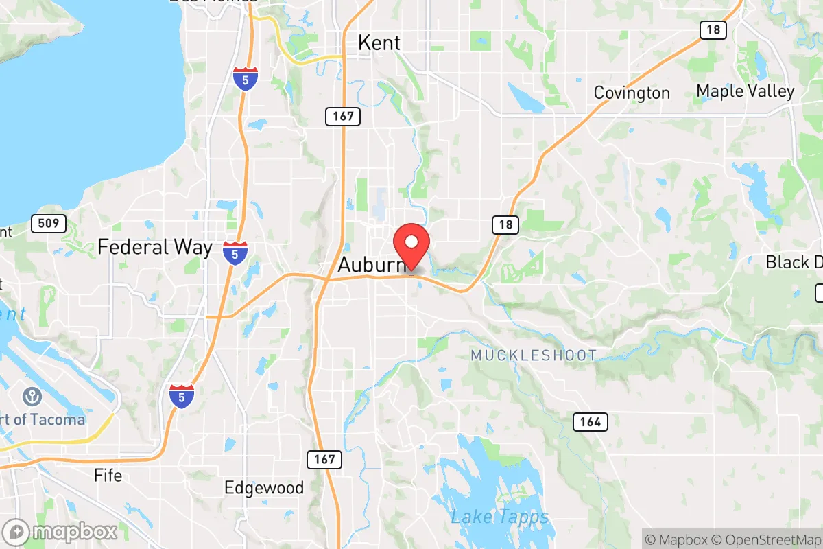
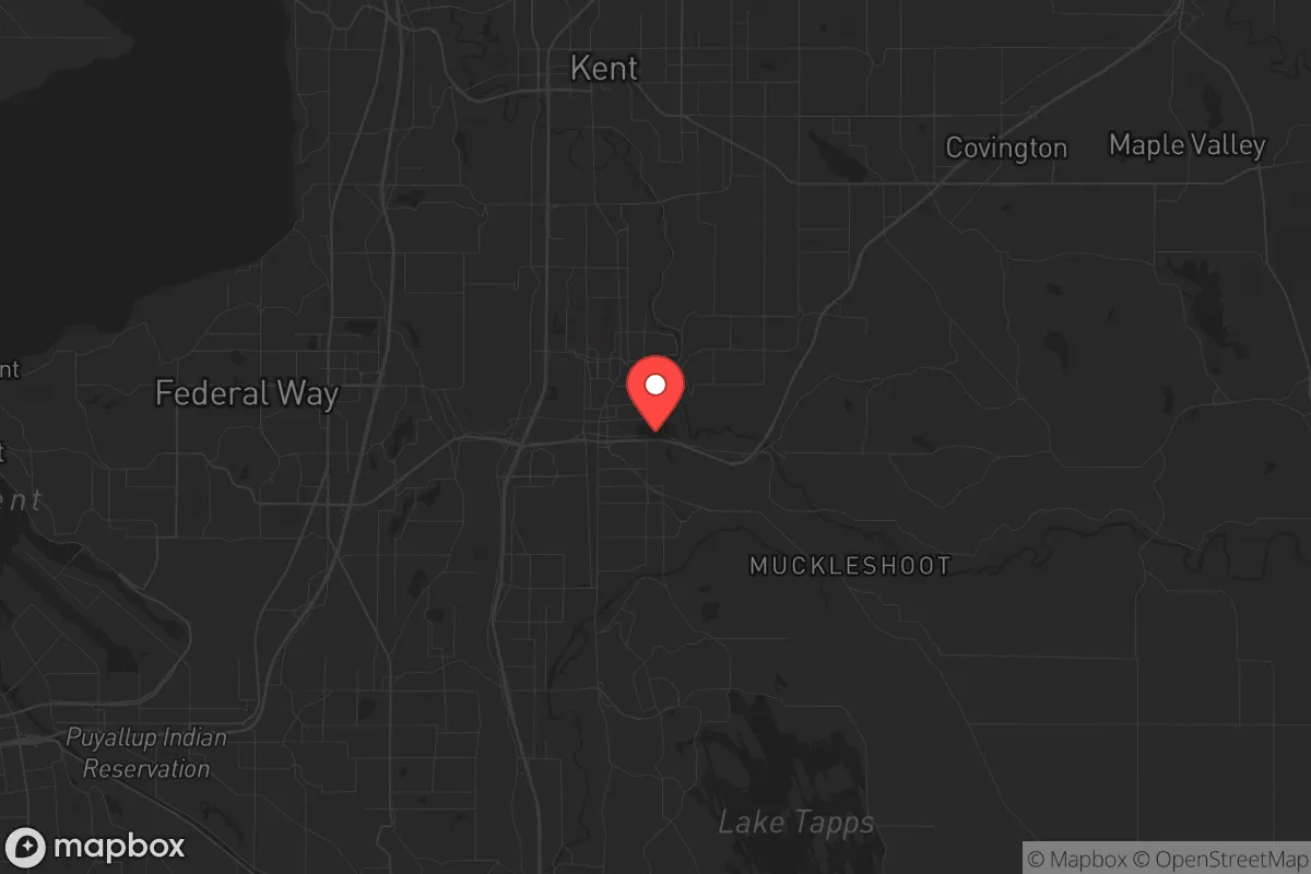
Auburn, Washington occupies a strategic position that is both a blessing and a liability for the survival-minded relocator. Nestled in the Green River Valley between Seattle and Tacoma, this city of roughly 80,000 offers proximity to critical infrastructure—Interstate 5, the BNSF Railway mainline, and Seattle-Tacoma International Airport—while sitting just far enough from the urban cores to provide a buffer zone. For the prepper assessing long-term viability, Auburn’s location at the confluence of the White and Green Rivers gives it a natural water source, but its position in a floodplain and within the blast radius of Joint Base Lewis-McChord (JBLM) introduces serious vulnerabilities that demand careful consideration.
Geographic position and natural advantages for long-term survival
Auburn’s geography offers a mix of defensive and resource-based strengths. The city sits at the southern edge of the Seattle metropolitan area, roughly 25 miles from downtown Seattle and 15 miles from Tacoma, placing it in a suburban-rural transition zone. This proximity to major population centers is a double-edged sword: it provides access to medical facilities, supply chains, and transportation hubs during stable times, but it also means Auburn lies within the likely fallout zone of any major event targeting the Puget Sound region. The Green River Valley, where Auburn is located, is a fertile agricultural corridor—the surrounding farmland and proximity to the Cascade foothills offer opportunities for subsistence farming, foraging, and hunting. The White River, which flows from Mount Rainier, provides a reliable freshwater source, though it’s subject to seasonal flooding and volcanic sediment from the glacier-fed system. The Cascade Range to the east offers escape routes into national forest land (Mount Baker-Snoqualmie National Forest is about 30 miles east), but those routes are limited by the narrow mountain passes that can become chokepoints during an evacuation. For the prepper, Auburn’s best natural advantage is its access to the Green River Watershed, which supplies drinking water to much of the region—but that same water system is a single-point-of-failure target for contamination or sabotage.
Risks, exposures, and proximity to fallout-relevant landmarks
The most significant risk for Auburn is its proximity to Joint Base Lewis-McChord, a major military installation located just 10 miles southwest. JBLM is a high-value target in any conflict scenario—it houses the I Corps headquarters, a Stryker brigade, and an airlift wing. A conventional or nuclear strike on JBLM would produce fallout that could blanket Auburn within hours, depending on wind patterns. Additionally, the Port of Tacoma and the Port of Seattle, both within 20 miles, are critical economic nodes that would be primary targets for disruption. The Seattle-Tacoma International Airport (Sea-Tac), 12 miles north, is another high-risk asset. For the survivalist, these landmarks mean Auburn is not a retreat location—it’s a staging area that could become a disaster zone quickly. The city itself has industrial zones along the Green River, including a rail yard and manufacturing facilities, which could become secondary targets or sources of hazardous material spills. The 2020 civil unrest in Seattle and Portland demonstrated how quickly urban chaos can spill into the suburbs; Auburn saw its own protests and property damage, a pattern that could repeat in a larger crisis. The city’s flood risk is also non-trivial: the Green River has a history of major floods (notably 1996, 2006, and 2009), and the Howard Hanson Dam upstream has structural concerns that could fail under extreme weather or seismic events, inundating large portions of Auburn.
Practical resilience for a relocator: food, water, energy, and defensibility
For the individual or family looking to establish a resilient household in Auburn, the practical challenges are substantial but not insurmountable. Water security is the most critical issue: the city’s municipal water comes from the Green River, treated at the Lake Youngs facility. In a grid-down scenario, this system would fail within hours. A well is not a realistic option for most Auburn properties due to the shallow water table and floodplain geology, so preppers must rely on rainwater catchment (legal in Washington, but with restrictions) and stored water. The Green River itself is accessible but requires filtration and treatment for sediment and potential industrial contaminants. Food production is more viable: the surrounding agricultural land (particularly in the Enumclaw plateau to the east) supports dairy, hay, and vegetable farms. Auburn’s climate—mild, wet winters and dry summers—allows for year-round gardening with season extension techniques. The city’s zoning allows for backyard chickens and small livestock in most residential areas, though HOA restrictions may apply. Energy independence is hampered by the region’s heavy cloud cover, which reduces solar panel efficiency by 30-40% compared to sunnier states. Micro-hydro from the White River is possible for properties with water rights, but that’s rare. A propane generator with a buried tank is the most practical backup for most households. Defensibility is Auburn’s weakest point: the city is a grid of suburban streets with multiple ingress/egress points, making it hard to secure a perimeter. The best defensive strategy is to choose a property on the eastern edge, near the Cascade foothills, where rural roads offer better chokepoints and escape routes into the forest. The Auburn Police Department is well-staffed for a city its size (about 1.5 officers per 1,000 residents), but in a crisis, response times would stretch thin, and the city’s proximity to Seattle means it could see an influx of refugees from the urban core.
The overall strategic picture for Auburn is one of calculated risk. It offers the resources and infrastructure to support a prepared household during normal times, but its location within the Puget Sound urban corridor makes it a poor choice for a long-term retreat. For the conservative prepper who values community, access to supplies, and a buffer from the worst of urban decay, Auburn can work as a base of operations—provided you have a bug-out plan for the Cascades and a robust stockpile of water, food, and medical supplies. The city’s best use is as a transitional location: a place to build skills, network with like-minded locals, and scout more defensible property in the foothills or eastern Washington. If the goal is true self-sufficiency and isolation from fallout risks, look further east past the Cascades. But if you need to stay within striking distance of employment and supply chains while maintaining a prepper mindset, Auburn is a workable compromise—just don’t mistake it for a fortress.
* Values derived from national, state, county, city and local statistics and may differ in a specific area. Last updated: 2026-04-21T11:11:02.000Z
Narrative content on this page is AI-generated and may contain mistakes. Verify any details that matter before acting on them.
ReloMaps may earn a commission from affiliate links at no extra cost to you.