Photo: Wikipedia
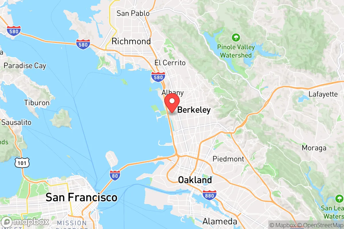
Strategic Assessment of Berkeley, CA
High tactical risk. This location is likely close to major population centers, strategic targets, or sits in a high-disaster corridor. A retreat property and careful exit planning is required.
What does the Strategic Assessment tell us?
Our Strategic Assessment grades tactical survivability of an area. Major population centers, military targets, fallout zones, natural disasters, and border exposure all drive risk — lower exposure means a more defensible position in a crisis.
This is heavily inspired by Joel Skousen's Strategic Relocation book. Highly recommended you checkout the book ($)What does this tell us?
Our Strategic Assessment grades tactical survivability of an area. Major population centers, military targets, fallout zones, natural disasters, and border exposure all drive risk — lower exposure means a more defensible position in a crisis.
This is heavily inspired by Joel Skousen's Strategic Relocation book. Highly recommended you checkout the book ($)Strategic Pillars

Key Distances
Regional Safe Places
Below is our recommended "safe zones" in California and the surrounding area based on our strategic heuristics. For most people, it's unrealistic to live in a “safe zone” full-time due to work, family or other personal reasons. They tend to be more rural. However, many of these areas are perfect for second homes and retreat properties that double as a vacation home or even a short-term rental.


Important Note: For informational purposes only. This does not mean nothing bad ever happens in the green zones. Please use common sense. This is based on public data and modeled with AI. We tried to take a conservative approach but mistakes happen. We update this regularly as new information becomes available.
Solar Generator Recommendations
Backup power matters more here than in safer locations. We've picked three solar generators across budgets and capacity tiers — start with the budget unit if you only need a few essentials, or step up if you want to run a fridge and HVAC for days at a time.

Jackery Portable Power Station Explorer 300
Budget OptionPower on the Go: Weighing only 11 lbs, it's convenient to set up and store with book-sized foldable solar panels

BLUETTI Portable Power Station AC180
Designed for both indoor and outdoor scenarios, AC180 is highly capable as it has a robost capacity and continuous output power.

EF ECOFLOW DELTA Pro Ultra Power Station
Upgraded PickEcoFlow DELTA Pro Ultra is a whole-home energy system designed to grow with your family. Integrated with the Smart Home Panel 2, it scales to meet your evolving energy needs — keeping your home powered, intelligent, and secure through every stage of life.
We earn a commission, at no additional cost to you.
Strategic Assessment Analysis
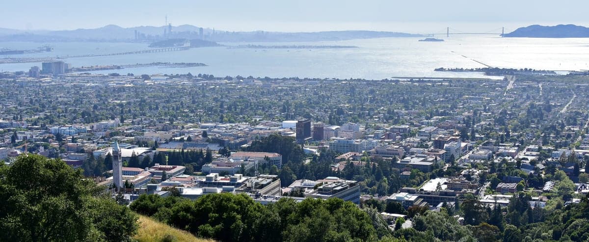
Berkeley, California, presents a complex strategic picture for the conservative prepper or survivalist. While its location on the eastern shore of San Francisco Bay offers some natural defensive advantages and access to water, its position within the densely populated, politically volatile Bay Area megaregion creates severe liabilities for long-term resilience. The city’s proximity to major economic and military targets, combined with its own high-density urban fabric and progressive governance, makes it a high-risk location for anyone prioritizing self-sufficiency and security in the event of widespread civic unrest or a major disaster.
Geographic position and natural defensive advantages
Berkeley’s geography is a double-edged sword. The city sits at the base of the Berkeley Hills, which rise sharply to the east, providing a natural barrier against overland approach from that direction. The San Francisco Bay to the west offers a potential water source and a route for evacuation or resupply by boat, though the bay itself is a contested and heavily monitored body of water. The hills also provide elevated vantage points for observation and communication, a significant tactical advantage. However, the same hills create a severe wildfire risk, with the 1991 Oakland-Berkeley firestorm serving as a grim reminder of how quickly the area can become an inferno. The city’s position on the Hayward Fault also means a major earthquake could sever roads, water lines, and power grids simultaneously, turning the hills into a trap rather than a fortress. For a relocator, the natural advantages are real but heavily offset by the region’s seismic and fire hazards.
Risks, exposures, and proximity to fallout-relevant landmarks
Berkeley’s strategic liabilities are dominated by its location within the Bay Area, a region packed with high-value targets. The city is roughly 10 miles from the Port of Oakland, a major shipping hub and potential chokepoint for supply chains. It is 15 miles from the San Francisco Financial District, a likely epicenter for civil unrest or a cyber-attack targeting the financial system. The Lawrence Berkeley National Laboratory sits in the hills above the city, a federal research facility that could be a target for sabotage or a source of hazardous material release. The University of California, Berkeley campus itself is a dense population center and a frequent flashpoint for political protests, which could escalate into violence during a national crisis. Furthermore, the city’s proximity to the San Francisco Bay means it is downwind of potential fallout from a strike on the Port of Oakland or the Naval Air Station Alameda (now largely decommissioned but still a symbolic target). For a survivalist, the concentration of political, economic, and scientific assets within a 20-mile radius makes Berkeley a high-exposure location.
Practical resilience for a relocator: food, water, energy, and defensibility
When assessing practical resilience, Berkeley scores poorly on most fronts. Food security is a major concern. The city relies almost entirely on just-in-time supply chains from the Central Valley and beyond. Local grocery stores would be stripped within 48 hours of a disruption. While there are farmers’ markets and some community gardens, they cannot support the city’s 120,000 residents. Water access is a mixed bag. The city draws from the East Bay Municipal Utility District (EBMUD), which relies on the Mokelumne River watershed in the Sierra Nevada. A major earthquake could rupture the aqueducts, cutting off supply for weeks. The bay itself is saltwater and requires desalination, which demands energy. Creeks like Strawberry Creek run through the city, but they are seasonal and heavily polluted in urban stretches. Energy is a vulnerability. PG&E’s grid is notoriously fragile, with public safety power shutoffs (PSPS) already a regular occurrence during high-wind events. Solar is viable on the hills, but battery storage is expensive and subject to theft. Defensibility is the weakest point. Berkeley is a dense, walkable city with a grid street pattern that offers few natural chokepoints. The hills provide some defensible terrain, but the flatlands near the bay are wide open. The city’s political culture is overwhelmingly progressive, meaning that in a crisis, you are likely to be surrounded by a population that is not armed, not trained, and not inclined toward self-reliance. For a relocator, the combination of food fragility, water dependence, grid instability, and low community resilience makes Berkeley a poor choice for long-term survival.
The overall strategic picture for Berkeley is one of high risk with limited reward. Its natural beauty and academic prestige are irrelevant when the grid goes down or civil unrest spills into the streets. The city’s location within a dense, politically charged megaregion, its proximity to multiple high-value targets, and its own lack of practical resilience make it a location to avoid for anyone serious about preparedness. If you are considering the Bay Area, look instead to the outer ring—places like Sonoma County, the Sierra foothills, or even the Central Coast—where population density drops, defensible terrain improves, and the political climate is more aligned with self-sufficiency. Berkeley is a place to visit for a lecture, not to hunker down for a collapse.
* Values derived from national, state, county, city and local statistics and may differ in a specific area. Last updated: 2026-05-02T04:54:29.000Z
Narrative content on this page is AI-generated and may contain mistakes. Verify any details that matter before acting on them.
ReloMaps may earn a commission from affiliate links at no extra cost to you.