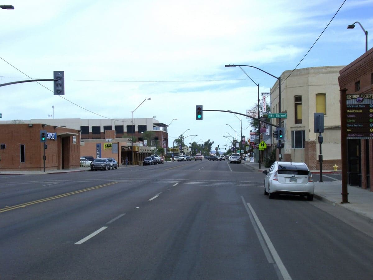
Photo: Wikipedia
Strategic Assessment of Buckeye, AZ
Multiple tactical vulnerabilities. Population density, target proximity, or disaster risk are likely compounding. A retreat property and exit planning is required.
What does the Strategic Assessment tell us?
Our Strategic Assessment grades tactical survivability of an area. Major population centers, military targets, fallout zones, natural disasters, and border exposure all drive risk — lower exposure means a more defensible position in a crisis.
This is heavily inspired by Joel Skousen's Strategic Relocation book. Highly recommended you checkout the book ($)What does this tell us?
Our Strategic Assessment grades tactical survivability of an area. Major population centers, military targets, fallout zones, natural disasters, and border exposure all drive risk — lower exposure means a more defensible position in a crisis.
This is heavily inspired by Joel Skousen's Strategic Relocation book. Highly recommended you checkout the book ($)Strategic Pillars

Key Distances
Regional Safe Places
Below is our recommended "safe zones" in Arizona and the surrounding area based on our strategic heuristics. For most people, it's unrealistic to live in a “safe zone” full-time due to work, family or other personal reasons. They tend to be more rural. However, many of these areas are perfect for second homes and retreat properties that double as a vacation home or even a short-term rental.
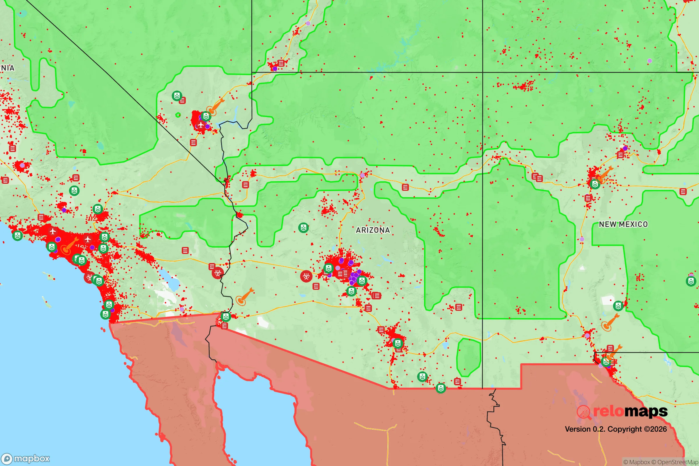
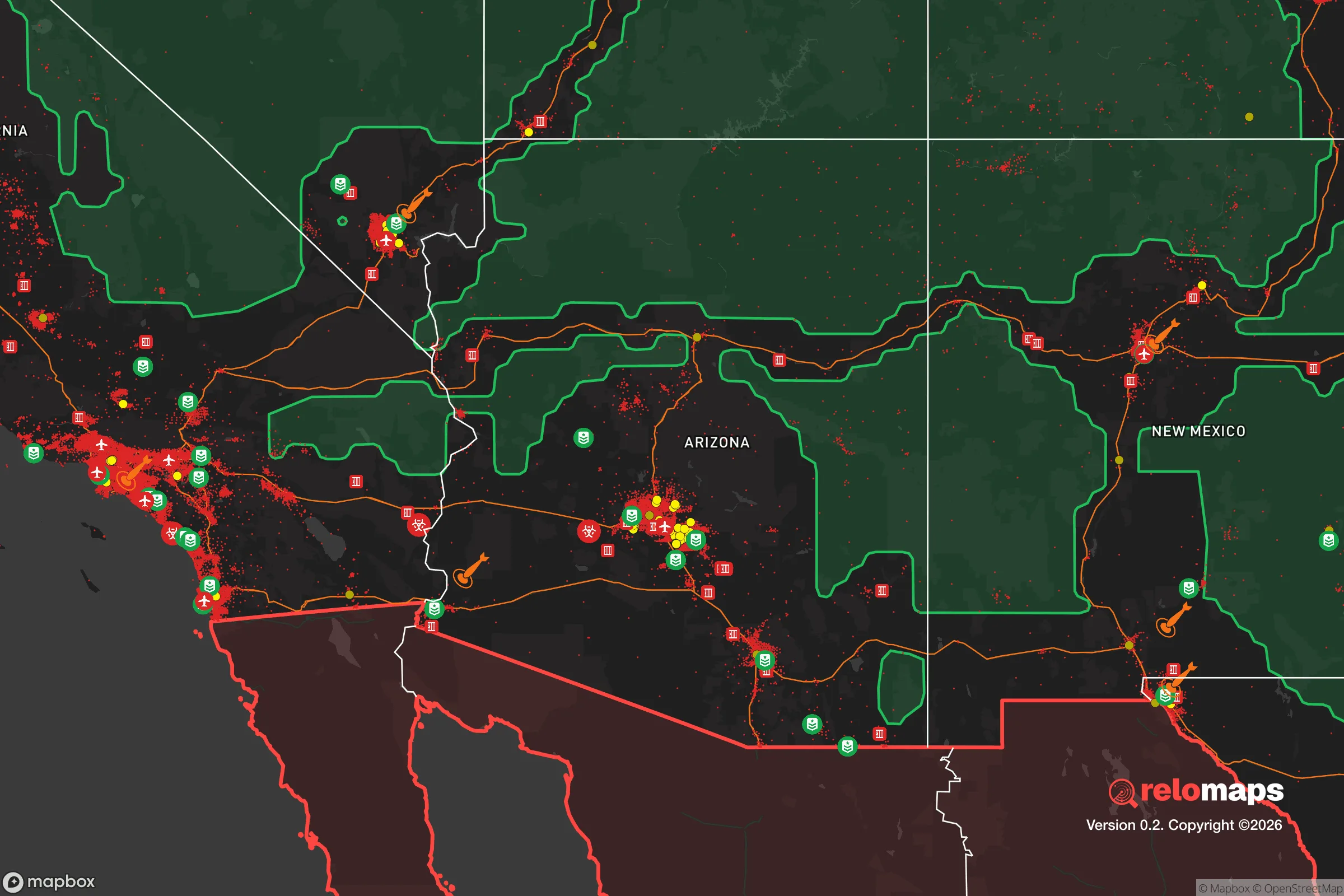
Important Note: For informational purposes only. This does not mean nothing bad ever happens in the green zones. Please use common sense. This is based on public data and modeled with AI. We tried to take a conservative approach but mistakes happen. We update this regularly as new information becomes available.
Solar Generator Recommendations
Backup power matters more here than in safer locations. We've picked three solar generators across budgets and capacity tiers — start with the budget unit if you only need a few essentials, or step up if you want to run a fridge and HVAC for days at a time.

Jackery Portable Power Station Explorer 300
Budget OptionPower on the Go: Weighing only 11 lbs, it's convenient to set up and store with book-sized foldable solar panels

BLUETTI Portable Power Station AC180
Designed for both indoor and outdoor scenarios, AC180 is highly capable as it has a robost capacity and continuous output power.

EF ECOFLOW DELTA Pro Ultra Power Station
Upgraded PickEcoFlow DELTA Pro Ultra is a whole-home energy system designed to grow with your family. Integrated with the Smart Home Panel 2, it scales to meet your evolving energy needs — keeping your home powered, intelligent, and secure through every stage of life.
We earn a commission, at no additional cost to you.
Strategic Assessment Analysis
Buckeye, Arizona, presents a mixed strategic picture for the conservative prepper or survivalist. Its rapid growth and proximity to Phoenix offer economic opportunity, but that same proximity introduces significant vulnerabilities in a crisis scenario. The area’s resilience is heavily dependent on its ability to secure water, energy, and supply lines independent of the sprawling Maricopa County metroplex, a challenge that becomes acute when considering the region’s exposure to both natural and man-made threats.
Geographic position and natural advantages for long-term survival
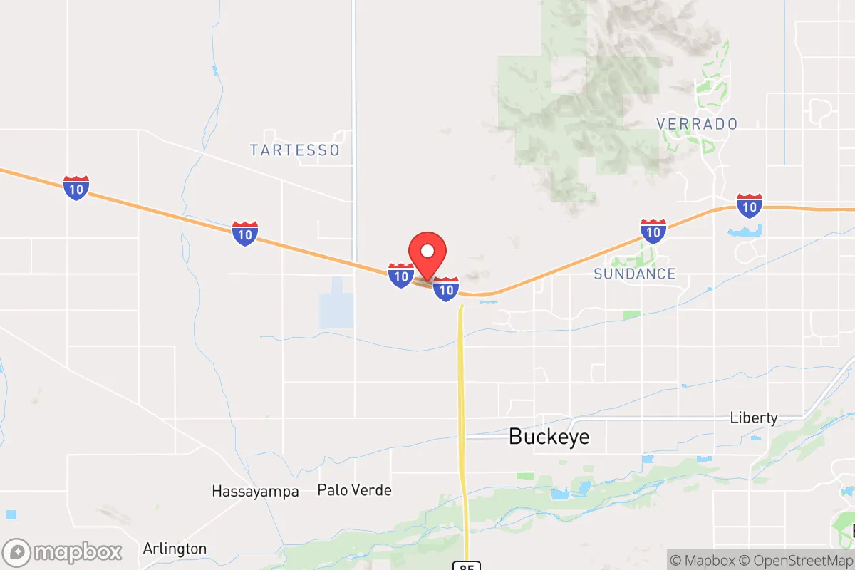
Buckeye sits at the western edge of the Phoenix metropolitan area, roughly 35 miles from downtown Phoenix. This location offers a buffer from the immediate chaos of a major urban collapse, but it is not remote. The surrounding landscape is Sonoran Desert, characterized by flat plains and low mountain ranges. The primary natural advantage is the Harquahala and Belmont mountain ranges to the west and north, which provide some degree of visual and physical screening from the densest population centers. The area’s elevation, around 830 feet, offers little relief from summer heat, which is a critical factor for off-grid living. Water is the single most limiting factor. The region relies on the Central Arizona Project (CAP) canal and the Salt River Project for its municipal supply. For a relocator, access to a private well with a deep, reliable aquifer is the difference between a viable retreat and a death trap. The Hassayampa River, a mostly dry wash, runs through the area and can flash flood, but it is not a reliable year-round surface water source. The natural advantages are limited to space and relative isolation from the immediate urban core, not to abundant natural resources.
Risks, exposures, and proximity to fallout-relevant landmarks
The most significant risk for a Buckeye-based prepper is its location within the Phoenix metroplex. In a scenario of civil unrest or a mass casualty event, the population of over 1.6 million people in the greater Phoenix area would likely attempt to flee outward. Interstate 10, the primary east-west artery, runs directly through Buckeye, making it a natural chokepoint for evacuation traffic and a potential vector for looting or refugee flow. The city’s rapid growth means many new subdivisions are built on former farmland, with limited natural barriers to movement. Proximity to Luke Air Force Base, roughly 20 miles east, is a double-edged sword: it provides a potential military response capability but also makes the area a target for any adversary seeking to disrupt air operations. The Palo Verde Nuclear Generating Station, the largest nuclear power plant in the country, is located about 50 miles west of Buckeye. While the plant has robust containment, a catastrophic failure or a deliberate attack could render large portions of western Maricopa County uninhabitable for years. Buckeye falls within the 50-mile emergency planning zone (EPZ) for Palo Verde, meaning a radiological release would require evacuation or sheltering, with prevailing winds potentially carrying fallout directly over the area. Additionally, the region is prone to extreme heat, drought, and the occasional catastrophic wildfire in the surrounding Tonto and Prescott National Forests, which can degrade air quality and threaten power lines.
Practical resilience for a relocator: food, water, energy, and defensibility
For a relocator serious about self-sufficiency, Buckeye demands a high level of preparation. Water storage is non-negotiable. A minimum of 55 gallons per person for two weeks is a baseline, but given the desert climate and potential for supply chain disruption, a 1,000-gallon tank or more is prudent. Rainwater harvesting is possible but yields are low (roughly 8 inches per year). A deep well, if permitted and financially feasible, is the gold standard. Food production is challenging due to the intense summer heat and alkaline soil. Raised beds with imported soil, shade cloth, and drip irrigation are required for any serious gardening. Hydroponics or aquaponics in a controlled environment (a greenhouse or indoor setup) is a more reliable path to year-round food production. Energy independence is achievable. Solar is excellent, with over 300 sunny days per year. A grid-tied system with battery backup (like Tesla Powerwall or a DIY lithium bank) can keep critical loads running during grid outages, which are common during summer monsoon storms. For off-grid living, a larger solar array (10kW+) with a generator backup for extended cloudy periods is recommended. Defensibility is a concern. Most Buckeye subdivisions are built on flat, open land with minimal cover. A rural property with a long driveway, perimeter fencing, and a clear field of view is far more defensible than a cookie-cutter subdivision home. The ideal setup is a property with a well, solar, and a septic system on at least 5-10 acres, located away from major roads and the I-10 corridor. Community resilience is weak; the area is growing so fast that many residents are newcomers with no deep ties, making mutual aid networks harder to establish.
The overall strategic picture for Buckeye is one of calculated risk. It offers a foothold in the Southwest with decent solar resources and space, but it is not a standalone survival location. The reliance on the CAP canal for water, the proximity to a nuclear power plant, and the vulnerability to urban refugee flows from Phoenix are serious liabilities. For a prepper willing to invest heavily in water storage, off-grid energy, and a defensible property, Buckeye can work as a base of operations. However, it is not a bug-out location. For those seeking true strategic depth, the higher elevations of northern Arizona (Prescott, Flagstaff) or the remote areas of eastern Arizona (Greenlee County) offer far better natural defenses, water availability, and distance from major targets. Buckeye is a compromise: close enough to urban resources for day-to-day life, but requiring significant preparation to survive a major disruption. It is a location for the prepared, not the casual relocator.
* Values derived from national, state, county, city and local statistics and may differ in a specific area. Last updated: 2026-05-04T00:16:11.000Z
Narrative content on this page is AI-generated and may contain mistakes. Verify any details that matter before acting on them.
ReloMaps may earn a commission from affiliate links at no extra cost to you.