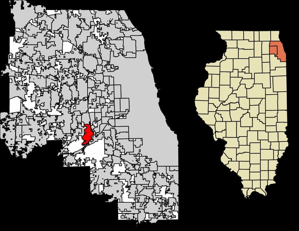
Photo: Wikipedia
Strategic Assessment of Burr Ridge, IL
Multiple tactical vulnerabilities. Population density, target proximity, or disaster risk are likely compounding. A retreat property and exit planning is required.
What does the Strategic Assessment tell us?
Our Strategic Assessment grades tactical survivability of an area. Major population centers, military targets, fallout zones, natural disasters, and border exposure all drive risk — lower exposure means a more defensible position in a crisis.
This is heavily inspired by Joel Skousen's Strategic Relocation book. Highly recommended you checkout the book ($)What does this tell us?
Our Strategic Assessment grades tactical survivability of an area. Major population centers, military targets, fallout zones, natural disasters, and border exposure all drive risk — lower exposure means a more defensible position in a crisis.
This is heavily inspired by Joel Skousen's Strategic Relocation book. Highly recommended you checkout the book ($)Strategic Pillars

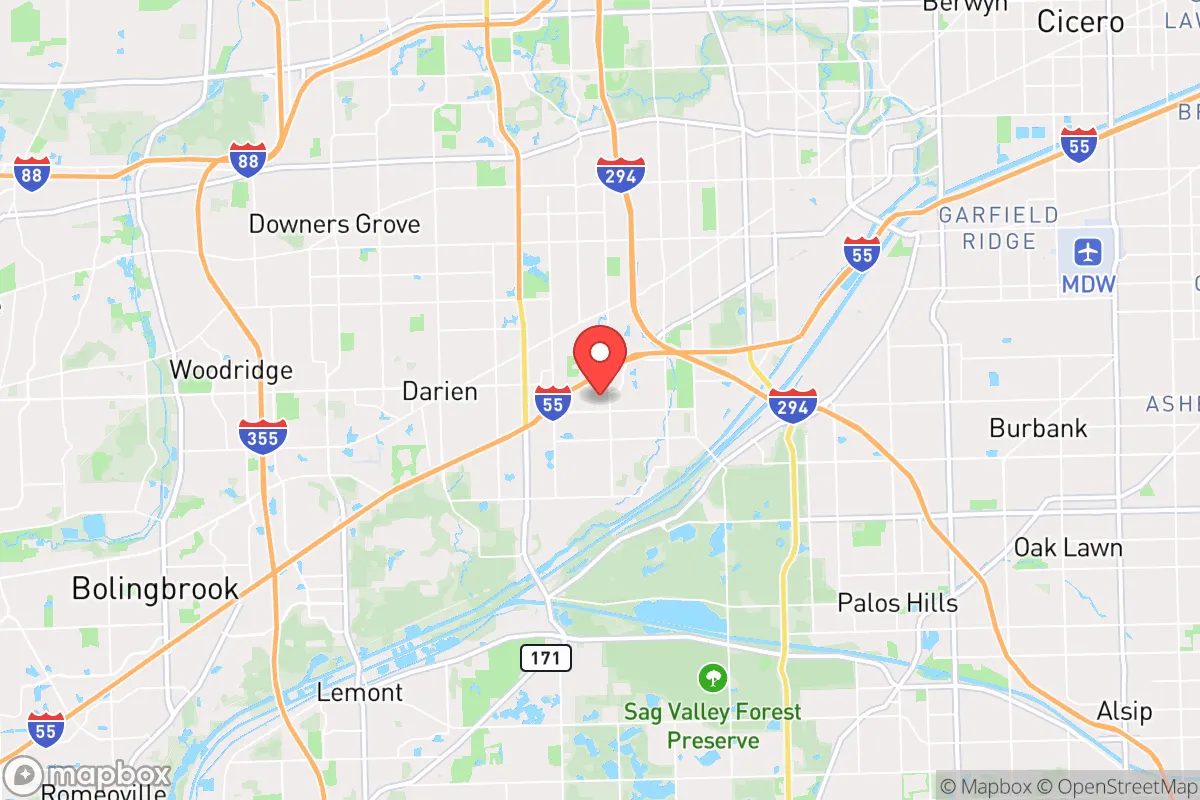
Key Distances
Regional Safe Places
Below is our recommended "safe zones" in Illinois and the surrounding area based on our strategic heuristics. For most people, it's unrealistic to live in a “safe zone” full-time due to work, family or other personal reasons. They tend to be more rural. However, many of these areas are perfect for second homes and retreat properties that double as a vacation home or even a short-term rental.
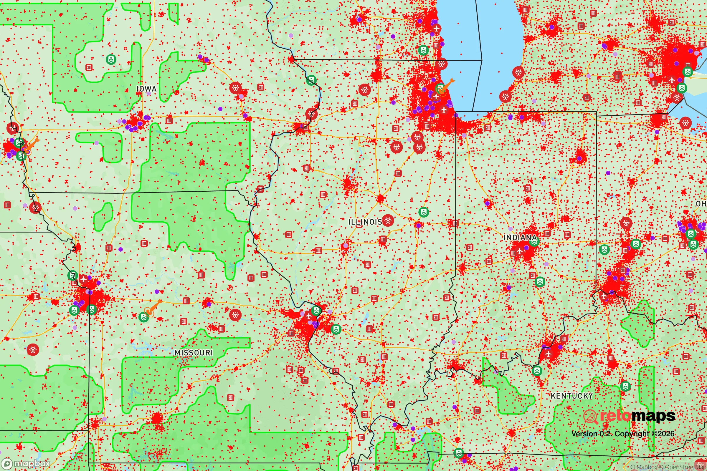
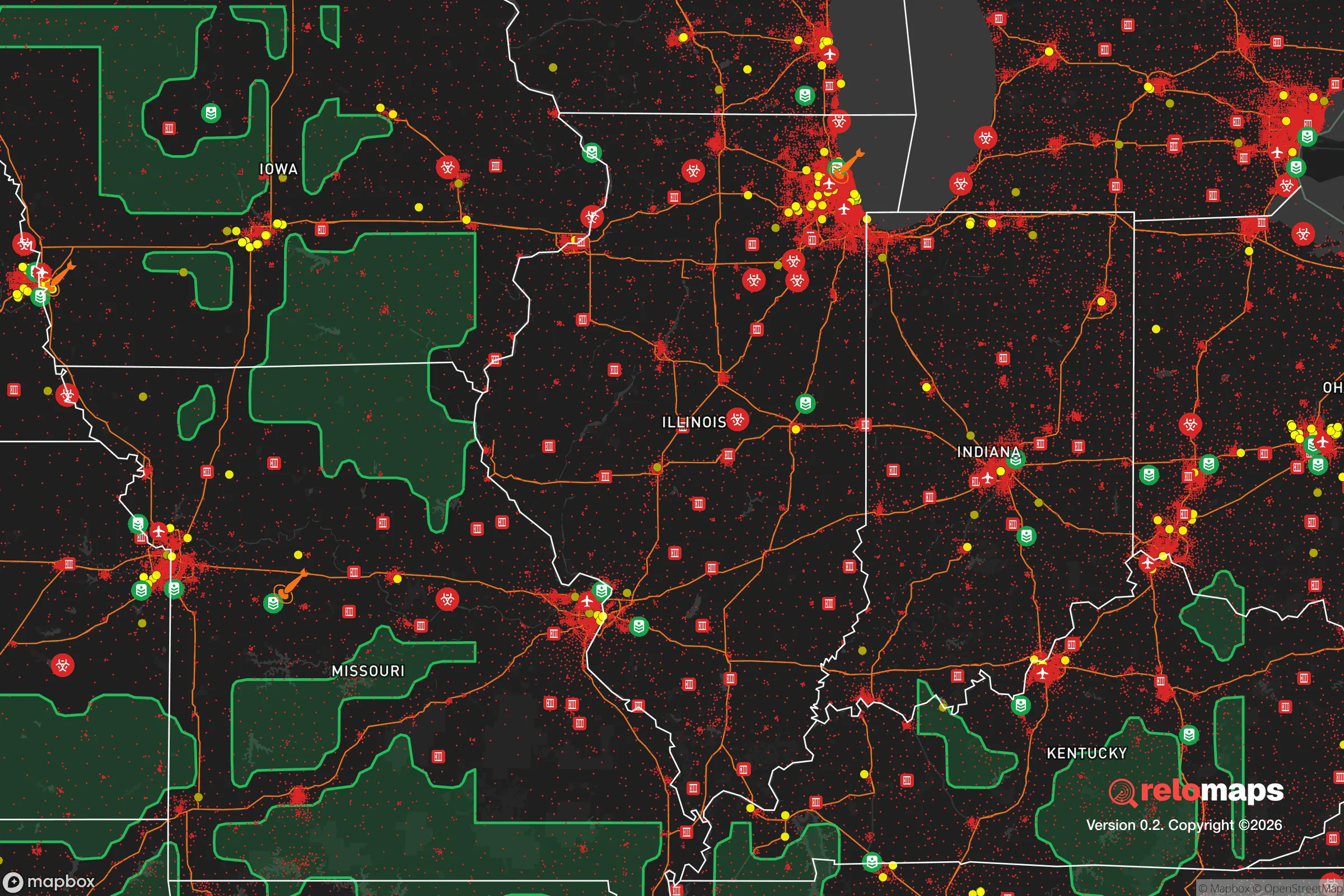
Important Note: For informational purposes only. This does not mean nothing bad ever happens in the green zones. Please use common sense. This is based on public data and modeled with AI. We tried to take a conservative approach but mistakes happen. We update this regularly as new information becomes available.
Solar Generator Recommendations
Backup power matters more here than in safer locations. We've picked three solar generators across budgets and capacity tiers — start with the budget unit if you only need a few essentials, or step up if you want to run a fridge and HVAC for days at a time.

Jackery Portable Power Station Explorer 300
Budget OptionPower on the Go: Weighing only 11 lbs, it's convenient to set up and store with book-sized foldable solar panels

BLUETTI Portable Power Station AC180
Designed for both indoor and outdoor scenarios, AC180 is highly capable as it has a robost capacity and continuous output power.

EF ECOFLOW DELTA Pro Ultra Power Station
Upgraded PickEcoFlow DELTA Pro Ultra is a whole-home energy system designed to grow with your family. Integrated with the Smart Home Panel 2, it scales to meet your evolving energy needs — keeping your home powered, intelligent, and secure through every stage of life.
We earn a commission, at no additional cost to you.
Strategic Assessment Analysis
Burr Ridge, Illinois, occupies a unique strategic position that balances proximity to Chicago’s economic engine with a degree of geographic insulation that appeals to those prioritizing resilience. Located roughly 20 miles southwest of the Loop, this affluent village sits atop the steep bluffs overlooking the Des Plaines River valley—a natural elevation advantage that provides both physical separation from flood-prone lowlands and a defensible high-ground posture. For a relocator concerned with civic unrest or mass casualty events, Burr Ridge’s low population density (roughly 10,500 residents across 7.3 square miles), its lack of major through-highways within the village core, and its established tree canopy offer a quieter, more controllable environment than the dense suburbs closer to the city. The village’s median household income exceeds $200,000, which translates into well-maintained infrastructure, private security presence in many subdivisions, and a tax base that can sustain emergency services without relying on Cook County’s strained budget—a tangible resilience factor when considering supply chain disruptions or local government failures.
Geographic position and natural defensive advantages
Burr Ridge’s most underrated asset is its topography. The village straddles the steep eastern bluff of the Des Plaines River valley, with elevations reaching 650 feet above sea level—roughly 100 feet higher than the surrounding floodplain. This elevation provides natural drainage, reduces wildfire risk (unlike western states), and offers visual line-of-sight advantages for anyone monitoring approach routes. The village is bounded on the west by the Des Plaines River and the Cook County Forest Preserve system, creating a natural buffer zone that limits vehicular access from that direction. To the east, Interstate 55 and the BNSF Railway line form a linear barrier, while the north and south are bordered by other affluent communities (Hinsdale and Willowbrook) that share similar demographic profiles. For a prepper mindset, this creates a funnel effect: only a handful of two-lane roads (County Line Road, 79th Street, and Plainfield Road) provide entry points, all of which can be monitored or physically blocked if needed. The village’s zoning is almost entirely residential on large lots (minimum 1-acre in many areas), meaning no industrial targets, no rail yards, and no chemical storage facilities within the immediate vicinity—a stark contrast to the refineries and rail hubs of nearby Joliet or the freight corridors of Bedford Park.
Risks, exposures, and proximity to fallout-relevant landmarks
The primary strategic liability of Burr Ridge is its location within the Chicago metropolitan area’s outer ring. While the village itself is low-risk, it sits within a 10-mile radius of several high-value targets that could attract civil unrest or secondary effects from a mass casualty event. The Argonne National Laboratory in Lemont is 8 miles southwest—a federal research facility that, while not a nuclear reactor, houses sensitive materials and could become a focal point for protest or security lockdown. The Chicago Sanitary and Ship Canal, running 5 miles west, is a critical piece of regional infrastructure that, if compromised, could disrupt water supply and transportation. More immediately, Interstate 55, which forms Burr Ridge’s eastern boundary, is a major evacuation route out of Chicago. In a crisis scenario, this road could become clogged with refugees or blocked by checkpoints, potentially isolating the village from supply routes to the south and west. The village also lies within 15 miles of Chicago Midway International Airport, a potential target for terrorism or civil aviation incidents. However, the prevailing winds in the region blow from the west-southwest, meaning fallout from a Chicago-centric event would likely drift toward Lake Michigan and Indiana, not directly over Burr Ridge. The real risk is not direct blast or contamination but the secondary wave of displaced populations, resource scarcity, and law enforcement diversion that would follow any major urban disruption.
Practical resilience for a relocator: food, water, energy, and defensibility
For someone serious about self-sufficiency, Burr Ridge offers a mixed picture. The village’s water supply comes from Lake Michigan via the Chicago water system, which is a centralized vulnerability—a single point of failure that could be compromised by cyberattack, infrastructure failure, or contamination. However, the village’s elevation and lot sizes (many properties are 1-5 acres) make private well drilling feasible, though it requires permits and geological assessment. The Des Plaines River is a nearby surface water source, but it carries industrial runoff from upstream communities and would require extensive filtration. Food resilience is more promising: the surrounding area includes active farmland in Will and Grundy counties within a 30-minute drive, and the village itself has several community gardens and farmers’ markets during growing season. For long-term storage, the large basements common in Burr Ridge homes (built on clay soil with minimal flood risk) provide excellent conditions for canned goods, freeze-dried stores, and water barrels. Energy resilience is a weak point—the grid is served by ComEd, which has experienced outages during severe storms (notably the 2020 derecho and 2023 ice storms). Solar panel installation is permitted but not incentivized at the village level, and natural gas is the primary heating fuel, meaning reliance on pipeline infrastructure. Defensibility is the village’s strongest suit: the combination of limited entry points, a well-funded police department (with mutual aid agreements with Hinsdale and Darien), and a population that is overwhelmingly law-abiding and armed (Illinois has a concealed carry rate of roughly 3% of adults, but in Burr Ridge that figure is likely higher given demographics) creates a community that could organize effectively for self-defense. The village’s homeowners’ associations in subdivisions like The Gates and Burr Ridge Estates already maintain private security patrols, which could be repurposed for neighborhood watch in a crisis.
The overall strategic picture for Burr Ridge is one of calculated trade-offs. It is not a remote bug-out location—it is a suburban enclave that offers a high baseline of safety and resources but remains tethered to the vulnerabilities of the Chicago region. For a relocator who wants to maintain professional employment (many residents commute to Chicago or Oak Brook) while having a defensible home base with good soil, elevation, and community cohesion, Burr Ridge is a strong candidate. The key is to treat it as a layered defense: invest in private water and energy backups, build relationships with neighbors who share your preparedness mindset, and have a secondary plan for relocating further south (toward the Shawnee National Forest or the Missouri Ozarks) if the Chicago metro area becomes untenable. The village’s real value lies in its ability to weather the first 30-90 days of a crisis without descending into chaos—a window that gives a prepared individual time to assess and act. It is not a fortress, but it is a well-positioned forward operating base for those who understand that resilience is a process, not a destination.
* Values derived from national, state, county, city and local statistics and may differ in a specific area. Last updated: 2026-04-27T14:43:14.000Z
Narrative content on this page is AI-generated and may contain mistakes. Verify any details that matter before acting on them.
ReloMaps may earn a commission from affiliate links at no extra cost to you.