Photo: Wikipedia
Strategic Assessment of Conway, SC
Multiple tactical vulnerabilities. Population density, target proximity, or disaster risk are likely compounding. A retreat property and exit planning is required.
What does the Strategic Assessment tell us?
Our Strategic Assessment grades tactical survivability of an area. Major population centers, military targets, fallout zones, natural disasters, and border exposure all drive risk — lower exposure means a more defensible position in a crisis.
This is heavily inspired by Joel Skousen's Strategic Relocation book. Highly recommended you checkout the book ($)What does this tell us?
Our Strategic Assessment grades tactical survivability of an area. Major population centers, military targets, fallout zones, natural disasters, and border exposure all drive risk — lower exposure means a more defensible position in a crisis.
This is heavily inspired by Joel Skousen's Strategic Relocation book. Highly recommended you checkout the book ($)Strategic Pillars

Key Distances
Regional Safe Places
Below is our recommended "safe zones" in South Carolina and the surrounding area based on our strategic heuristics. For most people, it's unrealistic to live in a “safe zone” full-time due to work, family or other personal reasons. They tend to be more rural. However, many of these areas are perfect for second homes and retreat properties that double as a vacation home or even a short-term rental.


Important Note: For informational purposes only. This does not mean nothing bad ever happens in the green zones. Please use common sense. This is based on public data and modeled with AI. We tried to take a conservative approach but mistakes happen. We update this regularly as new information becomes available.
Solar Generator Recommendations
Backup power matters more here than in safer locations. We've picked three solar generators across budgets and capacity tiers — start with the budget unit if you only need a few essentials, or step up if you want to run a fridge and HVAC for days at a time.

Jackery Portable Power Station Explorer 300
Budget OptionPower on the Go: Weighing only 11 lbs, it's convenient to set up and store with book-sized foldable solar panels

BLUETTI Portable Power Station AC180
Designed for both indoor and outdoor scenarios, AC180 is highly capable as it has a robost capacity and continuous output power.

EF ECOFLOW DELTA Pro Ultra Power Station
Upgraded PickEcoFlow DELTA Pro Ultra is a whole-home energy system designed to grow with your family. Integrated with the Smart Home Panel 2, it scales to meet your evolving energy needs — keeping your home powered, intelligent, and secure through every stage of life.
We earn a commission, at no additional cost to you.
Strategic Assessment Analysis
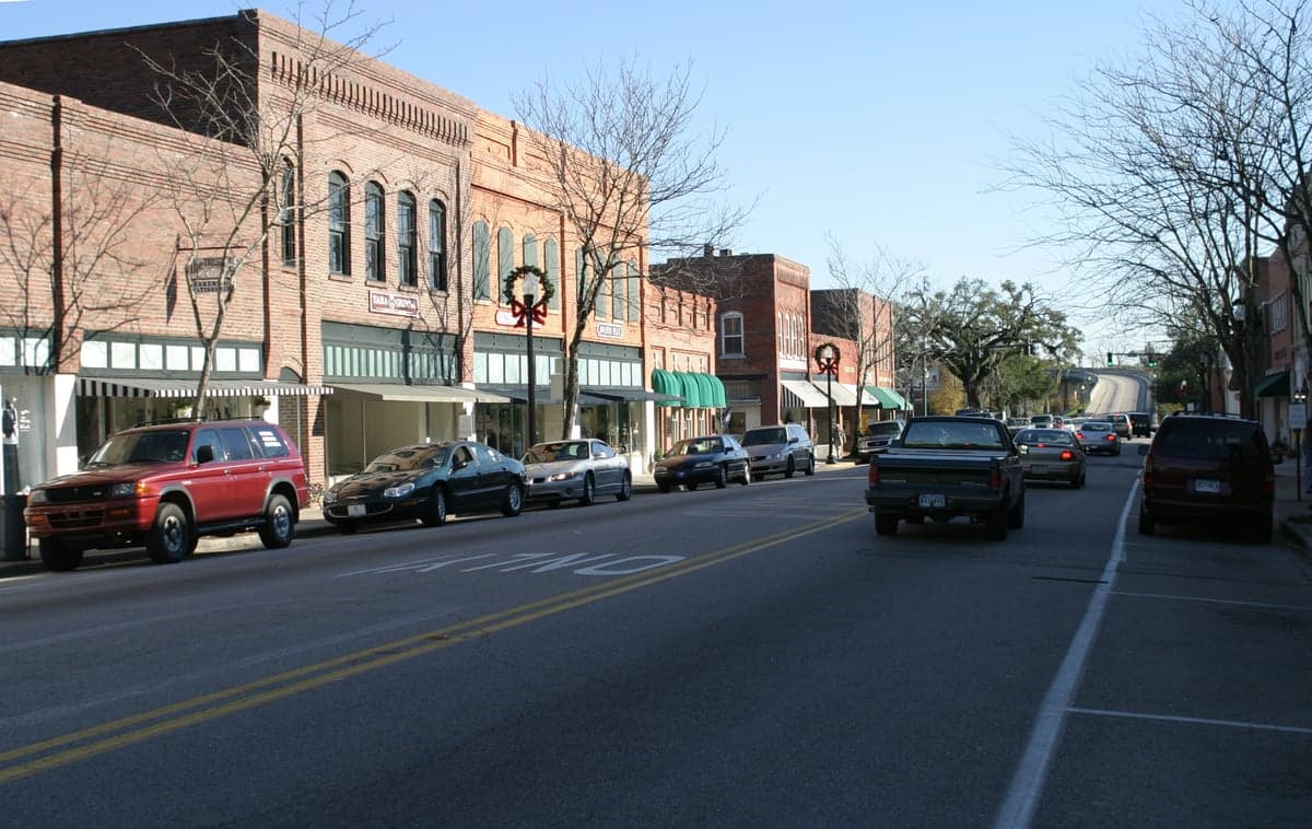
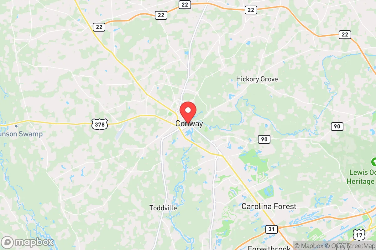
Conway, South Carolina, presents a mixed strategic picture for the conservative prepper or survivalist. Its inland location, roughly 14 miles from the Atlantic coast and 25 miles from Myrtle Beach, offers a buffer against direct hurricane storm surge while still providing access to coastal resources. The city sits on the Waccamaw River, a natural water source, and is surrounded by the sprawling Francis Marion National Forest, which offers both a resource base and a potential retreat zone. However, Conway’s proximity to the Myrtle Beach metropolitan area—a high-density tourist hub with over 400,000 seasonal visitors—introduces significant vulnerabilities that a serious relocator must weigh against its apparent advantages. This assessment focuses on resilience, fallout risks, and practical preparedness for a single individual or family looking to weather civic unrest, mass casualty events, and natural disasters.
Geographic position and natural advantages for long-term survival
Conway’s location is its primary strategic asset. It sits at the head of navigation on the Waccamaw River, roughly 30 miles inland from the coast, which places it outside the highest-risk storm surge zones while still within reach of the Intracoastal Waterway and Atlantic fisheries. The surrounding landscape is dominated by the Francis Marion National Forest (over 250,000 acres), which provides a massive buffer of timber, wildlife, and natural cover. This forest is a key resource for foraging, hunting, and potential off-grid retreats. The area’s flat, low-lying terrain is not ideal for defensible positions, but the dense pine and hardwood forests offer concealment and a natural barrier against large-scale movement. The Waccamaw River itself is a reliable water source, though it is tidal and brackish near Conway, requiring treatment or upstream sourcing for potable use. The climate is humid subtropical, with a long growing season (roughly 220 frost-free days) that supports year-round gardening and small-scale agriculture. For a prepper, this means the land can produce food, but the high humidity and frequent rainfall (about 50 inches annually) also mean mold, rot, and pest pressures are constant challenges. The region’s relative isolation from major interstate corridors—I-95 is 30 miles west, I-20 is 60 miles north—means that in a collapse scenario, Conway would not be a primary transit route for displaced populations, which is a net positive.
Risks, exposures, and proximity to fallout-relevant landmarks
The most significant risk for Conway is its proximity to Myrtle Beach, a major tourist destination that draws over 20 million visitors annually. In a mass casualty event, civil unrest, or pandemic scenario, this population influx becomes a liability. Myrtle Beach’s dense coastal development, with high-rise hotels and crowded beaches, is a prime target for looting, disease spread, and evacuation chaos. Conway, as the county seat of Horry County, would likely become a staging ground for emergency services and refugee flow. The city’s location along Highway 501, the main artery between Myrtle Beach and inland areas, means any coastal evacuation will funnel directly through Conway. This creates a choke point that could become a flashpoint for conflict over resources. Additionally, the Horry County Solid Waste Authority landfill and the Conway Regional Water Reclamation Facility are critical infrastructure points that, if compromised, could contaminate local water sources. On the positive side, Conway is far from major nuclear targets. The nearest nuclear power plant is the Robinson plant in Hartsville, about 100 miles northwest, which is outside the primary fallout zone for a worst-case event. No major military bases, strategic ports, or government command centers are within 50 miles. The closest significant industrial hazard is the Bayer CropScience facility in Myrtle Beach, which handles pesticides and chemicals—a potential secondary hazard in a disaster. For a prepper, the key takeaway is that Conway’s risks are primarily from human movement and infrastructure strain, not from direct strategic targeting.
Practical resilience for a relocator: food, water, energy, and defensibility
For a single individual or family, Conway offers a mixed bag for practical resilience. Water is the strongest asset: the Waccamaw River and numerous creeks and ponds provide surface water, but it requires treatment due to tidal salinity and upstream agricultural runoff. A well is the best option, and many rural properties in Horry County have shallow aquifers (50-150 feet) with decent yields. The city’s municipal water supply comes from the Waccamaw and is treated, but in a grid-down scenario, the Conway Water Treatment Plant (capacity 12 million gallons per day) would be a target for looting or could fail without power. Food resilience is moderate. The growing season is long, but the sandy, acidic soil typical of the coastal plain requires amendment for serious gardening. Local farmers’ markets and small farms exist, but the area is not a major agricultural hub—most food is trucked in from the Midwest. For long-term sustainability, a relocator would need to invest in raised beds, greenhouses, and soil building. Hunting and fishing are viable: the national forest has deer, turkey, and small game, and the river offers catfish, bass, and blue crabs. However, overhunting could become an issue in a prolonged collapse. Energy resilience is a weak point. The grid is served by Santee Cooper and Duke Energy, both of which have faced reliability issues during hurricanes. Solar is viable (the area gets about 215 sunny days per year), but tree cover is dense, so rooftop solar requires clearing. Backup propane or diesel generation is advisable, but fuel storage must account for humidity and corrosion. Defensibility is the biggest challenge. Conway is flat, with no natural high ground. The river provides a natural barrier on the east side, but the city is otherwise open to approach from all directions. A rural property with a long driveway, dense tree lines, and a perimeter fence is essential. The local law enforcement presence—Horry County Police and Conway Police, with about 400 sworn officers combined—is stretched thin in normal times and would be overwhelmed in a crisis. The nearest National Guard unit is the 151st Field Artillery in Sumter, about 90 miles away, meaning response times would be measured in days, not hours.
The overall strategic picture for Conway is one of cautious viability for the prepared relocator. It is not a fortress, nor is it a wasteland. Its strengths—abundant water, forest cover, and distance from strategic targets—are real but require active investment to leverage. Its weaknesses—proximity to a tourist magnet, flat terrain, and reliance on a fragile grid—demand serious planning. For a conservative prepper who values self-reliance and community, Conway offers a middle ground: close enough to coastal resources to be useful, far enough from the worst fallout to be survivable. The key is to buy land outside the city limits, preferably north or west of town, away from the 501 corridor, and to build a self-sufficient homestead with well water, solar backup, and a defensible perimeter. The local culture is generally conservative and rural, with a strong hunting and fishing tradition, which aligns with a prepper mindset. But do not mistake the area’s charm for safety. Conway is a good option for those who are willing to work the land and stay low-key, but it is not a bug-out location for the unprepared. If you are serious about resilience, treat Conway as a base camp, not a fortress, and have a secondary retreat deeper into the national forest or upriver. The area will survive, but only if you are ready to carry your own weight.
* Values derived from national, state, county, city and local statistics and may differ in a specific area. Last updated: 2026-04-30T02:27:01.000Z
Narrative content on this page is AI-generated and may contain mistakes. Verify any details that matter before acting on them.
ReloMaps may earn a commission from affiliate links at no extra cost to you.