Photo: Wikipedia
Strategic Assessment of Eagle, CO
Workable tactical position. Some exposure to population density or targets, but generally defensible in a crisis.
What does the Strategic Assessment tell us?
Our Strategic Assessment grades tactical survivability of an area. Major population centers, military targets, fallout zones, natural disasters, and border exposure all drive risk — lower exposure means a more defensible position in a crisis.
This is heavily inspired by Joel Skousen's Strategic Relocation book. Highly recommended you checkout the book ($)What does this tell us?
Our Strategic Assessment grades tactical survivability of an area. Major population centers, military targets, fallout zones, natural disasters, and border exposure all drive risk — lower exposure means a more defensible position in a crisis.
This is heavily inspired by Joel Skousen's Strategic Relocation book. Highly recommended you checkout the book ($)Strategic Pillars

Key Distances
Regional Safe Places
Below is our recommended "safe zones" in Colorado and the surrounding area based on our strategic heuristics. For most people, it's unrealistic to live in a “safe zone” full-time due to work, family or other personal reasons. They tend to be more rural. However, many of these areas are perfect for second homes and retreat properties that double as a vacation home or even a short-term rental.


Important Note: For informational purposes only. This does not mean nothing bad ever happens in the green zones. Please use common sense. This is based on public data and modeled with AI. We tried to take a conservative approach but mistakes happen. We update this regularly as new information becomes available.
Solar Generator Recommendations
Backup power matters more here than in safer locations. We've picked three solar generators across budgets and capacity tiers — start with the budget unit if you only need a few essentials, or step up if you want to run a fridge and HVAC for days at a time.

Jackery Portable Power Station Explorer 300
Budget OptionPower on the Go: Weighing only 11 lbs, it's convenient to set up and store with book-sized foldable solar panels

BLUETTI Portable Power Station AC180
Designed for both indoor and outdoor scenarios, AC180 is highly capable as it has a robost capacity and continuous output power.

EF ECOFLOW DELTA Pro Ultra Power Station
Upgraded PickEcoFlow DELTA Pro Ultra is a whole-home energy system designed to grow with your family. Integrated with the Smart Home Panel 2, it scales to meet your evolving energy needs — keeping your home powered, intelligent, and secure through every stage of life.
We earn a commission, at no additional cost to you.
Strategic Assessment Analysis
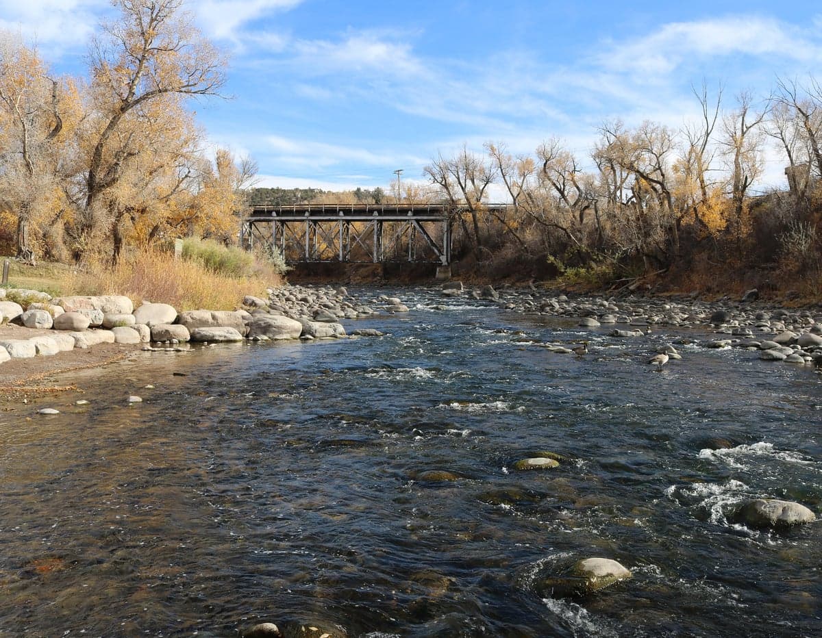
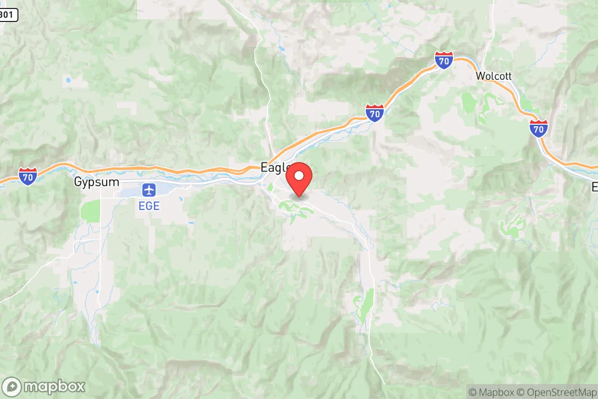
Eagle, Colorado, offers a compelling mix of geographic isolation and practical self-sufficiency that makes it a serious candidate for those prioritizing long-term resilience over convenience. Nestled in the Eagle River Valley at roughly 6,600 feet, this town of about 7,000 people sits far enough from Denver (150 miles west) and Salt Lake City (250 miles east) to avoid the immediate fallout of a major urban collapse, yet it remains connected via I-70 and the Eagle County Regional Airport for resupply or evacuation if needed. The area’s natural defenses—steep canyon walls, limited road access, and a high desert climate that discourages large-scale migration—create a buffer that few suburban or exurban locations can match. For a relocator thinking about civic unrest, mass casualty events, or systemic breakdowns, Eagle’s low profile and hard-to-reach geography are its strongest assets.
Geographic position and natural advantages for long-term security
Eagle’s location in the Rocky Mountains provides a natural fortress against the chaos that tends to emanate from coastal population centers. The town is situated in a valley flanked by the Sawatch Range to the south and the Gore Range to the north, meaning any approach by road is funneled through a handful of choke points—primarily I-70 from the east and west, and Highway 131 from the north. In a crisis, these routes can be monitored or blocked with minimal effort, giving residents a tactical advantage over any organized threat or desperate influx. The surrounding national forest (White River National Forest) offers thousands of square miles of rugged terrain for hunting, foraging, or fallback positions, though the high altitude (above 6,000 feet) means newcomers will need time to acclimate physically. The climate is semi-arid, with only about 12 inches of precipitation annually, which reduces the risk of flooding or mudslides that plague wetter mountain towns, but it also means water management is critical—more on that below. The area’s elevation and latitude also provide long daylight hours in summer for gardening, but brutal winters with heavy snow (averaging 40 inches) that can isolate the valley for days at a time, which is both a defensive bonus and a logistical challenge.
Risks, exposures, and proximity to fallout-relevant landmarks
Eagle’s primary vulnerability is its dependence on I-70, a major east-west artery that could become a funnel for refugees or looters during a Denver-area collapse. Denver is 150 miles east, but in a grid-down scenario, that distance could be covered by desperate people on foot or in vehicles within a few days. The town itself has no major military bases, nuclear facilities, or high-value industrial targets within 50 miles, which is a significant plus—there’s nothing here that would attract a precision strike or a mass casualty event from state-level adversaries. However, the nearby Eagle County Regional Airport (EGE) is a small but active facility that handles private jets and commercial flights; in a crisis, it could become a landing zone for evacuees or a target for those seeking to commandeer aircraft. The Vail Valley’s concentration of wealthy second-home owners (Vail is 30 miles east) also creates a risk: in a breakdown, those assets could draw organized criminal elements or desperate groups looking for supplies. The area’s reliance on tourism means that during a normal year, the population swells by tens of thousands in ski season, but in a collapse, those visitors would likely flee, leaving behind empty homes and infrastructure that could be scavenged. The biggest natural risk is wildfire—the 2020 Grizzly Creek Fire burned over 32,000 acres just west of Glenwood Springs, and Eagle’s dry brush and high winds make it susceptible. A major fire could cut off road access and overwhelm local firefighting resources, forcing a hasty evacuation into the mountains.
Practical resilience for a relocator: food, water, energy, and defensibility
For a prepper-minded individual or family, Eagle’s practical resilience hinges on three factors: water access, energy independence, and community cohesion. The Eagle River runs through town, providing a reliable surface water source, but it’s heavily regulated by Colorado water law, and most residential lots don’t have direct river access. A well is the gold standard here—groundwater is generally good quality but drilling depths of 200-400 feet are common, and permits are required. Rainwater collection is legal in Colorado (since 2016) but limited to 110 gallons per property, so it’s a supplement, not a primary source. For food, the growing season is short (May to September) due to elevation, but cold-hardy crops like potatoes, kale, and root vegetables do well; the Eagle County Fairgrounds hosts a community garden, and local farms like Eagle Springs Farm offer CSA shares. Hunting is viable—mule deer and elk are abundant in the national forest, but tags are limited and non-residents face higher fees. Energy is a mixed bag: the local grid is served by Holy Cross Energy, which gets about 50% from renewables (hydro, solar, wind), but in a prolonged outage, solar panels with battery storage (like Tesla Powerwall) are a smart investment, given the area’s 300+ sunny days per year. Natural gas is piped in from the west, but that infrastructure is vulnerable to earthquakes or sabotage. Defensibility is strong for a small group: the town’s layout is compact, with most homes on paved roads that can be barricaded, and the surrounding BLM land offers escape routes into the backcountry. The local sheriff’s office (Eagle County Sheriff) is well-funded and has a reputation for quick response, but in a widespread crisis, they’d be stretched thin. The biggest practical weakness is the lack of a major medical facility—the nearest hospital with a trauma center is in Glenwood Springs (Valley View Hospital, 30 miles west), and for serious care, you’re looking at Denver. Stockpiling antibiotics, trauma kits, and knowing basic field medicine is non-negotiable here.
The overall strategic picture for Eagle is one of high reward with moderate risk. It’s not a bug-out location for the unprepared—the altitude, winter isolation, and limited local food production will filter out those who aren’t serious about self-reliance. But for someone who can afford a property with a well, solar panels, and a defensible perimeter, Eagle offers a rare combination of natural barriers, low target value, and access to federal land that most suburban prepper communities lack. The proximity to Vail and Aspen means there’s a deep pool of resources (tools, vehicles, medical supplies) in nearby homes that could be leveraged in a crisis, but that same wealth also attracts attention. If you’re looking for a place to ride out a decade of instability without being on anyone’s radar, Eagle is a solid bet—just don’t expect to be comfortable without significant upfront investment in water storage, winter gear, and community ties. The locals are generally conservative, self-sufficient, and wary of outsiders, which is a double-edged sword: you’ll need to earn trust, but once you do, you’ll have neighbors who won’t panic when the lights go out.
* Values derived from national, state, county, city and local statistics and may differ in a specific area. Last updated: 2026-05-16T10:10:00.000Z
Narrative content on this page is AI-generated and may contain mistakes. Verify any details that matter before acting on them.
ReloMaps may earn a commission from affiliate links at no extra cost to you.