Photo: Wikipedia
Strategic Assessment of Fremont, CA
Multiple tactical vulnerabilities. Population density, target proximity, or disaster risk are likely compounding. A retreat property and exit planning is required.
What does the Strategic Assessment tell us?
Our Strategic Assessment grades tactical survivability of an area. Major population centers, military targets, fallout zones, natural disasters, and border exposure all drive risk — lower exposure means a more defensible position in a crisis.
This is heavily inspired by Joel Skousen's Strategic Relocation book. Highly recommended you checkout the book ($)What does this tell us?
Our Strategic Assessment grades tactical survivability of an area. Major population centers, military targets, fallout zones, natural disasters, and border exposure all drive risk — lower exposure means a more defensible position in a crisis.
This is heavily inspired by Joel Skousen's Strategic Relocation book. Highly recommended you checkout the book ($)Strategic Pillars

Key Distances
Regional Safe Places
Below is our recommended "safe zones" in California and the surrounding area based on our strategic heuristics. For most people, it's unrealistic to live in a “safe zone” full-time due to work, family or other personal reasons. They tend to be more rural. However, many of these areas are perfect for second homes and retreat properties that double as a vacation home or even a short-term rental.


Important Note: For informational purposes only. This does not mean nothing bad ever happens in the green zones. Please use common sense. This is based on public data and modeled with AI. We tried to take a conservative approach but mistakes happen. We update this regularly as new information becomes available.
Solar Generator Recommendations
Backup power matters more here than in safer locations. We've picked three solar generators across budgets and capacity tiers — start with the budget unit if you only need a few essentials, or step up if you want to run a fridge and HVAC for days at a time.

Jackery Portable Power Station Explorer 300
Budget OptionPower on the Go: Weighing only 11 lbs, it's convenient to set up and store with book-sized foldable solar panels

BLUETTI Portable Power Station AC180
Designed for both indoor and outdoor scenarios, AC180 is highly capable as it has a robost capacity and continuous output power.

EF ECOFLOW DELTA Pro Ultra Power Station
Upgraded PickEcoFlow DELTA Pro Ultra is a whole-home energy system designed to grow with your family. Integrated with the Smart Home Panel 2, it scales to meet your evolving energy needs — keeping your home powered, intelligent, and secure through every stage of life.
We earn a commission, at no additional cost to you.
Strategic Assessment Analysis
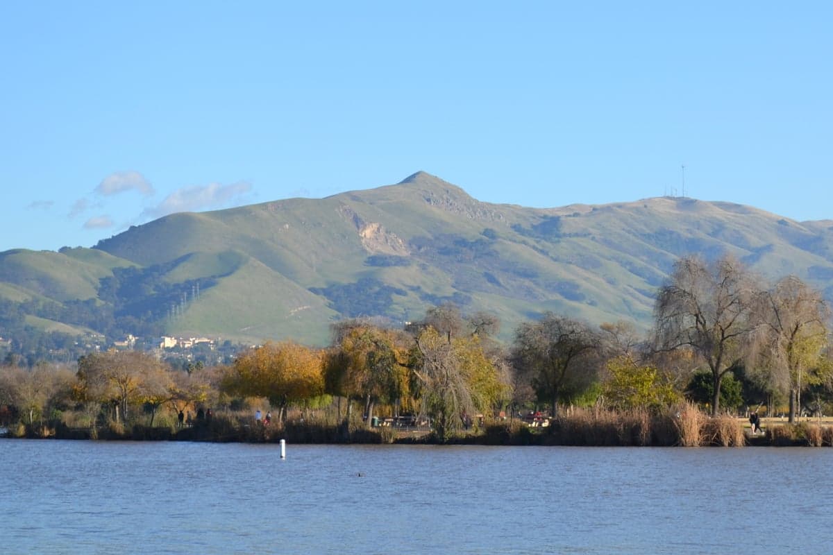
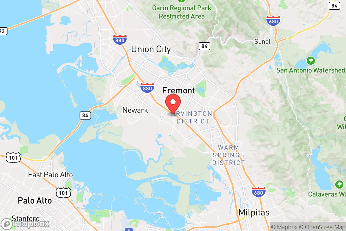
Fremont, California, sits at a geographic crossroads that offers both strategic depth and significant exposure for a relocator thinking in terms of resilience. Its position at the southeastern edge of the San Francisco Bay, where the Diablo Range meets the baylands, provides a rare mix of urban access and natural buffer zones that can be leveraged for self-sufficiency. For a conservative-leaning individual or family weighing the long-term viability of a location against the backdrop of potential civic unrest, supply chain disruptions, or natural disasters, Fremont presents a complex calculus: it is not a remote redoubt, but it is one of the better-positioned large suburbs in the Bay Area for those who want to stay close to economic opportunity while maintaining a credible baseline of preparedness.
Geographic position and natural advantages for long-term stability
Fremont’s geography is its strongest card. The city is wedged between the San Francisco Bay to the west and the Mission Peak and Sunol Ridge open spaces to the east, creating a natural funnel that limits approach vectors for any large-scale unrest. The Mission Peak Regional Preserve and the 20,000+ acres of the Sunol-Ohlone Regional Wilderness form a rugged eastern barrier, meaning that any major disruption coming from the Central Valley or the I-680 corridor would have to pass through narrow chokepoints like Niles Canyon or the Sunol Grade. This is a defensible posture, not in a military sense, but in the practical reality that a family can retreat east into public lands with water sources (Alameda Creek, the Arroyo de la Laguna) if the urban grid fails. The city’s elevation gradient—from sea-level bay flats to 2,517-foot Mission Peak—also means microclimates and varied growing zones within a short drive, a subtle advantage for anyone serious about food security. The Niles Cone groundwater basin beneath Fremont is a significant, underappreciated asset: it provides a local water supply that is less dependent on the State Water Project than many other Bay Area cities, giving residents a buffer against drought-induced rationing or system failures.
Risks, exposures, and proximity to fallout-relevant landmarks
No honest assessment can ignore the liabilities. Fremont’s location within the Bay Area places it within the shadow of several high-value, high-risk targets. Fremont is roughly 12 miles from the Port of Oakland, 15 miles from San Jose International Airport, and 25 miles from the Port of Stockton—all critical nodes in the national supply chain that would be primary or secondary targets in any major conflict or terrorist campaign. The city itself hosts a Tesla factory (the original Fremont plant), a major NUMMI legacy site, and numerous semiconductor and defense subcontractors (Lam Research, Western Digital, and parts of the Lockheed Martin supply chain). In a scenario involving EMP, cyberattack, or conventional strike, these facilities become liabilities, drawing secondary effects like panic-driven evacuation traffic, looting, or targeted sabotage. The Dumbarton Bridge and San Mateo Bridge are the only egress points west across the bay; both are single-point-of-failure chokepoints that would gridlock instantly in a crisis. For a relocator, the lesson is clear: Fremont is not a bug-out location—it is a location that requires a plan to either shelter in place with deep supplies or to have a pre-established secondary route east through the Altamont Pass, which itself can become a parking lot. The seismic risk is also real: the Hayward Fault runs directly through the city’s western neighborhoods, and a major rupture (estimated 7.0+ magnitude, 31% probability in the next 30 years per USGS) would collapse the water and gas infrastructure for weeks, if not months. This is not fearmongering; it is the baseline reality of living on the Pacific Ring of Fire.
Practical resilience for a relocator: food, water, energy, and defensibility
For a family or individual serious about preparedness, Fremont offers a mixed but workable profile. Water is the single most critical factor, and Fremont’s groundwater access is a genuine strategic asset. The Alameda County Water District manages the Niles Cone, and while the city’s surface water comes from the Hetch Hetchy system (a vulnerable 167-mile pipeline from Yosemite), the local wells can be tapped with a hand pump or solar-powered well pump if you own property in the right zone. Properties near the Niles district or along the eastern foothills are more likely to have private wells or access to the shallow aquifer. Food resilience is less straightforward: the city’s zoning is suburban, and most lots are small (5,000–8,000 sq ft), but the city’s community garden program and the existence of several working farms in the adjacent Sunol Valley (e.g., Tilden Regional Park’s historic farm, and small organic operations in the Warm Springs district) mean that a determined family can secure a plot or build a substantial raised-bed system. The climate is Mediterranean—mild, wet winters and dry summers—which supports year-round cool-season crops (kale, chard, carrots, onions) and summer staples (tomatoes, peppers, squash) with careful irrigation. Energy resilience is a bright spot: Fremont has a municipal utility (Silicon Valley Power) that is more reliable than PG&E’s grid, but it is still grid-dependent. Solar with battery storage is a no-brainer here—the city gets 260+ sunny days per year, and net metering policies (though eroding) still make it financially viable. For defensibility, the suburban layout is a double-edged sword: the street grid is predictable, and most homes are in cul-de-sac subdivisions that can be secured with basic barriers, but the density means that a determined mob or looters could move through neighborhoods quickly. The Fremont Police Department is well-funded and has a strong community policing reputation, but in a widespread collapse, they will be overwhelmed. The real defensive value lies in the eastern open space: a family with a property backing onto the Sunol Ridge or Mission Peak has a natural escape corridor and a high-ground observation point that most suburbanites lack.
The overall strategic picture for Fremont is one of calculated trade-offs. It is not a remote survivalist paradise—it is a dense, economically vital suburb with all the vulnerabilities that come with proximity to Silicon Valley, major ports, and fault lines. But for a conservative relocator who cannot or will not move to rural Idaho or Montana, Fremont offers a rare combination: a legitimate groundwater supply, defensible terrain on its eastern flank, and a local economy that is diversified enough to survive a regional shock. The key is to treat it as a base of operations, not a final redoubt. Stockpile for 90 days minimum (water, food, medical, ammunition if legally owned), establish a relationship with a rural property in the Central Valley or Sierra foothills as a secondary location, and invest in solar+battery and a well pump. The city’s schools (rated 8–10 on GreatSchools) and low violent crime rate (roughly 150 per 100,000, well below the national average) make it a viable place to raise children while maintaining a low profile. The risks are real, but they are manageable with discipline and capital. Fremont is a place to live strategically, not to hide—and for the prepared family, that is enough.
* Values derived from national, state, county, city and local statistics and may differ in a specific area. Last updated: 2026-04-30T04:17:46.000Z
Narrative content on this page is AI-generated and may contain mistakes. Verify any details that matter before acting on them.
ReloMaps may earn a commission from affiliate links at no extra cost to you.