
Photo: Wikipedia
Strategic Assessment of Greenville, NC
Meaningful friction. Expect exposure to either population pressure, blast zones, or natural disaster risk. Consider buying a retreat property.
What does the Strategic Assessment tell us?
Our Strategic Assessment grades tactical survivability of an area. Major population centers, military targets, fallout zones, natural disasters, and border exposure all drive risk — lower exposure means a more defensible position in a crisis.
This is heavily inspired by Joel Skousen's Strategic Relocation book. Highly recommended you checkout the book ($)What does this tell us?
Our Strategic Assessment grades tactical survivability of an area. Major population centers, military targets, fallout zones, natural disasters, and border exposure all drive risk — lower exposure means a more defensible position in a crisis.
This is heavily inspired by Joel Skousen's Strategic Relocation book. Highly recommended you checkout the book ($)Strategic Pillars

Key Distances
Regional Safe Places
Below is our recommended "safe zones" in North Carolina and the surrounding area based on our strategic heuristics. For most people, it's unrealistic to live in a “safe zone” full-time due to work, family or other personal reasons. They tend to be more rural. However, many of these areas are perfect for second homes and retreat properties that double as a vacation home or even a short-term rental.


Important Note: For informational purposes only. This does not mean nothing bad ever happens in the green zones. Please use common sense. This is based on public data and modeled with AI. We tried to take a conservative approach but mistakes happen. We update this regularly as new information becomes available.
Solar Generator Recommendations
Backup power matters more here than in safer locations. We've picked three solar generators across budgets and capacity tiers — start with the budget unit if you only need a few essentials, or step up if you want to run a fridge and HVAC for days at a time.

Jackery Portable Power Station Explorer 300
Budget OptionPower on the Go: Weighing only 11 lbs, it's convenient to set up and store with book-sized foldable solar panels

BLUETTI Portable Power Station AC180
Designed for both indoor and outdoor scenarios, AC180 is highly capable as it has a robost capacity and continuous output power.

EF ECOFLOW DELTA Pro Ultra Power Station
Upgraded PickEcoFlow DELTA Pro Ultra is a whole-home energy system designed to grow with your family. Integrated with the Smart Home Panel 2, it scales to meet your evolving energy needs — keeping your home powered, intelligent, and secure through every stage of life.
We earn a commission, at no additional cost to you.
Strategic Assessment Analysis
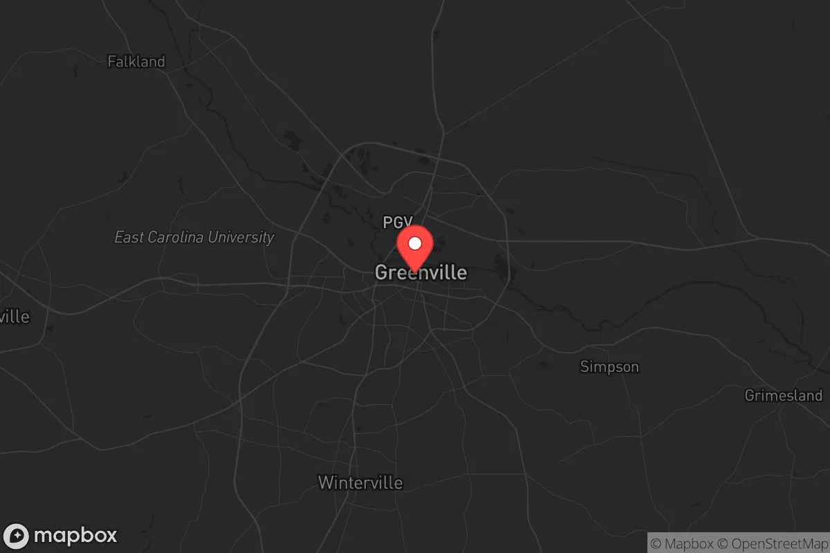
Greenville, North Carolina, offers a surprisingly resilient position for those prioritizing strategic relocation, balancing proximity to the coast with a buffer from the immediate fallout zones of major metropolitan targets. Its location roughly 85 miles east of Raleigh and 50 miles inland from the Atlantic places it outside the primary blast and thermal radii of a nuclear strike on a major city, while still providing access to critical infrastructure and supply chains. The city’s role as a regional medical and educational hub—anchored by East Carolina University (ECU) and Vidant Medical Center—gives it a functional backbone that many similarly sized towns lack, making it a viable base for long-term sustainability rather than just a temporary bug-out location.
Geographic position and natural advantages for long-term sustainability
Greenville sits in the coastal plain, a flat, low-lying region that offers both advantages and trade-offs. The Tar River runs through the city, providing a surface water source that, while not pristine, can be treated for potable use with the right filtration systems. The surrounding landscape is dominated by agricultural land—tobacco, soybeans, and corn—which means local food production is a realistic option for those willing to garden or barter with nearby farms. The area’s temperate climate allows for year-round growing seasons, though summers are humid and hurricane-prone. The lack of significant elevation means no natural defensive high ground, but the dense pine forests and swamps to the south and east offer cover and chokepoints for anyone needing to move discreetly. The proximity to the Pamlico Sound and Outer Banks (about 60 miles east) provides access to marine resources, but those same coastal areas are high-risk during storm surges and would be evacuation zones in a crisis.
Risks, exposures, and proximity to fallout-relevant landmarks
The primary strategic risk for Greenville is its location within 100 miles of several high-value targets. Raleigh-Durham, with its Research Triangle Park, federal facilities, and major universities, is a likely nuclear or EMP target, and Greenville sits downwind of prevailing westerly winds. A ground burst in Raleigh would deposit significant fallout across the I-95 corridor and into the coastal plain, potentially reaching Greenville within 4-6 hours. Seymour Johnson Air Force Base in Goldsboro (about 40 miles west) is a major strategic asset—home to the 4th Fighter Wing and F-15E Strike Eagles—making it a high-priority target for any adversary. A strike there would put Greenville in the immediate fallout zone, with lethal radiation levels possible depending on wind direction. The city itself has no major military or industrial targets, which is a plus, but it sits near US-264 and US-13, which would become evacuation routes during a crisis, potentially clogging roads with refugees from the coast. Hurricane risk is real: Greenville is about 50 miles inland, but Category 3+ storms can still bring 80+ mph winds and widespread flooding, as seen with Hurricane Floyd in 1999 and Matthew in 2016. The Tar River is prone to flooding, and low-lying neighborhoods near the river are at risk. For a prepper, this means avoiding properties in flood zones and having a plan to move to higher ground (which is relative here—elevation tops out around 60 feet).
Practical resilience for a relocator: food, water, energy, and defensibility
For someone serious about self-sufficiency, Greenville has a mixed report card. Water is the biggest concern: the Tar River is the primary surface source, but it’s contaminated with agricultural runoff and industrial discharge from upstream. Municipal water comes from the river and is treated, but in a grid-down scenario, you’ll need a robust filtration system—think Berkey filters with ceramic elements or a reverse osmosis setup. Well water is available in rural areas outside city limits, but the water table is shallow and prone to contamination from septic systems and fertilizers. Food security is better than most: the surrounding counties (Pitt, Greene, Lenoir) are agricultural powerhouses, with local farmers markets, u-pick operations, and direct-from-farm meat sales. Stockpiling is easy here because of the rural-urban mix—you can buy bulk grains, canned goods, and livestock feed at Tractor Supply or local co-ops. Energy resilience is a weak point. The grid is aging and vulnerable to hurricanes and ice storms. Solar is viable (the area gets about 210 sunny days per year), but net metering policies are average, and battery storage is essential for off-grid capability. Natural gas is available in town, but propane tanks are common in rural areas—a good option for backup heating and cooking. Defensibility is poor within city limits: Greenville is a typical sprawl of subdivisions, strip malls, and ECU campus. The best bet for a relocator is to buy land 15-20 miles outside town, in places like Grifton, Ayden, or Falkland, where you get acreage, tree cover, and distance from population centers. The local culture is Southern and gun-friendly—Pitt County has a strong hunting tradition, and concealed carry permits are common. The sheriff’s office is generally conservative and pro-Second Amendment, which matters if you’re concerned about civil unrest.
The overall strategic picture for a conservative relocator
Greenville is a solid B-tier relocation option for someone with a prepper mindset. It’s not a hardened bunker location like the Appalachian foothills, but it offers a realistic balance of access to medical care, food production, and relative isolation from the highest-risk targets. The biggest downsides are the hurricane threat and the fallout risk from Seymour Johnson and Raleigh. If you’re willing to invest in a well, solar panels, and a good water filtration system, and you buy land outside the floodplain and away from major highways, you can build a sustainable setup here. The community is politically mixed—ECU leans left, but the surrounding rural areas are deeply conservative—so you’ll find like-minded neighbors if you look. For a single individual or family looking to ride out the next decade of instability, Greenville offers a pragmatic middle ground: close enough to civilization to matter, far enough to survive. Just don’t expect mountain-grade security or desert isolation. This is the coastal plain—flat, humid, and vulnerable to weather—but with the right preparation, it’s a viable long-term base.
* Values derived from national, state, county, city and local statistics and may differ in a specific area. Last updated: 2026-04-21T15:14:21.000Z
Narrative content on this page is AI-generated and may contain mistakes. Verify any details that matter before acting on them.
ReloMaps may earn a commission from affiliate links at no extra cost to you.