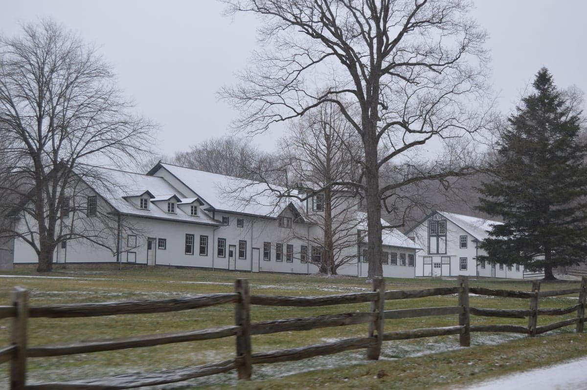
Photo: Wikipedia
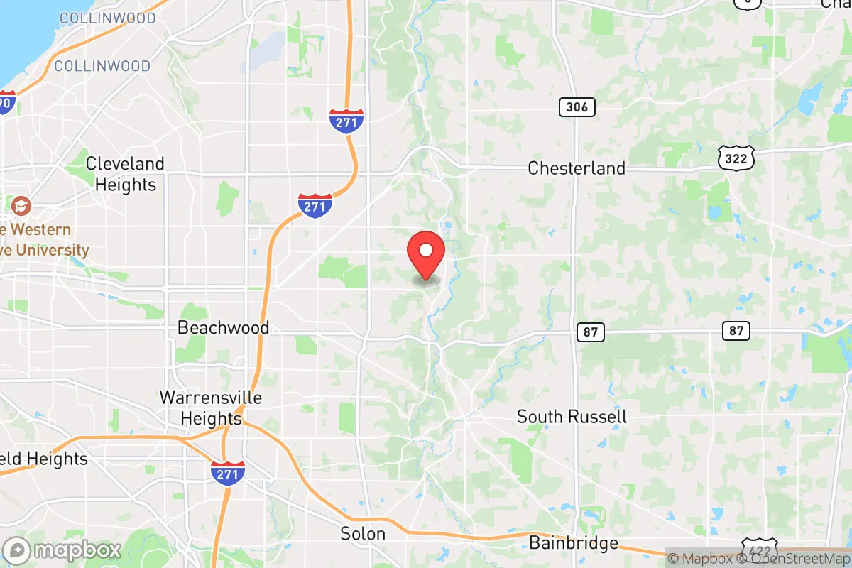
Strategic Assessment of Hunting Valley, OH
Meaningful friction. Expect exposure to either population pressure, blast zones, or natural disaster risk. Consider buying a retreat property.
What does the Strategic Assessment tell us?
Our Strategic Assessment grades tactical survivability of an area. Major population centers, military targets, fallout zones, natural disasters, and border exposure all drive risk — lower exposure means a more defensible position in a crisis.
This is heavily inspired by Joel Skousen's Strategic Relocation book. Highly recommended you checkout the book ($)What does this tell us?
Our Strategic Assessment grades tactical survivability of an area. Major population centers, military targets, fallout zones, natural disasters, and border exposure all drive risk — lower exposure means a more defensible position in a crisis.
This is heavily inspired by Joel Skousen's Strategic Relocation book. Highly recommended you checkout the book ($)Strategic Pillars

Key Distances
Regional Safe Places
Below is our recommended "safe zones" in Ohio and the surrounding area based on our strategic heuristics. For most people, it's unrealistic to live in a “safe zone” full-time due to work, family or other personal reasons. They tend to be more rural. However, many of these areas are perfect for second homes and retreat properties that double as a vacation home or even a short-term rental.

Important Note: For informational purposes only. This does not mean nothing bad ever happens in the green zones. Please use common sense. This is based on public data and modeled with AI. We tried to take a conservative approach but mistakes happen. We update this regularly as new information becomes available.
Solar Generator Recommendations
Backup power matters more here than in safer locations. We've picked three solar generators across budgets and capacity tiers — start with the budget unit if you only need a few essentials, or step up if you want to run a fridge and HVAC for days at a time.

Jackery Portable Power Station Explorer 300
Budget OptionPower on the Go: Weighing only 11 lbs, it's convenient to set up and store with book-sized foldable solar panels

BLUETTI Portable Power Station AC180
Designed for both indoor and outdoor scenarios, AC180 is highly capable as it has a robost capacity and continuous output power.

EF ECOFLOW DELTA Pro Ultra Power Station
Upgraded PickEcoFlow DELTA Pro Ultra is a whole-home energy system designed to grow with your family. Integrated with the Smart Home Panel 2, it scales to meet your evolving energy needs — keeping your home powered, intelligent, and secure through every stage of life.
We earn a commission, at no additional cost to you.
Strategic Assessment Analysis
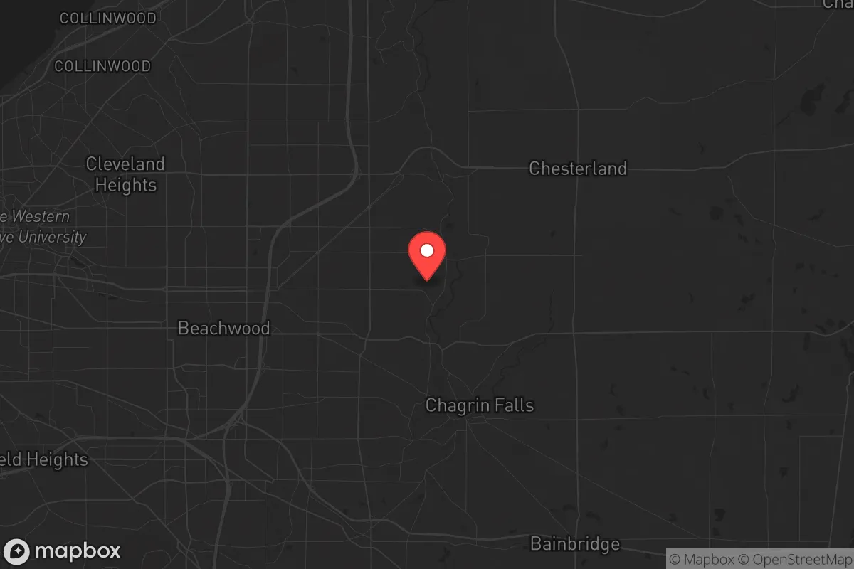
Hunting Valley, Ohio, sits as a strategic outlier in the otherwise densely populated Northeast Ohio corridor, offering a rare combination of physical isolation, natural barriers, and low-profile affluence that makes it a serious candidate for a long-term relocation base. While the surrounding region faces the typical vulnerabilities of Rust Belt urban centers—aging infrastructure, concentrated populations, and proximity to potential fallout targets—Hunting Valley itself is positioned on the far eastern edge of Cuyahoga County, bordering Geauga County, where population density drops sharply and the landscape shifts to rolling hills, deep woodlands, and winding river valleys. For a relocator prioritizing resilience over convenience, this is not a suburb to commute from; it is a place to dig in, with the Chagrin River and the Cuyahoga Valley National Park acting as natural buffers that slow access and create defensible terrain.
Geographic position and natural advantages for long-term security
Hunting Valley’s geography is its primary asset. The village sits atop the Portage Escarpment, a geological feature that provides elevated ground with clear sightlines over the surrounding lowlands—a meaningful advantage for situational awareness in any extended disruption. The Chagrin River cuts through the eastern edge of the village, creating a natural moat effect that limits vehicle access from several directions. The village itself is roughly 10 square miles, but with a population under 700, the density is among the lowest in Cuyahoga County. This low density means fewer neighbors to compete with for resources, less noise, and far less risk of being caught in a mass evacuation route. The surrounding Geauga County is heavily forested and agricultural, with Amish communities that maintain pre-industrial skills—blacksmithing, animal husbandry, and off-grid food production—which could become critical in a prolonged grid-down scenario. The proximity to the Cuyahoga Valley National Park (roughly 5 miles west) provides a massive, federally protected green space that can serve as a game corridor, foraging zone, and secondary retreat area if needed. However, the park also attracts recreational traffic in normal times, so pre-positioning supplies and establishing caches away from marked trails is advisable.
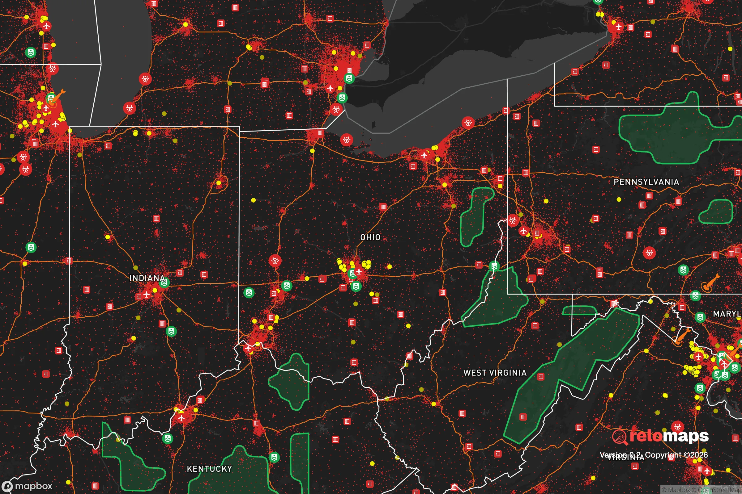
Risks, exposures, and proximity to fallout-relevant landmarks
The most significant risk for Hunting Valley is its location within the broader Cleveland-Akron metropolitan area, which contains multiple high-value targets in a major conflict scenario. Cleveland Hopkins International Airport (roughly 25 miles west) is a civilian hub that could be a secondary target or a chokepoint for evacuation. The Perry Nuclear Power Plant, located about 30 miles northeast along Lake Erie, is a potential radiological hazard—though prevailing winds generally blow from the west, meaning fallout from a Perry incident would likely push east over Lake County, not directly into Hunting Valley. The Davis-Besse nuclear plant in Oak Harbor (roughly 70 miles west) is farther but still within the 50-mile emergency planning zone. More immediate concerns are the urban centers themselves: Cleveland’s downtown, with its federal buildings, financial district, and port infrastructure, is a plausible target for civil unrest or precision strikes. In a mass casualty event or prolonged power outage, the urban population (roughly 370,000 in Cleveland proper, 1.7 million in the metro) would likely push east along the major highways—I-271, I-480, and US-422—all of which pass within a few miles of Hunting Valley. The village’s limited road access (only a handful of two-lane roads connect it to the outside) is a double-edged sword: it makes ingress difficult for outsiders, but it also means that if those roads are blocked or compromised, egress becomes equally difficult. A pre-planned secondary route via the Chagrin River valley or through the park’s trail network is essential.
Practical resilience for a relocator: food, water, energy, and defensibility
For a relocator serious about self-sufficiency, Hunting Valley offers a strong baseline but requires deliberate preparation. The village has no municipal water system; nearly all homes rely on private wells, which means water access is independent of city infrastructure. Well depth in the area typically ranges from 100 to 300 feet, and the aquifer is reliable, but a hand-pump or solar-powered pump backup is non-negotiable. The soil in the Chagrin River valley is fertile loam, suitable for vegetable gardens, but the growing season is short (roughly 150 frost-free days) and the winters are cold and snowy—meaning any serious food production requires a greenhouse or cold frame. The surrounding Geauga County has active farms and Amish markets, but in a crisis, those sources will be strained or cut off. Pre-stocking at least a six-month supply of shelf-stable food, plus seeds for cool-weather crops (kale, carrots, potatoes), is the minimum. For energy, the tree canopy is dense enough that solar panels will need to be mounted on cleared land or rooftops with southern exposure; ground-mount arrays on the open fields common in the area are ideal. Wood heat is the most practical backup—most homes in the village have fireplaces or wood stoves, and the surrounding forests provide ample fuel, but a chainsaw and a season’s worth of seasoned wood should be stockpiled before winter. Defensibility is high: the village’s layout, with long, winding driveways and homes set far back from the road, means that any approaching vehicle or person is visible from a distance. The local police force is small (a handful of officers), but the village has a strong homeowners’ association culture that can be leveraged for neighborhood watch and mutual aid. The biggest vulnerability is the lack of a centralized community food storage or medical cache—each household must be fully self-contained.
The overall strategic picture for Hunting Valley is one of calculated trade-offs. It offers genuine geographic isolation, natural barriers, and a low-density population that make it one of the more defensible positions in the entire Cleveland metro area. The risks are real but manageable: proximity to nuclear plants and urban fallout zones requires a solid radiation plan (potassium iodide, a Geiger counter, and a basement shelter with at least two weeks of supplies), and the limited road network demands a pre-planned secondary egress route. For a relocator who values privacy, self-sufficiency, and a community that is already oriented toward property rights and low government interference, Hunting Valley is a strong candidate—but only if you treat it as a base to be hardened, not a suburb to be enjoyed. The Amish networks to the east, the national park to the west, and the deep woods all around give you options, but those options only exist if you arrive prepared. This is not a place to flee to in a crisis; it is a place to be already living when the crisis comes.
* Values derived from national, state, county, city and local statistics and may differ in a specific area. Last updated: 2026-04-27T14:31:40.000Z
Narrative content on this page is AI-generated and may contain mistakes. Verify any details that matter before acting on them.
ReloMaps may earn a commission from affiliate links at no extra cost to you.