

Photo: Wikipedia
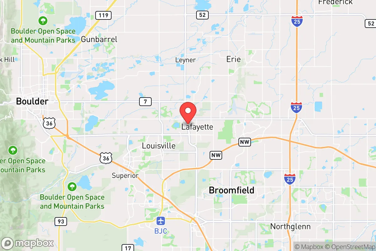
Strategic Assessment of Lafayette, CO
Multiple tactical vulnerabilities. Population density, target proximity, or disaster risk are likely compounding. A retreat property and exit planning is required.
What does the Strategic Assessment tell us?
Our Strategic Assessment grades tactical survivability of an area. Major population centers, military targets, fallout zones, natural disasters, and border exposure all drive risk — lower exposure means a more defensible position in a crisis.
This is heavily inspired by Joel Skousen's Strategic Relocation book. Highly recommended you checkout the book ($)What does this tell us?
Our Strategic Assessment grades tactical survivability of an area. Major population centers, military targets, fallout zones, natural disasters, and border exposure all drive risk — lower exposure means a more defensible position in a crisis.
This is heavily inspired by Joel Skousen's Strategic Relocation book. Highly recommended you checkout the book ($)Strategic Pillars

Key Distances
Regional Safe Places
Below is our recommended "safe zones" in Colorado and the surrounding area based on our strategic heuristics. For most people, it's unrealistic to live in a “safe zone” full-time due to work, family or other personal reasons. They tend to be more rural. However, many of these areas are perfect for second homes and retreat properties that double as a vacation home or even a short-term rental.


Important Note: For informational purposes only. This does not mean nothing bad ever happens in the green zones. Please use common sense. This is based on public data and modeled with AI. We tried to take a conservative approach but mistakes happen. We update this regularly as new information becomes available.
Solar Generator Recommendations
Backup power matters more here than in safer locations. We've picked three solar generators across budgets and capacity tiers — start with the budget unit if you only need a few essentials, or step up if you want to run a fridge and HVAC for days at a time.

Jackery Portable Power Station Explorer 300
Budget OptionPower on the Go: Weighing only 11 lbs, it's convenient to set up and store with book-sized foldable solar panels

BLUETTI Portable Power Station AC180
Designed for both indoor and outdoor scenarios, AC180 is highly capable as it has a robost capacity and continuous output power.

EF ECOFLOW DELTA Pro Ultra Power Station
Upgraded PickEcoFlow DELTA Pro Ultra is a whole-home energy system designed to grow with your family. Integrated with the Smart Home Panel 2, it scales to meet your evolving energy needs — keeping your home powered, intelligent, and secure through every stage of life.
We earn a commission, at no additional cost to you.
Strategic Assessment Analysis
Lafayette, Colorado, sits in a precarious but potentially advantageous position for those prioritizing resilience and strategic relocation. Nestled between the urban pressures of the Denver-Boulder metroplex and the rugged expanse of the Front Range, this town of roughly 30,000 offers a blend of suburban infrastructure and access to natural resources that can be leveraged for self-sufficiency. However, its proximity to major population centers—just 15 miles from Boulder and 25 miles from Denver—introduces significant risks that any serious prepper must weigh against its benefits. The key is understanding that Lafayette is not a remote retreat but a forward operating base: close enough to urban resources for initial supply runs, yet positioned to exploit the escape routes into the Rocky Mountains when the grid falters.
Geographic position and natural advantages for long-term survival
Lafayette’s location along the Front Range urban corridor places it at the intersection of several critical geographic features. To the west, the foothills of the Rocky Mountains rise within a 20-minute drive, offering immediate access to higher elevations, forest cover, and potential bug-out locations in Boulder County’s wilderness areas. To the east, the flat plains stretch toward the South Platte River basin, providing agricultural land and water sources that could sustain small-scale farming. The town itself sits on the Coal Creek drainage, a minor but reliable waterway that feeds into Boulder Creek, and the area’s aquifer is relatively shallow, making well drilling feasible for those with property rights. The elevation—roughly 5,200 feet—means cooler summers and less wildfire risk than lower-elevation plains communities, though the dry climate demands careful water management. For a relocator, the natural advantage here is the ability to stage supplies in multiple directions: stockpile in town for daily life, cache gear in the mountains for a retreat, and maintain a garden plot on the plains for food security. The nearby Rocky Mountain Arsenal National Wildlife Refuge, while a former chemical weapons site, is now a restored prairie that could serve as a game-rich hunting ground in a collapse scenario—provided one knows the contamination history.
Risks, exposures, and proximity to fallout-relevant landmarks
The most glaring vulnerability for Lafayette is its position within the Denver-Boulder metropolitan statistical area, home to over 3 million people. In a mass casualty event—whether from a pandemic, economic collapse, or coordinated attack—the town would be caught in the outflow of panicked populations fleeing the cities. Interstate 25 and U.S. Highway 287, both within 10 miles, would become chokepoints, and Lafayette’s own road network (primarily South Boulder Road and Baseline Road) is insufficient for mass evacuation. More concerning is the proximity to high-value targets: the Denver Federal Center in Lakewood (25 miles south) houses numerous federal agencies, including the U.S. Geological Survey and Bureau of Reclamation, making it a potential target for sabotage or civil unrest. The Rocky Flats National Wildlife Refuge, a former nuclear weapons plant just 8 miles west, has been remediated but still contains buried plutonium waste; a disaster there—or a deliberate release—could render large swaths of the area uninhabitable for generations. Additionally, the Boulder County government’s progressive policies on land use and energy could complicate off-grid living; zoning restrictions on solar panels, rainwater collection, and livestock are more stringent than in rural counties, limiting a prepper’s ability to operate without scrutiny. For the conservative-minded relocator, the political climate of Boulder County (which voted +60 Democratic in 2024) may also create social friction in a crisis, as ideological divides could hamper community cooperation.
Practical resilience for a relocator: food, water, energy, and defensibility
On the practical side, Lafayette offers a mixed bag for those seeking self-reliance. Water is the most critical concern: the town draws from the Colorado-Big Thompson Project, a complex system of reservoirs and canals that is vulnerable to drought, cyberattack, or physical sabotage. Municipal water is treated and reliable for now, but a prepper should plan for at least 30 days of stored water per person (roughly 30 gallons per person) and a means to purify from Coal Creek or local ponds. Rainwater collection is legal in Colorado but restricted to 110 gallons per property per year under state law—a pittance for serious gardening. Food resilience is better: the surrounding farmlands of Weld and Boulder counties produce corn, wheat, and hay, and local farmers’ markets (like the one at the Lafayette Public Library) offer seasonal produce. However, Lafayette’s zoning limits backyard chickens to six hens and no roosters, and goats or pigs require special permits, so serious animal husbandry is off the table within city limits. Energy-wise, Xcel Energy provides grid power, but the area’s high solar potential (over 300 sunny days per year) makes rooftop panels a viable investment—though net metering policies have been weakened in recent years. For defensibility, Lafayette’s suburban layout—single-family homes on quarter-acre lots with some older neighborhoods offering alley access—provides decent perimeter control if you fortify windows and doors. The town’s police force is small (roughly 40 officers) and would be overwhelmed in a widespread event, so a neighborhood watch or mutual-aid group is essential. The nearby Rocky Mountain Metropolitan Airport (Jeffco) is a potential extraction point for those with aviation connections, but its proximity to the Denver metro also makes it a likely target for looters.
The overall strategic picture for Lafayette is one of calculated risk. It is not a bug-out location—it is a staging ground. For a single individual or family willing to invest in redundant systems (well water, solar, food storage) and maintain a low profile, the town offers a balance of urban convenience and rural access that few Front Range communities can match. The key is to treat Lafayette as a base of operations, not a final destination. Have a pre-planned escape route west into the mountains (via Peak to Peak Highway or the Switzerland Trail) and a secondary cache in a rural county like Gilpin or Park. The political and social environment is challenging for a conservative worldview, but the area’s natural resources and infrastructure can be leveraged if you stay off the radar. In a world where the cities are powder kegs and the remote wilderness is too isolated for resupply, Lafayette occupies a middle ground—one that demands vigilance but rewards preparation. The smart move is to buy property here, build your resilience, and be ready to move deeper into the hills when the sirens sound.
* Values derived from national, state, county, city and local statistics and may differ in a specific area. Last updated: 2026-04-22T23:26:31.000Z
Narrative content on this page is AI-generated and may contain mistakes. Verify any details that matter before acting on them.
ReloMaps may earn a commission from affiliate links at no extra cost to you.