Photo: Wikipedia
Strategic Assessment of Maricopa, AZ
Multiple tactical vulnerabilities. Population density, target proximity, or disaster risk are likely compounding. A retreat property and exit planning is required.
What does the Strategic Assessment tell us?
Our Strategic Assessment grades tactical survivability of an area. Major population centers, military targets, fallout zones, natural disasters, and border exposure all drive risk — lower exposure means a more defensible position in a crisis.
This is heavily inspired by Joel Skousen's Strategic Relocation book. Highly recommended you checkout the book ($)What does this tell us?
Our Strategic Assessment grades tactical survivability of an area. Major population centers, military targets, fallout zones, natural disasters, and border exposure all drive risk — lower exposure means a more defensible position in a crisis.
This is heavily inspired by Joel Skousen's Strategic Relocation book. Highly recommended you checkout the book ($)Strategic Pillars

Key Distances
Regional Safe Places
Below is our recommended "safe zones" in Arizona and the surrounding area based on our strategic heuristics. For most people, it's unrealistic to live in a “safe zone” full-time due to work, family or other personal reasons. They tend to be more rural. However, many of these areas are perfect for second homes and retreat properties that double as a vacation home or even a short-term rental.
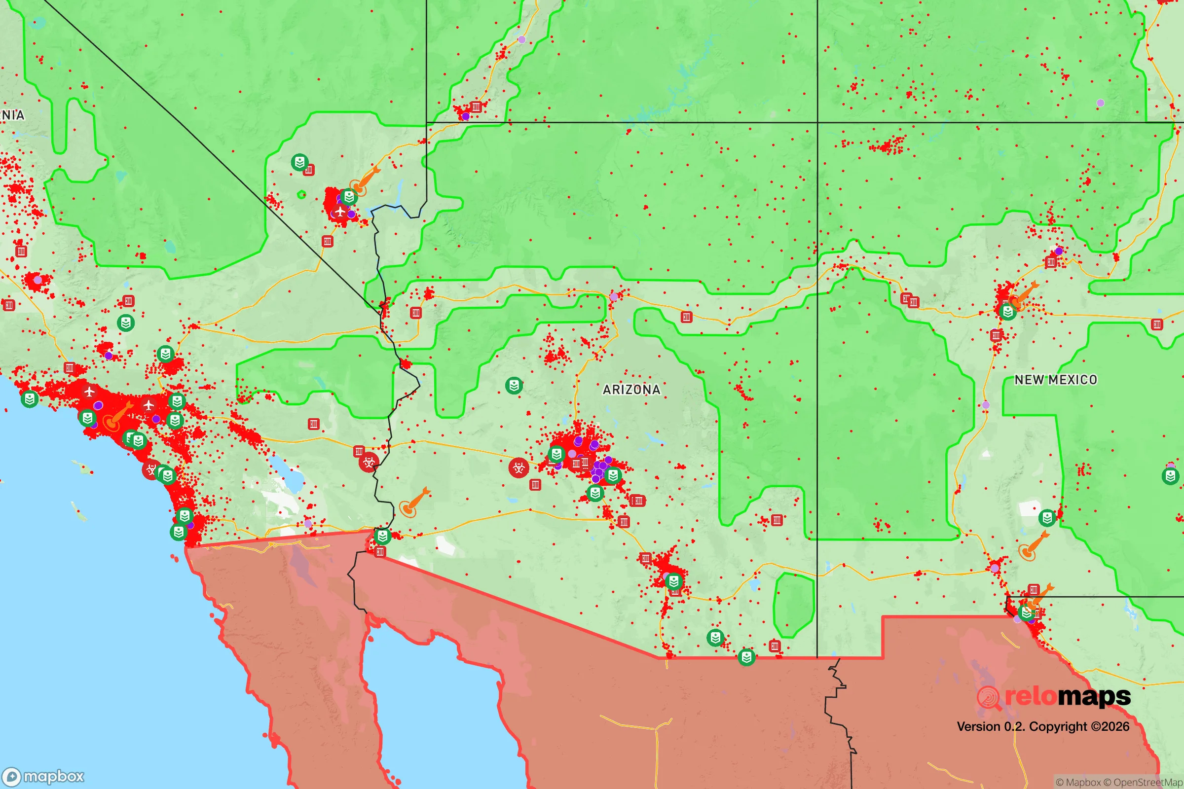
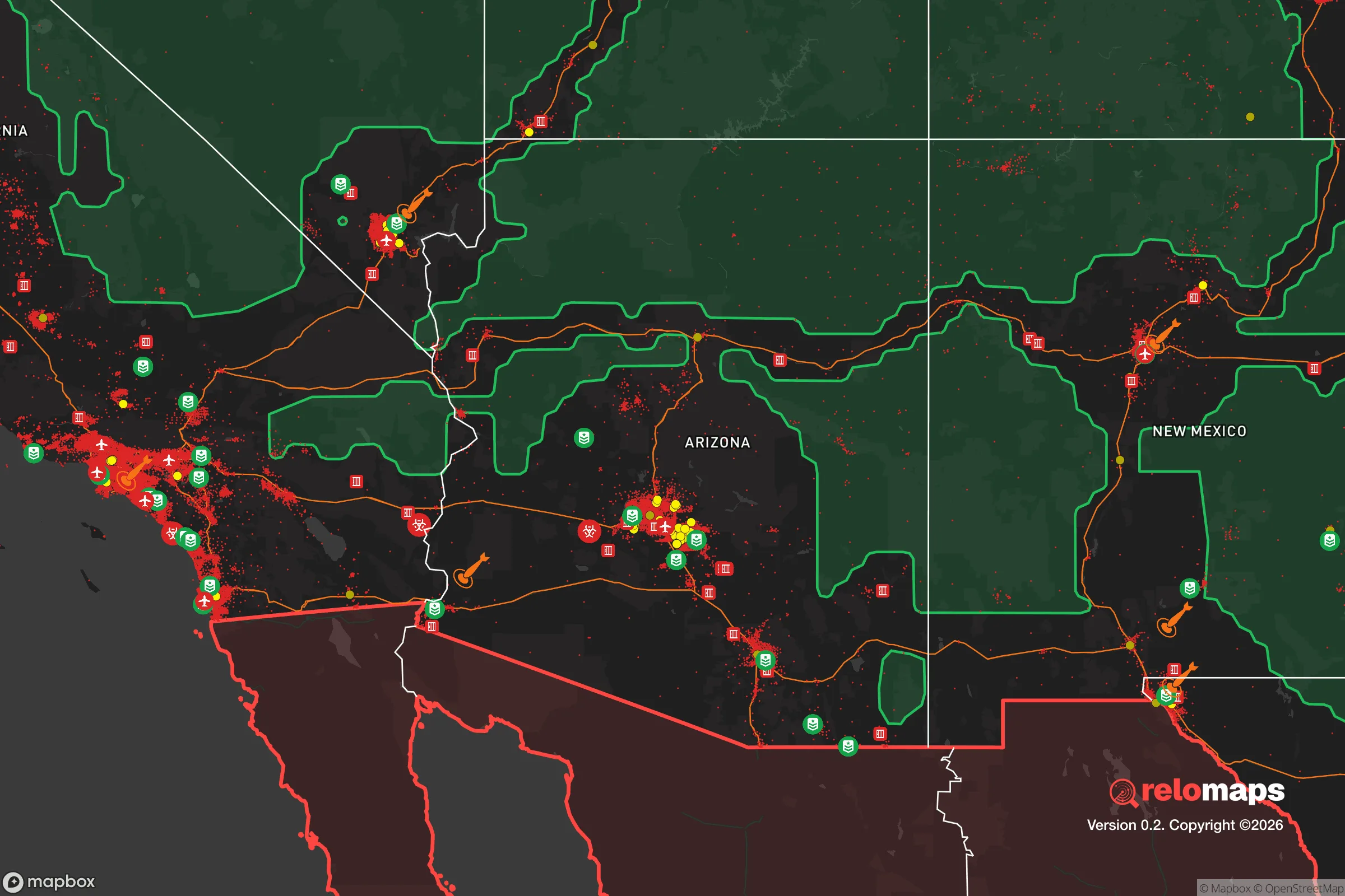
Important Note: For informational purposes only. This does not mean nothing bad ever happens in the green zones. Please use common sense. This is based on public data and modeled with AI. We tried to take a conservative approach but mistakes happen. We update this regularly as new information becomes available.
Solar Generator Recommendations
Backup power matters more here than in safer locations. We've picked three solar generators across budgets and capacity tiers — start with the budget unit if you only need a few essentials, or step up if you want to run a fridge and HVAC for days at a time.

Jackery Portable Power Station Explorer 300
Budget OptionPower on the Go: Weighing only 11 lbs, it's convenient to set up and store with book-sized foldable solar panels

BLUETTI Portable Power Station AC180
Designed for both indoor and outdoor scenarios, AC180 is highly capable as it has a robost capacity and continuous output power.

EF ECOFLOW DELTA Pro Ultra Power Station
Upgraded PickEcoFlow DELTA Pro Ultra is a whole-home energy system designed to grow with your family. Integrated with the Smart Home Panel 2, it scales to meet your evolving energy needs — keeping your home powered, intelligent, and secure through every stage of life.
We earn a commission, at no additional cost to you.
Strategic Assessment Analysis
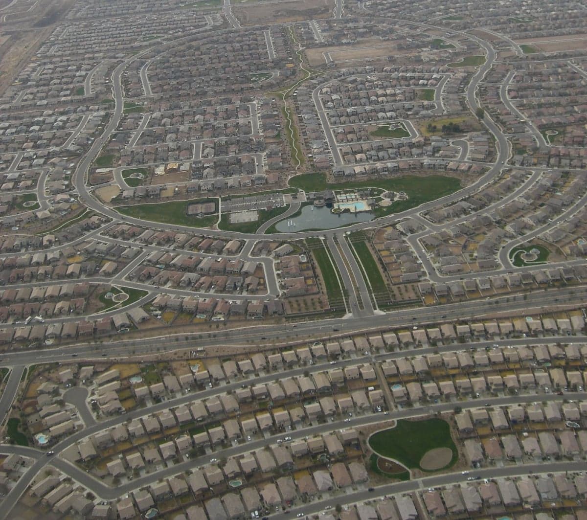
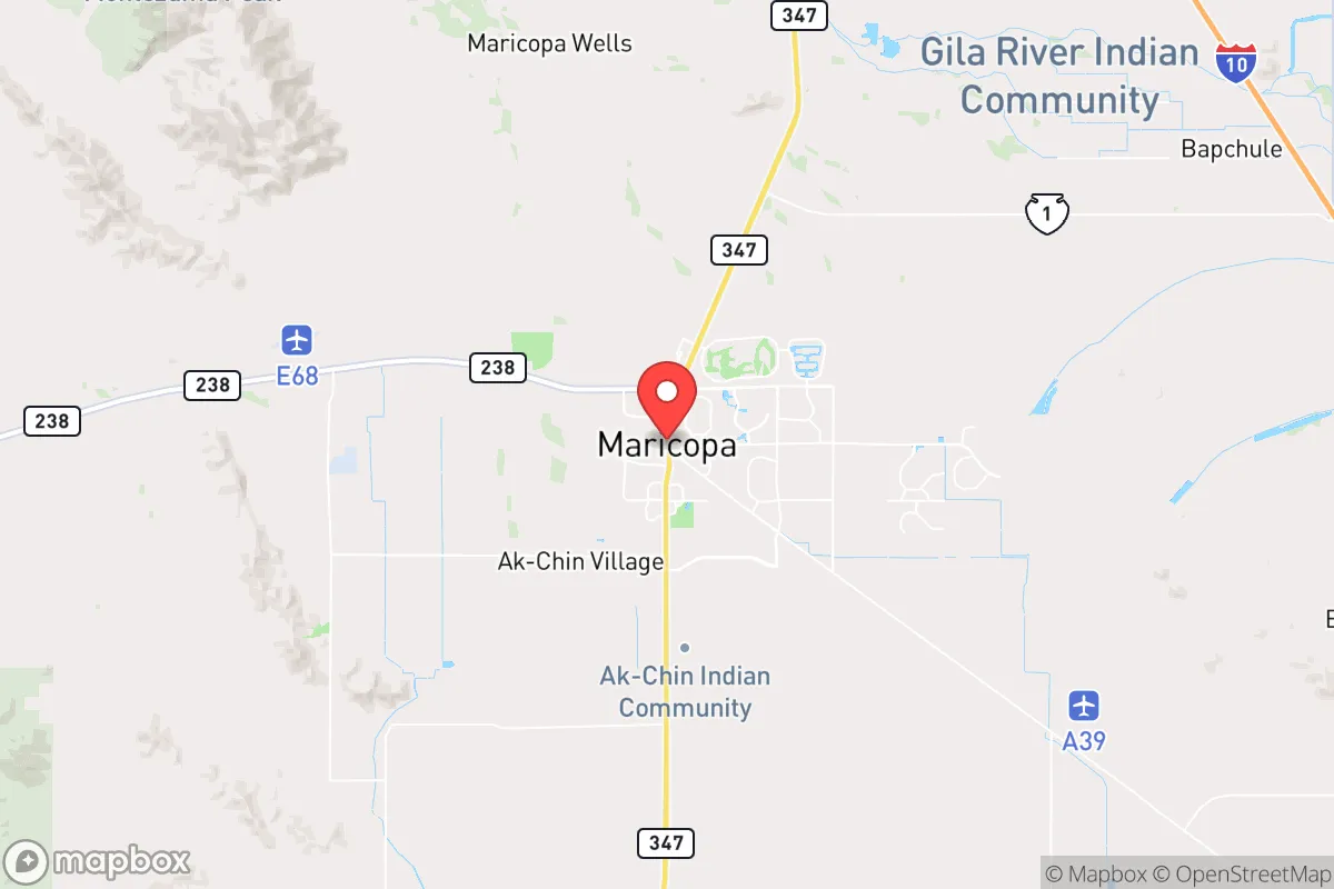
Maricopa, Arizona, sits in a strategic sweet spot that resilience-minded relocators should take seriously: far enough from Phoenix (roughly 35 miles south) to avoid the worst of urban collapse scenarios, yet close enough to access the region’s economic and logistical lifelines. Its position along State Route 347, the primary artery connecting the city to Interstate 10 and the broader Southwest, offers a defensible chokepoint—but also a single-point vulnerability that demands contingency planning. For those weighing civic unrest, mass casualty events, or large-scale disasters, Maricopa’s growth trajectory (population surged from roughly 1,200 in 2000 to over 70,000 today) signals both opportunity and risk: a rapidly built-out suburb that still retains a semi-rural feel, with enough open space to buffer against the chaos of a major metro collapse.
Geographic position and natural advantages for long-term security
Maricopa’s location in the Sonoran Desert, on the Gila River Indian Community’s southern edge, provides natural isolation without total remoteness. The city sits on a flat basin ringed by low mountain ranges—the Sacaton Mountains to the east, the Table Top Mountains to the west—which create a natural bowl that limits direct lines of sight from major highways. This terrain offers modest defensive value: an approaching force or mob would have to funnel through a few key routes, primarily SR 347 and the less-traveled Maricopa-Casa Grande Highway. The dry climate (average annual rainfall under 10 inches) means fewer weather-related disruptions than in flood-prone or wildfire-prone regions, though summer temperatures exceeding 110°F present their own survival challenges. Water access is the critical natural advantage: Maricopa sits atop the Pinal County aquifer system, and the Central Arizona Project canal runs within 15 miles, providing a backup water source that many desert communities lack. For a relocator thinking in decades, the area’s low seismic risk (far from major fault lines) and minimal tornado or hurricane exposure make it a stable long-term bet compared to coastal or Midwest alternatives.
Risks, exposures, and proximity to fallout-relevant landmarks
The biggest strategic liability is Maricopa’s dependence on a single road. SR 347 is notorious for traffic congestion during normal commutes—a single accident can gridlock the city for hours. In a mass evacuation or civil unrest scenario, that chokepoint becomes a kill zone. Luke Air Force Base, roughly 40 miles northwest, is a high-value military target in any conflict scenario; while Maricopa is outside the immediate blast radius of a conventional strike, fallout patterns from a nuclear event at Luke could drift south depending on wind direction. Similarly, the Palo Verde Nuclear Generating Station (about 50 miles west) is the largest nuclear plant in the U.S. by output—a catastrophic failure there would put Maricopa downwind in prevailing westerly flows. On the civil unrest front, Phoenix’s population of 1.6 million (metro area over 5 million) means that any large-scale breakdown in the capital will send waves of refugees south along I-10 and SR 347. Maricopa’s rapid growth has also strained local infrastructure: the city’s police force is relatively small (roughly 80 officers for 70,000 residents), and the nearest Level 1 trauma center is in Chandler, 30 minutes north under ideal conditions. For the prepper, these are not dealbreakers but factors that demand layered mitigation—stockpiled water, alternate exit routes (dirt roads east toward the Gila River), and a medical kit that can handle serious injuries without immediate hospital access.
Practical resilience for a relocator: food, water, energy, and defensibility
Maricopa’s practical resilience hinges on three factors: water availability, energy independence potential, and community cohesion. The city’s water supply comes from a mix of groundwater and Central Arizona Project allocations, but Pinal County has some of the most restrictive groundwater regulations in Arizona—new subdivisions must demonstrate a 100-year assured water supply, which limits unchecked growth and protects existing users. For a relocator drilling a private well, depths typically run 200-400 feet, with yields varying by location; pre-1980 properties often have grandfathered water rights that bypass modern restrictions. Solar energy is a no-brainer here: Maricopa averages 300+ sunny days per year, and net metering policies (though under political pressure) still make rooftop solar viable for off-grid backup with battery storage. Food resilience is weaker—the city has no major agricultural base, and the nearest working farms are in Casa Grande (15 miles south) or the Gila River Indian Community’s tribal lands. However, the Maricopa Farmers Market operates seasonally, and several local growers sell directly; for serious food security, a relocator would need to establish a desert-adapted garden (think mesquite, prickly pear, and drought-tolerant vegetables) or build relationships with nearby ranchers. Defensibility is mixed: the city’s suburban layout—curving streets, cul-de-sacs, and walled subdivisions—creates natural perimeter control for individual neighborhoods but also funnels movement into predictable patterns. A savvy relocator would prioritize a home on the city’s southern or eastern edge, where open desert provides buffer and multiple dirt-track escape routes toward the Gila River or the Tohono O’odham Nation lands to the south.
The overall strategic picture for Maricopa is one of calculated trade-offs. It offers genuine advantages—water access, isolation from direct urban fallout, a growing but still manageable population, and a climate that supports year-round solar and low-maintenance living. But those advantages come with real exposure: a single-road dependency, proximity to high-value military and nuclear targets, and a community that is still finding its identity between rural past and suburban future. For the conservative-leaning relocator who values self-reliance and community preparedness, Maricopa is not a bug-out location—it’s a long-term base that requires active investment in resilience. Stock the water, harden the home, learn the back roads, and build ties with neighbors who share the mindset. The city’s trajectory will be shaped by Phoenix’s stability; if the metro holds, Maricopa remains a quiet, defensible outpost. If it doesn’t, those 35 miles of desert will become the most valuable real estate in Arizona.
* Values derived from national, state, county, city and local statistics and may differ in a specific area. Last updated: 2026-04-19T07:19:09.000Z
Narrative content on this page is AI-generated and may contain mistakes. Verify any details that matter before acting on them.
ReloMaps may earn a commission from affiliate links at no extra cost to you.