
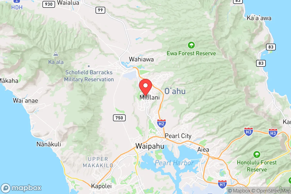
Strategic Assessment of Mililani, HI
Meaningful friction. Expect exposure to either population pressure, blast zones, or natural disaster risk. Consider buying a retreat property.
What does the Strategic Assessment tell us?
Our Strategic Assessment grades tactical survivability of an area. Major population centers, military targets, fallout zones, natural disasters, and border exposure all drive risk — lower exposure means a more defensible position in a crisis.
This is heavily inspired by Joel Skousen's Strategic Relocation book. Highly recommended you checkout the book ($)What does this tell us?
Our Strategic Assessment grades tactical survivability of an area. Major population centers, military targets, fallout zones, natural disasters, and border exposure all drive risk — lower exposure means a more defensible position in a crisis.
This is heavily inspired by Joel Skousen's Strategic Relocation book. Highly recommended you checkout the book ($)Strategic Pillars

Key Distances
Regional Safe Places
Below is our recommended "safe zones" in Hawaii and the surrounding area based on our strategic heuristics. For most people, it's unrealistic to live in a “safe zone” full-time due to work, family or other personal reasons. They tend to be more rural. However, many of these areas are perfect for second homes and retreat properties that double as a vacation home or even a short-term rental.


Important Note: For informational purposes only. This does not mean nothing bad ever happens in the green zones. Please use common sense. This is based on public data and modeled with AI. We tried to take a conservative approach but mistakes happen. We update this regularly as new information becomes available.
Solar Generator Recommendations
Backup power matters more here than in safer locations. We've picked three solar generators across budgets and capacity tiers — start with the budget unit if you only need a few essentials, or step up if you want to run a fridge and HVAC for days at a time.

Jackery Portable Power Station Explorer 300
Budget OptionPower on the Go: Weighing only 11 lbs, it's convenient to set up and store with book-sized foldable solar panels

BLUETTI Portable Power Station AC180
Designed for both indoor and outdoor scenarios, AC180 is highly capable as it has a robost capacity and continuous output power.

EF ECOFLOW DELTA Pro Ultra Power Station
Upgraded PickEcoFlow DELTA Pro Ultra is a whole-home energy system designed to grow with your family. Integrated with the Smart Home Panel 2, it scales to meet your evolving energy needs — keeping your home powered, intelligent, and secure through every stage of life.
We earn a commission, at no additional cost to you.
Strategic Assessment Analysis
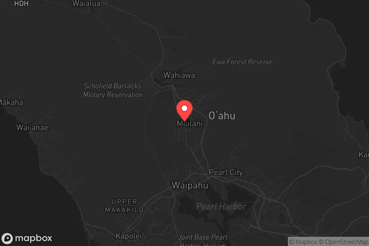
Mililani, situated on the central plateau of Oahu, offers a strategic paradox: it is a master-planned suburb that sits within a 30-minute drive of Honolulu, yet its inland location and elevation provide a meaningful buffer against the coastal chaos that would follow a major disaster. For the prepper or survivalist with a conservative mindset, this area demands a clear-eyed assessment of its resilience and its vulnerabilities. While it is not a remote redoubt, its geographic position, water resources, and community infrastructure make it a more defensible option than most of Oahu’s coastal sprawl, provided you understand the trade-offs.
Geographic position and natural advantages for long-term survival
Mililani’s primary strategic asset is its location on the Leilehua Plateau, roughly 900 feet above sea level. This elevation places it above the tsunami inundation zones that would devastate Waikiki, Honolulu, and the North Shore in a seismic event. The area is also shielded from the worst of hurricane storm surges by the Waianae and Koolau mountain ranges, which funnel trade winds but also block the brunt of Pacific cyclones. The soil here is deep volcanic loam, capable of supporting substantial agriculture—a critical advantage for any long-term food security plan. The nearby Wahiawa Reservoir (Lake Wilson) and the extensive ditch system from the Koolau watershed provide a reliable freshwater source that is less vulnerable to saltwater intrusion than coastal aquifers. For a relocator, this means the land can sustain gardens, small livestock, and rainwater catchment systems far more effectively than the sandy, salt-prone coastal zones. The central location also offers multiple egress routes: the H-2 freeway south to Honolulu, Kamehameha Highway north to the North Shore, and Kunia Road west to the agricultural heartland of Central Oahu. In a grid-down scenario, these routes could be used for resupply or retreat, though they would also become choke points.
Risks, exposures, and proximity to fallout-relevant landmarks
The most significant vulnerability for Mililani is its proximity to Pearl Harbor and Joint Base Pearl Harbor-Hickam, located roughly 12 miles south. In a conflict scenario involving a near-peer adversary, these military installations would be primary targets for conventional or even nuclear strikes. The prevailing trade winds blow from the northeast, meaning fallout from a strike on Pearl Harbor would likely be carried toward the southern and western parts of the island, potentially sparing Mililani from the worst of immediate radioactive debris. However, the base’s ammunition depots, fuel storage, and naval reactors present a secondary hazard of conventional explosions and toxic releases. Additionally, the Honolulu International Airport and the Kapolei harbor complex are within 15 miles, making the entire southern half of Oahu a high-value target zone. For the prepper, this means Mililani is not a fallout-safe zone—it is merely less exposed than the coastal cities. The area also sits near the Schofield Barracks and Wheeler Army Airfield, which are active military installations. While these provide a potential security presence in a crisis, they also make the area a magnet for looters and refugees fleeing the coast. The 2018 false alarm missile alert demonstrated the psychological fragility of the population here; a real event would trigger a mass exodus from Honolulu, and Mililani’s position along the H-2 corridor would make it a natural bottleneck for that movement.
Practical resilience for a relocator: food, water, energy, and defensibility
Mililani’s master-planned design offers both advantages and drawbacks for self-sufficiency. The community is built around a central town center with grocery stores, hardware outlets, and medical clinics, all within walking distance for many residents. This walkability is a major plus for a post-collapse scenario where fuel is scarce. The area’s zoning allows for backyard gardens and small livestock, and many homes already have fruit trees (mango, papaya, banana) that can supplement diets. Water resilience is strong: the Board of Water Supply’s central Oahu system draws from the Koolau aquifer, which is deep and well-protected. However, the system relies on electric pumps; a prolonged power outage would cut water pressure within hours. Preppers should plan for rainwater catchment and storage—roof area is plentiful, and annual rainfall averages 40-50 inches. Solar panels are viable here, with consistent sun exposure, though the frequent cloud cover from trade winds reduces efficiency compared to drier climates. Defensibility is mixed. Mililani is a grid of cul-de-sacs and arterial roads, which can be barricaded at key intersections, but the sheer number of entry points (over a dozen) makes it impossible to fully secure. The population density (roughly 5,000 people per square mile) means that in a crisis, you would be surrounded by neighbors who are largely unprepared—a liability for security and resource competition. The nearby Kunia Road leads to the agricultural fields of Del Monte and Dole, which could become critical food sources, but also targets for looting. For a relocator, the best strategy is to establish a home base here for its water and soil, but maintain a secondary bug-out location in the more remote Waianae or North Shore valleys for true collapse scenarios.
Overall, Mililani presents a calculated risk for the conservative prepper. It is not a survivalist paradise—it is too close to military targets, too dependent on grid infrastructure, and too densely populated to be a true redoubt. However, its inland elevation, water security, and agricultural potential make it one of the more viable options on Oahu for a medium-term survival scenario (weeks to months). The key is to treat it as a staging ground: build your food and water stores, harden your home against looters, and have a plan to move deeper into the island’s interior if the situation deteriorates. The state of the world suggests that Hawaii’s isolation, once a strength, is now a vulnerability—but within that vulnerability, Mililani offers a foothold that is better than most, and worse than some. Know your neighbors, know your exits, and keep your bug-out bag packed.
* Values derived from national, state, county, city and local statistics and may differ in a specific area. Last updated: 2026-04-24T00:08:12.000Z
Narrative content on this page is AI-generated and may contain mistakes. Verify any details that matter before acting on them.
ReloMaps may earn a commission from affiliate links at no extra cost to you.